Washoe Park trail upgrades improve access


Erick Estrada, from left, Eddie Cuttman and Zackery Schell finish trail improvements at Washoe Meadows State Park. Photo/Kathryn Reed
By Kathryn Reed
WASHOE MEADOWS STATE PARK – Trudging through water or creating a side trail is no longer necessary in sections of Washoe Meadows State Park.
Work was completed this month on about a mile of trail. Included is a rather major bridge over Angora Creek and smaller crossings to get people out of other wet areas.
“Now people have access to this section of the park longer and earlier,” explained Nathan Shasha with California State Parks.
Water had been a barrier.

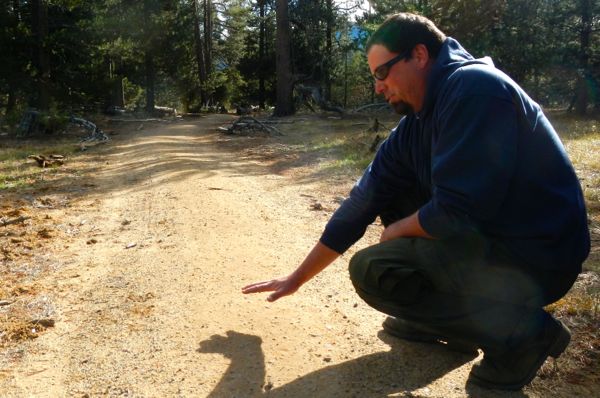
Before the work began the trail was impassable. Photo/California State Parks
This nearly 600-acre park on the South Shore is a bit of a secret to many because there are no signs, trailhead markers or parking. But for those who know about it, there are myriad walking, mountain bike, snowshoe and cross country trails, as well as a slew of entrances.
Carol Curran of South Lake Tahoe was walking in the park with her husband, Larry, and their dog last week. This was their second time to Washoe. When they looked up online how to get to it the directions had them go to Sawmill Road. But there is no access from that road.
When the general plan is created for the park basic amenities like signs are expected to be addressed. State Parks has taken inventory of the trails and everything else in the park so it knows what it has, but no plan has been created for what do with the park. Part of the holdup has to do with a lawsuit involving realigning the Upper Truckee River and moving holes of Lake Tahoe Golf Course.

The park and its access points.
The trail upgrades, which cost about $70,000, will allow for more recreation throughout the year. The money came from state agency, Tahoe Fund, Proposition 84 and Bureau of Reclamation.
“This is a hundred times better. There is an actual trail. Now I don’t have to deal with mud,” said Candace Raynar, who was jogging with her two dogs. She drives from Christmas Valley and parks on the Lake Baron side of the park to start her 11-mile run. “The transformation is amazing. It was so needed.”
The quickest way to access this improved section that park employees and California Conservation Corps members worked on is from Mountain Meadow Drive. Shasha said this section was chosen for rehabbing because it is a major thoroughfare and is heavily used.
Gone is a trail that was wide as a road with compacted dirt. Even with the limited moisture this fall puddling was occurring which made for less than a pleasant experience.
The trail is now more like a single-track, but it’s raised a bit in places. The crown will also help the trail last longer.
Chunks of asphalt were removed. Berms built by previous landowners are still evident.
Nathan Shasha with State Parks shows the contour of the new trail. Photo/Kathryn Reed
Shasha described creating it being like making lasagna, where various substances are put down in a layered manner – fabric, rock and dirt.
Rocks are on the side so water can run between them. The improvements should also allow more people into the area because of not having to wade into the water and giving access year-round. One user group Shasha would like to restrict is equestrians.
“I would like horses only on park roads. They have such an impact on our trails,” he told Lake Tahoe News.
Shasha and his crew will return in the spring to see how things held up and if any changes need to be made. By that time some vegetation should be sprouting along the trail sides.
Dirt used in the project has been stored at the park since it was brought in from the 2007 Angora Fire. This same dirt pile was used for the detention ponds by South Tahoe High School.

A sturdy bridge crosses Angora Creek. Photo/Kathryn Reed
The redwood bridge across Angora Creek is much heftier that what was there. The old one was made out of 2 x 6 plywood by neighbors. Two years ago a horse fell through that necessitated State Parks to do something.
If there were no structure, horses and others would likely still cross the water. The bridge was built for safety reasons as well as environmental. Angora Creek is the largest tributary of the Upper Truckee River.
The bridge is 35-feet long, while the entire crossing is 85 feet. It was built to State Parks specifications. Individual parks don’t have much say in how these things are constructed – same with the paths.

My home borders this state park. I really hope there are not too many more ‘improvements’ or it will be overrun with tourists.
The lawsuit is not about realigning or restoring the river. It is about not redistricting State Park land so that it can be given to a private developer (which has never been done before in the State of California) who wants to encroach on this beautiful meadow, especially for a sport that has fewer adherents every year. And while I love the serenity of the meadow, I would also love to see signs directing people to this gem of a park so that is is more highly used. If the State can pay the money to replace the stone sign at the golf course a few years ago, why can they place signs showing users how to access the park. One might think they are trying to keep people from using it so that they can “sell” it to the developer. The improvements to the trail are wonderful and much appreciated.
These are wonderful improvements to an under appreciated but beautiful State Park that is and should be open to everyone.
I agree with Tahoereader and Lisa, the park should be open to everybody, even snooty locals!
The private developer people refer to here is probably American Golf who is a permittee on the State land. If the golf course is placed where the State wants it to be, the park will be bisected by the golf course and interrupt access by both people and wildlife. As it is now the golf course is off to one side. Also, the nasty precedent of downgrading State Park land to state recreation area would take place and the practice could proliferate in many of our most treasured areas. When money is tight corporate sponsors of recreational pursuits are more likely to be allowed.
All these improvements are to pacify the locals so the State Parks can down grade from a state park to a recreational area. This will allow the golf course to be moved across the river. This change of land classification is unprecedented and cannot be allowed. If you look at the map you will see the area outlined in green. That is the proposed area for the relocation of part of the golf course not the existing layout.
If the signage were improved and more people used the park the realignment of the golf course would be more contested and might not even happen.
The Washoe Meadows Community has a long-standing lawsuit against the State over these exact issues. You can go to washoemeadowscommunity.org to read about the current status. Defense of Place is involved in the lawsuit and is rallying against the State setting the precedent of downgrading park land that was purchased and protected by taxpayer money.
The residents and visitors to Meyers are VERY fortunate to have both a State Park and a State Recreation area in the neighborhood. Unfortunately the State Recreation area is the only public land that the vast majority of people are aware of. There is not only room for both but benefits as well. School yards, cemeteries, even golf courses all provide open air even if not open access. Personally I don’t play golf but I can accept there are those who elect this form of recreation and exercise.
Owning or renting a home bordering public property has both benefits and disadvantages. Benefits often include open views. (Which sometimes cause one to become protective of the view from one’s property across either other’s private or public property that they don’t actually own. Sorry about the run on sentence.) Disadvantages include people who park on public streets and access public lands hopefully only through designated gates. The public needs to both protects public land and not encroach on private property to gain access to public property. It would be best if the park had both signage and parking area(s) in addition to use of public streets.
The neighbors and those who regularly use the Washoe Meadows State Park would benefit from greater public awareness of the park (even with some of the annoyances that would come with actual usage of the park.) Bottom line; the more park lovers = more park supporters.