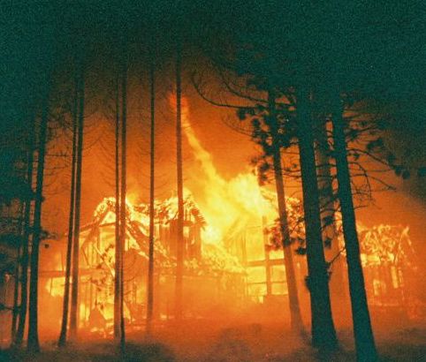
Lake Tahoe Airport: Golden dreams
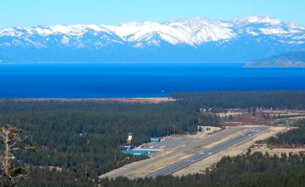
Lake Tahoe Airport has never been without controversy. Photo/LTN file

Lake Tahoe Airport has never been without controversy. Photo/LTN file

Publisher’s note: This is one in a series of stories Lake Tahoe News will be running leading up to the 50th anniversary of South Lake Tahoe on Nov. 30.

“He who has the gold, makes the rules.”

       – Michael Hotaling, Airport Master Plan consultant, at the March 16, 2015, public meeting

By Joann Eisenbrandt


“You know, the city purchased the airport from the county in 1983 for $1. Maybe we should sell it back,” an attendee at the March 17, 2015, South Lake Tahoe City Council meeting said while looking over alternative configurations for the Lake Tahoe Airport prepared by the master plan consultants.

That $1 purchase price has been a decades-long mainstay of local conversation, often repeated in print as fact. But it’s not true. The airport was not purchased from the county, but rather it was annexed by the city through the LAFCo (Local Agency Formation Commission) process. LAFCo is an independent commission that coordinates changes in local government boundaries. As the LAFCo resolution confirming the annexation states, “There is no monetary consideration for the transfer herein.”

City 50th Anniversary Logo v4Perhaps the $1 idea came from a staff report from then City Attorney Dennis Crabb at the May 3, 1983, City Council meeting when the annexation was in its early stages. “Too many unknowns exist at this point,” he noted, “to allow the drafting of precise transfer documents,” but added, it can be assumed, “that the transfer will be accomplished for one dollar or other nominal consideration.”

Del Laine, former city councilwoman and mayor, recalls another $1 sale offer in the late 1970s or early ’80s by former El Dorado County Supervisor Bill Johnson.

“It was tempting,” she told Lake Tahoe News, “because it also came with the promise of a two-year subsidy.” Johnson does not remember that specific offer, and no written confirmation could be found, but he agrees, “There was always some conversation about the cost of running the airport. From my standpoint, it was always a matter of money.”

Of course the devil is in the details. There was no monetary consideration for the 1983 transfer, but the city was responsible for costs “incidental to the fulfillment by the parties hereto of the transfer conditions set forth in this document.” The cost of fulfilling those conditions turned out to be quite high.


Commercial service was once robust at Lake Tahoe Airport. Photo/Del Laine

Commercial service was once robust at Lake Tahoe Airport. Photo/Del Laine

The beginnings of air travel at Tahoe

But before there was a Lake Tahoe Airport, there was Sky Harbor. Located in Rabe Meadow in the mid-1940s and 1950s, down Kahle Drive from what is now Lakeside Inn. It was a dirt runway carved out of the meadow, where early fly-by-the-seat-of-their-pants pilots needed all the skill and courage they could muster to avoid landing in the lake or against a mountainside. There were no fueling facilities. Pilots came in over the mountains, then circled back over the lake toward the Sky Harbor Casino to land, which they could only do when there was no wind, and during daylight hours.

Former City Councilman and El Dorado County Supervisor John Cefalu, remembers, “My father-in-law flew in to Sky Harbor in his Stearman from Placerville. People in the basin, led by Harvey Gross and Oliver Kahle, realized there had to be a place where aircraft could land.”

It was only used from 1946 to 1956. A number of other areas around the South Shore were briefly used or proposed as landing strips, including float planes landing on the lake, areas in Meyers, Johnson Meadow in Bijou, Pope Beach and the undeveloped area which is now the Tahoe Keys.

On March 12, 1956, the Board of Supervisors applied for a $75,000 grant under the Federal Airport Act to construct Lake Tahoe Airport. The county put in $63,000 from “available reserves” and the board levied a 10-cent countywide tax over the next year, with the remainder to be paid over the subsequent two years to cover additional airport construction costs.

Lake Tahoe Airport officially opened Aug. 1, 1959. Seventy-five planes flew in that first day. It was open, but it was bare bones. An Aug. 6, 1959, Tahoe Sierra Tribune (precursor to the Tahoe Daily Tribune) article described opening day: “One by one, planes of almost every make and description dropped in. (County Airports Manager Malcolm) Wordell, seated on the steps of a trailer which had been converted into a ‘control tower’ was busy at the Unicom, a small portable two-way radio. Searching the sky with his powerful binoculars, Wordell would advise the pilots when all was clear for a takeoff or landing.”

There was no control tower, terminal, on-site weather reporting equipment, paved parking for planes or cars, runway lights, hangars, restaurant or other visitor amenities.

It was a festive opening nonetheless. The airport was operational just in time for the 1960 Squaw Valley Winter Olympics. In an Aug. 6 Lake Tahoe News article, correspondent Vivian Little wrote, “At last you can fly to the lake in the sky! A phrase coined by Malcolm Wordell, Airport Manager.”

The official dedication was conducted the weekend of Sept. 11-13, 1959, with festivities overseen by master of ceremonies singer/actor Dennis Day. California Lt. Gov. Glen Anderson was a guest speaker, and the first Miss Tahoe Airport contest was held, with nine “beauties” competing in demure one-piece swimsuits. But it rained and rained — perhaps a hint that the airport’s high-flying honeymoon might be short lived.

The August 1959 edition of the Pre Flight Air News, a monthly pilots’ magazine based in Oakland, reflected the excitement of area airmen. “Now, at last, the California pilot can jump in his plane with visions of jackpots dancing before him. He can zoom past the bumper to bumper crowds, and be well on his way to wealth … before the poor earthlings have cleared Placerville.”

El Dorado County was the first operator of the airport. Photo/South Lake Tahoe

El Dorado County was the first operator of the airport. Photo/South Lake Tahoe

A bumpy ride

Some of the “earthlings” in Placerville, it turned out, were not as thrilled about the airport. Its costs to county taxpayers raised West Slope dissatisfaction even before it opened. The El Dorado County Property Owners Association told the Tahoe Sierra Tribune in July that the airport was, “for the benefit of a few fly-by-night developers and cheep (sic) gamblers.”

South Shore chamber member Jerry Calvert responded in an Aug. 20, 1959, Tahoe Sierra Tribune article. He called the Taxpayers Association, “A group of obstructionists (who) are now trying to forestall the future of the airport.” Of the gaming industry, he said, “This element and those who conduct this activity are an important segment of our economy. There is absolutely nothing cheep (sic) about any of them.”

In the airport Master Plan it was preparing, Charles Luckman Associates suggested the county, “Consider the feasibility of obtaining financial support or advances from Gaming and Stateline Entertainment interests which would profit from immediate development of the Master Plan.”

Tahoe was growing — there was the impressive $150 million Tahoe Keys development, a $3 million Harrah’s expansion, an explosion in building permit applications, a shopping center in Tahoe Valley, new schools, and the airport, which was seen as a vital component in all that growth. Not everyone was thrilled with this either.

“Only the people in Lake Tahoe wanted it,” Bill Johnson told Lake Tahoe News. “It was the clubs who were the pushers at that stage. I didn’t care for the airport being there. I didn’t care for the Tahoe Keys being there.”

The FAA has provided a substantial amount of money to help keep the runways and tarmac in decent shape. Photo/LTN file

The FAA has provided a substantial amount of money to help keep the runways and tarmac in shape. Photo/LTN file

The good and the bad

Shortly after its festive opening, there were three crashes at the airport all within a week, with two fatalities. Safety became an issue. Failure to gain altitude on takeoff was the problem in two, with one plane crashing and catching on fire and the other ending up wedged into a pine tree. Wordell defended the airport as safe, charging the accidents to “pilot error,” specifically the failure to recognize the effects of density altitude — the lower performance levels of planes at high altitude in hot weather.

In late 1959, a density altitude warning system and weather-reporting instrumentation were put in place along with leases for car rentals, limousine service, and a gift and tobacco shop. A rudimentary runway lighting system was approved by the FAA in October 1960 and the airport began 24-hour operations. There was still no control tower.

Hopes for the airport remained high on its third birthday in September 1961. A Lake Tahoe News article [the former print version of LTN has nothing to do with today’s online news site] of Sept. 9 affirms enthusiastically, “The fast growing baby thus far is fulfilling the growth potential, if not exceeding that which was predicted for it even prior to birth.”

Adjoining lands were purchased to provide the “clear zone” required by the FAA for operations by four-engine aircraft. Land from the Barton-Ledbetter family was purchased through a complex arrangement with Harrah’s South Shore Corporation, which agreed to pay $60,000 in landing fees over the next five years to cover the county’s $300,000 matching share to acquire the land and extend the runway. An FAA grant paid the other $602,000. Additional land was later purchased from Harvey Gross and others. The runway was extended to 8,541 feet in 1962.

On March 1, 1964, a Paradise Airlines Constellation bound to Tahoe from Oakland, carrying 85 passengers and crew, crashed in a blinding snowstorm on a peak just above Genoa, killing all aboard. Relatives of victims claimed in their lawsuits that faulty weather reporting by the county was to blame, with some saying that had there been a control tower, the tragedy could have been averted. Later that month, the Board of Supervisors approved funding for land acquisition for a control tower, putting off runway work at the Placerville airport for a year. The tower was completed in December 1964, and formally dedicated in June 1965. Tahoe pioneer Glen Amundson, who had also flown into Sky Harbor in the ’40s, cut the ceremonial ribbon by flying through it in a plane.

On its fifth birthday in September 1964, a Lake Tahoe News editorial still touted the airport’s money-making potential. “There can be little doubt that the Lake Tahoe Airport has a strong effect on the economy of the area and will have even more in the future.” But the airport was losing an average of $20,000 a year, and additional airport improvements were slow in coming. Del Laine remembers, “There was always some conversation about the cost of running the airport. The bottom line no matter where you are is money. Attitudinally, it is where the county was.”

Today Lake Tahoe Airport is busiest during the celebrity golf tournament each July. Photo/LTN file

Today Lake Tahoe Airport is busiest during the celebrity golf tournament each July. Photo/LTN file

Local control always elusive

Tahoe Valley’s desire for local control was growing, but it wasn’t new. A Sept., 17, 1959, editorial in the Lake Tahoe News entitled “Men or Mice” urged Tahoe Valley residents to stand up to the county. “Lake Valley may be the step-child of El Dorado County, but there is a point to how much we must be forced to take …. Let’s act like men and not mice.”

On Nov. 30, 1965, Tahoe Valley citizens did just that when the city of South Lake Tahoe was incorporated. Unfortunately, the hopes for local control were soon dashed by the emergence of organizations that believed they also had a say in the future of Lake Tahoe. The League to Save Lake Tahoe was formed in 1965, and supported the formation of a regional agency to oversee the lake. CTRPA (California Tahoe Regional Planning Agency) was formed in 1967, and its successor, the bi-state Tahoe Regional Planning Agency (TRPA), in 1969.

Additional outside regulation came from the Civil Aeronautics Board (CAB), which had authority over airlines’ entry into or exit from domestic interstate airline routes as well as fares. The California Public Utilities Commission (CPUC) had control over intrastate flights. Tahoe felt it was “underserved” by commercial carriers, but getting CAB approval for new routes was difficult. It hinged on whether the carrier was classified as interstate or intrastate. This led to some creative nitpicking. In 1966, Pacific Airlines contended that Paradise Airlines’ flights to Tahoe from inside California were actually interstate, because their passengers went directly from the airport, often in free shuttles provided by Harvey’s, to the clubs across the state line in Nevada to gamble, in effect using the California airport to serve Nevada interests — a theme which has persisted throughout the airport’s history.

The county was growing tired of carrying the financial burden for an airport many felt was of greatest benefit to the gaming properties across the state line and the newly-incorporated city was tired of fighting for needed improvements. Pacific Airlines, in fact, was so upset about the airport’s deteriorating facilities that they threatened to stop flying into Tahoe if they were not upgraded.

On Jan. 4, 1966, the City Council, “… decided unanimously that the city should try to acquire the airport and then make decisions as to operation.” County Supervisor Joe Ronzone agreed and offered his support. “The airport,” he told the Mountain Democrat, “is a benefit to the entire county, but its prime benefit is to the Lake Tahoe area, of course. As it is, under county jurisdiction, serious problems are created and many of these would be removed if the people at the lake had full control.”

He told a chamber luncheon in Tahoe that February, “You can get the airport at no cost. … If the city will come to us with a proposal, we’ll accept it.” City Councilman Gene Marshall immediately tried to get the council to prepare a proposal to acquire the airport, but they opted for a feasibility study instead. Marshall, exasperated, told the Tahoe Sierra Tribune, “…too many studies and not enough action.” This also became a recurring theme.

In1966, the city began exploring the idea of creating an airport district with taxing authority, with boundaries similar to those of the Lake Tahoe Unified School District. The first-year tax rate would be less than 0.04 cents per $100 of assessed valuation, and in five years, then City Manager John Williams believed, the airport would be on a “paying basis.” The county had already spent $1,801,937.33 to-date on facility improvements and $300,000 on operational costs and another $1,987,900 was still needed. With great foresight, Williams urged quick action to increase commercial flights into Tahoe, as the Reno Airport was “a major continental air facility” which was already drawing off fly-in visitors.

Williams presented the idea to the supervisors in 1967. They directed county counsel to “prepare the necessary papers to begin formation of an Airport District,” and later requested a feasibility study, but no formal action was ever taken.

Supervisor Johnson, and the Lake Valley Taxpayers Association he helped start, were opposed to the airport district. “I thought they should dig a tunnel and use the airport in Minden,” Johnson said. Lake Tahoe Airport, the group told the city in a letter, “will never be able to accommodate the planes of the future. … Minden airport will eventually be developed to handle even the largest planes.”

From 1967 until its eventual annexation in 1983, there was much talking, but little doing. In 1968, Williams broached the idea of a city/county Joint Powers Authority (JPA). Meanwhile, the cavalcade of airlines serving Tahoe continued. Hughes Air West and Holiday Airlines ended service to Tahoe in 1974 and 1975 respectively. In 1975, Air California (AirCal) and Pacific Southwest Airlines (PSA) began service using Lockheed Electra turboprop aircraft.

In May 1977, a management agreement for operation of the airport by the city was discussed and another feasibility study prepared, but it never penciled out. County Airports Director Peter Boyes told the supervisors on June 6, “The central point concerning city acquisition of the Lake Tahoe Airport is money.” The city considered the offer, but at its July 5, 1977, meeting decided it, “was not interested in taking over the operation of the airport at this time ….”

A Lockheed Constellation in 1963. Photo/Dave Borges

A Lockheed Constellation in 1963. Photo/Dave Borges

Airport discord continues

Enplanement numbers at the Lake Tahoe airport began to rise. A new terminal had replaced the converted barracks. Airfield improvements were slowly being made with the help of FAA grants. Airlines were just transitioning from aging Lockheed Electras to jets. Noise first became a major concern. South Lake Tahoe residents protested the growing intrusion of aircraft noise into Tahoe’s peaceful environment by loud business jets and the 727-100 jets flown by PSA charters.

A series of petitions with close to 500 signatures were presented to the board. Then Al Tahoe resident Mary Lou Mosbacher summed up the concerns in her letter. “We are anxious,” it said, “that no jets are allowed to use our area as the noise is intolerable. … How much disturbance can be tolerated. … How important is the economic health of a community versus the physical and mental health of its citizens?”

In June 1977, the county passed an emergency ordinance making it unlawful for “pure jet aircraft to arrive or depart between the hours of 8pm and 8am, of any day at the Lake Tahoe Airport.”

When the board later considered amending the ordinance to prohibit commercial jets from landing or taking off at Tahoe, except those that met acceptable decibel noise levels, the business community, gaming and airline interests protested. Tom Davis, then a member of the chamber’s Aviation Committee, spoke in opposition to the ordinance. Representatives of AirCal and PSA said they would, “not be able to live with the restrictive measurement standards based on decibels.” CTRPA felt airport activity in general was “inappropriate for Tahoe” as it conflicted with their goals and policies to “restore Tahoe’s tranquility.” The board left the revised ordinance in “introductory status” awaiting purchase and installation of noise monitoring equipment for Tahoe. The economy versus environment debate was heating up.

In July 1978, the board again asked the city to consider a management agreement. The airport and equipment would remain the property of the county, with the city responsible for total airport management. The county would retain approval over the budget and all major capital improvements. City Finance Director David Millican pointed out the risks if the city were responsible for making up operating losses and providing matching funds for FAA grants. Again, it was the money. The city decided to wait and see.

In October 1978, the playing field changed forever when the federal Airline Deregulation Act was signed into law, removing government authority over fares, routes and market entry of new commercial airlines. The powers of the CAB were gradually phased out. Enplanements at Tahoe reached their peak of 294,188 in 1978, but after deregulation, quickly plummeted. Airlines could now choose to abandon less profitable routes, which generally meant less point-to-point service with greater focus on larger hubs.

In 1979, CTRPA contested AirCal and PSA’s requests to use jets in Tahoe, and both airlines soon terminated service. Using Electras in Tahoe was expensive, and they found passengers preferred taking jets to Reno instead. Del Laine, who was on the City Council then, remembers, “The airport wasn’t a big focal point for the local community. Many of us who used the airport would take the airport shuttle from Harrah’s (to Reno). Flights went where we wanted to go. I never used Tahoe as a base from which to travel a distance.”

Others apparently felt the same way. Enplanements dropped immediately to 169,683 and in 1980 to 68,729.

Environmental issues -- like the Upper Truckee River -- will always be a factor when it comes to making decisions about the airport. Photo/LTN file

Environmental issues — like the Upper Truckee River — will always be a factor when it comes to making decisions about the airport. Photo/LTN file

Airport flounders

The county had begun a new master plan in 1979, but it was slow going and expensive. Concerns were raised by regulatory agencies over the adequacies of its assumptions and accuracy of its environmental documentation. Aspen Airways and Pacific Coast Airlines were serving Tahoe, but the airport budget was in trouble. A December 1982 letter from Kent Taylor, county CAO, to the board indicated, “During the month of November, the Airport Enterprise Fund had insufficient funds to meet payroll and other expenses.” That year, enplanements in Tahoe reached their lowest point of 37,533.

There was talk of the Tahoe Transportation District assuming airport operations as TRPA was getting ready to adopt its Regional Plan. A memo from Richard Milbrodt, TRPA acting executive director, to TTD’s CAO Kent Taylor in September 1982, notes, “The district board needs to know if the Board of Supervisors is agreeable to discussions regarding transfer of airport operations and the possible conditions that would be attached to such transfer.” It was talked about but never implemented.

In early 1983, the county began looking at other options for running the airport. A JPA was again considered with the city, Douglas County, and possibly Alpine County. “The county,” John Cefalu explains, “was disinterested in the airport and unwilling to put in their 10 percent (match for FAA grants). It was basically neglected. General aviation was having difficulty with the condition of the runways.” The massive landslide at Whitehall that closed Highway 50 that year highlighted the need for another reliable way in and out of the basin.

In April 1983, the city approved annexation of the airport from El Dorado County. Councilman Cefalu asked that a letter be directed to Douglas County, offering to work with their legal counsel “to develop a mechanism for shared responsibility of the Lake Tahoe Airport.” Such cost sharing never happened.

“When we initially took over the airport,” Cefalu recalls, “we thought we had Douglas County in our corner to put money into the airport and be a partner. Douglas County commissioners said no we don’t want to put our money into Lake Tahoe, but prefer to put it into our own airport in Minden.”

On Oct. 7, 1983, a ceremonial ribbon cutting by a phalanx of city and county leaders marked the official annexation of the airport. The city got control of the airport, but also took on responsibility for the monetary and regulatory problems that came with it, including completing the still-unfinished county Master Plan.

AirCal had just resumed service to Tahoe. Because of the landslide’s impacts, the Attorney General’s Office granted a 90-day exemption allowing existing flight levels while the city completed the Master Plan’s environmental documents. The city almost immediately increased AirCal’s flights, filing a negative declaration saying the increase had no environmental impacts. This started a virtual lawsuit landslide where all parties with any interest in or jurisdiction over the airport sued everybody else. In 1991, AirCal, caught up in the aftermath, terminated service.

Years of trying to reach consensus failed. In October 1992, to end the lawsuits, the parties signed the Lake Tahoe Airport Master Plan Settlement Agreement. “AirCal wanted to expand and go to (quieter) Stage 3 aircraft,” Tom Davis recalls, “but the lawsuits tied things up for a long time. The 1992 Settlement Agreement was the death knell. It put so many restrictions on that it couldn’t work out for an airline … good service out of Reno hurt us as well.”

A number of airlines including United Express, Alpha Air/Trans-World Express, Sierra Expressway, Allegiant Air, Tahoe Air and Reno Air struggled, but failed, to make serving Tahoe profitable. Tahoe Airline Guarantee Corporation (TAG), a privately funded entity, even put up a $1million subsidy in1994-95 for Reno Air, but once the subsidy ended, so did the service.

The last commercial carrier, Allegiant Air, pulled out of Tahoe in 2000 and the control tower, no longer funded by the FAA because of low service levels, closed in 2004 when the city alone could no longer fund it.

In 2003, the city had considered forming a JPA with El Dorado and Douglas Counties, and again in 2007, this second time at the request of then-City Councilman Bill Crawford. “What I was after,” he told the council, “was to bring three parties to share in the cost of operating this airport because all three parties are an interested party economically in this airport.”

South Lake Tahoe City Manager David Jinkens was tasked by council to, as he explains, “make contact with El Dorado County and Douglas County to determine if they would be interested in partnering with us to operate and share costs for airport operations. Neither officials of these counties were interested in doing so.”

Mike Bradford, Lakeside Inn CEO and longtime airport commissioner remembers the JPA idea coming before the Airport Commission. “I was the Douglas County rep,” he told Lake Tahoe News, “so I brought any proposals back over here and vetted them politically. I believed it would be appropriate to enter into some sort of cooperative agreement with the city and El Dorado County, but then when the city withdrew its (marketing) funding from the LTVA (Lake Tahoe Visitors Authority), we thought if they wouldn’t even help market, why would we partner with them on the airport.”

The Master Plan Settlement Agreement expired in October 2012, and the city began preparing a new Master Plan. Three public workshops were conducted, the last on March 16. At the City Council meeting the following day, the City Council voted to relinquish the airport’s FAR Part 139 certificate, required for commercial service, and focus instead on general aviation.

“It was during the Master Plan Aviation Demand Forecast,” Airport Director Sherry Miller explains, “that we learned how unlikely it was for air service to return.”

“The airline industry has changed,” Michael Hotaling of C&S Companies, the Master Plan consultants, told the council on March 17. With less competition and operating costs increasing, airlines need higher load factors and are very selective about airports they serve. Costs to meet Part 139 requirements for firefighting staff training and airfield reconfiguration are also prohibitive. A $1 million to $2 million subsidy/load factor guarantee, like Mammoth Mountain Airport uses, would be needed to entice an airline to serve Tahoe.

“STAR (South Tahoe Alliance of Resorts – an expanded version of the Gaming Alliance) was asked directly if they would participate,” Miller added. “They indicated they would contribute $250,000 per year to go toward advertising.”

Bradford confirms, “We went forward and gained through Douglas County an increase in transient occupancy tax to support air service. The understanding was that this would be to subsidize marketing for new service, but not to subsidize flights because of the negative experience we had with TAG. Then we inquired about the demand for service and it was never adequate to start the service.”

Councilman Davis asked how long it would take and how difficult it would be to regain the Part 139 certificate should a regional carrier want to serve the airport in the future. “I’d hate to give up something and then have the FAA say it’s impossible to get it back.” Hotaling responded that it would be “fairly simple.”

The city had long insisted, for years after commercial service had ended, that it was committed to seeing it return. Surrendering the Part 139 certificate marked a distinct change in focus. Not everyone agrees it was a good idea.

“I was disappointed,” former Lake Tahoe Airport Director Rick Jenkins, told Lake Tahoe News. “I understand they were concerned about the costs of keeping it but once you give that certificate up and try to get it back, it’s almost impossible. They won’t be able to walk the dog backward.” He added, “A small commercial airport doesn’t make a lot of money from service, but communities make tremendous income. I don’t think it’s true (commercial service) can’t come back without a subsidy. There would be people who want to fly in here.”

Former South Lake Tahoe Chamber of Commerce CEO Duane Wallace agrees, “I think based on how quickly the airline industry goes up and down, I wouldn’t have done it. There are grants available to small airports all the time. To give up on something that’s a possible major asset in the future makes no sense to me.”

“I think they’re giving up too soon,” John Cefalu believes. “Today, the way airlines operate (commercial service) is unlikely but over time circumstances change. There are people out there who want the airport to revert to its natural state. I’ve heard the [California Tahoe] Conservancy wants to put up the money and pay back the FAA (for federal grants). That would be a mistake.”

Others see it differently. “The League applauds the city’s move,” Darcie Goodman Collins, executive director of the League to Save Lake Tahoe, explained, “as it shows City Council agrees that commercial air service is not appropriate for Tahoe.” The League would like to see the wetlands in the airport’s stream environment zone restored. “We believe the area would provide more value if more of the land were once again acting as a natural filter for the lake, with its paved footprint reduced and airport operations greatly scaled down.”

Some feel the airport serves many important roles. “Its value is multi-faceted,” Del Laine said. “It’s obvious it brings people here to enjoy our area, but it is also an important tool in a fire emergency. It’s invaluable.” David Jinkens added, “The Lake Tahoe Airport is an important transportation facility, an economic asset and an emergency management asset for the city of South Lake Tahoe and the Lake Tahoe region.”

The city has indicated it’s looking into ways to enhance the airport’s revenue potential as a general aviation airport. It plans on conducting a citywide economic study, of which the airport will be a part. Bill Crawford thinks tapping the airport’s potential is vital. “We have the airshow in the summer, but you have to do more. Several times a year, have a real fly-in for general aviation. You have to promote it.”

Fifty-six years ago, the airport opened to unlimited expectations, but early on clear battle lines were drawn over its economic value and who should control it. It has not been just a struggle over airport funding and commercial service, but rather a reflection of the larger Lake Tahoe struggle to perfect the delicate balancing act between economy and environment.

If it is true that, “He who has the gold makes the rules,” it will be interesting to see who has the gold and who makes the rules for Lake Tahoe Airport’s future.




Protecting the lake, benefiting the community

The Upper Truckee Marsh in the 1950s would have have been developed today. Photos/League to Save Lake Tahoe

The Upper Truckee Marsh, as seen in the 1950s, would have have been developed today. Photos/League to Save Lake Tahoe

Publisher’s note: This is one in a series of stories Lake Tahoe News will be running leading up to the 50th anniversary of South Lake Tahoe on Nov. 30.

City 50th Anniversary Logo v4By Darcie Goodman Collins

As the city of South Lake Tahoe turns 50 this year, I have been contemplating the League to Save Lake Tahoe’s relationship with the city. As many people are aware, we have not always had the strongest partnership.

To understand the legacy between the city and the League, we should consider the environmental challenges we inherited as our organizations grew during the 1960s. Unbridled development without any urban planning had already begun to impact the lake. The Tahoe Keys had destroyed hundreds of acres of valuable wetland. The region lacked any long-term vision. By the 1990s, however, the idea of redevelopment gave hope for revitalization on the South Shore. The League, the city and other interested parties ironed out a plan for Tahoe’s first redevelopment project, the Heavenly Village. The League worked to get as many old motels torn down as possible, and sought to gain as much wetland and shoreline restoration as possible from the project. The Heavenly Village now serves as a model for redevelopment around the lake.

Finding a redevelopment model to help Tahoe’s communities revitalize while also benefitting the lake is a bright spot from the past 50 years. In reflecting on my three-year tenure as the League’s executive director, I also found many positive points.

For example, the Tourist Core Area Plan passed in 2013 with relatively little controversy. We supported it after the city addressed our concerns on new zoning identified in the draft plan. Also in 2013, we were thrilled when the city passed a landmark plastic bag ban, the first community at the lake to do so. The ban will substantially reduce the amount of plastic waste in our streams and lake. And this past year, the League was very pleased to see the commercial service option dropped from the Airport Master Plan process. This will help keep airport noise in check, to the benefit of wildlife and community members, as well as eliminate any need to expand the airport’s footprint. The city is also making step-by-step progress toward achieving pollution-reduction targets set by the TMDL, an EPA program to reduce sediment flowing into the lake.

These encouraging examples remind us that we can protect the lake while also benefitting the community.

Next up, the League will be keeping a close watch on the Tahoe Valley Area Plan and the Loop Road project to ensure they maximize benefits for the lake. The League supports the Tahoe Valley Area Plan, which will be brought forward for adoption within the next few months, for its open space and environmental benefits.

In the 1960s when the Tahoe Keys was built environmental concerns were not a major concern for most people.

In the 1960s when the Tahoe Keys was built environmental concerns were not a major concern for most people.

The second phase of the TMDL will be more challenging, and the city will have to identify several new water quality improvement projects to meet pollution reduction requirements. We are also encouraging the city to improve public transportation and winter road sanding operations, a huge source of sediment flowing into the lake. As the city moves forward with more redevelopment, we’re hoping to see the city create targets for coverage reduction and restoration on sensitive lands. We are committed to productive dialogue with city staff and policy makers to identify solutions to these current challenges.

The League’s purpose has always been to act as a strong watchdog for the lake. However, we can’t Keep Tahoe Blue without community involvement. I was born and raised in South Lake Tahoe and care deeply about its future. Since coming on board, I’ve built a robust community engagement program because I believe the more residents gain hands-on experience tackling the lake’s environmental challenges, the more they’ll understand what solutions are needed and stand up for them.

For example, in addition to our two new volunteer programs, Eyes on the Lake and Pipe Keepers, which call on community members to help with scientific monitoring, we are now partnering with Lake Tahoe Unified School District to develop a Tahoe-based environmental curriculum. Students will use the lake itself as a laboratory to study geography, biology, public policy and other subjects.

The environmental movement is evolving, and finding more productive ways of achieving results. We are encouraged that the city is also growing and responding more to the concerns of its citizens.

Environmental progress is slow without true partnerships. With the League, the city and the community working together, we can achieve so much, for much less money and in a quicker, more efficient way. We wish the city a very happy 50th anniversary and look forward to collaborating to improve our environment and benefit our community.

Darcie Goodman Collins is a native of South Lake Tahoe and serves as executive director for the League to Save Lake Tahoe.


Not all dreams of South Lake Tahoe founders realized 50 years after incorporation

One of the first things to be changed in the city was signs. This is Highway 50 near Park Avenue in 1964. Photo/Bill Kingman

One of the first things to change in the city was signs. This is Highway 50 near Park Avenue in 1964. Photo/Bill Kingman

Publisher’s note: This is one in a series of stories Lake Tahoe News will be running leading up to the 50th anniversary of South Lake Tahoe on Nov. 30.

City 50th Anniversary Logo v4By Laurel Ames

Despite the grumbling by South Tahoe residents about the county seat located in Placerville, 60 miles away, and the difficulty of getting to El Dorado Board of Supervisors meetings, emotions did not coalesce about various irritations until it was revealed that El Dorado County was largely financing the West Slope county government with funds they collected in the Tahoe basin.

Those funds were primarily the locals’ property taxes, and the taxes and fees paid by the developers of new subdivisions that were exploding around the communities. The new subdivision projects were clear-cutting trees, gouging out flat home sites, and installing sub-par roads, with only a thin layer of asphalt. Because the decisions about how large, how many and where the subdivisions would be built and what level of engineering they needed were made in Placerville, they received only a very cursory review.

In addition, developers were throwing up poorly-designed shoddily-built buildings on Highway 50, damaging or filling wetlands and shoving streams into ditches, plus building on the beaches and had already dredged the Upper Truckee Marsh for the Tahoe Keys – all of it approved by the county Board of Supervisors.

But the worst evidence of our powerlessness was the indefensible proliferation of ugly signs along the highway, each competing to be larger and more gaudy in color, with a fast increase in every kind of lighting, moving lights blinking, flashing and bursting across the signs.


 “We’ve become incorporated five years too late.” — Brad Murphy, first mayor of South Lake Tahoe, the Tahoe Daily Tribune reported Dec. 1, 1965. But he proclaimed the city would now take leadership in protecting the lake’s beauty. 


After incorporation, everyone agreed that the sight down the highway at the state line was a horrible vision of our new city. The San Francisco Chronicle described it as “The Market Street of the Sierra.”

With the feeling that we were being ripped off, being surrounded by poor standards of building, by the county’s failure to recognize the special Tahoe environment and the shoddy level of county-provided public services, including poor snowplowing service, slow sheriff response times, and little road repair, plus the failure to even acknowledge the need for a community vision for the South Shore area that recognized the importance of the lake for our community, people began to talk about creating their own local government.

A small core group came together to build a strong organization of dissatisfied residents to figure out how to get ourselves our own locally elected officials, keep our taxes in the basin and under our control, and assure that the former charm of our mountain town was restored, while our lake was protected. Creating a new city was the solution, and incorporation was the legal process. Volunteers soon joined in for the numerous tasks – from typing stencils for the mimeograph machine to organizing fundraisers and everything else in between.

That group was made up of Betty and Tom Mitchell, the Bijou Elementary School principal; Mary and Vaughn Burlingham, a developer; and myself and Wink Ames, an insurance broker and my husband at the time.


“The people of Lake Tahoe’s South Shore formally have taken steps to control and preserve the natural beauty of this area. The overwhelming vote for incorporation proves the people do care what happens to the lake. We now have local government control and do not have to rely on those from other areas to take care of our needs.” –– Wink Ames


With the help of many others, we researched local government law and faced the problems of attaining property owner signatures when 67 percent of the lot and cabin owners were not residents, all in an era when there were no computers, no faxes and no copy machines. It was plain hard work after buying the property owner rolls from the county assessor to sort the thousands of names and addresses by hand (first, we cut the county records into individual strips by name and address and then laid them out, one by one, in a very primitive sorting system) until we could write (again by hand) addresses on envelopes, paste on stamps and mail requests for a signature to residents and out-of-town property owners so we could form our own town.

Betty Mitchell remembered the numerous “addressing parties” that locals came to in order to help the effort. And then the county, which was watching us attack their golden egg, threw up a big hurdle – they interpreted the state law on signatures required for incorporation to be every signature on a property deed. We were dumbfounded, as the county required only one signature for many actions, including paying property taxes. We were looking at properties that individually were owned by up to 18 people. The decree by the county set us back, until a local lawyer volunteered to help. We sued the County (Ames vs. Board of Supervisors) and a judge agreed with us – only one signature per parcel.

Following two years of work by volunteers, our efforts paid off in a wildly successful election, and the city of South Lake Tahoe was born on Nov. 16, 1965 — the date of the vote.

El Dorado County officials  approved development on the South Shore without regard to the environment. Photo/LTN file

El Dorado County approved development on the South Shore without regard to the environment. Photo/LTN file

How the city has shifted

This past few weeks Betty Mitchell, Wink Ames and I have looked back, reminisced, and thought about what the city was in the beginning, and what it is now. Fifty years is a long time, but our memories came together over highlights and details.

By far the most significant and we hope long-lasting change was from the challenge to the city from the myriad ugly, ugly signs and billboards. It wasn’t easy, and Mitchell remembers her husband, who had been appointed to the first Planning Commission, was irate about a large Harrah’s sign stuck in the ground on property in California next to the highway. That sign, among others of the most gross, was targeted for removal in the first phase of cleaning up the signs. But Harrah’s put pressure on a city councilman, the city manager put pressure on Tom Mitchell, who stood his ground, but the other planning commissioners caved and gave Harrah’s 14 years to remove the sign.

Today, all those signs are gone, much of the gaudiness has gone away, and, except on the Nevada side, signs are now classier, muted from the wild abandonment of the 1960s, but still subject to the whims and senses of the city Planning Commission, as those who read the city agendas can see. The city’s early vision of signs that were not obtrusive was on the road to attainment until this past summer when the city got two new very large very bright-colored lighted signs – Auto Zone orange and BevMo red. Oops. Is this the vision for the city’s future?

The other great success we remembered was the city action to kill the proposed freeway from Meyers to Harrah’s parking lot at Stateline. The route of the four-lane freeway was through every meadow in town, as it further rerouted the Upper Truckee River along the airport, and curved toward Stateline across the river and ran parallel to Barbara Street. Just past the north end of the airport, in the middle of that meadow, a large freeway flyover, with off ramps and on ramps to the flyover to connect to another freeway that would replace Highway 89 up the West Shore. That 89 freeway right-of-way can still be seen in the form of the large lagoon on the town side of Venice Drive in the Tahoe Keys. The roadways would cover up all of the meadow at the intersection of 50 and 89. Another place to see the old proposed freeway is the snow storage yard for Caltrans at the end of Sierra Boulevard.

The freeway then headed toward Stateline across Trout Creek meadow, Bijou Creek meadow, across the drainage above Pioneer Trail, across Ski Run, up the hill, through the houses and down to the Harrah’s parking lot. Caltrans had spent years buying up right-of-way, businesses and houses, as they advanced their plans.

The new City Council got wind of the enormity of the road and how it would affect the town, and called Caltrans (at that time the Department of Highways) to meet with the community at a meeting in the new high school auditorium – and the city turned out. The Caltrans engineers were there with their presentation, and the freeway opponents brought in experts and organized local speakers. South Tahoe was passionately opposed to the freeway.

The highlight of the event was when the head Caltrans engineer was asked if they had prepared mock-ups (models) of the freeway, and he said “no”. But Bill Ledbetter, CEO of Harveys, had managed to obtain a full-color picture of the mock-up of the exit into Harrah’s parking lot, had made 400 8 x 10 color glossies and had them handed out to the audience as the question was being asked. The Caltrans rep slunk back to his seat and the City Council took up the issue of signing an agreement with Caltrans to proceed with the project. The vote was 4-1 against.

When the city went off the rails

Several years later, a different group was formed by Ed McCarthy (later the founder of the Council for Logic and mentor of Terry Trupp, later the mayor of the city who was arrested for drug dealing) that announced that the freeway was desperately needed and campaigned for a vote of the people to approve the freeway. His ads said, in full caps, “THE STATE OF CALIF WILL BUILD AND PAY FOR ANY KIND OF ROAD WE WANT.” By that time the time-share developers were building time-shares and they signed up their new owners to support a new parkway. People voted for it, even though “parkway” was just a nice name for a freeway. But it was too late, and a combination of Caltrans harboring a grudge against the city, and the later advent of CEQA and new environmental rules that would have prevented the super-sized road in the wet meadows, ended the idea of splitting the city into two sides and destroying parts of large wetlands of the largest river in the Tahoe basin.

While later the city hungered for the two loop roads at the state line, one above and one to connect to the road near the Edgewood golf course, and even today wants a larger loop road above the existing loop road, it has not attempted to reignite any effort to build a freeway through the city’s meadows. The early city had its head on straight, and the town held a vision of protecting the meadows. Wink Ames noted that he ran for the second City Council on a platform to protect the environment and the communities, and that local control would be brought to us by thoughtful and responsible representatives. Ames got the most votes.

At the beginning, the new city quickly hired a land use planner, and citizens got to work in a yearlong process called 14,000 Planners. As Ames remembers, the planner told the groups that they could have any kind of community it wanted, provided they could articulate and agree on a picture of what that vision was. They met for a year and turned out the city’s first General Plan, which was aimed at creating a true mountain village style community, protecting the remaining open spaces, limiting sizes of building to be compatible with the small communities of Stateline in California, Bijou, Al Tahoe and Tahoe Valley. And protecting the large pine trees for their significant role along the highway for the scenic values of the communities was important to the residents.

“I really believed it would work,” Ames said of the 14,000 Planners plan. “But the vision is gone. It doesn’t look any better now.”

Mitchell noted that the community wanted local control and they thought that, in addition to snowplowing that was better than the hit-or-miss of the county, road repairs and a city police department, they would see their town start to look better. But it never happened.

BevMo's sign lacks a mountain feel. Photo/LTN

BevMo’s sign lacks a mountain feel. Photo/LTN

My thought is the city lost its vision of being a series of mountain villages and has not replaced that with a cohesive new vision, as demonstrated by the new BevMo and Auto Zone. The Chateau at Stateline is seen as an improvement over the Hole in the Ground (brought to us by city approval) but lacking an architecturally pleasing exterior reminding us all that when the beautiful Outdoorsman building was remodeled into a drug store, the best building South Shore ever had was lost forever.

And worst of all, the water at the lake’s edge in the summer, which was astoundingly clear in 1965, is now lost to streaming algae, milfoil mats and a shoreline that is no longer the “pristine purity and crystal clarity” that the politicians used to brag about in 1965. Instead, the city, when faced with state and federal rules to protect the lake, took umbrage at the concept that the locals would be stewards, and led the fight against a regional agency, fought the legislation that required new development rules, and did not accept fiscal responsibility for protecting the lake – garnering the city its moniker in out-of basin government offices as “welfare queens” in that the city wanted the state and feds to pay for protecting the lake, but to reap the benefits from living at Tahoe.

Today, as you drive down Highway 50, try to imagine the highway lined with tall pine trees, with the Y a real Y with a hundred old Ponderosa pines in the center – an area that is now all pavement. Fifty years from now, will the remnants of tall pine trees still exist, or will the highway run past a solid wall of 42-foot tall buildings, side by side?

The city of South Lake Tahoe can try again for a new vision for the town and embrace protecting the meadows, the lake, and the big trees, emphasizing the natural values of the surroundings in their decisions.

Based on the last 50 years, it looks like a long shot.

Laurel Ames was one of the key players in getting South Lake Tahoe to incorporate. She still lives in the city.


South Lake Tahoe turns 50

South Lake Tahoe turns 50 this year in November.


Ballot measures: South Lake Tahoe voters make critical financial decisions for the city

Linear Park in South Lake Tahoe receive a makeover with the help of Measure R funds. Photo/LTN file

Linear Park in South Lake Tahoe received a makeover with the help of Measure R funds. Photo/LTN file

Publisher’s note: This is one in a series of stories Lake Tahoe News will be running leading up to the 50th anniversary of South Lake Tahoe on Nov. 30.

City 50th Anniversary Logo v4By Kathryn Reed

One reason South Lake Tahoe incorporated 50 years ago was to have a greater say in how it was governed. Residents were a bit disgruntled with how the powers that be in Placerville were doing things at the lake.

It took a vote of the populace to make the city of South Lake Tahoe a reality. But that wasn’t the end of ballot initiatives in the city. Through the years voters have had an opportunity to decide on a number of issues.

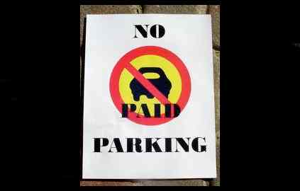
All tax proposals, by law, must go to voters – whether it’s at the city, county or state level. But a city can bring other issues up for a vote – like parking. The June 3, 2014, Measure P was the last item a City Council put on the ballot.

Anti-paid parking advocates to their cause to voters in June 2014. Photo/LTN file

Anti-paid parking advocates took their cause to voters in June 2014. Photo/LTN file

This came about because of the controversial metered parking program the city had initiated in various parts of town. While the issue had been talked about for years, approved by various councils and included in budgets, after it became a reality a group of citizens called Tahoe for Tahoe wanted the meters and the program to be abolished. Because of legal reasons they could not get a measure on the ballot themselves. The city, knowing it could essentially be stabbing itself in the foot, agreed to take the issue to the people.

And the people said get rid of the program. It required a 50 percent plus 1 percent vote to pass. It did so with 66.96 percent.

The meters associated with the program were removed Aug. 31, 2014.

The first vote put to the people after incorporation came on Nov. 6, 1984. It was called Measure C. This would have created the county of Tahoe. It failed, with the naysayers casting 22,027 votes and proponents having 18,434 votes.

This idea, though, has not gone away. There are people today who believe the basin portion of El Dorado County would be better off being its own county.

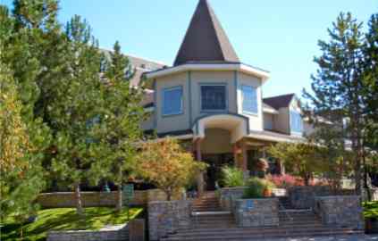
Lake Tahoe Resort Hotel, which was Embassy Suites when it opened, is a still a player in redevelopment.

Lake Tahoe Resort Hotel, which was Embassy Suites when it opened, is a still a player in redevelopment.

Next came another Measure C, but for a completely different reason. This was to increase the transient occupancy tax to 10 percent in most parts of the city and to 12 percent at specific hotels in the redevelopment area.

Voters on Nov. 8, 1988, said yes with 77.5 percent. It required a 66 percent yes vote to pass.

This was the start of redevelopment in the city. The purpose of the higher tax rate was and still is to help pay off the $110 million bond debt in case property taxes were ever insufficient. Every year at least some of those TOT dollars have gone to the debt. That debt won’t be paid off for more than 20 years. There was a time before the recession that only $100,000 from the TOT was needed to help with the debt. As property values rise, the property taxes increase, which in turn means less TOT required to pay the bills and more of it going to the general fund.

The city didn’t ask the voters for anything else until 12 years down the road. This time it was a joint measure with El Dorado County and the Tahoe Paradise Resort Improvement District. The three formed the Community Facilities District Recreation Joint Powers Authority.

Hockey is not popular at the city owned ice rink. Photo/ Jessie Marchesseau

Hockey keeps becoming more popular at the city owned ice rink. Photo/ Jessie Marchesseau

A special election was called on Sept. 19, 2000, where voters were asked to pay a 30-year $18/year tax to fund recreation. This was known as Measure S. The $6.5 million in bonds are to paid off in 2030. The money paid for the city ice rink that is now operated by a private company, the ball field next to Lake Tahoe Community College and $50,000 a year of TPRID, as well as bike trail improvements.

Sixty-nine percent of the voters said yes.

Hotel taxes were back before voters two years later.

Measure Z passed on Nov. 5, 2002, with 56.1 percent of the voters saying yes. It needed 50 percent plus 1 percent vote.

This measure added $1 to every hotel room night to add to the city’s transient occupancy tax revenue. TOT along with property and sales taxes are the three main revenue sources for South Lake Tahoe.

It was in place from Feb. 1, 2004, to Oct. 31, 2006. Measure Z brought in about $1.1 million a year when it existed, which at the time helped the city make ends meet.

This was the last time the city raised the TOT.

South Lake Tahoe lodging establishments are accessing a fee that goes toward marketing. Photo/Provided

South Lake Tahoe lodging establishments are assessing a fee that goes toward marketing. Photo/Provided

However, in 2006 the South Lake Tahoe Tourism Improvement District was formed. The group of lodging establishments agreed to assess guests $3 per night at hotels-motels and $4.50 night at time shares and agent-managed vacation home rentals. That money is then used for marketing purposes by the district. It is considered a fee and that is why it did not have to go to the voters.

They did this the day after Measure Z expired.

The sales tax in South Lake Tahoe went from 7.25 percent to 7.75 percent after voters gave the go-ahead on Nov. 2, 2004.

Measure Q passed with 58 percent of the vote. It needed 50 percent plus 1 percent for approval.

That extra half percent goes directly to South Lake Tahoe. This is unlike most sales tax that is set by the state, collected by the state, and spent by the state. Some is filtered back to the county and then the city, but not a ton compared to what is collected.

Voters on Nov. 8, 2005, said no to raising the snow removal fee. This was called Measure R – not to be confused with the later recreation measure by the same name.

This Measure R would have increased the snow removal tax from $20 to $40 per parcel. It required a two-thirds approval, but only 54.2 percent of the voters said yes so it failed.

Voters on Nov. 3, 2010, were asked to revise Measures S with Measure B, which stood for ball fields. It would have given more money to ball fields, but the bike community came together to help defeat the measure.

It needed 66 percent to pass; it received 60.54 percent.

Next up was the idea to increase the maximum amount on business license fees. It would have increased the not to exceed amount from $3,387 to $10,000 per calendar year.

But voters on Nov. 2, 2010, said no to Measure E – but barely. It required a 50 percent plus 1 percent vote. It received 50.81 percent.

Bike trails are improving with Measure S/R funds. Photo/LTN file

Bicycle trails are improving with Measure S/R funds. Photo/LTN file

Ball field and bicycle advocates came together in 2011 to successfully rewrite Measure S. What is now known as Measure R was approved by voters that Nov. 8. It rejiggered how money could be allocated, making it less restrictive. More existing ball fields and bike trails have received upgrades instead of the money mostly going to new facilities.

On the June 5, 2012, ballot the business license cap was revisited by the city.

The analysis from the city attorney at time regarding Measure B said, “Passage of Measure B will reduce the business license tax on 95 percent of businesses in the city of South Lake Tahoe by 5 percent. The measure increases the maximum any business pays from $3,448 to $20,000 based on the tax rate for each type of business. The current business license tax rates and maximum tax are increased annually for inflation, but if Measure B passes, the tax rate per $1,000 of gross receipts and the maximum tax of $20,000 shall not be increased for inflation.”

It passed with 55.61 percent of the votes.

The next ballot measure likely to be put forth by the city will come in 2016. It may be to raise the transient occupancy tax or create an amusement tax or both, all with the purpose of creating a funding source for recreation improvements.


South Lake Tahoe — a 50-year work in progress

South Lake Tahoe voters in November 1965 agreed   form an incorporated city.

South Lake Tahoe voters in November 1965 agreed to form an incorporated city.

slt 50th logoPublisher’s note: This is one in a series of stories Lake Tahoe News will be running leading up to the 50th anniversary of South Lake Tahoe on Nov. 30.

By Kathryn Reed

“The people of Lake Tahoe’s South Shore formally have taken steps to control and preserve the natural beauty of this area. The overwhelming vote for incorporation proves the people do care what happens to the lake. We now have local government control and do not have to rely on those from other areas to take care of our needs.”

– Wink Ames

Ames was one of the founding fathers of South Lake Tahoe and went on to serve on the City Council. The quote above was his official statement to the media after the votes were counted.

From dirt roads to a major federal highway. From just a few year-round residents, to thousands. From ranching to gaming’s housing hub to a recreation mecca. South Lake Tahoe has gone through a multitude of changes through the years.

Before the vote to incorporate took place in November 1965, the area was divided more into neighborhoods that still exist – Al Tahoe, Bijou, Bijou Park, Stateline, Tahoe Valley and Tallac Village.

There were 12,000 people who called South Lake Tahoe home in 1965. The vote to incorporate was 2,011-614. Voter turnout was 65 percent. With approval, South Lake Tahoe became the 398th city in California.

Norm Woos is the longest  serving member on the City Council. Photo/South Lake Tahoe

Norm Woods is the longest serving member on the City Council. Photo/South Lake Tahoe

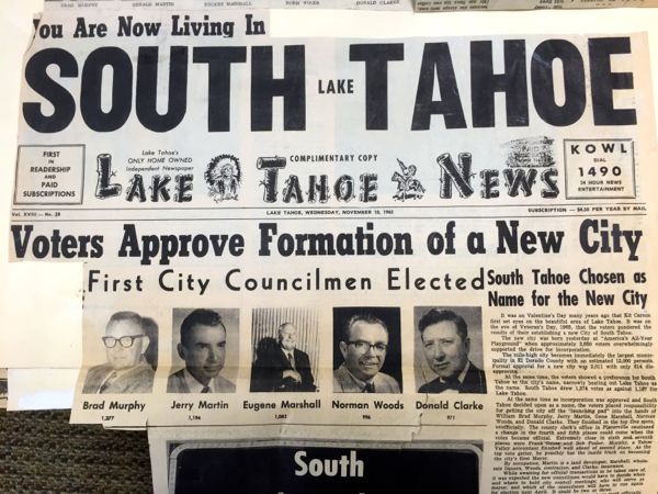
The first council consisted of Brad Murphy who was the top vote getter at 1,377; Jerry Martin (1,194); Eugene Marshall (1,082); Norm Woods (996); and Donald Clarke (971).

What has changed through the years is not the number of votes, but the voter turnout. With the city having a population of about 21,500 people, a total of 9,414 votes were cast for City Council in November 2014 when voters could vote for three candidates. Wendy David received the most at 1,727.

Woods is the longest serving member at 21 years – 1965-70 and 1976-92. By the time current members Hal Cole and Tom Davis finish their terms, each will have served 20 years. Cole from 1994-2006 and 2008-16; and Davis from 1992-2004 and 2010-2018.

From 1965-68, all mayors served a six-month term. Today they serve a one-year stint.

Echo Motel on Highway 50 and Ski Run Boulevard comes down June, 26, 1989, for the first phase of redevelopment. Photo/South Lake Tahoe

Echo Motel on Highway 50 and Ski Run Boulevard comes down June 26, 1989, for the first phase of redevelopment. Photo/South Lake Tahoe

Pictures of everyone ever elected to the council are on a wall in the room where the five electeds meet, with the dates served posted as well.

Originally the council met in the basement of what was the Tahoe Savings & Loan Building. It is now El Dorado County offices on Takela Drive.

City offices have moved throughout the years, including being in what is now the senior center. Today they are at Lake Tahoe Airport and on Tata Lane.

Fire, police and snow removal were the three tenants upon which incorporation were sold to the public.

In 1966, the city took over Lake Valley Fire Protection District stations that were in the city limits.

The first police chief, Ray Lauritzen, was hired in April 1967. He then started hiring officers.

Plow drivers were adept enough by the end of 1966 to clear all city streets within 12 hours.

Not everyone was happy with the city being its own entity and no longer under complete control of El Dorado County. A move for disincorporation was put on the ballot in 1968 and was defeated.

John Williams served as the first city manager until 1969.

In 1966, Pioneer Trail was open year-round from Meyers to near the state line.

The base of the gondola was put in by American Ski Company. Photo/Heavenly Mountain Resort

The base of the gondola was put in by American Ski Company. Photo/Heavenly Mountain Resort

Planners in the early 1970s expected the city to one day have a population of more than 50,000 people. This was at a time when there was talk of Pioneer Trail being more like a freeway. Even Caltrans was going to build a bigger highway and had the right-of-way to do so.

When the Greenway Bike Path, which may start construction this summer, is completed, much of it will be along that former Caltrans right-of-way that goes from Meyers to almost the Nevada border.

Entertainment and recreation have long been integral to South Lake Tahoe’s economy and tourist draw. The Stateline casinos in some form have existed since the 1940s. With the opening of Lake Tahoe Hard Rock this week, there is another reason for people to visit.

While technically there isn’t a ski resort in the city limits, the 1960 Winter Olympics at Squaw Valley put all of Lake Tahoe on the map as a winter wonderland.

Heavenly Mountain Resort’s gondola opened for the 2000-01 season. It made it so skiers near the bulk of the hotel rooms could be whisked to the mountaintop without having to drive to one of the base lodges. Two years later Vail Resorts would own the gondola and ski resort. The village, anchored by two Marriott properties, continues to be the hub of tourist activity in South Lake Tahoe.

While the city has made considerable improvements through years, some things never change. The first talk of doing something with signs was in 1967. Regulations about billboards, neon, motif, color, type and style have been made ever since then. Even last year the council was still talking about what to do about sandwich boards. And signs are likely to continue as a topic when it comes to design standards in the Tahoe Valley Area Plan.

—–

Notes:

  • The city is planning open houses at various city building throughout June and July.

  • A time capsule unveiling and citywide treasure hunt will take place in September.

  • Homecoming and community parade is set for October.

  • The 50th anniversary dinner and gala at Lake Tahoe Resort Hotel is Nov. 7.


Tahoe agencies close to failing in their job to implement change post-Angora Fire

By Kathryn Reed

Five years later and people are still wondering how they will evacuate safely from the Lake Tahoe Basin in an emergency, if a reverse 911 system has been installed, and how to get their neighbors to get rid of that shake roof.

While a panel of agency officials sat on the stage of the theater at South Tahoe High School on Monday talking about what they have done in the five years since the Angora Fire, it was more personal information the audience sought.

But answers for them were few or limited.

The June 25 forum was hosted by state Sen. Ted Gaines, R-Roseville. Speakers were Gareth Harris of Lake Valley Fire Protection District, Kelly Keenan with CalFire, Patty Kouyoumdjian of Lahontan water board, Joanne Marchetta-TRPA, and Mike LeFevre-USFS.

North Shore real estate agent Sue Daniels asked why the Caltrans signs can’t alert people about red flag warning days and what the state’s $150 rural fire tax will be spent on.

Gaines said he would look into the sign question. As for the tax, he calls it double dipping. The money collected from homeowners won’t help CalFire or any firefighting efforts.

Keenan explained the tax means $89 million for CalFire, but in reality the department’s budget from the state has been reduced by that same amount so the tax is not a net gain to the state fire agency. What people are paying for is unknown. The tax really goes to the general fund to be spent however the governor and Legislature want.

A resident in the Lake Valley area asked what to do about a neighbor who believes doing nothing to their fire prone-shake roof is fine.

Harris said his district received a $5 million grant from FEMA to deal with just that issue. The money is available to assist homeowners in Lake Valley, Meek’s Bay and Fallen Leaf Lake fire districts.

But Harris also encouraged residents to call their local fire department about any defensible space issue and have the firefighters be the bad guys and the court be the enforcer if it were to get to that point.

Angora burn area resident Susan Ward told the audience of more than 100 how she never received a reverse 911 call five years ago. No one told her Monday night the reason there was no call is because the El Dorado County Sheriff’s Department thought the governor had to make that decision. Not so. The county has the capability to use this system without Sacramento’s OK – so do other jurisdictions.

While El Dorado County Sheriff John D’Agostini and South Lake Tahoe Police-Fire Chief Brian Uhler attended the forum, neither spoke and neither stayed until the end. They would be the ones to answer how the 911 system works.

The other issue Uhler and D’Agostini could have addressed is the evacuation plan because that is the job of law enforcement. None of the speakers could give any details about how people will be evacuated in the event of an emergency.

It was total chaos five years ago that proved whatever system might have been in place did not work. This proved true the Sunday the fire started and then the Tuesday when the Tahoe Keys area was evacuated when the fire jumped Highway 89.

Grading the work done post-Angora

State Sen. Ted Gaines reveals the agencies in the Lake Tahoe Basin barely received a passing grade based on the lack of implementation of recommendations post-Angora. Photos/Kathryn Reed

Gaines had asked the non-partisan Senate Office of Research to examine how the 90 recommendations issued by the bi-state Blue Ribbon Fire Commission that was convened by then Govs. Arnold Schwarzenegger and Jim Gibbons had been implemented.

Sixty have been completed and 10 are in the process. To this, Gaines gave the effort a C-minus grade – barely passing by most standards.

One recommendation of the bi-state commission was to, “Adopt the priority of life, property, and the environment, in that order, with respect to fire safety and fire prevention.” The action taken, according to the report released Monday, was, “Implemented.”

Firefighters have those priorities, but those who control the basin have a different agenda. Water quality is one. Spending grant money to keep their jobs is another. Planning and more planning without implementation appear to be other priorities.

“It’s not an important issue, it’s an urgent issue,” Gaines said of needing to make Lake Tahoe fire safe.

He doesn’t understand when people talk about the importance of Lake Tahoe how protecting it from a devastating fire isn’t at the top of the list. He pointed to the Democrats in the state Legislature not wanting to fund projects that would help Tahoe.

One of the recommendations was to create an 800 number for people to call for information about defensible space guidelines. But the number provided in the report went to a personal residence when Lake Tahoe News called it Monday night.

An “undetermined” was the action for the recommendation, “To avoid continued confusion regarding interagency communications during wildland fire occurrences, all dispatch centers and responding resources in the Tahoe basin will adhere to the existing agreements.”

Considered “implemented” was the recommendation to, “Work with their respective congressional delegation to establish an annual sustainable fund for forest health for the Lake Tahoe Basin.”

But the people speaking on the stage Monday said money is an issue and there is no “sustainable fund” for fuel reduction or firefighting. Congress has not reauthorized the Lake Tahoe Restoration Act that supplied the initial money for environmental projects that included fire related activities. SNPLMA funds are about exhausted. And some entities in the basin would like the remaining Southern Nevada Public Lands Management Act dollars be spent on a loop road on the South Shore instead of fire related issues.

One of the recommendations that was found to be “undermined” was, “Find more stable, long-term funding to replace the stopgap funding provided by the states, likely through the collection of a parcel fee or similar special assessments on property owners.”

Everyone in at the forum would likely have categorized that as “not implemented”.

Going into the burn

Before the evening meeting, Gaines went on a tour of the Angora burn, witnessing the forest as it looks today, talking to homeowners who have rebuilt and seeing a community garden that has sprouted from the ashes.

“We all move to Tahoe because it’s beautiful. We stay because of the people,” Marsha Hudson told Gaines. She said having an evacuation to-do list on the inside of a cupboard helped her family retrieve more belongings than they would have otherwise remembered in such a stressful situation.

ngg_shortcode_0_placeholder (Click on photos to enlarge.)


South Lake Tahoe: A link between the people and the action


By Kathay Lovell

I will never be able to get out of my mind the sights and smells of the Angora Fire. I was at ground zero on the morning of June 25, 2007. I never want anyone to experience that again – the loss of their mementos, personal belongings and their beloved pets. All things lost during the fire that can never be replaced.

Angora Fire -- 5 years later

In my opinion, South Lake Tahoe forever changed at 2:15pm, June 24, 2007. I was mayor at the time of what would be later known as the Angora Fire. The events over the course of the next week following the fire were the most difficult times for our community. Others will recount the details of the cause and circumstances of the fire.

For me, the most vivid details started shortly after the fire started. From my house I had a clear view of the initial plume. I knew it was trouble just by the heat, wind, and a very dry previous winter. I snapped a few pictures from my Blackberry and sent them to the city manager who was working that Sunday at the airport. We spoke briefly and he said that this was a significant event. According to the city’s fire chief, the fire at that time was within the jurisdiction of the county but on track to move toward the city. Details were sketchy, but the conditions and location of the fire caused great concern. The city manager and I decided it was imperative to open the Emergency Operations Center (EOC) located at the airport in the City Council chambers just in case the fire escalated.

I left my home for the EOC never imagining how aggressive the fire had become or was about to be. We (the city manager, police chief, city clerk, city attorney, and a few senior staff members and myself) were briefed. The fire wind gusts were up to 50 miles per hour and the fire area was heavily timbered with a dense canopy in the path of hundreds of homes. People were being evacuated. Federal, state, and local fire agencies responded on the initial attack and it quickly became evident that home protection and evacuations were the priorities.

The appropriate staff and other local agencies were notified the EOC was being opened. It seemed like within minutes the room was full. There wasn’t a lot of talking at first, everyone was setting up tables, computers, and phones lines were being drug across the floor. The city’s information technology staff was laying additional lines and setting up fax machines and televisions. Different public safety agencies were flowing in. Staff was soon making arrangements at the Parks and Recreation Center for evacuees. The pre-existing disaster recovery plan was in full swing.

Everyone was very professional and operated in a unified environment. The mission we were tasked with was to gather information as it was coming in and disseminate out to the public as quickly as we could. It was very fluid. I called the El Dorado County sheriff and undersheriff to tell them how serious this fire was and how quickly it was spreading. The sheriff immediately dispatched this county EOC staff. The fire chiefs and U.S. Forest Service had immediately made all the necessary requests for other additional assistance.

Kathay Lovell speaks about the Angora Fire while the governors of Nevada and California, Lake Tahoe Basin fire chiefs and Sen. Dianne Feinstein, D-Calif., listen. Photo/Kevin Chandler

There was an almost immediate intense media presence and their numbers were growing at a rapid rate. The media overwhelmed us. The city had no public information officer, so the city manager and I were the point of contact. The city clerk and the city attorney would gather updated information from our briefing and the city clerk would provide to us, almost every 10 minutes, with updates so we could inform the media and public as rapidly as possible. Every time we got an update we were relieved there were no reported human casualties, but the number of lost homes was unclear. Lives of residents and first responders were constantly a worry.

In the meantime, my son called me while I was at the EOC. He told me he and his wife were evacuating. I told them just go to my house with whatever they could take and safely get out. It was a long night with information coming in quickly.

We had every type of media truck in the parking lot at the airport. The city manager and I did constant interviews with the media most of the night as information was coming in to us. I went home sometime around 3am to return at 6am Monday. As I arrived, I was being updated. The sheriff was on his way up from Placerville. The fire chief was making arrangements to take the sheriff, the police chief, and me to the burn area.

As we drove into ground zero of the burn area, the thick stench of burnt timber and building materials hung in the air. The blue sky Tahoe is famous for was gone and a gray haze of smoke surrounded us. Suddenly we could see the total devastation of homes and forest. Everyone was silent as if to pay reverence to the loss. Cars were reduced to metal hulls. Homes burned to the foundation. Smoldering ashes surrounded us of what was no more.

We stopped the car as the fire chief began to explain the course and intensity of the fire. A few feet from where we stopped there was a child’s bicycle, completely charred. The bike was in front of what used to be someone’s home. I could only think it was a miracle no one died.

That same Monday night was the first of three public meetings. I attended every public and community meeting regarding the Angora Fire during that summer. Not all locally elected attended those public or community meetings. They should have and this bothered me. The community needed all of us, even if to vent or have a shoulder to lean on. I wanted to be there for my community. This first meeting was in the gym at the middle school. The estimated attendance was 1,500. I think all the Angora Fire victims and their families were there; rightfully so, I sensed a lot of fear, anger, and questions.

The Forest Service firefighters, sheriff, CalFire, fire chiefs and others were there to answer questions and provide current information. TRPA Executive Director John Singlaub took questions but was quickly verbally attacked by the audience. It was a pivotal moment. Many in the audience believed that the fire was made worse by regulations forbidding homeowners from clearing adequate “defensible space” from around their properties. Every agency realized there had to be a collaborate effort to deal with defensible space in the future. It was an emotional night and we needed to provide comfort and answers.

Tuesday, I was again at the EOC, and we were briefed about the containment. It was of grave concern because the same conditions as Sunday, with high heat and dry winds, were expected. I went home for an hour to take care of my dogs. While outside with them, I saw a plume of smoke. I took pictures and immediately sent them to the city manager and the fire chief. I was told the fire had rekindled and spread quickly. Due to the conditions, it had broken containment and was heading toward South Tahoe High School, the Gardner Mountain housing tract and Tahoe Keys. A few moments later, while still in my back yard with the dogs, I began to see huge red glowing embers of wood blowing onto my roof and yard. I soon found out I was going to have to evacuate. Now I was experiencing what many others in the path of the fire had already been through.

My husband had been in Alaska since Friday on a fishing trip. He was at a remote lodge with no phones or cell service. I couldn’t contact him during the first few days of the fire. He was of no help. My son, who was able to return to his home that he had previously evacuated, came to get my things and my dogs. I was not organized and ran in a bit of a circle as to what to take and what to leave. My son said, “You have 2 minutes or I will carry you out.” I grabbed my dogs, dog food, leashes, my laptop, a few pieces of jewelry, some jeans and tops, and my son said I was done. As we departed, he grabbed a collage I had with pictures of the family.

We were trying to leave the Tahoe Keys area along with everyone else. We went to 15th Street first only to find it was blocked. After a long wait on Tahoe Keys Boulevard we made it out along with everyone else. Yes, it was a disaster and very frightening. To add to my concern, as my son was driving on Tahoe Keys Boulevard, I realized I had forgotten my pet bird. He would not turn around – it was bumper to bumper. My daughter also resided in the same area and I frantically called her. She left work and gathered her two dogs and a few possessions before evacuating.

My son dropped me off at the EOC. He took my things and dogs to his house. I needed to regain my composer; I needed to do my job. It was another night of horrible fires and valiant efforts to successfully save our high school and surrounding residences. I made my way home around 2 or 3am. I laid my head on the pillow fearing for my community. I could see Gardner Mountain was aglow with flames; we were still under siege. I got a few hours of sleep and then returned to the EOC. The following days brought more containment and resources until finally the fire was out. So many had fought this fire in order to save lives and homes; some that fought the fire lost their own homes in the process.

In the days, weeks, months following the devastation of the Angora Fire, it was clear we had to do everything possible to help our community. For those who lost everything, we had to be there to comfort and help them. We had city employees and we all had friends who lost homes. One of the councilmembers suggested we give up a month’s salary and contribute to employee victims, three of us did. Additionally, the City Council took action on July 12, 2007, to put in place city code changes and purchased supportive firefighting equipment including a wildland fire engine and new programmable radios. These changes along with defensible space clearing around city owned properties were positive steps toward future fire prevention.

In retrospect, the healing process for the community was both grief and joy. The losses were incredible, but so was the community support for the victims. So much so, the victims refused to be labeled anything other than “survivors”. The fire was an emergency. Nothing works perfect in an emergency, but from my viewpoint at the EOC and in the time following all agencies went above and beyond. While personal belongings, pets, and keepsakes were lost during the fire and can never be replaced, not one human life was lost nor was anyone seriously injured as a direct result of the fire. The devastation of homes and the fire damage is insurmountable and still scars our lives.

Kathay Lovell was mayor of South Lake Tahoe during the Angora Fire.


Lahontan: Water issues a concern now, during and after fires

By Lauri Kemper

June 24, 2007, began strangely. My niece and her family were spending their last day of their vacation with us. We set out to hike around Echo Lakes early that morning. The hot, dry winds were so fierce that sand from the trail was blowing into my grandniece’s eyes. It was no fun, so we returned to my home off North Upper Truckee Road to take a walk to Osgood Swamp, instead, because it is more protected behind Flagpole Peak.

Angora Fire -- 5 years later

On our way back, we saw a puff of smoke that I first thought was a lone thundercloud. But quickly the puff became a tower of billowing smoke.

To get back to the subdivision, we had to move toward this tower of smoke before turning away from it. We started running, as if our lives depended on it. My niece and her family had already packed their car, so they jumped in and left the basin, probably reaching Echo Summit before the first fire truck got there.

From my house, we watched the smoke grow in size and density. We watered our yard and hosed down the house, but luckily for our neighborhood, the winds kept the smoke and fire away. Still, we were evacuated, because a change in wind direction would have brought the fire to us.

Two of my water board colleagues lost their homes in the Angora Fire, and several employees were evacuated.

The Lahontan Water Board was not directly involved in the fire suppression efforts. During a fire emergency, the water board is not a first responder. Over the years, the water boards and the USEPA have advised fire suppression agencies to take steps, where possible, not to adversely affect streams and lakes during fire suppression activities. For example, fire retardants contain phosphorus that, if dumped directly into a lake or stream, could cause fish kills and large increases of algal growths. So, fire agencies avoid applying fire retardants directly to streams and lakes.

On Monday, Lahontan water board staff members joined the state’s Emergency Management System, including a multi-agency response team. Lahontan water board staff brought their knowledge and expertise in communication, water quality, science, engineering, and public funding to assist in the effort.

A local assistance office with phone banks was set up to answer the public’s questions and concerns. Lahontan water board loaned a staff person to the office to answer calls and provide information to the public. We were fortunate to have a student intern working for us that summer who was a South Lake Tahoe native, a great communicator and forestry major. As our key staff person at the assistance center, he was instrumental in effectively handling inquiries and linking individuals to the specific resources they needed. Our technical and communications staff participated in regular updates to the multi-agency team so that all current information was shared and collective responses could be prepared to address new information or concerns.

The types of fuel reduction allowed in Angora Creek has been debated. This is the area in May 2012. Photo/LTN

The Lahontan water board’s primary role following the fire was to protect water quality. Water board staff participated on several teams addressing debris removal (from the burned homes), erosion and runoff controls, and water quality monitoring.

We served on the Debris Removal Multi-Agency Committee ensuring that plans were designed and implemented to address the risks to water quality and public health from the debris remaining at the burned home sites. When a home burns, all contents are burned with it, including appliances, carpets, paints, pesticides, cleaning products, automobiles and building materials. The ash and debris remaining may contain toxic levels of chemicals and pollutants that pose risks to public health and safety, and to aquatic life and wildlife. Additionally, the debris itself constitutes a nuisance.

This group of dedicated local and state agency staff persons was instrumental in successfully removing all the debris before the fall rains hit. Many logistics involving property owner approvals, insurance company involvement, health and safety concerns from debris and dead trees, disposal methods, and erosion control/site restoration were resolved by the committee members, including Lahontan Water Board staff. Debris and contaminated soil and ash associated with the burned home sites were removed, and building sites were protected from erosion by a single contractor overseen by El Dorado County and the state’s Integrated Waste Management Agency staff.

Water board staff requested and received approval for $380,000 from the state water board’s Cleanup and Abatement Account funds. This money was used for water quality monitoring of Angora Creek and supported increased county and city road and drainage structure maintenance efforts, and an emergency water treatment system at Angora Creek proposed by El Dorado County. Staff coordinated with the California Tahoe Conservancy, U.S. Forest Service, El Dorado County, and U.S. Geological Survey to plan and coordinate water quality sampling in several locations to assess the impacts on Angora Creek. The Water Board contributed $90,000 to an approximately $350,000 interagency water quality monitoring program.

The U.S. Forest Service implemented its Burned Area Emergency Response Team (BAER) to evaluate the risks to water quality, soils and vegetation resources from the Angora Fire, which was primarily on lands it manages. The U.S. Natural Resource Conservation Service assessed erosion risks on private and county lands. Water board staff advised these teams, providing input to the field reports, risk ratings and corrective action plans. The BAER Team found that 76 percent of the soils within the burn area were hydrophobic (meaning that the soils may resist infiltrating or percolating rain water). If the burn area were not treated, stormwater runoff would carry ash and sediment to nearby streams and to Lake Tahoe. With Lahontan water board’s support and assistance, Forest Service, El Dorado County and city of South Lake Tahoe received resources from state and federal agencies to install runoff control measures such as basins, channels and sand bags, and to control erosion using mulches, seeding and other measures.

“The water board is committed to working with land managers and landowners in the Tahoe basin to facilitate fuel reduction activities while encouraging the restoration and improvement of watershed functions.”       — Lauri Kemper

We believe these efforts to control erosion and manage increased stormwater runoff prevented substantial amounts of sediment and ash from reaching streams and lakes. Additionally, the weather cooperated and delivered below normal precipitation following the fire, reducing the amount of runoff that would carry sediment and debris to streams. Data collected showed some minor increases in sediment, nitrogen and phosphorus to Angora Creek, but the impacts to water quality could have been much worse. The Water Board had provided El Dorado County funds to rent an emergency water filtration system that was stationed at the junction of Angora Creek and Lake Tahoe Boulevard to be operated during runoff periods, where the creek was anticipated to be highly turbid from runoff carrying ash, debris, and sediment. The treatment system was set up and ready to operate, but was not used because the turbidity didn’t increase to the levels anticipated or to the point where treatment would be beneficial.

Following fire response and recovery, water board staff participated in the Bi-state Tahoe Basin Fire Commission. A water board member served on the commission and staff members participated in working groups to identify constraints to fuel reduction projects and to craft creative solutions and improvements to hasten the implementation of fuel reduction projects.

In May 2008, the governor of California issued a proclamation encouraging the water board to take expedited action to implement the recommendations of the Fire Commission or develop findings why any recommendation should not be implemented. Ten recommendations of the commission applied to the Lahontan water board. By March 2009, these recommendations had been implemented or otherwise addressed.

The water board adopted a revised regional waiver of waste discharge requirements for vegetation management activities, including fuel reduction projects. This waiver simplified or eliminated permitting application and reporting requirements for many “low threat to water quality” fuel reduction projects. For defensible space projects and for projects involving hand crews, no application, fee, or water board review is required. Other fuel reduction projects receive expedited review.

The 2009 waiver provides a table listing several types of fuel reduction activities, including the use of mechanized equipment and burning that can be conducted in stream environment zones without separate authorizations from the water board. The water board must separately review and authorize other activities involving soil disturbance in stream environment zones. This review and authorization involves a 10-day public notice and can be approved by the executive officer. The 2009 waiver has been instrumental in protecting communities and hastening fuel reduction efforts throughout the Lahontan region.

The fire commission encouraged all public agencies and private property owners “to work together more effectively to implement fuel reduction projects designed and prioritized to minimize the risk of wildfires.” Water board staff continues to participate in the Tahoe Basin Tahoe Fire Fuels Team meetings, coordinating and cooperating with fire districts, and state and federal agencies to ensure rapid implementation of the highest priority fuel reduction projects. Water board staff also provides input on the design of research projects to address areas of uncertainty related to potential impacts to water quality from more aggressive forest treatments, such as burning piles of slash in stream environment zones, using heavy equipment or innovative low ground pressure equipment on steep slopes and in stream zones.

In 2012, water board staff intends to bring a Basin Plan Amendment to the water board for its consideration to further clarify exemptions allowed for soil disturbance work within stream environment zones to facilitate tree and vegetation thinning. This year, water board staff will also be providing input into TRPA’s Regional Plan updated to ensure agency consistency in the rules and regulations concerning fuel reduction and vegetation management activities.

The water board is committed to working with land managers and landowners in the Tahoe basin to facilitate fuel reduction activities while encouraging the restoration and improvement of watershed functions.

The Lahontan Regional Water Quality Control Board is a California agency established to protect and restore water quality, including restoration of Lake Tahoe’s transparency. The water board regulates discharges of pollutants to water quality.

Lauri Kemper is assistant executive officer of the California Regional Water Quality Control Board, Lahontan Region.


Pets continue to have final resting spot in forest

Where do Tahoe’s animals go when they die?

For some, their remains are in the Angora burn area.

For decades before the 2007 fire, people had been burying their animals not far from the Gardner Mountain neighborhood. Although dogs are the primary pet of choice for those who live on the South Shore, other animals are buried in the forest.

Pet cemetery continues on in Angora burn area. Photos/Kathryn Reed

While this burial site on U.S. Forest Service land is technically illegal, the feds for now continue to allow this expression of grief, remembrance and closure to continue.

How long this pet cemetery has existed is not known. But the fire did not curtail the desire for humans to bury their four legged family members in the forest.

Some markers are new, while others are charred. Some are more elaborate than others. All are a symbol that life is fragile and that the dash is never long enough.

 — Kathryn Reed

ngg_shortcode_1_placeholder (Click on photos to enlarge.)