Expensive jets line the tarmac at Lake Tahoe Airport as players arrive for the ACC. Photo/LTN
While former President Bill Clinton flew into Lake Tahoe Airport on Tuesday and is expected to be here the week, he will not actually be playing in the American Century Championship.
Clinton is known for being more of a hacker on the course.
The actual tournament at Edgewood Tahoe is Friday-Sunday.
Tuesday was a practice round and the Tahoe South celebrity-am, Wednesday is another practice round and the Harrah’s celebrity-am, with Thursday being the American Century celebrity-am. It’s possible Clinton could be participating in one of the celebrity-am events or just practice with the other players.
The additional security for this year’s tournament is not because of Clinton.
“Restrictions are actually standard at other tournaments. ACC is just responding to current security precautions,” Carol Chaplin, executive director of Lake Tahoe Visitors Authority, told Lake Tahoe News.
— Lake Tahoe News staff report
USFS to use herbicides on plants in basin
The U.S. Forest Service Lake Tahoe Basin Management Unit will continue a project to eradicate, control, and contain known infestations of invasive plants in the Lake Tahoe Basin using chemical treatment.
Work will take place at approximately 90 infestations sites (18.25 acres) beginning in mid-July and continuing through September.
There are 493 known invasive plant infestation sites located on National Forest System lands managed by the LTBMU. Invasive plants reproduce and spread rapidly, displacing native plant species’ richness and diversity. Invasive plants can reduce the range and quality of fish and wildlife habitat, increase soil erosion and stream sedimentation, as well as, impair recreational quality.
LTBMU is managing as many as 723 separate invasive plant populations with 30 percent of those planned for treatment this year. While some invasive species like common St. John’s wort are managed by manually uprooting them, 40 percent of the 2017 priority populations will be treated chemically.
Current project areas include 64 Acres parking lot, Angora Fire and Angora Creek restoration areas, Lam Watah Trail, Luther Pass Campground, Heavenly Creek Meadow, Heavenly Mountain Resort, Meyers Landfill, the Lower Truckee River corridor, Spooner Summit Fire Station, Genoa Ridge, Tallac Historic Site and Taylor Creek.
In addition, weed infestations on Forest Service urban lots will be treated in the following Lake Tahoe Basin neighborhoods: Bijou, Kingsbury Grade, North Upper Truckee, Tahoe Paradise, South Upper Truckee, Sierra Tract, Ski Run, Ward Creek and Zephyr Cove.
Chemically targeted invasive plant species include Russian knapweed (Acroptilon repens), perennial pepperweed (Lepidium latifolium), Dalmatian toadflax (Linaria dalmatica var dalmatica), yellow toadflax (Linaria vulgaris), hoary cresses (Lepidium appelianum & L. draba) and Canada thistle (Cirsium arvense).
Treatments will include the use of three herbicides: Rodeo, Milestone, and Telar. Applicators will apply the product with backpack sprayers and other handheld tools.
Caution signs will be posted in treatment areas and will remain for at least 48 hours after treatment.
Trail will link Tahoe City, Kings Beach and Truckee
By Karen Marks, Sacramento Bee
Bit by bit, a trail is taking shape at Lake Tahoe that will eventually connect Tahoe City, Kings Beach and Truckee.
The Northstar Community Services District recently received $250,000 in hotel tax money to begin the next phase, about 2 miles of the Martis Valley Trail. The Martis Valley Trail is part of a planned 62-mile trail network that Peter Kraatz, assistant director for Placer County’s public works and facilities department, calls the “resort triangle.”
Of the 62 miles, half has been completed. The remaining half includes the Martis Valley Trail along the northeastern leg of the resort triangle, in addition to a few unfinished gaps along the north shore of Lake Tahoe and Truckee River.
Subalpine meadows are among the Sierra Nevada’s most enchantingly picturesque landscapes. These sparsely wooded, grassy expanses are home to plants and animals found nowhere else, and they play an important role in regulating the flow of water from the Sierra snowpack to the rest of the state.
But these ecosystems may soon disappear.
A UC Merced study authored by former doctoral student Kaitlin Lubetkin, Professor Leroy Westerling and Sierra Nevada Research Institute scientist Lara Kueppers found that these meadows are being increasingly overrun by forest as changing conditions allow the offspring of nearby trees to take hold in meadow environments that previously favored shrubs and grasses over saplings. For the many species that depend on meadows, this change may force them to find new habitats.
Before heading to the woods to fly a recreational drone, U.S. Forest Service officials ask pilots to comply with all Federal Aviation Administration regulations.
The FAA has regulatory authority over all airspace, including recreational use of airspace by drones. Information is available online.
When flying recreational unmanned aircraft systems (UAS) on National Forest System lands, there are some restrictions that pilots should be aware of. Since UAS are considered to be both “motorized equipment” and “mechanical transport,” they cannot take off from, land in, or be operated from congressionally designated wilderness areas.
“Designated wilderness provides opportunities for primitive types of recreation, which is a much needed contrast from our increasingly developed and mechanized world,” said Jamie Fields, recreation and Wilderness program manager. “Pilots should also refrain from flying recreational UAS in popular recreation areas for public safety and to allow others to enjoy their recreational experience.”
Additionally, UAS should not be flown over or near wildlife as this can create stress that may cause significant harm and even death. Disturbance, pursuit, or harassment of animals during breeding, nesting, rearing of young, or other critical life history functions is not allowed, and may be in violation of a number of laws including the Endangered Species Act, the Migratory Bird Treaty Act, and the Bald and Golden Eagle Protection Act.
“If forest users want to use their UAS to search for or detect wildlife and fish, they need to follow state wildlife and fish agency regulations regarding the use of aircraft,” said Kris Boatner, wildlife program manager.
Recreational UAS must also abide by temporary flight restrictions (TFRs) in place by the FAA over disasters such as wildfires. In 2016, there were more than 40 documented instances of members of the public and others flying UAS without authorization over or near wildfires in 12 states (Arizona, California, Colorado, Idaho, Minnesota, Montana, Nevada, New Mexico, North Carolina, Utah, Washington, and Wyoming). This resulted in aerial firefighting operations being temporarily shut down on more than 20 occasions, which may have caused wildfires to grow larger and unduly threaten lives, property, and valuable natural and cultural resources.
Aerial firefighting aircraft, such as air tankers and helicopters, fly at very low altitudes, typically just a couple of hundred feet above the ground and in the same airspace as UAS flown by the public. That proximity creates the potential for a mid-air collision that could seriously injure or kill aerial and/or ground firefighters.
TFRs typically put in place during wildfires require manned or unmanned aircraft not involved in wildfire suppression operations to obtain permission from fire managers to enter specified airspace. The FAA, the U.S. Forest Service, the U.S. Department of the Interior, and other wildland fire management agencies consider UAS, including those used by the public for hobby and recreation purposes, to be aircraft and therefore subject to TFRs.
People should not fly UAS over or near wildfires even if a TFR is not in place because of the potential for accidents and disruption of suppression operations. Individuals who have been determined to have interfered with wildfire suppression efforts may be subject to civil penalties of up to $25,000 and potential criminal prosecution.
To keep UAS pilots aware of flight restrictions, the FAA has developed an easy-to-use smartphone app called B4UFLY. The app helps unmanned aircraft operators determine whether there are any restrictions or requirements in effect at the location where they want to fly. B4UFLY is available for free download.
Tips for responsible hobby or recreational use of UAS on NFS lands:
UAS must be flown below 400 feet and remain clear of surrounding obstacles.
Do not fly any aircraft weighing more than 55 pounds (total weight, including payload and fuel source).
Launch the UAS more than 328 feet from wildlife. Do not approach animals or birds vertically with the UAS.
Keep your UAS within your visual line of sight at all times.
Take lessons and learn to operate your UAS safely.
Remain well clear of and do not interfere with manned aircraft operations.
Fly your UAS at least five miles from an airport or backcountry airstrip.
Keep your UAS away from populated and noise-sensitive areas, such as campgrounds, trailheads, and visitor centers.
Obey all privacy laws.
Erica Hupp works for the Humboldt-Toiyabe National Forest.
Bikes & Brews festival coming to Kirkwood
The inaugural Kirkwood Bikes & Brews event is July 29 at Kirkwood Mountain Resort.
This event will support the Tahoe Area Mountain Biking Association.
Bike events starting at 10am., brew festival events from 3-6pm at Kirkwood Village Plaza.
Activities include live music by Lebo and Friends, mountain bike events, unlimited beer sampling, a raffle, rock climbing walls, Euro Bungee trampolines, bouncy house, face painting, balloon twisting, barbecue, KBar drink specials and more.
Gran Fondo mountain bike rides will be organized throughout the day, with coaching sessions based on skill level. Kids also have the opportunity to participate in the youth bike race.
Complimentary buses will be available from MontBleu in Stateline at 1:15pm. The bus will return to the casino at 7:30pm. The shuttle option is available when tickets are purchased online.
Star Guide: Jupiter’s mysterious moons
By Tony Berendsen
Jules Verne (1828-1905) wrote adventure stories about a trip “From the Earth to the Moon” and a visit to “The Mysterious Island”; only two of his many science fiction adventures. His writings inspired the imagination, spurring interest in adventure and scientific exploration for many of us, including the rocket genius Robert Goddard and astronomer Edwin Hubble.
Verne’s imagination has been surpassed by the science of the 21st century. We know so much more about the world today, and our capabilities of exploring the solar system with robots have yielded hints of other strange worldly places he never imagined.
On Jan. 7, 1610, Galileo wrote of his discovery of moons orbiting Jupiter, and 369 years later the Voyager 1 spacecraft passed by Jupiter imaging its four Galilean moons sending pictures back to Earth. Just as mysterious as the story of an undiscovered island from mind of Verne, scientists discovered future adventure for generations of explorers within the moons of Jupiter.
Galileo spacecraft image of Europa. Photo/NASA
Imagine, a trip to Jupiter, 500 million miles from the sun, a planet so large the entire solar system would fit within its volume and an armada of 69 moons within its gravitational grasp. An adventurous voyage of this magnitude would surely merit space within the pages of one of Verne’s books.
Jupiter’s moons vary wildly in size and description, from regular to irregular. The irregular are 60 plus small satellites less than 160 miles in size orbiting in prograde and retrograde directions up to millions of miles from the planet. The regular are much closer, with two having orbital periods less than a Jovian day, and four as large as our own moon.
Io is the closest of the four largest we call the Galilean moons. It orbits Jupiter every 40 hours, and is a strange place with over 100 active volcanos, a thin atmosphere of sulfur dioxide, and mountains higher than Everest. Io has temperatures varying from 3,000 degrees near volcanos, to minus 202 in frozen fields of sulfur dioxide. An expedition to explore this place would be no less daring than being shot out of a cannon to the moon.
Yet, the most mysterious moon may be Europa. It’s frozen icy crust is almost devoid of craters revealing dynamics renewing its surface by interaction with subsurface liquid water. Yes, water, maybe subterranean lakes and a hidden salty ocean where the wonder of life may exist beyond the bounds of the planet Earth?
NASA is considering a robotic mission to this distant place to fly by and capture water ejected from geysers they have found spouting from Europa’s crust. What would they find within their sample? If life was found it would be as strange as one of Verne’s fantastic tales come to life. Imagine the great burden of scientists on the mission team formulating a message to the public telling them life is not constrained to the Earth alone.
And if we did find life, would humans want to venture to Europa to study the creatures that gave evidence we are not alone? Would we begin a 21st century legacy of Jules Verne with a trip to the mysterious moons of Jupiter?
Tony Berendsen runs Tahoe Star Tours. He may be reached at 775.232.0844 or tony@tahoestartours.com.
Mobile bike shop comes to you
By Blair Anthony Robertson, Sacramento Bee
For most of his long career in the bicycle industry, Jack Cauthen greeted customers, made sales and repaired their faulty chains, frayed cables and poorly shifting gears in a traditional bike shop.
Cauthen hasn’t left the bike business, but these days he’s rolling around town in a customized Mercedes van that’s essentially a repair shop on wheels.
Velofix is a Canadian franchise that now has a presence in Sacramento, with two new Mercedes vans operating from Elk Grove to Placerville and Auburn. Customers book appointments online and Velofix shows up at home or work – or even at a bike race or your kid’s soccer practice. Most of the repairs can be done in under an hour and Cauthen says prices are competitive with the brick and mortar bike shops.
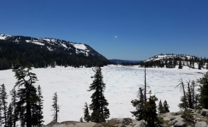
Lake Aloha is still mostly covered with ice. Photo/Brian Homberger/USFS
The report and photos below are from U.S. Forest Service wilderness ranger scouting expeditions on July 2.
The trail around Upper and Lower Echo Lakes is completely melted out giving relatively snow free access to Tamarak, Ralston and Cagwin lakes.
Around the Lucille and Margery lakes junction, the trail to Lake Aloha is completely covered in snow. Aloha is 90 percent frozen, but breaking up fast from the heat.
GPS and/or map and compass are recommended to find the trail along with proper footwear, clothing and gear. Keep in mind your mobile device may not work in some areas. Develop an emergency plan in case you cannot call for help and always go with a buddy, never alone.
Do not walk on frozen or partially frozen lakes. The snow can be very weak and brittle late in the day.
Heavenly strikes it rich with Silver Rush zipline
Rosemary Manning of South Lake Tahoe on her way across the East Peak Reservoir. Photo/Kathryn Reed
By Kathryn Reed
STATELINE – Hanging on and letting go at the same. Free, yet harnessed in. Remote wilderness, but modern safety features. For a brief moment the world seems to stand still, and yet it’s whirring by at 40 mph.
Welcome to the world of ziplining. While there was a time when this swinging between the trees was a form of transportation, in today’s world it’s all about the adrenaline rush of flying in a relatively controlled manner from one platform to the next.
Heavenly Mountain Resort this month debuted the Silver Rush. And what a rush it is.
Leonardo Aguirre, a 2013 South Tahoe High grad on break from college, belays off a platform. Photo/Kathryn Reed
Progressively the five ziplines get longer, faster and more suspenseful. In all, it’s more than 4,000 feet of soaring, with the last cable being 1,510-feet long.
Before starting off it’s necessary to get geared-up. A harness and helmet are the basic pieces of equipment. Chandler and Magdelynn are constantly checking everyone’s gear. It’s easy for things to loosen up as the day goes on. Redundancy is built into the process. Safety is Heavenly’s No. 1 concern.
Fun and exhilaration are what guests experience. Up to eight people can go on each tour, which includes two guides per trip.
Magdelynn ensures equipment is fastened securely. Photo/Kathryn Reed
Our guides on July 7 added to the wonderful experience. Thorough and serious in their jobs, but fun and encouraging.
We meet near the Tamarack Lodge after taking the gondola up. From there we take the Easy Rider chairlift and walk to the gear shack. After another trek through the woods we come to the first tree with the platform about 20 feet in the air.
The U.S. Forest Service and the company that installed the apparatuses scouted out the location to determine which trees would be best. It’s certified on an annual basis. Guides receive weeks of training.
Coming in for a landing is Leonardo Aguirre. Photo/Kathryn Reed
Holding onto what looks like a toddler-size handlebar, each of us is told to essentially sit – though there is only air to sit on – and cross our legs in front of us. For Rosemary and Leonardo it’s their first time on a zipline. (They are both hooked and ready for more.) Screams of excitement echo through the pines.
By the third zipline the five of us are feeling pretty comfortable. Then you look at the fourth one. It’s so much longer at 1,480 feet. On the other ones it was easy to enjoy the scenery, to look into the Carson Valley. This one, well, it has you realizing just how far off the ground you are and how long you are in the air. There is time to think about how little gear is involved to keep you suspended.
Smiles. Everyone had one as they landed. What an incredible rush.
Getting down requires trusting the guide when she says, “Just lean back.” Photo/Kathryn Reed
Next up it gets worse – in terms of thinking about consequences, and better – in terms of fun factor. Between the platforms is the East Peak Reservoir. This body of water is used during the winter for snowmaking. On Friday its purpose is to be a natural feature to add to the adrenaline searing through our bodies. It works. I don’t want to look straight down, but then I do – just briefly.
Trust in the gear and guides – it’s so necessary.
Beyond the ziplines, the Silver Rush requires climbing two ladders, walking across a swinging rope-wood bridge, a few short jaunts through the woods, and belaying down from two platforms – one more than 40-feet high. These added features – plus the 4-wheel drive ride back to the start – make for an incredibly fun filled three hours.
It’s an impressive amount of ground, um, air, we covered. The drop in elevation is most noticed taking the ride out from East Peak Lodge which is at 8,625 feet. The top of Easy Rider is 9,300 feet.
This isn’t an excursion for everyone. Fear of heights could be a stumbling block. Some upper body strength is needed, especially to pull yourself onto the landing platform.
The sky bridge takes guests to the fourth zipline. Photo/Kathryn Reed
—-
Notes:
· Different packages are available and prices vary based on age. Details are online.