Nature Conservancy’s purchase may ease drought worries

By Lenita Powers, Reno Gazette-Journal

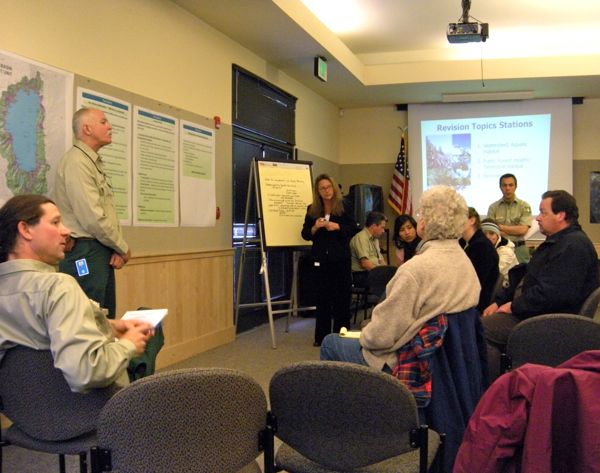
The purchase announced Tuesday of thousands of acres around Independence Lake by The Nature Conservancy will protect a critical source of water for Reno and Sparks in times of drought, a member of organization said.

The Nature Conservancy’s $15 million purchase of 2,325 acres of forest land in the Sierra Nevada from NV Energy also will preserve one of the only two lakes in the world with indigenous populations of the threatened Lahontan cutthroat trout, said Chris Fichtel, Independence Lake project manger for The Nature Conservancy.

“It’s a beautiful lake and, obviously, this will prevent development that could negatively affect water quality and could impact the native fish that live in the lake and the public’s ability to enjoy the property,” he said.

Read the whole story


Cycling event lets riders be creative with route, distance

The Alta Alpina Cycling Club is offering a new concept in cycling events: Build Your Own Challenge. The idea is simple. Riders can choose between one and six passes around the Markleeville area. Just like a menu at a restaurant, cyclists can pick and choose whatever their particular appetite might be to challenge themselves. Distances for the June 12 rides range from 30-160 miles with 3,600-16,700 feet of climbing as part of the options.

Do one pass, do them all, or mix it up. The beauty of this new approach is you get to call the shots.

The Alta Alpina Challenge: Riding the Wild Sierra is a cycling event which offers four distinct registration options: The Kid Carson Challenge is a family ride aimed at local individuals and families along with the friends and family of cyclists participating in one of the other rides. The Wild Sierra Century offers three mountain passes with just more than 100 miles of climbing. The 8 Pass Challenge is one of 20 California Triple Crown events in which experienced endurance cyclists

ride approximately 200 miles in one day.

Finally, the Build Your Own Challenge represents a new

innovation in organized rides. Each participant sets a personal goal based on their individual skills

and ability to ride between one and six mountain passes.

The Alta Alpina Cycling Club is a nonprofit corporation promoting all forms of safe cycling in the Lake Tahoe, Carson Valley, Carson City, and Markleeville areas. The club has decades of experience producing comparable events and we are excited to be producing this event because it directly promotes cycling both within the community and by bringing cyclists to the region…

For more information, contact Pete Costa at (775)782.8493, or email Mel at president@altaalpina.org.


Renaming Nevada cove after Mark Twain stirs controversy

By MyMotherLode.com

Before he became Mark Twain, a dirt poor Samuel Clemens chased a dream of being a timber baron from the shores of Lake Tahoe. But his hopes went up in smoke when he accidentally started a wildfire while preparing to cook dinner over a campfire.

Nearly 150 years later, Nevada historians are embracing new research they say pinpoints the location of his camp near Incline Village on the lake’s northeast shore with the help of a huge, table-like granite boulder that Twain used for meals and card games.

The Nevada State Board on Geographic Names is considering a request to name the site Sam Clemens Cove after the man who later assumed his pen name as a newspaper reporter in nearby Virginia City and created literary characters Huckleberry Finn and Tom Sawyer.

Nevada state Archivist Jeff Kintop, a board member, said the recognition is fitting because Twain penned perhaps the most eloquent and immortal descriptions of the lake and there is no geographic feature in the state named for him.

Read the whole story


Firewood permits for Tahoe National Forest

USFSFirewood permits for the Tahoe National Forest can be purchased beginning May 12.

The price for permits is $15 per cord with a two-cord minimum and an annual 10-cord maximum per household. Permits can be obtained at all TNF Ranger Stations, the Forest Headquarters or by mail. Applications for mail-in permits can be found online at www.fs.fed.us/r5/tahoe/. Firewood season will extend into the fall, until rain and snow traditionally make the roads impassable.

On the Yuba River Ranger District, woodcutting will end no later than Nov. 7 to protect hardwood trees that lose their leaves and may appear to be dead. The remainder of the forest will be open for cutting until Nov. 30 depending on the weather and its effect on forest roads.

In general, the firewood permit allows removal of dead and down wood on TNF system lands unless otherwise signed, but not on private land. It also authorizes removal of standing dead conifer trees within 200 feet of some roads. Trees may not be cut if marked with paint, wildlife signs, boundary landmark signs, other official signs or in areas closed to woodcutting.

Tom Quinn, TNF supervisor, reminds woodcutters to carefully study the maps accompanying the permits to see which areas are closed to firewood cutting.

“The amount of snow in the higher elevations this year may reduce early access to some of the forest, however it is still a good idea to get your wood as soon as possible so it has a chance to dry. Dry wood provides 50% more heating value and emits fewer pollutants than an equal weight of green wood,” Quinn said in a press release.

Wood cutters are reminded that they are required to keep a serviceable shovel at least 46 inches long and an approved fire extinguisher (2 pound dry chemical or 1 pound foam type – ABC or greater) within 25 feet of where saws are being operated. All gasoline-powered saws, splitters, etc. must have a USFS approved spark arrester installed. Transportation load tickets will be issued along with the permit.

To determine what areas are open for cutting and the fire danger for the day, call the woodcutting hot line for the Ranger District where you plan to cut wood (also found on the permit).

Forest Headquarters – Nevada City, (530) 265.4531, 631 Coyote St. Nevada City, CA 95959

Woodcutting Hot Line: (530) 478.6253


Trek to top of Mt. Tallac opens up another world

By Kathryn Reed

Something about Mount Tallac calls to people – more so in the summer than now.

Still covered in snow, the icon of the South Shore of Lake Tahoe that seems to be present no matter where one is, now requires an ice ax, crampons and an appreciation for Mother Nature if one is to trek to the top.
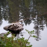
Floating Island Lake

Floating Island Lake

Soon, though, as the temperature begins to consistently rise, the snow will disappear – though not always completely. There have been years where splotches, sometimes even the cross, are evident until the snow begins to fly again.

Last August I made my second ascent of the 9,735-foot mountain. Though it’s not the highest in the basin, it is one of the most beautiful. It’s not even the most difficult to hike. (I don’t need to slog up Freel Peak again.)

Tallac, though, is worth the climb. And worth doing multiple times.

It is just one of the many peaks people bag each year in the 63,960 acres called Desolation Wilderness.

Unfortunately, on this particular Friday the basin is socked in with smoke from some now forgotten wildfire outside the area. Still, the trail is full of hikers destined for the rocky summit.

Access to the trailhead can be obtained from a few areas off Highway 89. This time Sue and I opted to go in from Cathedral Road.
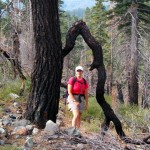
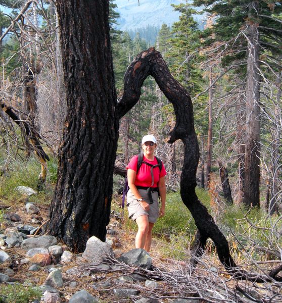
Sue Wood along the trail near Fallen Leaf Lake.

Sue Wood along the trail near Fallen Leaf Lake.

Not far in are some charred trees. They linger from a fire a few years ago (before the 2007 Angora Fire) that burned some of the area. The last time Sue was there she had a notebook in her hand and fire officials telling her she wasn’t supposed to be there. Then a bit of fire retardant drifted toward her – staining her clothes for posterity.

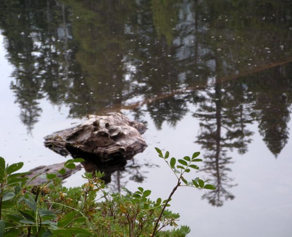
This day was about enjoying the hike, the scenery and being one with nature. But even on Friday the trail is well used. Several people have stopped to snack at Floating and Cathedral lakes. The stillness of the water transforms them into reflecting pools.

A group from the Student Conservation Association is working with the U.S. Forest Service – which maintains Desolation Wilderness – to make part of the trail a little less steep. The work was to be completed last October.

Even though the trail (5 miles one way) is full of people, it’s not anywhere as congested as Half Dome in Yosemite. On this Friday it was full of locals. Though a couple cousins from Maryland seemed to be sprinting up the mountain.

Unfortunately, people were able to get cell phone reception at the top. Somehow this seemed to negate the point – to get away from life below.
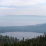
Fallen Leaf Lake and Lake Tahoe are covered by smoke in August 2009. Photos/Kathryn Reed

Fallen Leaf Lake and Lake Tahoe are covered by smoke in August 2009. Photos/Kathryn Reed

What little wind there was (usually the wind is significant at the top) just filled the senses with smoke instead of the usual clean mountain air.

Chipmunks scurry from one group of people to the next at the top in hopes of crumbs being left over.

Along the way birds chirp. Sage grouse hide in the brush, trying to avoid having their picture taken. We didn’t know what it was until we looked it up at home. We thought it was a prehistoric chicken.
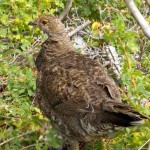
Sage Grouse

Sage Grouse

Normally, the views of Lake Tahoe are breathtaking from the summit. Today the smoke obscures the azure water. Fallen Leaf is also buried in the haze.

I guess it just means I need to get my hiking legs in shape to make the trek this summer – under sunny, clear skies.

USFS gearing up to open seasonal rec sites in Tahoe

USFSWith the arrival of spring temperatures and snow quickly diminishing, the U.S. Forest Service, Lake Tahoe Basin Management Unit will begin the annual process of opening recreational facilities around the Lake Tahoe Basin. Many facilities, including campgrounds and day use areasm will formally open in mid-May, weather permitting.

The Taylor Creek Visitor Center and Tallac Historic Site traditionally open near Memorial Day weekend.

Before facilities can open, the Forest Service must complete the hiring of crews to staff and manage the sites, clean up from winter, remove safety hazards, and wait for the danger of a freeze to pass before turning on water systems.

As a reminder, until recreation areas officially open, there is no parking, trash removal, or restroom facilities available. Park your vehicle off the roadway and do not block access gates. All trash must be packed out and where pets are allowed, you must clean up after your animal.

For a complete list of projected opening dates, visit the Campground and Day Use Area Opening webpage at http://fs.usda.gov/goto/ltbmu/RecAreaOpenings or call the Forest Supervisor’s office to ask about the status of a specific site at (530) 543.2694.


Carson River Aquatic Trail about to expand

For the first time, boaters have a developed area to put into the Carson River at Morgan Mill Road in Carson City. The area offers a concrete launching ramp, paved parking, picnic tables and a restroom, and similarly improved facilities to take out of the river at Santa Maria Ranch in Dayton.

The unveiling by Carson City and Lyon County officials will be May 22.

This stretch of the river opens new boating facilities for whitewater rafting and kayaking that have opened on the Carson River Aquatic Trail between Carson City and Dayton.

The public is invited to attend the ceremony at 10am and tour new Morgan Mill facilities, just upstream of the Bureau of Land Management offices at Deer Run and Morgan Mill roads, south of Highway 50. The Carson River Aquatic Trail has two segments:

The 3.3-mile Upper River Class I float is a peaceful 1.5- to 2-hour ride from Carson River Park through cottonwood and willow-lined riverbanks, concluding at Morgan Mill. It is suitable for beginners.

The 9.3-mile, 2.5- to 3-hour Lower River Class III ride for experienced floaters puts in at Morgan Mill and offers exciting, challenging rapids in scenic Carson River Canyon with wildflowers, historic rock walls, mill sites and other relics from the old V&T Railroad and Comstock mining era. It terminates at Lyon County’s newly redesigned Santa Maria Ranch River Park in Dayton, next to the Santa Maria subdivision on Highway 50 in Dayton. It now includes parking, restrooms and a river-access beach for rafters and kayakers.


Birding events at Sorensen’s

Discover dabblers, divers, and other feathered friends on an early morning walk with Jim Woods, local birder and member of the Lahontan Audubon Society.

See what species are coming and going during the annual spring migration, and what birds stick around all year. Sign upfor this educational and fun workshop. For reservations and lodging, call Sorensen’s Resort in Hope Valley at 800.423.9949.

When: May 14, May 31 (8–11am)

Cost: $40 guests/$55 non-lodging guests (includes brunch at Sorensen’s).


Sierra Cascade bicycle map released

mapBy Terry Richard, Oregonian

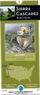
The Adventure Cycling Association of Missoula, Mont., has released its new Sierra Cascades Bicycle Route, a 2,389 -mile road-based map that runs from Sumas, Wash., through Oregon to Tecate, Calif.

The new route brings Adventure Cycling Route Network to 40,633 miles, the equivalent of riding around the planet more than one-and-a-half times.

Adventure Cycling’s network, which was launched in 1976 with publication of maps for the 4,262-mile TransAmerica Bicycle Trail, is the largest mapped cycling route system in the world.

Read the whole story


Barefoot runners refuse to lace-up ever again

barefootBy Jim Krajewski, Reno Gazette-Journal

Dr. Mel Magboo lost his shoes more than a year ago. On purpose.

And it was one of the best things he ever did.

For most people, running without shoes seems a little risky. There is debris in the form of rocks, glass and other hazardous material on the ground. And it goes against years of ingrained thinking, which is that more padding is better.

But for runners who have made the leap, there is no alternative to running barefoot. It’s not sweeping the running world, yet, but practitioners are passionate about this “new” way of running.

Read the whole story