Experts to dissect Mother Nature’s snowy dangers

By Susan Wood

When author Jennifer Woodlief wrote acknowledgements in her book “A Wall of White” about the 1982 Alpine Meadows-area avalanche that killed seven, she thanked snow expert Jim Plehn for explaining the difference “between a snowflake and a pure stellar crystal.”

This kind of knowledge goes a long way in the Sierra Nevada Mountain Range, where a freak storm can mean the difference between living or dying, and a wet, heavy layer on top of ball-bearing soft flakes can turn a good time in the wilderness into a scary day.

Just ask the avalanche forecasters and controllers about the Lake Tahoe region. It is challenging terrain because the masses tend to show up on skis, boards and snowshoes for this world-renowned resort area – turned winter wonderland to ride the slippery surface.
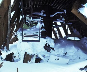
The deadly 1982 Alpine Meadows avalanche will be discussed at this month's climate symposium.

The deadly 1982 Alpine Meadows avalanche will be discussed at this month's snow science symposium.

And because more people who play in it test the backcountry each year, the masses of snow experts trained to protect and rescue them are booking reservations for the 2010 International Snow Science Symposium.  More than 900 attendees are expected to turn out for the Oct. 17-22 workshop at Resort at Squaw Creek.

Woodlief will speak next Monday at 8:30pm in the resort’s Grand Sierra Ballroom about her book’s account of Alpine’s monumental snowstorm and subsequent massive slab avalanche that roared over and buried buildings and people. The worst avalanche in Tahoe history occurred a few miles from the conference.

The public is invited to the talk, without registering for the conference. The conference costs $325 for five days. Attendees may also sign up for individual days.

A slew of subjects will be covered ranging from snow stability and thermal photography to snowpack properties and the state of the explosives industry. The lecture halls will give way each day to field observations and a social agenda. Product demonstrations will also be on hand.

One example: There’s an avalanche airbag of sorts that can deploy like a parachute from a pack for a snow rider to float to the surface of a moving avalanche. Another featured device, which looks like a snorkel, allows a buried skier or hiker to breathe under snow.

“We think for the regular recreationalist, there is value,” said Lel Tone, the event chairwoman and Squaw Valley ski patroller.

While novices make not understand the subject matter, workers in the field may be joined by the growing number who venture into the conditions that command expert technology and information.

Mike Laney, event registration chairman and avalanche program director for the National Ski Patrol System, believes increased development in mountain towns with increased interest among people to tread into avalanche-prone areas makes these conferences necessary and crucial to risk managers, patrollers, search-and-rescue volunteers, land-use managers and scientists. Laney is a retired science teacher.

The mantra of the symposium, Laney explained, is “merging theory with practice.”

“I’ve had a few close calls in the wilderness, none of which would have been helped with modern technology, but almost all would have been avoided if I knew what I know now,” Laney told Lake Tahoe News.

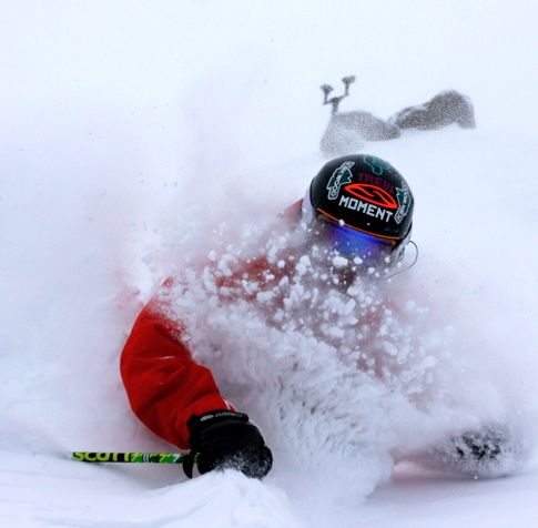
Sugar Bowl — Definitely more than an E-ticket ride

Publisher’s note: Lake Tahoe News is providing a glimpse into what skiers and boarders can expect at Lake Tahoe area resorts for the 2010-11 season.

Sugar Bowl: Finding the sweet spot is easy

• Projected opening date: Thanksgiving, conditions permitting

• Daily adult lift ticket price: $71

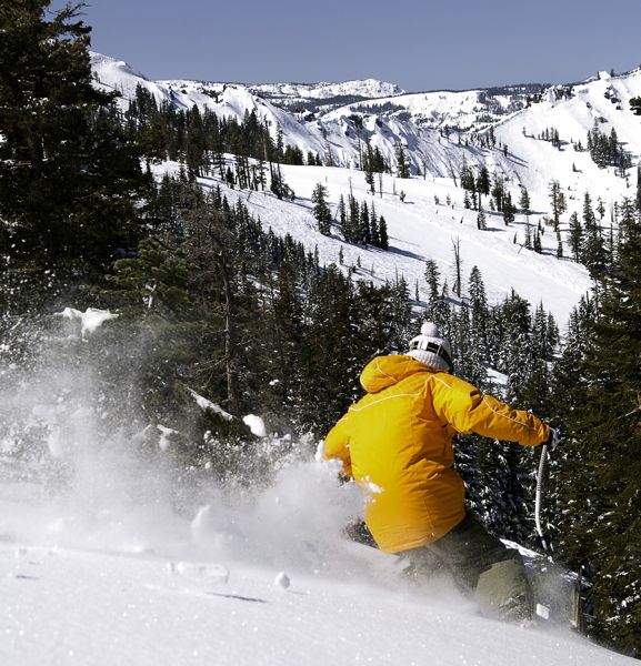
Sugar Bowl is a sweet experience. Photo/Kath Howard

Sugar Bowl is a sweet experience. Photo/Kath Howard

• What’s new?: Sugar Bowl enters this year with a feather under its cap from last season – being awarded the “Best Guest Service” by the National Ski Areas Association.

• What’s special about Sugar Bowl: The Disney-rooted ski resort has discovered the ideal blend of honoring its history and adding onto the next generation of activities in backcountry travel to take advantage of its Donner Pass location touting deep snow and less crowded conditions.

• Last year’s snow total: 431 inches

• Lift hours of operation: 9am to 4pm

• Skiable terrain: 1,500 acres

• Number of lifts: 13

• Vertical feet: 1,500

• Directions: Take Highway 89 north to Interstate 80 and head west to the Soda Springs exit, drive a few miles up the road to the resort.

Website

— Compiled by Susan Wood


Wanting to do tricks in the snow leads to trampoline park

By SF Appeal

Aspiring athletes, kids having birthday parties, and people just looking for something to put a bounce in their step can now head to a new trampoline park that opened in San Francisco.

House of Air, a park located in a historic airport hangar in the Presidio, is the brainchild of two action sports enthusiasts.

Founders Dave Schaeffer and Paul McGeehan met in Lake Tahoe around 2003 and took a class on how to do aerials on trampolines so they could do tricks on the mountains during snow season.

“We always thought, well gee, they only had one trampoline. Imagine if we got a whole space and just filled it with trampolines,” Schaeffer said.

Read the whole story


Expansive views of Lake Tahoe from Snow Valley Peak

By Kathryn Reed

SPOONER SUMMIT — One of the hazards of wanting to get some incredible views of Lake Tahoe is that it takes a bit of climbing. But those 2,000-feet of uphill to get to Snow Valley Peak are worth it.

Fortunately, it’s not one of those grueling routes that make you think housecleaning would have been a better activity. But it isn’t something parents with little kids are going to want to try.

The six miles (one way) are part of Tahoe Rim Trail.

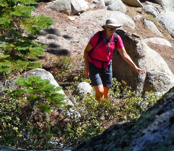
Brenda Knox on her way to Snow Valley Peak. Photos/Kathryn Reed

Brenda Knox on her way to Snow Valley Peak. Photos/Kathryn Reed

“The trail beyond here is incredible,” Brenda Knox says of the area past our turn around point at Snow Valley Peak. She has done the entire 165-mile TRT.

Mount Rose would be the next exit point of the Tahoe Rim Trail. Sand Harbor isn’t far away, but it’s not visible from the part of the trail we’re on. Part of this route is used for the Tahoe Rim Trail’s endurance run.

Even though the four of us did an out and back on this September Saturday, it’s possible to do a circle by going down to North Canyon Road. This is the dirt road mountain bikers use to access the Flume Trail. It means having to circle around Spooner Lake at the end.

Now the fall colors should be in abundance.

We start our morning at 7,146 feet at Spooner Summit. Snow Valley Peak is 9,214 feet.

Several signs along the mostly soft dirt trail say “vista point” so hikers can go slightly off the trail for views of Lake Tahoe and the Carson Valley. Seeing both at once is always such a contrast in what this area has to offer — the liquid blue alpine lake v. the barren high dessert.

Camping in this area must be done in designated sites. Signs point the way. These are the rules of Nevada’s Lake Tahoe State Park.

Up we go, passing beneath towering pines that are spaced so the terrain can be enjoyed without feeling closed in. Shrubs are close to the ground, including Manzanita.

The sign says 1.5 miles more as we are about to begin the trek across the ridge. The four of us agree it feels like a whole lot more than 1.5 miles.

A few wildflowers are out, but not many.

Lake Tahoe unfolds below us. This is one of those hikes where the size is so obvious. Often it doesn’t look 22-miles long or 12-miles wide.

Directly across from us the mouth of Emerald Bay opens up, with the peaks of Desolation Wilderness looming over her.

From this vantage point it’s obvious how Fallen Leaf Lake is at a higher elevation than Tahoe.

The wind is whipping. It’s only Labor Day weekend and fall is definitely in the air. We take shelter behind a small rock outcropping to have lunch before making our way down. Marlette Lake is a short distance from us.

But it’s the views of Lake Tahoe that make this 12-mile roundtrip hike worth doing over and over again.

Getting there:

From South Lake Tahoe take Highway 50 to the top of Spooner Summit. Just past the turn off for Highway 28 is a small parking area on the left for the Tahoe Rim Trail. (You may feel like you’re headed to the Carson Valley because it’s just over the crest.) Park, walk. Trail goes to the right for the peak, to the left for Spooner Lake.

It’s also possible to access the trail by parking at Spooner Lake, but it costs money to do that.

ngg_shortcode_0_placeholder (Click on photos to enlarge.)


Northstar — Creating fun on and off the slopes

Publisher’s note: Lake Tahoe News is providing a glimpse into what skiers and boarders can expect at Lake Tahoe area resorts for the 2010-11 season.

Northstar-at-Tahoe: Providing on and off the slopes entertainment

• Projected opening date: Nov. 20

• Daily adult lift ticket: TBA; last season’s was $84

Burton makes snowboarding at Northstar a breeze. Photo/Provided

Burton makes snowboarding at Northstar a breeze. Photo/Provided

• What’s new?: For the first time, Northstar will host on March 18 the Nordic SuperTour, a premier cross country race series in North America that will start and finish at the Village at Northstar. The resort has also invested in more skills clinics and new rental equipment including K2 skis, Burton snowboards and Dalbello ski boots.

Also, a new pottery-making studio will join the collage of shops and restaurants in the 150,000-square-foot village.

• What’s special about Northstar?: The resort is beautiful and features wind-protected slopes, great tree skiing, and the Burton Snowboard Academy.

• Last year’s snow total: 420 inches

• Lift hours of operation: 9am to 4pm weekdays; 8:30am to 4pm weekends and holidays

• Skiable terrain: 3,000 acres

• Number of lifts: 19

• Vertical feet: 2,280

• Directions: From Highway 50, turn left on Highway 28 at Spooner Summit skirting the East Shore of Lake Tahoe, then turn right on Highway 267.

Website

— Compiled by Susan Wood


Decision made on travel routes in Tahoe National Forest

Tahoe National Forest Supervisor Tom Quinn has chosen a modified version of one of the alternatives in the Travel Management Final Environmental Impact Statement.

“I have selected Alternative 6 with some modifications. I believe this alternative strikes a balance between providing motorized recreation access and protecting critical natural and cultural resources. This decision recognizes the extensive network of roads and motorized trails that currently exist on the Tahoe National Forest,” Quinn said in a statement. “Although the decision will reduce the amount of motorized opportunities as compared to the existing condition, approximately 83 percent of the forest will be within a half mile of an authorized road or motorized trail.”

The existing National Forest Transportation System of roads and motorized trails for public use in the TNF is approximately 2,400 miles and includes one open motorcycle area, Prosser Pits north of Truckee. With this new decision, the following will be added to the existing motorized system for public use:

• 13.1 miles of roads (346) segments

• 48.9 miles of motorized trails (107 segments)

• 11.4 miles of closed roads will be open for motorized use (13 segments)

Other attributes of the decision include:

• Prohibition of Cross County Travel: Motorized travel will be prohibited off designated roads or motorized trails on 835,800 acres.

• Open Areas: 244 acres at Boca, Prosser, and Stampede Reservoirs will be available for highway legal vehicles to access the shoreline of the reservoirs in select, established areas while protecting cultural, aquatic, and other sensitive resources.

• Seasonal Restrictions: Wet weather seasonal restrictions will be placed on 1,369.5 miles of road and motorized trails. On the westside of the forest, these restrictions will be in effect from Jan. 1 to March 31 and on the remainder of the forest, from Jan. 1 through April 23.

• Over the Snow Use: On the Fordyce Jeep Trail, over the snow use will be permitted on 3.6 miles when 15 inches of snow are present on the ground. In addition, Maintenance Level 3, 4, and 5 roads will remain available for wheeled-over-the-snow use, except for roads on the Truckee District and those roads designated as snowmobile trails.

• Motorized Mixed Use: Mixing both highway legal and non-highway legal vehicles will be limited to roads less than 3 miles in length (as per California Vehicle Code 16.5) except that 117 miles of longer segments will be open for mixed use during deer hunting (rifle) season when log hauling does not occur.

• Lowering Maintenance Level: Mixed use will be allowed on 122 miles of road previously listed as Maintenance Level 3 (smoother dirt) roads which have been downgraded to Maintenance Level 2 to reflect their existing rougher conditions.

• Dispersed Recreation Spurs: Hundreds of short unauthorized road segments are added to provide dispersed recreation opportunities.

• Protection of Inventoried Roadless Areas (IRAs): The majority of existing unauthorized routes within the IRAs have not been added to the National Forest Transportation System to protect the values of solitude, old forest ecosystems, wildlife habitat, and other resources. With only one congressionally designated Wilderness on the TNF, opportunities for quiet recreation and solitude are limited. A few short trail segments totaling 4 miles, however, have been added to the West Yuba, East Yuba, Grouse Lakes, Duncan Canyon, Bald Mountain, and Castle Peak IRAs that would not adversely affect roadless area characteristics.

The Final EIS and Record of Decision are available online.

For questions, contact the Tahoe National Forest Headquarters, (530) 265.4531.


$30,000 grant helping restore Truckee River watershed

The Truckee River Watershed Council received a matching grant of up to $30,000 a year for five years from the Martis Fund for their Together for the Truckee Society.

“The impact of this leadership gift has already served as inspiration to others to come along side the Martis Fund and support the restoration of the Truckee River watershed,” Lisa Wallace, executive director of the Truckee River Watershed Council, said in a press release. “We thank the Martis Fund for helping society donations go even further.”

Together for the Truckee Society provides an opportunity for community members to join together to protect water quality and restore habitat in local rivers, streams and lakes.

The Martis Fund will match pledges each year up to a total of $30,000 a year, a potential grand total of $150,000.

So far 19 individuals, families and local businesses have contributed in 2010, resulting in $26,000 toward the match.

If you are interested in learning more about the Together for the Truckee Society or the matching grant from the Martis Fund, please contact Michele at (530) 550.8760.

The Martis Fund supports programs to secure open space, promote habitat restoration, and create workforce housing in the Martis Valley region. It was established in 2006 as a collaborative project of DMB/Highlands Group, Mountain Area Preservation Foundation, and Sierra Watch. For more, visit www.martisfund.org.

Truckee River Watershed Council brings the community Together for the Truckee. It focuses on collaborative solutions for the protection, enhancement and restoration of the Truckee River Watershed. For more info, visit www.truckeeriverwc.org.


Tahoe resorts hope Amgen bike tour is economic boon

By Jeremy Evans

Next year’s spring shoulder season will be physically and economically dependent on hundreds of people literally being on the shoulder of Tahoe’s roads.

With this week’s official announcement of the Amgen Tour of California starting in South Lake Tahoe in May 2011 and incorporating Northstar-at-Tahoe and Squaw Valley into the frenzy, people are already projecting an economic boon to the region during a time that is usually slow and quiet.

“To have an international event like this take place at Tahoe is a gift to our economy and will have a very positive impact on our exposure globally,” said Marc Sapoznik, marketing and public relations manager for the Resort at Squaw Creek. “We anticipate not only selling out our property, but the entire Squaw Valley area will likely be sold out over the dates of the event. The combination of Lake Tahoe and a major cycling event should provide a terrific incentive for travel.”

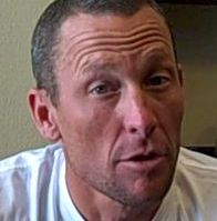
Lance Armstrong is a regular on the Amgen bike tour.

Lance Armstrong is a regular on the Amgen bike tour.

Steven Holt, regional public relations director for the Ritz-Carlton Hotels of Northern California, echoed Sapoznik’s thoughts.

“This is a huge opportunity for Lake Tahoe,” Holt said. “Bringing a marquee event like the Amgen Tour of California will shine the national media spotlight on the entire region and attract new destination guests and cycling enthusiasts. It will be great for business, especially in a month like May.”

What the region will have to spend to get ready for the event is not known. Nor is it known where the money would come from since all of the jurisdictions are struggling to stay solvent.

Nor are people predicting what kind of dollars might actually flow into the area.

The tour itself has been losing millions of dollars each year, according to published reports. One former host city, Santa Cruz, didn’t apply to be part of next year’s event because of the costs involved.

Although Highway 50 over Echo Summit, the principal artery connecting Sacramento to South Lake Tahoe, will be closed during the time of the race because of work on the retaining wall, some local cyclists are convinced the race will still attract new visitors who can easily use an alternative highway to reach the South Shore.

“I am pretty excited for it to be coming here, especially in May when nobody is usually around here,” said Stateline resident and cyclist Will Davenport. “This is a pretty big deal that gets all of the top guys. Biking is part of the lifestyle here, and I don’t know if we’re on the map like Moab (Utah). But if we have a good showing and it comes back year after year, it could get there.”

Now in its fifth year, the Amgen Tour is an 800-mile, 15-stop tour of the Golden State. South Lake Tahoe was chosen as the Stage 1 start community. Cyclists will depart from the California-Nevada state line and travel 1½ times around the lake before finishing at Northstar. Stage 2 will depart from Squaw and end in Sacramento.

The event is May 15-22; with Thousand Oaks the last stop.

“We think it’s our best route ever,” said AEG President Andrew Messick, whose company is the event’s title sponsor. “Lake Tahoe is a place where we always wanted to go. There is great bike riding culture there. It’s gorgeous and it’s in a part of the state where we’ve never been. It’s a place where we couldn’t go when we were racing in February. It’s a great place to start the 2011 race.”

For more information about the event, go online.


Kirkwood — Snow comes by the feet, not inches

Publisher’s note: Lake Tahoe News is providing a glimpse into what skiers and boarders can expect at Lake Tahoe area resorts for the 2010-11 season.

Kirkwood Mountain Resort: The lines you experience are behind you in the powder

• Projected opening date: between mid-November and mid-December, conditions permitting

• Daily adult lift ticket price: TBA on opening date; last season’s was $74

Powder is easy to find at Kirkwood. Photo/Josh Otto

Powder is easy to find at Kirkwood. Photo/Josh Otto

• What’s new?: As an expansion to the hailed Expedition Kirkwood program, New ZipTahoe Treetop Canopy Tour promises to deliver a one-of-a-kind experience that even the non-skier can enjoy. The combination of 10 ziplines, aerial spans and bridge networks whisks guests 1,100 feet to the base.

In addition, the ski resort features a season pass with no blackout dates.

• Why is Kirkwood special?: The resort’s location nestled against the spine of the Pacific Crest provides snow measured in feet when some resorts are reporting inches. It’s home to the North American Freeskiing Championships for expert skiers, yet also boasts recognition from USA Today as one of the Top 10 Places to Learn to ski or board.

• -Last year’s snow total: 537 inches

• Lift hours of operation: 9am to 4pm

• Skiable terrain: 2,300 acres

• Number of lifts: 15

• Vertical feet: 2,000

• Directions: Take Highway 89 south to Pickett’s Junction and head west toward Jackson to the Kirkwood Meadows Loop Road and turn left.

Website

— Compiled by Susan Wood


Sierra, Northstar on TransWorld Snowboarding’s Top 10 list

The 2011 TransWorld Snowboarding Resort Guide, which hits newsstands this week, lists Northstar and Sierra-at-Tahoe resorts among the Top 10 Overall Resorts in the United States.

“To make it as one of the 10 best a resort has to rank high in both the park and pipe categories, as well as in other crucial areas such as nightlife, snowfall, vibe, lodging, food, et cetera,” explain the editors of TWS. “All the other stuff that matters when you’re looking for the best shred experience possible.”

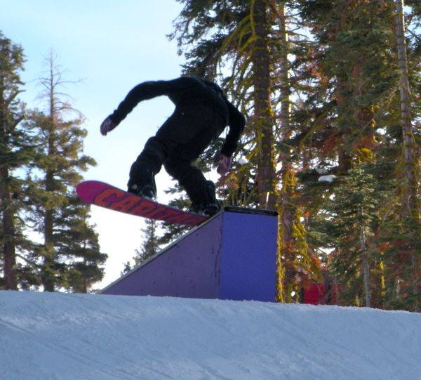
Bashful terrain park at Sierra is one reason Transworld Snowboarding ranked the resort so high. Photo/Kathryn Reed

Bashful terrain park at Sierra is one reason TWS likes the resort. Photo/Kathryn Reed

The rankings speak to the commitment by both resorts to creating and maintaining innovative freestyle terrain that appeals to an ever-growing demographic of skiers and snowboarders, resort officials said.

Designed, built, and maintained throughout the season by the lead innovators in the industry – Snow Park Technologies (SPT) – the freestyle terrain at both resorts offers an experience that caters to the young and old, first-time jibbers and seasoned park riders, families and college students alike.

Both resorts were also recognized as among the Top 10 Best Parks in the nation, earned by scoring high in specific categories like jump and rail design, grooming, variety of features, overall vibe, and park challenge.

The cumulative rankings for Sierra-at-Tahoe are:

* No. 7 Overall Resort

* No. 10 Best Parks

* No. 4 Best Value

* No. 7 Best Vibe

The cumulative rankings for Northstar-at-Tahoe are:

* No. 6 Overall Resort

* No. 6 Best Parks

* No. 9 Best Pipes