Lousy real estate market puts more land in conservationists hands

By Julie Cart, Los Angeles Times

VOLCANO LAKE — The news is distressing: A cratering real estate market, tight-fisted banks unwilling to make loans and no appetite among elected officials to let go of a dime.

So why are conservationists smiling?

It turns out that the tattered economy has cracked open a window of opportunity for groups seeking to set aside land for preservation. With property developers and speculators on the sidelines — and cautious folks electing to forgo building that cabin in the woods — desirable land is on the market for a fraction of its former price.

And thanks to laws extending tax breaks and other incentives, rural residents are lining up as never before to work with local land trusts in hopes of saving the family farm.

“There are some extraordinary deals out there, from [parcels in] the North Woods of Maine to timber companies divesting because there are no housing starts and they can’t sell their lumber,” said Rand Wentworth, president of the Land Trust Alliance.

Statistics are difficult to come by, but anecdotal evidence suggests that land conservation rates have maintained the pace of the first half of the decade. Total acres set aside by local, state and national trusts doubled from 2000 to 2005; a snapshot for 2005 to 2010 will be released in coming months.

Read the whole story


Not all Shore Shore rec measure officials kept in loop

By Kathryn Reed

The treasurer of the board that oversees recreation Measure S on the South Shore just recently found out about the half dozen meetings the board has had this year geared primarily to rewriting the voter approved initiative.

It took a call by an El Dorado County resident to county Auditor Joe Harn in the last few weeks to alert him to what is going on. Harn is also the joint powers authority’s treasurer.

“Protocol would be I’d be informed about the meeting. It is unusual that an officer of the JPA would not be informed of the meeting,” Harn said.

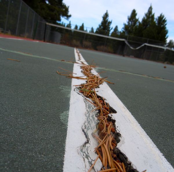
Pine needles fill in the lines at Tahoe Paradise tennis courts in November 2010.

Pine needles fill in the lines at Tahoe Paradise tennis courts in November 2010.

Meetings to discuss changing Measure S to Measure R so the money allocation could be altered have been going on since early spring.

On Aug. 8 Harn was told by county Supervisor Norma Santiago about today’s meeting. Santiago is chairwoman of the recreation JPA. Other board members are South Lake Tahoe City Councilman Hal Cole and Tahoe Paradise Park board member Deborah Henderson.

At the last meeting on July 29, John Upton said in writing and verbally that an audit of the JPA’s books is not necessary. South Tahoe resident Tom Wendell asked the lone paid staff member of the JPA: Why?

Upton said with the JPA writing about eight checks a year that Harn’s “strong position is it’s not necessary.”

Courts at Tahoe Paradise have not been safely played on in years.

Courts at Tahoe Paradise have not been safely played on in years.

Harn on Aug. 9 told Lake Tahoe News, “I’m not saying one is necessary, but I have not spoken to John Upton about JPA business in a couple years.”

An audit in 2006 by Harn uncovered serious accounting deficiencies. He suggested several changes at that time regarding how the 2000 voter approved measure be handled.

This week he agreed the JPA has little money to spend after it pays bond debt, Upton, and disseminates the money per the measure’s requirements. He said that is all straight forward. What Harn said would be the true reflection of how Measure S money is spent is for the three entities receiving the money to have their auditors do an independent schedule showing what happens with the JPA money.

At the annual meeting two weeks ago where finances are talked about, the JPA board did not mention this more detailed analysis being a possibility or consideration.

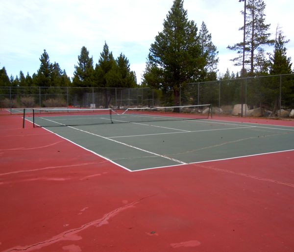
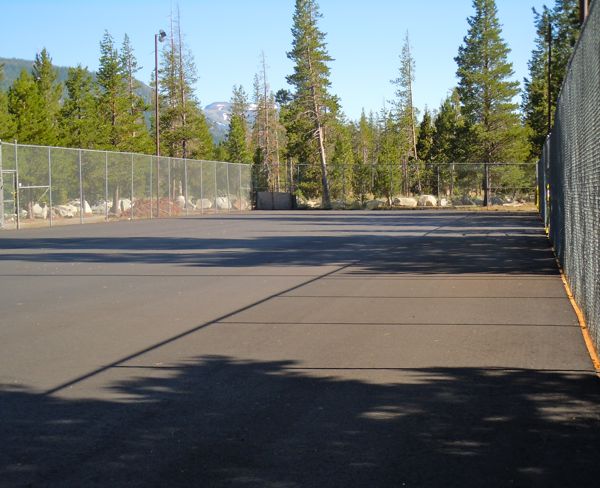
When the courts at Tahoe Paradise will be open remains an unknown. Photos/Kathryn Reed

When Tahoe Paradise courts will open is unknown. Photos/Kathryn Reed

Harn doesn’t even know what Measure R is designed to do.

“If there is not a lot of transparency, normally the voters don’t trust you. I found out (about Measure R) from a member of the public, but it sounds like they are about to go to the voters,” Harn said.

And he’s right. Today is decision day. The board meets at 9am at Lake Tahoe Airport for its last chance to stop the process of putting Measure R on the Nov. 8 ballot. The potential cost of the election is the main sticking point for the board, otherwise the three have agreed to the resolution and reasons to alter the measure.

R would allow bike trails built pre-2000 to receive maintenance money and funds to be directed to improving existing ball fields.

As it stands now, there is no more money for ball fields and only post-2000 bike trails receive cash for upkeep.

Tahoe Paradise is allocated $50,000 a year. This summer two of the three tennis courts at the park were supposed to be resurfaced. In Upton’s July 29 staff report he said they would be open this month.

Lake Tahoe News spoke with groundskeeper Steve Dunn at the unfinished courts on Tuesday. They won’t be ready for play this month. Dunn wouldn’t even give a date because he doesn’t know when they will be painted and it will be two weeks after they are painted before people can use them.

It used to cost $5 an hour to play on those courts. The groundskeeper said the Tahoe Paradise board has not set a fee, but he said he has heard it could be $10.


Burke Creek, Rabe Meadow plans moving forward

By Anne Knowles

MINDEN – Plans to reroute Burke Creek under Highway 50 are getting under way in the first phase of a long-term project to restore Rabe Meadow.

Douglas County Commissioners last week requested $100,000 from the Tahoe Regional Planning Agency’s Stream Environment Zone Fund to design the Burke Creek portion of the project. The request came after the TRPA board approved the money at its July 27 meeting.

The Nevada Tahoe Conservation District, which is overseeing the project, has sent a letter to half a dozen Lake Tahoe Basin environmental consulting firms asking for statements of qualifications, according to Mahmood Azad, principal engineer and fisheries biologist with the conservation district and previously the Douglas County engineer.

Burke Creek in Stateline is carry tons of sediment into Lake Tahoe. Photos/Kathryn Reed

Burke Creek in Stateline carries tons of sediment into Lake Tahoe. Photos/Kathryn Reed

The district will choose a firm from among those contacted and try to negotiate a contract in time to seek approval from its board of directors on Aug. 18, said Azad. The district hopes to have the project design completed by year-end and start work in 2012.

“It could go a long, long way to filtering water that comes off (Highway) 50 and go a long way to improve lake clarity,” Azad said.

Currently, Burke Creek, which was relocated when an airport was built in Rabe Meadow in the 1940s, runs over Highway 50, collecting road sediment that ends up in Lake Tahoe.

Azad said the Burke Creek portion of the project is on a fast track, while the overall restoration of Rabe Meadow is on a slow track and could take up to a decade to complete. That will include removing nonnative grasses that were introduced to the meadow when it was used for grazing cattle as well as restoring the many springs that once flowed into the meadow.

“Sagebrush and pine trees are starting to encroach,” Azad said. “Rabe Meadow is a filtration system and it is not functioning correctly.”

The conservation district is now working with the U.S. Forest Service, which owns Rabe Meadow, to secure a $300,000 grant for the restoration project, Azad said. Nevada Department of Transportation is also providing $200,000 in funding. The $600,000 in funding from the TRPA, NDOT and the USFS will cover the initial design of the project, Azad said. The total cost of the project will not be known until the master plan is completed as part of the design.

Rabe Meadow is part of the long-term restoration plans.

Rabe Meadow is part of the long-term restoration plans.

The project could reduce the Burke Creek area’s sediment flow into the lake by as much as 85 percent to 95 percent, according to Azad. He added the exact amount is unknown because the project covers what he calls a subwatershed of a larger watershed.

“Wetlands, by their nature, if functioning properly, will take almost all sediment out,” Azad said.

The area’s restoration will also attract more wetlands avian and the raptors who prey on them as well as becoming a suitable breeding ground for the Lahontan cutthroat trout that are being continually released into the area’s waters.

“The biggest positive impacts will be on the fisheries,” said Azad.

The Stateline restoration project has been in the works for years, with the TRPA as the lead agency on the project starting in 2007. In 2009, TRPA published a report on Burke Creek restoration, funded with $500,000 in Southern Nevada Public Land Management Act money. In the last year, Douglas County took over the role of lead agency.

The 4-mile creek runs through several private properties, including Sierra Colina, the single- and multi-residential project, which has been involved in the restoration work from the start. The League to Save Lake Tahoe has stalled the project by filing a lawsuit.

In 2006, the developers undertook their own study, done by Northwest Hydraulic Consultants, to evaluate their parcel but also to give the TRPA, USFS and Douglas County engineering ideas, said Steve Kenninger who, with Gail Jaquish, owns the 18-acre Sierra Colina site.

Kenninger said he’s not aware of the details of the conservation district’s plans, but that he was fully supportive of the plans laid out in the design drawn up by Winzler & Kelly in the original TRPA study.

“Therefore, we are unaware of the nature or proposed design of the ‘new’ Burke Creek Restoration Project and are unable to specifically comment on that design, or whether any anticipated changes could conflict with the Sierra Colina project,” Kenninger said in an email to Lake Tahoe News. “However, we reiterate Sierra Colina’s support for a Burke Creek Restoration project being implemented, and Sierra Colina’s continued desire to cooperate with the county.”

Sierra Colina donated 10.7 acres of its parcel to Douglas County for public recreation and open space, and 2.4 acres of that is the area needed to conduct creek restoration on the property.

The creek also runs through Tahoe Beach Club, a 20-acre site for estate homes and condominiums at the end of Kahle Drive that is still a mobile home park.

“We’re doing 2 acres of stream zone restoration ourselves, hopefully in cooperation with the agencies,” said Tom Castaneda, vice president of Tahoe Beach Club. “We’ve spoken to the Forest Service, although we haven’t talked to anyone in six or seven months. But we’re very willing to be cooperative.”

The restoration work was part of its environmental impact statement filed to gain approval from the TRPA for the development.

Approved three years ago, the Tahoe Beach Club is working to raise financing for the $200 million project from private equity interests who are more prepared to invest in it than are the banks, Castaneda told Lake Tahoe News.

Burke Creek also runs through the property where the Nugget Building is located, but owner Chuck Bluth said he was unaware of the project and had not been contacted by anyone about it.

Anderson dominates women’s slopestyle in New Zealand

By Charlotte Trundle, ESPN Action Sports

Riders from all corners of the globe battled it out this weekend at The Billabong Slopestyle 4-star TTR World Snowboard Tour event at Snow Park New Zealand, with Roope Tonteri of Finland winning the men’s finals and Jamie Anderson dominating the women’s field.

With the highest ever TTR rating and $30,000 in prize money, more than 90 competitors representing 16 countries took to the course, which had a final feature dubbed the Monster Volcano, a channel-gap jump with a giant inflatable Monster can to air over.

This slopestyle contest is the second stop on the 2011-12 TTR World Tour and it’s also the first of its kind on the global calendar since the International Olympic Committee confirmed the discipline for the 2014 Winter Olympics.

Tonteri earned the top spot and a $5,000 check with a score of 89.40. His run included a front board on the round bar, a nose bonk 360 on the pole jam, and two massive 900s to a huge front 7. “I am so happy. It has been so nice to ride with friends at Snow Park,” Tonteri said.

Second place went to American Sam Hulbert, with a score of 84.60, and third place to Finland’s Antti Autti, who scored 84.20. Kiwi Milu Multhaup-Appleton, a first-time entrant into a TTR event, was the sole local New Zealander to compete in an open final, placing seventh overall.

In the women’s field, event favorite American Jamie Anderson did the expected — completely nailing two huge runs to earn the top score in her division. Anderson’s winning run included a tailslide on the down box, a back 180 mute grab, a switch back 5, a backside 360 over the 65-footer, and a tweaked stale grab over the Monster Volcano. Anderson took home a check for $2,500.

Read the whole story


Tahoe researcher helping map icebergs

By Alex Forrest

Our departure from Quebec City was delayed for a day, but sailing has been pretty smooth since. We’re now five days out, nearing the northernmost tip of Labrador, and soon will cross over to Baffin Island. For the Autonomous Underwater Vehicle (AUV) team, this means that we’re closing in on our objective of mapping the underside of an iceberg.

For the team, which includes Alexander Forrest (UC Davis), Andrew Hamilton (University of British Columbia), Derek Mueller (Carleton University), and Val Schmidt (Coastal Center for Ocean Mapping – University of New Hampshire), this AUV deployment represents the culmination of several months of working with the Canadian Ice Service in preparation for any envisioned scenario. Although the team has experience with AUVs under-ice in the Arctic and Antarctica, this application has several challenges that haven’t previously been encountered. Unlike shorefast-ice tested before in earlier deployments, the target we are searching for will be moving and rotating while we are surveying. Typical drift rates can be 10 to 15 km per day. Additionally, we will be testing a bathymetric mapping sonar unit that we have only had access to since the day before our departure.

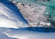
Seals resting on an embayment. Photo/Alex Forrest

Seals resting on an embayment. Photo/Alex Forrest

We had our first taste of the challenges in store for us once we came through the Strait of Belle Isle (in between Newfoundland and Labrador) where the ship made a slight diversion to a fragment of the Petermann Ice Island (PII-A) that has been drifting south from northern Greenland since August 2010. This is the same fragment that has recently been in the news as a result of its size (its long axis is nearly 10 km long and at least half that across).

After debriefing from our helicopter pilot, we were flown across to PII-A to make ice thickness measurements at seven stations. Similar measurements had been made by a Newfoundland-based R&D organization when it had established these stations in mid-June. With these two sets of measurements, it will be possible to produce an estimate of how fast the ice is melting and to examine how this might be related to drift.

On our first foray over to the island we managed to make measurements from two stations. The helicopter was then required to return to the ship to refuel before heading back to find another three stations. Of the last two stations that we were unable to find, one was thought to be on a smaller piece of ice that had detached from the rest of the iceberg. The second was simply never found.

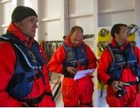
Alex Forrest, Derek Mueller and Andrew Hamilton suited up to fly to PII-A. Photo/Val Schmidt

Alex Forrest, Derek Mueller and Andrew Hamilton suited up to fly to PII-A. Photo/Val Schmidt

As the ship pulled away from PII-A, we found ourselves speculating what the conditions might have been on the underside of the iceberg given the state of the surface. While we might expect similar undulating conditions, there could be significantly greater crevassing in regions where the original glacier had been furrowed by the underlying rock. There is also concern that marginal regions of the iceberg will be worked by wave action that will result in embayments where the vehicle could be trapped.

Our trip then has continued north and the next stop for the AUV team will be Cumberland Sound (southern Baffin Island to the northwest of Iqaluit). Once there, we will take advantage of the fact that we will be in relatively shallow water (50 to 100 m) to conduct a last round of in-water tests of the vehicle. This will be a final chance to do a full systems check before reaching the iceberg we intend to survey next week. This is obviously a far cry different than the systems checks we were able to do in North Hatley (southern Quebec) during the first week of July.

We spend our evenings dreaming up and discussing scenarios that might arise in an effort to be prepared for the unforeseen challenges that lay ahead. We also are struggling to fully understand the nuances of the bathymetric sidescan sonar and the limitations of the rest of the instrumentation we will be working with. While these are relatively normal growing pains for any AUV operation, they are made all the more difficult by being at sea. However we’re making progress and expect to be fully ready to go when the time comes.

Alex Forrest is a post-doctoral researcher at UC Davis Tahoe Environmental Research Center in Incline Village. He is part of a team of scientists mapping the underside of an iceberg in the Arctic using autonomous underwater vehicles. Some of the same instruments being used for this project were recently used at Lake Tahoe to map the locations of Asian clams.


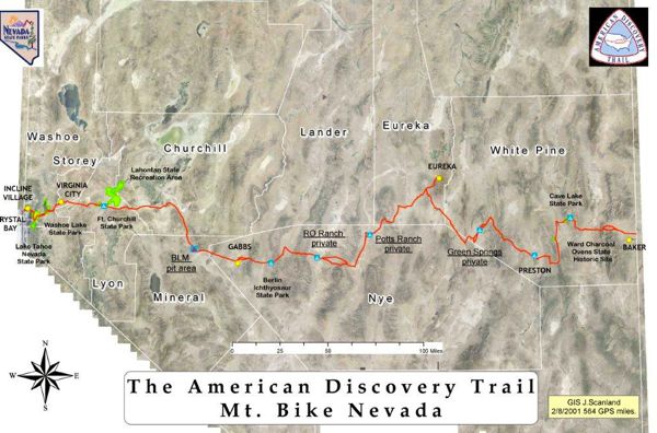
21-day mountain bike trip takes riders across Nevada

Mountain Bike Nevada is a 519-mile border-to-border tour from Sept. 10-20.

Sponsored by the Nevada State Parks, the tour will start at the historic Cal Neva Resort on the North Shore and end in the shadow of Wheeler Peak in Great Basin National Park.

mapThe off-road route will explore the Flume Trail, six State Parks, mining ghost towns, Pony Express Trail, wild mustang herds and numerous hot springs which include the unique Dinah’s Punch Bowl.

“We completed an exploratory ride last year which led way to organizing this year’s inaugural event that also benefits Nevada public education,” Todd Whear, ride organizer and event co-founder, said in a press release. “This is not along Highway 50 and the Loneliest Road in America. This route is much lonelier, more isolated and more scenic. Mountain bikes were built for this kind of riding and Nevada offers some of the finest mountain terrain, weather conditions and trail systems anywhere in the U.S.”

The 2011 Mountain Bike Nevada adventure tour is limited to 50 participants with registration available until Aug. 20. The $1,600 fee includes:

• Daily guide services

• Daily support crew services

• Two nights at a Eureka hotel on rest day

• All meals (except on rest day in Eureka, meals on own)

• All camping fees

• MTBNV riding jersey, water bottle and camp mug

• All non-alcoholic beverages

• Bike technician services

To register and learn more, go online.


La Niña may be gaining steam to return to Tahoe

By Jeff Delong, Reno Gazette-Journal

La Niña, the weather pattern that helped produce an epic winter for the Reno-Tahoe region in 2011, could return in a few months.

The U.S. Climate Prediction Center on Thursday issued a La Niña watch, citing conditions indicating a return of the climatic phenomenon sometime next fall.

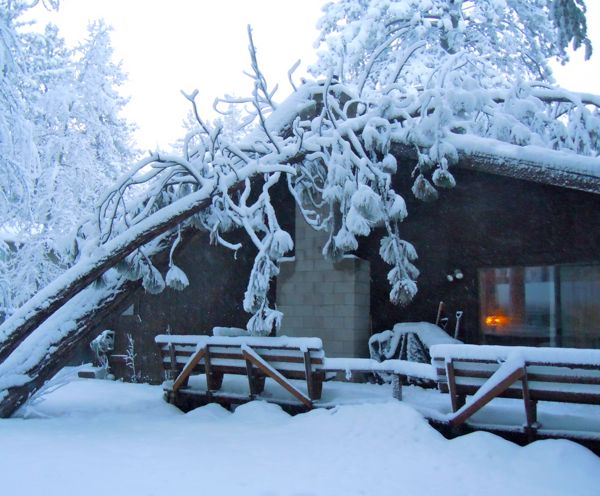
Heavy snow winter forced trees into houses. Photo/LTN file

Heavy snow last winter forced trees into houses. Photo/LTN file

La Niña, characterized by cooler surface ocean temperatures in the eastern Pacific, was in place from late 2010 through much of 2011 but was declared over by the climate center two months ago.

So-called “neutral” conditions are in place today. Predictions into what will happen next vary by computer model, but some suggest the return of a mild La Niña by fall.

The climate center also cites “the historical tendency for significant wintertime La Niña episodes to be followed by relatively weaker La Niña episodes the following winter.”

Read the whole story


Tough Mudder event at Squaw up for sports travel award

Tough Mudder, a military-style obstacle course and one of the most difficult events in the country, has been nominated by readers of SportsTravel magazine for a SportsTravel Award.

The event is at Squaw Valley Sept. 17-18.

Criteria for nomination and voting include superior organization of and attendance at the event, an excellent experience for the competitors and/or spectators at the event, and how the site or venue served to enhance the event. Final balloting is open through Aug. 15, with the winners announced at the TEAMS ’11 Conference & Expo Oct. 3-6 in Las Vegas.

Vote online.


KidZone Museum taking youth outdoors

For the first time since its inception five years ago, KidZone Museum Family Camp is offering families the opportunity to join in on guided nature walks, art projects, science exploration, entertainment and home-cooked meals for just a day, skipping the overnight camping.

Family Camp is each year at Sagehen Creek, UC Berkeley’s field station where researchers are stationed to study the unique natural science that is found in the area. The station is 8.5 miles north of Truckee. Camp festivities start Aug. 12 and end Aug. 14. The cost for the weekend is $180 for adults and $80 for children; Saturday only camp cost is $45 for adults and $15 for children; evening programs run $25 for adults and $10 for children. Kids under 2 years of age are free.

At Family Camp, UNR scientists share their knowledge of the natural world with hands-on exploration of bugs, snakes and fish.

To sign-up to attend, call the Kidzone Museum at (530) 587.5437 Tuesday through Friday from 9am-1pm.


Mountain bike group to work on Christmas Valley trail

TAMBA’s Aug. 20 trail day will be work on the Christmas Valley trail. Work will include rounding turns, enhancing flow, bashing down square edge rocks, and fixing drainage problems.

Lunch and post work barbecue with drinks will be provided to all volunteers — plus some goodies to give away.

Meet at 9am at the lower parking lot on South Upper Truckee in Meyers.