Money in place to build bike path on Hwy. 50 in S. Tahoe

A high-priority bike path project in South Lake Tahoe has received the necessary funding — the El Dorado Beach to Ski Run route.

This is a missing link in South Lake Tahoe and is listed as the highest priority project in the Lake Tahoe Region Bicycle and Pedestrian Plan.

South Lake Tahoe, Caltrans, and the Tahoe Regional Planning Agency officials worked together earlier this year to re-route supplementary funds from the ongoing Highway 50 water quality project to the bike path project.

Approximately $2 million was rescued when the bid for the Caltrans Highway 50 water quality project from Trout Creek to Ski Run Boulevard came in under the engineer’s estimate. This money was going to return to original grant sources outside the Lake Tahoe Basin when the agencies worked together to re-allocate the funding to the bike path.

The move will also help free up other funds which can go toward other projects such as sidewalks along Pioneer Trail and other high priority transportation projects in the city.


Images of iceberg edges help with calculating their thickness

By Val Schmidt

We arrived in Cumberland Sound on the evening of July 25 and the ship immediately commenced an SX90 sonar acoustic fisheries survey for Arctic Cod that they hoped to find in this area. This was not part of our own effort, but rather that of the chief scientist for this leg, Louis Fortier. That said, the SX90 is a new addition to the Amundsen and we are greatly interested in its operation.

The main reason for our own interest is that it also has the capability to image the edges and estimate the thicknesses of icebergs. While the resolution is coarse, we hope it will provide ancillary data during our own effort at iceberg mapping in the next few days.

The morning of July 26 began with an early 5am start. As the ship commenced a water column and benthic habitat sampling station, we departed the Amundsen aboard the “barge” for a few short hours of AUV and EM3002 sonar testing. While we will be running the AUV underneath the iceberg, the EM3002 will be mounted at a 45-degree angle to image the side of the iceberg. The barge is a small landing craft carried by the Amundsen, useful for calm weather science and operations to shore when required.

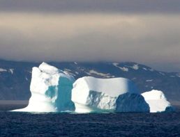
Smaller iceberg drifting in Cumberland Sound. Photo/Alex Forrest

Smaller iceberg drifting in Cumberland Sound. Photo/Alex Forrest

Our plan was to find calm water near shore in the vicinity of Cape Mercy, NU (about 25 nautical miles from where the CCGS Amundsen was collecting other samples) in which to ballast the AUV with the new SwathPlus sonar module, conduct a short test mission and also conduct a patch test for the EM3002 shallow water multibeam. The team from the University of New Brunswick (UNB) has installed the EM3002 aboard the barge for the season and Travis Hamilton of UNB will operate the EM3002 during our iceberg-mapping event. A special mount has been manufactured that tilts the sonar toward the surface allowing the system to capture a high-resolution swath around the periphery.

We set out for Cape Mercy, to the only inlet with any soundings on the chart. We would later learn that this foreboding looking location was once part of a Cold War era Defense Early Warning Station (“the DEW Line”). The enclosed area afforded calm water for our ballasting tests. After these tests, two short AUV missions were run and data was collected for the EM3002 patch test. The next step is to reproduce what we were doing here upside down.

The opportunity to test the AUV was fortunate as the vehicle was unable to successfully complete a mission, stubbornly refusing to dive beneath the surface. In addition, the CTD (conductivity-temperature-depth) sensor mounted on front of the AUV failed to collect data during our test – a recurring problem that we had thought had finally been resolved in our pre-cruise testing. This was of significant concern for those on the team interested in studying the mixing dynamics associated with the iceberg. These issues made for a solemn return to the ship as we pondered our next step. We took some time to warm up and take a short nap before having a closer look at the log files being stored by the AUV during the in water tests. The ship had also been busy while we were away, conducting various casts and box-core samples, which had brought up several hundred species of benthic critters.

After a careful inspection of the log files of the AUV we determined our Acoustic Doppler Current Profiler (ADCP) – an instrument used to measure water currents – to be malfunctioning, such that the AUV was unable to reliably measure the distance to the bottom. This would result in the vehicle frequently measuring zero meters when the bottom was in fact more than 14 meters. Altitude measurements are critical to operation, as the AUV will initiate evasive maneuvers to prevent collision with the bottom when values near zero are returned.

This behavior prevented the AUV from diving beneath the surface. Investigation of the ADCP data showed beam 3 of the 4-beam array to contain no useful data. With no further recourse we opened the ADCP module to see if we might be able to test or isolate the problem. No immediate options to do so were apparent, but we took the opportunity to ensure all connectors were firmly in place.

On reassembly and testing we found beam 3 to be producing data comparable to the other beams. While the solution is not wholly satisfactory, we hope to have an opportunity to test the system in the water later this afternoon.

Excitement increases for the real event. We expect to be above 70 degrees north within the next day or so. Once above this latitude, the search will begin in earnest to find a suitable target. While smaller ones like this one in Cumberland Sound are scenic, they are too small for our needs.

Val Schmidt is with the Coastal Center for Ocean Mapping at the University of New Hampshire. He is part of team that includes a researcher from UC Davis TERC in Incline Village studying icebergs.


Wildflowers a bonus treat on hike to Dardanelles Lake

By Kathryn Reed

Pretty face, cow parsnips, California valerian, forget-me-nots, lupine, columbine, Indian paintbrush, larkspur, groundsel – these are just some of the flowers flourishing in a kaleidoscope of color along the trail to Dardanelles Lake.

It’s helpful to have someone on the trail telling you what you’re looking at instead of just saying – ooh, look at that pretty red or yellow or purple flower. They actually have names besides colors.

This splash of color was an added bonus to the hike Sue and I took my mom on two weeks ago. I don’t often think of this trail as a wildflower destination, but instead I like it for the magical alpine lake at the end of the 3.5 miles.

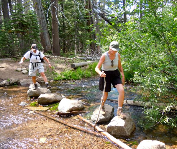
Sue Wood and Cleo Reed cross a stream on hike to Dardanelles Lake. Photos/Kathryn Reed

Sue Wood and Cleo Reed cross a stream on a hike to Dardanelles Lake. Photos/Kathryn Reed

With the abundance of moisture this season, not only are the flowers prolific, so are the mosquitoes. Even with bug juice, we had plenty of souvenirs to itch.

Another consequence of the snowfall and water is the bridge leading into Big Meadow has collapsed. While the water was still tumbling over it on the last Saturday of July, it was crossable without getting wet.

But that’s not the only water crossing. Fairly stable rocks have been strategically placed in other sections to make stream crossings do-able.

It was magical on this particular Saturday to see the array of wildflowers. Some are so tiny, some are like groundcover, while others go above my knees. I just want to pick them to have for a bouquet – but instead I take their pictures.

We pause to marvel at their beauty. But soon we are hitting ourselves to swat at the skeeters.

Big Meadow is so aptly named. The tall grasses make me channel Julie Andrews – but I don’t sing out loud. The hills really do seem alive, though.

We carry on. After all, the meadow is just the beginning.

Plenty of shade covers the trail – which is welcome. Mostly it’s dirt at a moderate climb. We start at 7,200 feet, with the maximum elevation being 7,760 feet.

The worst part of the hike is leaving the lake. It’s a good descent at the end to Dardanelles Lake, so climbing out is no fun. We certainly didn’t appreciate the downhill enough since we were whining going out.

Oh, but that lake. It shimmers in a way that it looks like it is dancing. Granite walls line one side. People are swimming to rocks; others wade closer to the shore.

I think cold water is for drinking, not dipping into. After all, snow dots the far shore as well as the peaks.

Flat granite provides an ideal spot for lunch. While there are several people doing the same, we still have our own spot in the Sierra.

Color on this trail is not limited to the wildflowers. In the fall, the aspens come alive in their array of yellows and oranges.

Getting there:

From South Lake Tahoe, go west on Highway 50.

Pass the bug station, then turn left onto Highway 89. Before reaching the summit of Luther Pass, Big Meadow trailhead parking is on the left. Park.

Follow the trail from the lot that crosses the highway. You passed the trailhead marker on Highway 89 on your right.

Follow the signs to Dardanelles Lake. Signage is good for the most part. But about a quarter mile from the sign that has you go right, you need to make a sharp left. The trail is obvious, but it also goes straight – so it’s not obvious turning left leads to Dardanelles.

Part of this is the Tahoe Rim Trail.

The route is 7 miles roundtrip. The U.S. Forest Service rates it as moderate. My 76-year-old mom says it’s a wee bit more than moderate.

ngg_shortcode_0_placeholder (Click on photos to enlarge.)


Squaw Valley woman barely survives falling through snow into water

By Marek Warszawski, McClatchy-Tribune

There was no time to react. One instant, Marcia Rasmussen was walking on snow. The next, she was engulfed by icy water and being swept downstream.

“There was no way,” says Rasmussen, the tone of disbelief in her voice still fresh. “I didn’t hear the ice crack or groan. No way. It all happened amazingly fast.”

It was a sunny and warm June afternoon at Mineral King, the glacial valley in southern Sequoia National Park in California. For the 51-year-old ultramarathon runner from Squaw Valley, it was one of her usual training jaunts.

Running and hiking alone, Rasmussen was on her way back to the car when she came to the spot where the Farewell Gap Trail crosses Franklin Creek on a snow bridge.

Snow bridges are a common sight during early summer in the Sierra backcountry, formed when snowdrift fills in the opening around a creek. This one appeared sturdy. In fact, Rasmussen had thoroughly checked it out before crossing without incident on her way up. She even carried an 8-foot-long branch with her for safety.

“It felt very firm and was about 4 feet thick,” she says. “I poked at it with a stick, to see if it had softened any.”

Rasmussen was about two-thirds of the way across when the section she was walking on gave way. She remembers her head going underwater, gasping for breath and feeling helpless as the current carried her over a small waterfall and farther down the snow tunnel.

After about 40 feet, Rasmussen managed to grab onto a bush. It took all her strength to pull against the current and drag herself out of the water.

“There was an alcove just big enough for me to stuff my body into,” she says.

Cold and shivering, Rasmussen took a minute to gather herself. Her decades of experience as a mountaineer one who used to teach search and rescue courses in Virginia taught her not to panic. Despite being trapped beneath several feet of snowpack, she knew she was lucky to be alive.

Read the whole story


3-day outdoor expo at El Dorado County Fairgrounds

Lovers of the great outdoors in El Dorado County can gather at the fairgrounds in Placerville for the second annual Gateway to the Sierra Sportsman’s Outdoor Expo Sept. 30-Oct.2.

The expo celebrates the rich and plentiful opportunities for outdoor recreation in El Dorado County and beyond, from fishing and hunting to boating, archery, biking, barbecuing and more.

Highlights of the three-day expo include seminars and hands-on demonstrations in such topics as fly fishing, bear hunting and river guide services, as well as special hands-on demonstrations for children including free catch and release trout fishing sponsored by Wilderness Unlimited Foundation. Also featured are vendors in outdoor sports offering the latest know-how and equipment, clothing and accessories.

Barbecue fans are invited to watch how the pros do it in the KCBS sanctioned Smokin’ for Gold BBQ Cook Off on Oct. 1. This competition features teams competing for prize money and the Grand Champion trophy. Then, on Sunday everyone is invited to try their hand at the grill in the “just for fun” Open BBQ Cook Off. Following each event, Expo attendees are welcome to sample the cooks’ creations during People’s Choice tasting events, five tastes for $10.

Go online for a full list of expo activities, vendor information and daily schedules.


Lake Tahoe’s famed clarity getting substantially murkier

By Katherine E. Hill

Lake Tahoe’s world-renowned water clarity dropped 3.7 feet in 2010 from 68.1 feet to 64.4 feet, the second-lowest clarity level ever recorded.

The drop in clarity is the result of climate change and increased algae growth, according to the UC Davis Tahoe Environmental Research Center in the annual State of the Lake Report released Friday.

Lake Tahoe’s famed clarity can increase or decrease based on any number of factors such as fine articles, algae growth, sediment runoff, snowmelt and others. Researchers say the decrease between 2009 and 2010 in clarity is the result of climate change that may have allowed for the growth of a tiny, free-floating algae named Cyclotella. These tiny algae, which proliferate in warmer temperatures, have grown significantly in recent years.
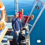
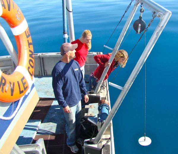
The Secchi disc is lowered into Lake Tahoe for one several readings. Photo/Katherine E. Hill

The Secchi disc is lowered into Lake Tahoe for one of several readings. Photos/TERC

“This year, in particular, these single-cell algae were concentrated very close to the surface, strongly scattering light and thereby impacting lake clarity,” said John Reuter, associate director of TERC in a release about the decline in clarity.

The State of the Lake report also calls for continued joint efforts by California and Nevada to manage the health of Lake Tahoe. The Nevada Legislature passed a bill in June to pull out of the Tahoe Regional Planning Agency Compact by 2015 unless the Regional Plan is amended.

“While land use activities, resource management activities and policy can be controlled to conform to geopolitical boundaries, the waters of Lake Tahoe are not constrained by these human boundaries,” the report states. “What happens in the waters of Lake Tahoe is a direct reflection of activities in both states. If a concrete example of why Lake Tahoe needs to be managed jointly by the two states is needed, then this is one.”

Optimism despite decline

The clarity report also reports a trend in increased clarity during the winter months, with decreased clarity occurring during the warmer, summer months. Researchers stated in the report that improvements in winter clarity measurements may be due to recent efforts to reduce urban stormwater flows, but that those gains are being lost in the summer, which sees higher than normal temperatures due to climate change.

“There is every reason to believe that if it were not for the decades of watershed management, development policy and water quality restoration projects, the lake’s transparency would be worse than it is today,” Geoffrey Schladow, TERC’s director, said in the release.

Despite the drop in clarity, researchers remain positive about the overall health of the lake. The lake clarity chart shows the measurement through the years.

“Taken alone, that decline in clarity is unusual, but it is within the range of normal fluctuations,” Schladow said.

For the first time, researchers also have gleaned a bigger picture of Lake Tahoe’s clarity using remote sensing to record data from around the lake. Most notable in the remote sensing findings is that clarity on the East Shore is lower than the West Shore for most of the year, according to the report. As well, clarity generally improves 1 mile off the shoreline than at points closer to the shore.

How clarity is defined

Lake clarity is measured by several scientific means, but it has been continuously measured since 1968 using a Secchi disc, a 10-inch white disc that is lowered into Lake Tahoe throughout the year to come up with a yearly average. The Secchi measurements are the longest continuous measure of Lake Tahoe’s water clarity.

The Secchi disc was developed in 1865 for use by ships to measure the depths of harbors, but has been used in modern times to measure the clarity of water.
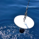
The Secchi disc is the main means to measuring lake clarity. Photo/Provided

The Secchi disc is the main means to measuring lake clarity.

The Secchi disc measurements are taken by researchers every 10 days at solar noon at the same two locations – off the Tahoe City shelf and off Homewood toward the middle of the lake, according to Heather Segale, TERC’s Education and Outreach director.

The disc is lowered from the boat by a metered wheel and the researcher marks the point on the wheel at which the disc disappears from view, Segale explained, and then marks the point at which the disc reappears as it is raised. The distance between these two points is averaged for the day’s reading.

Since the researchers rely on their eyesight to mark the points at which the disc disappears and reappears, they are required to have their eyesight checked regularly, cannot wear sunglasses, and measurements are performed only during smooth waters, according to Segale. The annual clarity measurement is an average of about 20 to 25 measurements; about 10 are thrown out due to anomalies such as inclement weather, wind and other factors.

While the Secchi disc measurements represent the longest study of the lake’s clarity, researchers also rely on other measurements to gauge clarity. Researchers use several high-tech instruments mounted on a Seabird profiler: a transmissometer that measures how much light of a certain wavelength is received over a fix path; an optical backscatter sensor that measures how much light from a LED is scattered backward by particles; a photosynthetically active radiation sensor that measures solar radiation; and a turbiditimeter that measures the cloudiness of water.

In addition to the annual clarity report, the State of the Lake report also addresses efforts to control aquatic invasive species, such as the Asian clam that were first reported in Lake Tahoe in 2002. The report also addresses the impact of climate change on precipitation, changes in the lake’s water temperature and effect of lake warming on circulation.

To view the report, go online.


Zephyr Cove doesn’t have fuel for private boaters

By Kathryn Reed

Boaters beware – don’t expect Zephyr Cove Resort to be able to fill your tank.

The fuel leak discovered earlier this summer at the South Shore marina is making fueling difficult even for the resort’s fleet.

“Right now, the fuel is being used to fill our fleet of recreational watercraft. If we are unable to accommodate private boaters, we will direct them to one of the other marinas,” David Freireich, spokesman for Aramark, told Lake Tahoe News.

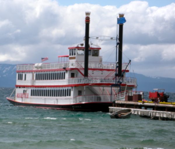
The Dixie is having to fuel up at Lakeside Marina, but still leaves from Zephyr Cove. Photo/LTN file

The Dixie is having to fuel up at Lakeside Marina, but still leaves from Zephyr Cove. Photo/LTN file

Boaters are telling Lake Tahoe News they are being turned away. This can be a bit precarious for boaters with the fuel needle near empty.

Aramark is the concessionaire on the U.S. Forest Service owned property.

This is where the M.S. Dixie II is docked. While the paddle-wheeler is still operating, the fueling schedule has changed. Now the vessel is going to Lakeside Marina to fill up on thousands of gallons of diesel.

The leak was discovered during the replacement of fuel pumps to two tanks that are a part of the underground storage tank system.

“A smaller, temporary fuel storage system has been installed at Zephyr Cove, until a permanent solution is finalized,” Freireich said. “We apologize for any inconvenience and are working with the Forest Service and NDEP (Nevada Department of Environmental Protection) to finalize plans for a new storage system, so that we can resume normal fueling services as soon as possible.

The financial impact of the leak to the resort is unknown. There has been no evidence of drinking water being impacted. Soil samples continue to be taken, with cleanup under way.


7,000 acres near Truckee off-limits to developers

By Jane Braxton Little, Sacramento Bee

TRUCKEE – Conservationist groups and Sierra Pacific Industries have reached a first-of-its-kind agreement that protects wet meadows and wildlife habitat in the headwaters of the Little Truckee River.

A conservation easement on 7,085 acres near Jackson Meadows Reservoir in Sierra County will permanently limit development along Henness Pass Road while allowing recreation and selective logging in the mixed conifer forest.

The deal announced last month is the first conservation transaction negotiated with Sierra Pacific, an Anderson-based timber company and the state’s largest private land holder.

Truckee Donner Land Trust worked with the Trust for Public Land, a national conservation organization, to set the terms of the agreement and raise $3.25 million to purchase the development rights from Sierra Pacific, said Perry Norris, executive director of the land trust based in Truckee.

Read the whole story


Lake Tahoe sports camp designed for active women

Lake Tahoe’s All-Women Sports Camp is hosting a weekend of mountain biking, road cycling, triathlon training and running for women of all abilities on Aug. 20-21 at Northstar-at-Tahoe.

The weekend will include endurance clinics, group bike rides, group runs, yoga on the beach, and stand-up paddleboard.

The All-Women Sports Camp will be led by mountain biker Marla Streb; professional triathlete Jessi Stensland; and former U.S. cycling team member Julie Young.

For more information, go online or call (530) 563.889.


Boat bound for Tahoe covered in quagga mussels

By Jeff Delong, Reno Gazette-Journal

Inspectors discovered a powerboat encrusted with quagga mussels during a routine roadside inspection Sunday, officials report.

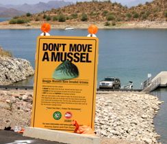
musselThirty-seven quagga mussels were found on the boat, which was repeatedly decontaminated before being released from the inspection station at Spooner Summit, said Pete Brumis, public outreach specialist with the Tahoe Resource Conservation District.

It was determined the vessel had been recently operated in Lake Mead, which is heavily infested with mussels.

Read the whole story