Northstar creates growth plan for the next decade

By Kathryn Reed

What would Northstar be like if skiers were whisked to the village via a gondola from the lower parking lot, if 300 acres of terrain were added, and those runs were accessed by an additional seven lifts?

Skiers and snowboarders will get to know the answers firsthand in the next decade or so if Vail Resorts has its way.

The Northstar Mountain Master Plan is on the street for people to comment on, and Placer County officials to review before the environmental documents are created. It is all about the mountain and does not include a real estate component.
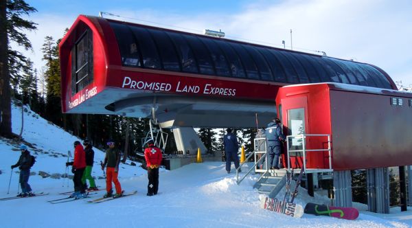
Vail Resorts has spent more than $30 million to upgrade Northstar, including the Promised Land lift that opened last season. More money is on its way. Photo/LTN file

Even though Northstar is on private property and the resort would not normally have to go to the level of detail that it is, the Martis Valley settlement required a bit more depth to planning.

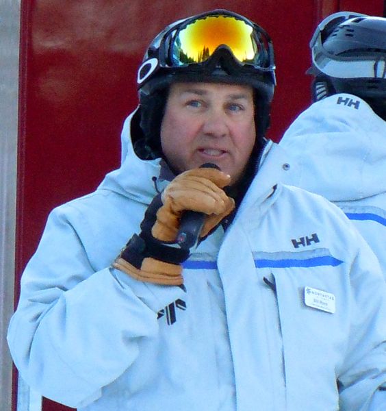
“This plan is based on the overall Habitat Management Plan,” Northstar COO Bill Rock told Lake Tahoe News. That plan was developed in conjunction with Sierra Watch and other conservation groups. Those entities, according to Rock, have also been privy to the details of the master plan as Northstar was formulating the document.

“This plan really is designed to be a real benefit to the people who are already here. No additional parking is proposed in this plan. That is what limits access to resort,” Rock said.

Parking has long been one of the biggest complaints about the ski resort. Lodging wiped out where people used to be able to park within walking distance to the village and slopes. Now people are bused from close to the entrance off Highway 267.

Rock says the gondola that is proposed to take people to the village from the parking area will get buses off the road and “provided a better experience for guests.”

Other lifts are designed with the idea of getting people dispersed throughout the mountain faster and more efficiently. A lift would start in the village to take riders to the top of Lookout Mountain.

“This outlines our vision for the next 15 years – what we might do at the resort.” — Bill Rock, Northstar COO

“We have a great plan to go out onto Sawtooth Ridge. It will absolutely enhance the skier experience,” Rock said.
To help Mother Nature, more snowmaking apparatuses would be put in the ground. Snowmaking helped save last season at so many Tahoe-area resorts.

“Well-engineered, thoughtful snowmaking is a critical piece of any resort no matter where it’s located,” Rock said.

He said Northstar has enough access to water on the mountain so its reservoir storage will not need to be expanded. Rock added that snowmaking is good because it replenishes the groundwater supply.

Things that are included in the master plan that are likely to get built right away include expanding the Summit Deck and Grill (which is near the top of Comstock and Backside lifts), possibly putting in a warming hut on the backside of it, adding other bathrooms and warming huts on the mountain, and minor food and beverage options.

In this PDF of Northstar’s plans, it shows skier service areas in yellow as well as where other changes could occur. For now, those are areas where resort officials believe they want to do something, but don’t have the specifics of what could go there.

“This outlines our vision for the next 15 years – what we might do at the resort,” Rock said.

Besides needing Placer County’s stamp of approval, the Vail Resorts board of directors must weigh in as to when the checks would be written for the expansion and what gets done first.

What build-out of the components in the proposed master plan would cost are not being discussed because a time line to build them has not been established. Plus, this document is mostly about the big picture, and not specific details of individual projects.

While this is a winter master plan, Rock said Northstar would like to enhance its summer offerings at some point, too. A separate plan would be submitted to the county for those ideas. Things being talked about include a mountain coaster that is a toboggan-like device that would go through the forest on rails, family-friendly bike trails, and a zipline and canopy tours.

Notes:

• More information may be found online.

• Written comments will be accepted until Dec. 5 at 5pm. Send them to Maywan Krach, Environmental Coordination Services, Community Development Resource Agency, 3091 County Center Drive, Ste. 190, Auburn, CA 95603 or cdraecs@placer.ca.gov.

• A meeting to receive comments on the scope of the environmental impact report will be Nov. 28 at 10am at the Lakeview Suite, North Tahoe Event Center, 8318 North Lake Blvd., Kings Beach.




Weather gods smiling on Tahoe — resorts opening this week

Mother Nature and a bit of snowmaking means ski resorts in the Lake Tahoe area are bumping up their opening dates.

Heavenly Mountain Resort and Northstar are opening Wednesday with a combined seven lifts and eight trails, totaling 51 acres.

“No need to bring your ‘rock skis’ to our resorts,” Pete Sonntag, Heavenly’s general manager, said in a statement.

Heavenly’s gondola will run Nov. 14 — opening day of the 2012-13 season. Photo/LTN file

The other Vail Resorts-owned property in the Tahoe area, Kirkwood Mountain Resort, is set to open Friday.

Squaw Valley is also opening Nov. 16. It could be a powder day for Kirkwood and Squaw’s opening days.

Just announced Nov. 12 is Gold and Silver Tahoe Super Passes will include Squaw, Alpine Meadows and Sierra-at-Tahoe.

For Sierra season passholders, they can ride Squaw and Alpine Meadows from opening day until Dec. 21, as well as from April 15, 2013, until closing day for free. In between early and late season, Sierra passholders may ski or ride Squaw or Alpine at the friends and family rate of $75 weekends and $50 midweek.

“We will commence operations on Friday with Searchlight, Red Dog, Squaw Creek and FirstVentures lifts, and you will be seeing even more terrain opening before Thanksgiving,” Andy Wirth of Squaw said in a statement. “I’ve asked our mountain operations teams to prepare the upper sections of the mountain including Gold Coast, Mountain Run, and with every effort possible, potentially down into the Shirley Lake area. Our snowmakers and snow guns have been absolutely going gangbusters and conditions continue to look great. We will also open Alpine Meadows earlier than our original planned date of Dec. 7.”

— Lake Tahoe News staff report


4-day experiment to test Lake Tahoe’s currents

Sixty-four containers each about the size of a 2-liter soda bottle are about to be thrown into Lake Tahoe.

Called drifters, these devices will track the water motion at 1-minute intervals by recording and transmitting their changing GPS location. They are submerged at the water level (to the approximate level of the orange tape visible in the photo) so that their motion is driven by lake currents.

UC Davis research engineer Alexander Forrest programs the drifters that will be used to track Lake Tahoe surface currents. Photo/Provided

Researchers at the UC Davis Tahoe Environmental Research Center in collaboration with UC Berkeley want to better understand the surface currents of Lake Tahoe. The experiment will run Nov. 12-15.

Scientists say understanding surface currents of Lake Tahoe is important because currents are responsible for the transport of contaminants, invasive species, urban stormwater and floating debris.

The drifters will be released on north-south and east-west lines. On the first day, 32 drifters will be deployed. After two days they will replaced by another 32 drifters. The positions of the drifters will be mapped over the entire four-day period.

If the units are not retrieved by the end of the day Nov. 15, they will lose battery power and will no longer be able to be tracked.

What the drifters might do to Tahoe if left to float around a while, is not being revealed. But the scientists would like them back if anyone finds one after Nov. 16. Just call (530) 902.2272 or email gschladow@ucdavis.edu.


Dog doo-doo fouling waterways

By Clara Vaughn, Capital News Service

When you fail to pick up after your pooch, you may be doing more than irking the next-door neighbors.

Studies conducted over more than a decade in watersheds across the state have found that pets produce up to one-third of bacterial pollution in waterways near developed areas. That’s right. Dog poop is the source of startling amounts of E. coli, Giardia, salmonella and other microscopic pathogens in local waters.

In extreme cases, 68 percent of bacterial pollution in the Severn River watershed of Maryland has been recorded as coming from pet waste. And a whopping 87 percent of bacterial pollution in the Magothy River’s Forked Creek tributary has been traced back to pets.

The findings come from more than 50 studies by the Maryland Department of the Environment and Salisbury University tracking waterborne bacteria back to its sources. Acting as poop sleuths, scientists have been able to determine whether waste came from humans, livestock, wildlife or pets based on a bacteria’s unique patterns of resistance to antibiotics.

That’s because different antibiotics are used to treat people and various animals, said Mark Frana, professor of biology at Salisbury University, who has been involved with the studies since 1999.

“If fecal material gets into water systems, there’s an increased risk to human health,” Frana said.

In addition to carrying a host of disease-causing bacteria and parasites, untreated doggy doo is rich in nutrients that foster algae blooms and contribute to oxygen-depleted dead zones downstream, including the Chesapeake Bay.

So why don’t more people bag their dogs’ bunk? A 1999 study by the Center for Watershed Protection found that 41 percent of bay-area dog-owners rarely or never pick up after their pets.

Most people simply don’t make the connection between pet waste and water quality, said Suzanne Etgen, Watershed Stewards Academy Coordinator at the Arlington Echo Outdoor Education Center.

Etgen recently taught a Watersheds Steward Academy class on behavior change where she had her students survey their communities to find out why people don’t pick up after their dogs.

“Most people said that they do pick up their pet waste when they’re out in public, but not when the dogs are just in their backyard,” Etgen said. “People don’t really perceive that it’s that important when it’s just ‘poop in the woods.'”

But that waste is carried downstream during rainstorms and enters waterways as runoff or through storm drains. The influx of untreated dog logs contributes to spikes in overall bacteria after rainfall, often causing recreational areas to close.

After rainfall, all Anne Arundel County beaches are under a no swimming or water contact advisory for two days due to high bacteria levels.

“Wherever that waste lands, there’s a potential for it getting into water systems,” Frana said.

People like Carolyn Ricketts, a master watershed steward and graduate of the Chesapeake Bay Voices Program, are working to raise awareness of the problem of dogs’ unbagged bits in their local communities.

“Most people are not aware that pet feces contain such a high level of pathogens – bacteria that are not being treated. And it does impact our water systems, and eventually the Chesapeake Bay,” Ricketts said.

She and several other graduates of Etgen’s course are circulating flyers outlining the health risks of dog waste in Annapolis.

Waste disposal stations equipped with bags for picking up your pooch’s piles are also in the works, as is a mobile phone app mapping their locations in the city.


STHS volleyball team snares state title

South Tahoe High School’s volleyball team became state champions on Nov. 10.

This video from KTVN-TV has highlights.

The Vikings beat Chaparral High in a contest played in Reno.


Turkey trot — a short race for all ages

South Lake Tahoe’s Turkey Trot is Nov. 17, with sign-ups beginning at 10am.

Entry fees are $2 per runner.

Races are run snow, rain, or shine at the Parks and Recreation complex at 1180 Rufus Allen Blvd.

Race distances range from 25 yards to 2.8 miles for adults. Youth races begin at 11am and adults at noon.

This event is sponsored by the Tahoe Optimist Club.

For more information, call (530) 542.6056.


Expect to see smoke this weekend in Cold Creek area

U.S. Forest Service fuels management crews will conduct prescribed fire operations in the Cold Creek area near South Lake Tahoe on Nov. 10.

Crews anticipate burning 3-5 acres, conditions permitting. Operations may last through the weekend.

Residents and visitors can expect to see smoke from this prescribed fire project area. The Forest Service strives to minimize the impacts of smoke on local communities. Smoke-sensitive residents should consider staying indoors and keeping doors, windows and outside vents closed. To directly receive prescribed fire updates, send an email to pa_ltbmu@fs.fed.us.

Forest Service staff will post road signs around areas affected by prescribed fire, and update the local fire information line at (530) 543.2600, No. 6.


4 spots available in 2013 Ironman Lake Tahoe

With next year’s Ironman Lake Tahoe sold-out, the only way to compete is to submit a picture and a corresponding caption (up to 250 characters) via the North Lake Tahoe Facebook page about why you should be selected for one of four spots.

The contest, titled “What Drives Your Personal Ironman Quest/Race/Triathlon?,” runs through Dec. 7.

Ten finalists will be chosen and then asked to create a three-minute video that describes their story. North Lake Tahoe Facebook fans will vote between Dec. 21 and Jan. 6. The winners will be announced Jan. 7.

The Sept. 22 competition will be the first full-distance Ironman event in California since 2001.


Prescribed fire in Crystal Peak Park area on Saturday

North Lake Tahoe Fire Protection District’s fuels crew will continue their hazardous fuels reduction project in the Crystal Peak Park area on Nov. 10.

They will be pile burning approximately 5 acres.

This project is a cooperative effort between North Lake Tahoe Fire Protection District, Truckee Meadows Fire Protection District, Washoe County Parks Department and Nevada Division of Forestry.

The debris or slash piles were created as a result of a hazardous fuels reduction and defensible space project earlier this year, to help minimize the risk of wildland fires in the area.

The burning piles are expected to produce smoke that may be visible throughout the area. Smoke resulting from the pile burns will affect the surrounding areas for approximately 24-36 hours.

For further information, call (775) 831.0351, ext. 0.


All schools in Tahoe basin open on Friday

Ma Nature did not let weather forecasters down – she brought at least 6 inches of white stuff to South Lake Tahoe and Kings Beach, 8 inches in Meyers, 2 inches at Round Hill and 4 inches at the top of Kingsbury Grade on Thursday, with more on its way.

Snowplow drivers have been busy. This means schools throughout the Lake Tahoe Basin are open.

However, a winter weather advisory remains in effect for the Lake Tahoe-Truckee area through 4pm Friday. While the white stuff was not falling this morning, expect more to come in the afternoon. Another 2-5 inches are forecast above 7,000 feet, with 1-4 inches below that elevation.

“The cold and unstable nature of this system favors the development of narrow heavy snow bands, which can produce significantly higher snowfall amounts over a small area,” the National Weather Service in Reno says. “Snowfall rates of 1 to 2 inches per hour are likely in the heavy snow bands.”

Temperatures will remain cold, with single digits overnight Saturday. The sun will come out Sunday before the next system moves in Tuesday.

 — Lake Tahoe News staff report