Tahoe National Forest back in business

The Tahoe National Forest has reopened many recreational facilities typically open at this time of year and is reinstating timber and stewardship contracts that had been suspended during the federal government shutdown.

People interested in learning whether a specific site is open should contact a local Forest Service office.

Concerning timber and stewardship contracts, resumption of operations will depend on factors such as weather, terrain conditions, and the readiness of contractors to mobilize.

Those recreating and working in the forest are asked to take extra precautions to reduce human-caused wildfire risk, especially as strong north to northeast winds predicted through the end of November are likely to cause unusually dry conditions. Anyone making campfires or operating mechanical equipment, such as chain saws or vehicles, should remember that heat and sparks can easily ignite dry grasses and pine needles.


Bears looking for food; 2 die in Tahoe

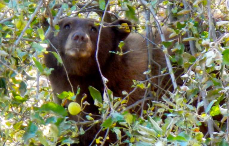
A bear in South Lake Tahoe on Oct. 22 munches away on apples. Photo/Kathryn Reed

A bear in South Lake Tahoe on Oct. 22 munches away on apples. Photo/Kathryn Reed

Two bears have died recently in Lake Tahoe, others have been caught and released, and many are roaming neighborhoods.

A female cub was hit and killed by a car near Zephyr Cove and a 2-year-old female was found in a stream. Nevada Department of Wildlife officials said residents in the area of the stream had reported a “lethargic, sickly looking bear” before it was found.

NDOW caught two bears in traps in Reno. One was in the area around West Plumb Lane and Ferris Lane, and the other in the Juniper Ridge area of Reno. Both were released back into the wild.

“These bears are hungry and west Reno offers a lot of temptation,” NDOW black bear biologist Carl Lackey said in a press release. “Besides the always-present human garbage, there are still fruit trees which attract these very hungry bears.”

One of the females was last caught in 2007 by NDOW. That year was another poor year for wildland nuts and berries, similar to the conditions in the Sierra Nevada this year.

NDOW still has two traps set in west Reno.

Early Tuesday morning, a 350-pound male black bear was caught in west Carson City. That bear, according to Lackey, had never been handled before and was expected to be released Oct. 23.

Lackey estimates his department has run into 10 bears in 10 days.

In addition to the ongoing issue with people leaving trash out for bears, they are also attracted to fruit on the ground and in trees. Fruit on the ground is a bear magnet.

Officials expect bear activity to continue for another month before they begin hibernating. That usually happens between Thanksgiving and Christmas as food sources become harder to find.

— Lake Tahoe News staff report


Expect smoke in basin from prescribed fires

U.S. Forest Service fuels management crews will begin prescribed fire operations in several locations around the Lake Tahoe Basin on Oct. 23.

Weather and conditions permitting, operations will take place on the South Shore near Pioneer Trail and Al Tahoe Boulevard, Blackwood Canyon on the West Shore, Spooner Summit on the East Shore, and Bunker Drive near Tahoe City. Crews will burn approximately 1 to 2 acres per day in these locations and expect to continue operations through the weekend and into next week. Operations will remain small until the basin receives regular periods of rain and snow.

Smoke will be visible. The Forest Service strives to minimize the impacts of smoke on local communities. Smoke-sensitive residents should consider staying indoors and keeping doors, windows and outside vents closed.


USFS giving tour of Upper Truckee River project

The U.S. Forest Service Lake Tahoe Basin Management Unit will host a field trip Oct. 25 to observe progress on the Upper Truckee River restoration project.

Participants should meet on Onnontioga Street, just south of the Omaha Street intersection at 5pm. Onnontioga Street is located off of Washoan Boulevard on Pioneer Trail.

Sturdy shoes are recommended and no RSVP is required.

Staff will be on hand to answer questions and provide information about the project. Project information is online.


North Shore resorts in a Ski Town Throwdown

Sugar Bowl and Squaw Valley-Alpine Meadows are relying on Facebook votes to move to the finals of Powder magazine’s Ski Town Throwdown.

Each resort will have 24 hours to garner more votes than its competition.

First up, Sugar Bowl Resort will compete against Mount Baker, Wash., on Oct. 24. Next up, Squaw Valley-Alpine Meadows will take on Whitefish, Mont., on Oct. 28.

The Ski Town Throwdown voting for all 64 resorts began Oct. 14. If the resorts receive more votes than their competition, they will enter the second round of voting beginning Oct. 31.The winner will be announced Dec. 16 after multiple rounds of voting.

To vote, go online.


Eldorado National Forest to begin controlled burning

Prescribed burning in the Eldorado National Forest will resume as soon as air quality and vegetation conditions are right, possibly this week.

Residents of Pollock Pines and travelers along Highway 50 will see smoke rising from a 250-acre prescribed burn planned on Peavine Ridge about a mile north of Pollock Pines and west of the community of White Meadows. The Peavine Ridge prescribed burn will provide additional wildfire protection to Pollock Pines and White Meadows. An information board with details about the burn will be posted at Sierra Vista Shell Station in Pollock Pines.

The Forest Service also plans to continue burning along the Mormon Emigrant Trail west of Silver Fork Road.

For any additional call Nickie Washington at (530) 621.5237 or email nickielwashington@fs.fed.us.


Forest Service returning to normal in Tahoe

The U.S. Forest Service Lake Tahoe Basin Management Unit is working to open many facilities and restore public services that had been suspended during the government shutdown.

Most Forest Service facilities in the Lake Tahoe Basin normally close by the end of October. Sites that normally close in mid-October, such Pope, Baldwin and Nevada beaches and Fallen Leaf, Meeks, William Kent and Kaspian campgrounds, will remain closed.

The LTBMU’s priority will be opening day-use recreation sites for the remainder of the season as soon as staff can clean them and determine that they are safe for public use. This includes sites such as Eagle Falls, Glen Alpine and Big Meadow trailheads, the Sand Pit, Sawmill Pond, Echo Lakes, Logan Shoals Vista and Secret Harbor and Chimney beaches.

The Taylor Creek Visitor Center parking lot and restrooms will open to serve visitors using nearby beaches or the trails, but the visitor center and the stream profile chamber will remain closed for the season.

Watson Lake and Blackwood Canyon campgrounds will open, but Luther Pass Campground will remain closed. Camping opportunities continue to be available at Zephyr Cove Campground and Camp Richardson. Inspiration Point will be open through mid-November.

The Forest Supervisor’s office has resumed its normal schedule of Monday through Friday, 8am-4:30pm. The North Shore office may resume its normal Wednesday through Friday schedule as soon as Friday.

For questions about the status of specific facilities, call (530) 543.2694.


Prescribed fire planned for South Lake Tahoe

U.S. Forest Service fuels management crews will conduct prescribed fire operations near the intersection of Pioneer Trail and Al Tahoe Boulevard in South Lake Tahoe beginning Oct. 18.

Crews expect to burn approximately 1 acre per day, weather and conditions permitting. Operations are expected to last through next week.

Smoke will be visible. The Forest Service strives to minimize the impacts of smoke on local communities. Smoke-sensitive residents should consider staying indoors and keeping doors, windows and outside vents closed.

Forest Service staff will post road signs around the areas affected by the prescribed fire, send email notifications, and update the local fire information line at (530) 543.2600, No. 6. To receive prescribed fire notifications, send an email to pa_ltbmu@fs.fed.us.


Lake Tahoe unfolds along slice of Rim Trail

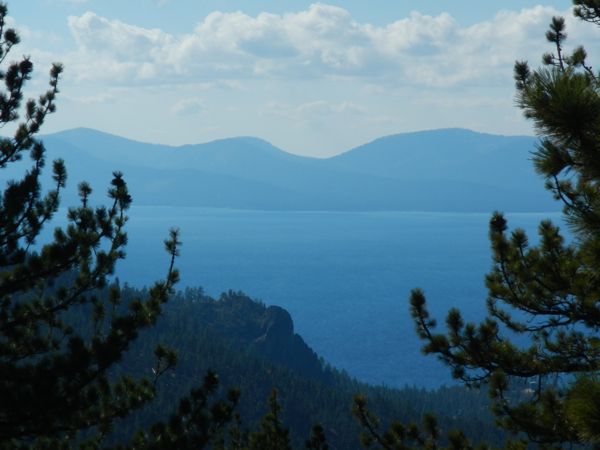
Outstanding views of Lake Tahoe along the Tahoe Rim Trail near Spooner Summit. Photos/Kathryn Reed

Outstanding views of Lake Tahoe along the Tahoe Rim Trail near Spooner Summit. Photos/Kathryn Reed

By Kathryn Reed

SPOONER SUMMIT – If you think Spooner Summit is busy now, you really would not have liked traveling this route more than a century ago.

A dirt road and a railroad line were in this area in the late 1800s. This was a critical link between Placerville and Virginia City during the Comstock era. It was all about logging and silver in those days. Much of the wood that was harvested was used to build the mines in Nevada.

Today Spooner Summit the road – or Highway 50 – is the main path between South Shore and Carson City. But the summit itself is the gateway to some spectacular hiking.

At the trailhead on the south side of the highway are numerous signs depicting the history of the area.

“In 1860, French-Canadian entrepreneur Michele E. Spooner acquired about 640 acres of land with the idea of starting up a sawmill, a shingle mill and a hotel. He named the area Spooner Station. Ten years and several business partners later, Spooner had acquired interest in flumes, a toll road, and other businesses, and controlled a total of 1,840 acres surrounding the summit that now bears his name,” reads one of the signs.

Spooner sold his flumes and toll road in 1872 to Duane Bliss and H.M. Yeringon.

It was President William McKinley who in 1899 created the Lake Tahoe Forest Reserve. This agency predated today’s U.S. Forest Service. When that government body came into being in 1905 this land became part of the USFS.

The four-lane road was built in the 1950s.

A spectacular aspen grove marks the start of the trailhead. Yellows and oranges were shimmering in the sun last Saturday. The day use area is awash in autumn colors.

We had our choice of destinations: Genoa Peak Road 3 miles, Ridgetop Lake View 5 miles, Kingsbury Trailhead 12, Kingsbury Grade 14, or Tahoe City 102.

These are all along a section of the Tahoe Rim Trail that neither Sue nor I had been on before. One day we’ll hike all 165 miles. We might set a record for the most number of years for full-time residents to do so.

I was hoping to do an out-and-back to the Ridgetop Lake View. However, my pulled muscles from a tennis match a couple weeks earlier said, “You have got to be kidding.” We did the 6-mile roundtrip to Genoa Peak Road.

We are thinking of finishing the other side of the trail to Kingsbury on our bikes next year.

A couple mountain bikers passed us and there was clear evidence equestrians had been out recently. Those who were hiking were bundled up to ward off the crisp chill in the air, which became more pronounced as an afternoon breeze picked up.

While the largest dose of fall colors is at the start of the hike, evidence of the changing seasons dots various spots along the way.

“It’s a collision of seasons,” is how Sue described the mountainside in the distance with the aspens and snow.

Various groves of Douglas fir made her want to pick out a Christmas tree right then and there. Many were not more than a Charlie Brown tree.

While we didn’t make it to the ridge view, there are ridges and there are views. And they are outstanding views of Lake Tahoe. And being so high, they are also vast views.

Spooner Summit is at 7,150 feet and the hike is a gradual climb, with the steepest (and it’s not really steep) section at the start.

Briefly the colorful tree-lined Spooner Lake on the other side of the highway is visible.

The single-track trail is in great shape. Splotches of snow on the ground are a clear sign winter is closer than summer. Just don’t be fooled by the first road you come to. It’s not Genoa so you have not gone 3 miles.

—-

Getting there:

From South Lake Tahoe, take Highway 50 east. At the top of Spooner Summit on the right before descending into the valley is a parking lot. If the lot is full, there are also spaces on the highway.

ngg_shortcode_0_placeholder (Click on photos to enlarge.)


Study: Nutrient pollution threatens ecosystems

By Tony Barboza, Los Angeles Times

National parks from the Sierra Nevada to the Great Smoky Mountains are increasingly being fertilized by unwanted nutrients drifting through the air from agricultural operations, putting some of the country’s most treasured natural landscapes at risk of ecological damage, a study has found.

Thirty-eight of 45 national parks examined by scientists are receiving doses of nitrogen at or above a critical threshold that can harm sensitive ecosystems, such as lichens, hardwood forests or tallgrass prairie, scientists found.

Scientists looked at nitrogen oxides and ammonia that are released by vehicles, power plants and farms and carried on air currents into national parks, including those in some of the most remote areas of the West.

Read the whole story