Wind and snow on their way to Tahoe

Batten down the hatches because it’s going to get super windy this afternoon in the Lake Tahoe Basin.

The National Weather Service has issued a wind advisory from Sunday at 1pm to 5am Monday. Winds will be from the southwest at 20-35 mph, with gusts of 50 mph.

Waves on Lake Tahoe are expected to be 3 to 5 feet, with the highest waves on the north and east shores.

“Winds may also down tree branches and move unsecured outdoor items,” the Weather Service said.

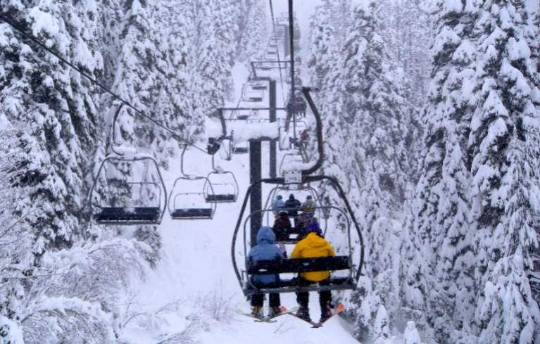
With the wind, will come moisture. There is a 40 percent chance of rain-snow at the lake this evening, and 70 percent chance of snow on Monday.

— Lake Tahoe News staff report


State reserve protects rugged coastal beauty

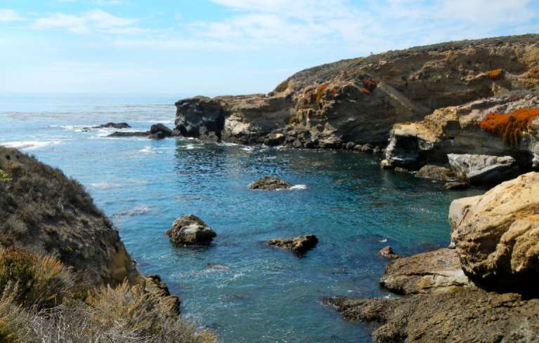
Point Lobos State Reserve in Carmel offers endless views of the Pacific Ocean. Photos/Kathryn Reed

Point Lobos State Reserve in Carmel offers endless views of the Pacific Ocean. Photos/Kathryn Reed

By Kathryn Reed

CARMEL – Tails smacking the water, backs breaking the surface and water spewing from the blowhole.

It’s an unusual sight in early October to see humpback whales breaching off Point Lobos. About a half dozen of these creatures were a few hundred yards from shore. A volunteer with the state preserve says a shelf about 1,000 feet deep provides plenty of food for the whales. He allows visitors to peek through his high-powered binoculars to get a better view of the action in the ocean.

A couple kayakers are out with the whales in what looks like a potentially precarious situation.

Point Lobos State Reserve is full on this first Sunday in October. We had to park on the road – which saved us $10. Maybe it had something to do with the federal shutdown; after all it’s why the four of us were there. Our girls camping weekend was canceled because we were headed to a national park. But Plan B was just fine – Carmel and its surroundings.

Birds are the most common and easiest form of wildlife to spot. Cormorants, herons, and pelicans flock to rock outcroppings and are in the bay area perched on kelp as they scout for food.

It would be near impossible, definitely exhausting, to hike all the trails in the reserve in one day. The $2 map that may be purchased at the parking kiosk is worthwhile. Besides letting you know where you are and how to get to the next spot, there is a wealth of information about the preserve.

Trails for all ability levels abound and some are wheelchair accessible. And those not into exploring by foot will find parking near the water.

Offshoots along many of trails provide sweeping vistas of the Pacific Ocean. The reserve is on a jagged slice of the Central Coast, which provides for several rather tranquil coves, at least on this day.

Windswept trees look deformed as their branches are not uniform. This just adds a unique natural beauty to the already stunning scenery. The Cypress Grove Trail goes through one of two naturally growing stands of Monterey Cypress trees that exist in the world.

Chinese fishermen built the Whalers Cabin in the 1850s. Now it’s a museum that tells stories of abalone being shipped to Japan, how cattle were brought to the area by the Carmel Mission padres in the 1770s, that Portuguese dairy farmers in about 1903 started making Monterey Jack cheese. The Jack is a tool, not a person.

Point Lobos is also a popular launching spot for scuba divers. In 1960, it became one of the country’s first underwater reserves.

In total, the reserve includes 775 acres underwater and 554 acres on land. The State Parks system began managing the area in 1933. It is on the National Register of Historic Places.

ngg_shortcode_0_placeholder (Click on photos to enlarge.)


Feds to protect sage grouse in Calif., Nev.

By Jason Dearen, AP

SAN FRANCISCO — Federal wildlife officials on Friday proposed to list as threatened populations of greater sage grouse in Nevada and California in an effort to save the struggling species, a decision that promises to pose new challenges for ranching and energy development in the West.

The U.S. Fish and Wildlife Service found that invasive species and energy development in the desert have had a devastating effect on the large, ground-dwelling bird’s populations, said Ted Koch, Nevada state supervisor for the service.

“It’s not the eleventh-hour for sage grouse here, but it is maybe the 10th hour,” Koch said. “And that’s good news. It means we have some time and space to turn things around.”

The service found multiple threats facing this specific sub-population of the sage grouse, a chicken-size bird whose males have a large white tuft of feathers around their necks.

The service estimates there are only about 5,000 of the birds left.

Non-native pinyon pine and juniper trees introduced to the habitat and power lines have given low-to-the-ground perches for raptors, which eat the grouse, Koch said.

The service also found that an invasive grass from Asia that burns easily has helped decimate sagebrush, which is key to the grouse’s survival.

Industry, federal and local officials say a local effort already underway to save the bird is a promising start. Passed in 2012, the plan is being used by federal officials to help clear red tape for industry in the area.

Some state legislators greeted the proposed listing with suspicion, saying it could have wide-ranging economic impact on the rural economies in the region. Senate Majority Leader Harry Reid of Nevada said the decision will have “major ramifications” on the way of life in parts of Nevada and California.

“This listing is further proof that we need to work together to protect sensitive species before they get to such a dismal point and negatively affect our rural economies,” Reid said in a statement.

The final decision on the service’s proposal will occur next year, and the public will have 60 days to comment.

Ranchers, miners and energy developers who use the mostly public lands that serve as the sage grouse’s habitat have opposed the listing, saying it would have a deep economic impact in the rural West.

Friday’s proposed listing comes as the service is also determining whether the entire western sage grouse population should be federally protected. Sage grouse also live in Colorado, Idaho, Montana, North Dakota, Oregon, South Dakota, Utah, Washington, Wyoming and parts of Canada.

Ranchers worry that protections will scuttle or block outright vast grazing areas. They say it adds a lot of uncertainty to any plans to expand or even launch habitat restoration plans on their lands.

“For guys talking about expansion and going to the bank for loan, I’m not sure what the bank is going to tell me,” said JJ Goicoechea, a rancher and veterinarian who is president of the Nevada Cattlemens Association.

“And the rural economy is heavily dependent on those ranching families, who generate revenues that help keep towns and schools running. What’s going to happen to those rural communities?” he asked.

The Center for Biological Diversity, which sued the service to protect the sage grouse, said the decision was long overdue.

“The sage grouse we have here in Nevada and California is a true symbol of all that is wild — what a relief that it’s finally getting the protection it needs to survive,” Rob Mrowka, a Nevada-based center ecologist, said in a statement.


Ski racing season begins for professionals

By USSA

SOELDEN, Austria — In the first race of the season, two U.S. women skied the final run.

Slalom world champion Mikaela Shiffrin (Eagle-Vail, Colo.) skied into sixth place in the Soelden giant slalom to kick off the 2014 Audi FIS Alpine World Cup Season on Oct. 26. Shiffrin led the U.S. women in the season opener and snagged her career-best World Cup giant slalom result.

Switzerland’s Lara Gut sealed her first World Cup GS victory despite a huge mistake on the steeps.

Olympic giant slalom Champion Julia Mancuso (Squaw Valley) finished 27.

On Sunday, Ted Ligety (Park City) will be gunning for his third-straight win in Soelden while Bode Miller (Franconia, N.H.) returns to the snow for the first time since February 2012.


Backcountry avalanche training in Tahoe City

With winter fast approaching, it is time to prepare backcountry ski equipment and refresh those avalanche safety skills.

On Nov. 7 at 7pm Alpenglow Sports will provide a free educational forum to prepare backcountry enthusiasts of all ability levels for the upcoming season. In the first of two installments of the annual Community Avalanche Safety Seminars, the Tahoe City shop will provide an evening for backcountry travelers to refresh their skills, learn new information, and witness the latest equipment in avalanche safety.

Ricky Newberry, director of ski patrol at Kirkwood Mountain Resort and ambassador for Backcountry Access and K2, will give professional-grade expertise on topics like terrain assessment and risk management, beacon rescue skills, probing technique, companion rescue and float air bag technology.

The seminar will last two to three hours, and will consist of an indoor and outdoor component, the majority of which will fall on education and field-testing. Backcountry enthusiasts of all ages and abilities are encouraged to participate. Bring your favorite beacon, a headlamp and appropriate clothing for cold weather. Adult beverages provided and potluck-style food is encouraged. The event will be limited to 75 people, so arrive early.

While the evening is open to any and all interested, it does not take the place of formal avalanche education or a AIRE or AAI Level 1-type course.

Call (530) 583.6917 with any questions.


Lake in El Dorado County for sale

By Tom DuHain, KCRA-TV

Bass Lake in El Dorado County is for sale, and a school district is negotiating to purchase it.

The 90-acre lake, a rock dam and another 58 acres of land around the lake are being offered by the El Dorado Irrigation District.

The lake is home to a variety of water fowl and fish.

“You’ve got geese, herons, pelicans and egrets,” said John Thompson, of the Bass Lake Action Committee. “All the wildlife is coming through here to Bass Lake. It’s an asset to the community.”

Irrigation district officials said they no longer need the lake, which was used for water storage. As excess public property, it was first offered to public agencies.

Read the whole story


Stateline bike path opens up another world

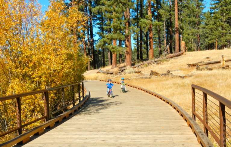
Users of all ages enjoy the trail at Rabe Meadow. Photos/Kathryn Reed

Users of all ages enjoy the trail at Rabe Meadow. Photos/Kathryn Reed

By Kathryn Reed

STATELINE – It’s being called a game changer. And it just might challenge the Camp Richardson trail as the go-to path for pedestrians and cyclists on the South Shore.

The 2.2-mile section of the Stateline-to-Stateline bike path that goes from Rabe Meadow to Round Hill Pines beach officially opened this week.

One day this path will link the actual state line on the South Shore to the state line on the North Shore.

Not one tree had to be removed on the Rabe Meadow section. The route meanders through a large tract of U.S. Forest Service land. For the most part it follows trails that already existed. The difference now is there is pavement.

But there are still trails that are dirt, so it has not ruined what has always been a popular access point to Nevada Beach. It has opened up the area to other types of users and now goes farther.

Curves in the trail make it more interesting than if it were a linear path.

By the end of the month signs are expected to be in. Some are directional signs, others will be interpretive. A larger sign will be at Rabe Meadow showing the trail and the distances to different points of interest.

Without signs, as was the case last weekend, one can get slightly off course. Once at Elks Point Road there is a sign toward Nevada Beach – the correct route. Going right leads to the commercial area. (Don’t stop in at the Wyndham resort, they don’t know anything about the trail – even though it’s been talked about for years, written about a ton and the first phase completed a year ago.)

The point to cross the road is slightly down toward Nevada Beach. Once across the street it’s a clear shot to Round Hill Pines.

For those who are adverse to hills, just keep looking at the scenery. This new section of trail swerves around Round Hill. The climb isn’t so noticeable until it’s time to descend to Round Hill beach.

Along the way are benches that offer views and a chance to rest if need be.

Added late was the trail to that beach. It was going to drop people onto the road. This addition, which is to the right and above where vehicles drive, is a pleasant, safe way to get to the sand.

(Any day the U.S. Forest Service will release who will be running the concession at Round Hill Pines. Local USFS officials are citing the National Defense Authorization Act of 1997 as to why they can’t ever release the names of the people/businesses that bid on the proposal except for the winner.)

A short spur leads to Highway 50 just west of the Bourne Meadow.

This bike path is a collaborative project spearheaded by the Tahoe Transportation District.

A cost savings on the project of $800,000 will allow for Laura Drive behind Lakeside Inn casino to be worked on next summer. Still to be determined is if it will be a separated bikeway or a bike lane.

“Concurrently, we are working with Edgewood on the right-of-way to do final design of the section of (Highway) 50 in front Edgewood and Lake Parkway,” Alfred Knotts, planner with TTD, told Lake Tahoe News. Building it is a few years out.

(One day the Greenway Bike Path in California will be built and connect with what will be the true starting point of the Stateline-to-Stateline trail.)

Construction on the Incline to Sand Harbor section of the Stateline-to-Stateline trail, which is just more than 3 miles, is expected to start in 2015. It’s in the environmental phase. Lakeside and mountainside routes are being studied. It goes mostly through Nevada State Parks and Nevada Department of Transportation rights-of-way.

“There is no fatal flaw with either one. It depends on how the document shakes out and the public comments we get,” Knotts said.

A feasibility study was done that came up with three possible routes for the path from Round Hill to Sand Harbor. No money is in the coffers right now to continue with designing that main link. But planners are looking at options.

Douglas County will be responsible for the maintenance and operation of the trail on the South Shore.

—-

Getting there:

From South Lake Tahoe, go east on Highway 50. Turn left on Kahle Drive in Stateline. Park immediately to the right. Bike trail starts at far end of the lot. At the first Y, stay to the right. At the T, follow the sign toward Nevada Beach. Cross Elks Point Road to continue to Round Hill Pines. Once at Round Hill Pines, cross the road and follow the path toward the beach. At the next intersection, left goes to the beach; right goes to Highway 50 where the trail ends.

ngg_shortcode_1_placeholder (Click on photos to enlarge.)


Questioning economic benefit of harvesting beetle-infested trees

By Science Daily

A recently published study by U.S. Forest Service researchers evaluates potential revenues from harvesting standing timber killed by mountain pine beetle in the Western United States.

The study shows that while positive net revenues could be produced in West Coast and Northern Rockies states with active timber markets, the central Rocky Mountain states of Colorado, Utah, and Wyoming — which have the largest volume of standing dead timber — would not generate positive net revenues by salvaging beetle-killed timber.

A mountain pine beetle epidemic in the Western United States has left mountainsides covered with dead pines, especially lodgepole pine, with most of the timber and land affected on national forests.

Policymakers and forest managers are considering increasing timber salvage rates on these lands as a way to address potential wildfire threat, hazards from falling trees, and visual impact, but first need to assess the broader economic ramifications of putting more timber on the market in areas where mills have closed and markets have waned over the two last decades.

Research Forester Jeff Prestemon and fellow scientists with the Forest Service Southern Research Station Forest Economics and Policy unit and with the Eastern Forest Environmental Threat Assessment Center were asked to evaluate the circumstances under which salvaging pine beetle-killed timber would be cost-effective. The researchers used an economic assessment model to estimate potential salvage volumes, costs and revenues from programs that would encourage salvage of standing dead timber, summarizing findings by state and owner groups.

Read the whole story


USFS to pile burn near Zephyr Cove

U.S. Forest Service fuels management crews may begin prescribed fire operations north of Zephyr Cove this weekend.

Operations will take place across Highway 50 from the Skyland subdivision. Weather and conditions permitting, crews will burn approximately 1 to 5 acres per day and expect to continue operations into next week.

Due to the lack of California Air Resource Board declared burn days in California, operations previously scheduled in California have been switched with locations in Nevada.

Smoke will be visible on Highway 50. The Forest Service strives to minimize the impacts of smoke on local communities. Smoke-sensitive residents should consider staying indoors and keeping doors, windows and outside vents closed.

Forest Service staff will post road signs around the areas affected by the prescribed fire, send email notifications, and update the local fire information line at (530) 543.2600, ext. 6. To receive prescribed fire notifications, send an email to pa_ltbmu@fs.fed.us.


Tahoe resorts make upgrades for ski season

By Paul McHugh, Sacramento Bee

One might imagine that it’s all about snow and nothing else. But optimism is just as valuable a resource these days for skiers, snowboarders and resort operators in and around the region.

Last winter, both were in short supply. A few early storm dumps, backed up by snow-making, enabled an adequate holiday season. But New Year’s Day led straight into the dry months that left ski conditions marginal by March, forcing an early season closure on many slopes.

Many Tahoe area ski resorts want to open before Thanksgiving. Photo/LTN file

Many Lake Tahoe area ski resorts want to open before Thanksgiving. Photo/LTN file

However, this fall meteorologists predict a mild El Niño – in other words, an “average” winter, and an improvement from the previous season. That notion is seconded by folklorists who cite signals as varied as early acorn drops, the coats on caterpillars and the gloss on black bear fur. The resorts are back to cultivating optimism and hoping for a robust run.

“Last season was challenging,” said Bob Roberts, CEO and president of the California Ski Industry Association. “I’d estimate we had a fall-off of about 12 percent (from the previous year’s attendance), for a total of less than 7 million visits to our resorts. Yet economic yields were still good, since early season-pass sales now establish a solid base. And new efficiencies in services, as well as expansion into summer operations, increasingly help most resorts to stay profitable.”

In preparing for the coming months, California resorts have generally been burnishing their appeal by expanding programs and making facility improvements, rather than by championing big-infrastructure additions that won headlines in seasons past. However, there are notable exceptions, including Sugar Bowl and feisty up-and-comer Sierra-at-Tahoe.

Read the whole story