Rain swells Tahoe water bodies, minor flooding
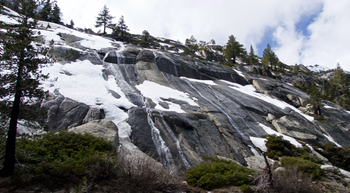
Water tumbles from the granite along Echo Summit on April 7. Photo/Kathryn Reed

By Kathryn Reed

No rainfall records were set in the Lake Tahoe Basin, but what fell has caused creeks and rivers to rise, with standing and running water in unusual places.

Highway 50 going up Echo Summit has water spilling from the granite so fast that it looks like substantive waterfalls have sprung forth.
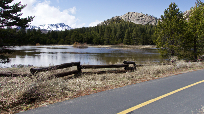
Water is close to the bike trail in Meyers. Photo/Kathryn Reed

A boulder about 8-feet in diameter fell into the passing lane of the highway just west of Sierra-at-Tahoe on Saturday. Caltrans was able to clear it fairly fast.
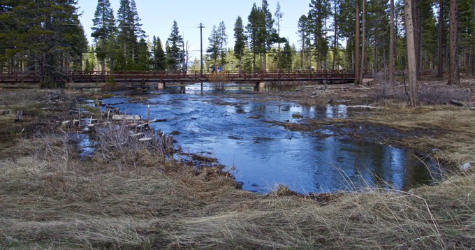
Water under the 15th Street bridge off Emerald Bay Road in South Lake Tahoe. Photo/Kathryn Reed
In the 24-hour period ending at noon April 7, the National Weather Service in Reno recorded the following rain totals:
• Echo Peak – 4.4 inches
• Alpine Meadows – 3.4
• Meyers – 3.02
• Homewood – 2.93
• Tahoe City – 1.71
• Incline Village – 1.35
• Lake Tahoe Airport – 1.34
• Carson City – 0.59

Jim Marino with South Lake Tahoe public works told LTN there are “no significant problems.”

Low lying area have standing water with some reports of floods.

The Upper Truckee River is well beyond its banks in many locations and is raging like the American River in some locations.

At Lake Tahoe Airport the runways are fine, but the river looks to be encroaching. Plus, the drainage basin between the runways is full, giving an impression it might be challenging for pilots to decipher where to land.

A spokesman for the airport said the only issue for pilots on Saturday was the wind. The water is normal in storms like this.

For some people all this moisture means fun.

South Lake Tahoe resident Scott Valentine put his paddleboard in the Upper Truckee River on Saturday afternoon at Elks Club and floated to the Tahoe Keys. It took him about an hour to make that 5½-mile trip.
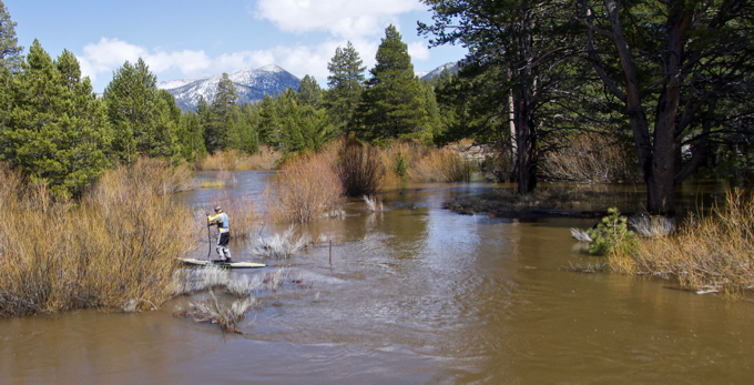
Scott Valentine starts his trek down the Upper Truckee River on April 7. Photo/Kathryn Reed

“There are some serious river hazards out there and running the river is not recommended. I have over 20 years as a professional whitewater guide, I know the river, I was wearing a dry suit, I understand how to read water, and know the consequences,” Valentine told Lake Tahoe News. “People should know that there is water flowing through trees and bushes, there is water flowing over the floodplain making route-finding difficult, there are strong currents and eddy-lines, and there are downed logs, fence posts, low bridges, and barbed-wire in the channel. It makes for an exciting run if you know what you are doing.”

He said the flow was 1,800 cubic feet per second.
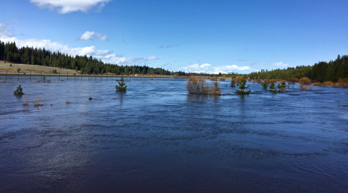
It’s hard to know the true boundaries of the Upper Truckee River. Photo/Scott Valentine

The basin is expected to dry out for the next couple of days. Wednesday night into Thursday another system, and a cooler one, is expected to roll in.
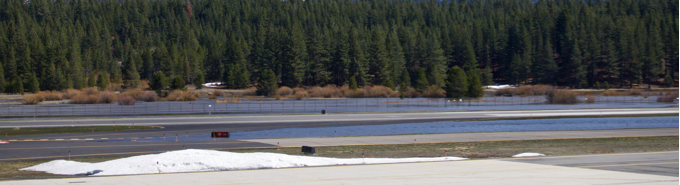
It looks like there is more water than asphalt at Lake Tahoe Airport because the Upper Truckee River is well beyond its bank. Photo/Kathryn Reed

Mark Deutschendorf, meteorologist with the National Weather Service in Reno, told Lake Tahoe News, “It could produce some snow at the lake.”

He described this time of year as transitional, with the potential for a little bit of everything – sun, rain and snow, as well as temps warm enough for shorts and cold enough for fleece.
Why weather forecasters still don’t always get it right

By Jeffrey B. Halverson

It was March 2017, and a winter storm named Stella promised to deliver up to a foot and a half of snow to New York City and parts of New Jersey. Officials pushed out blizzard warnings, suggesting the city was under imminent snowy siege.

But only 7 inches fell. Then-Gov. Chris Christie blasted forecasters. “I don’t know how much we should be paying these weather guys,” he said. “I’ve had my fill of the National Weather Service after seven and a half years.”

For anyone following the weather, forecasts for big storms are sometimes still roller coaster rides – with sudden shifts in track or intensity. As a meteorologist who forecasts for a large urban market, I can attest to the frustration. Why can’t we get it right every time, given this era of 24/7 weather data, dozens of satellite and sophisticated computer models? The answer lies in the quirks between the most popular forecasting models.

Battle of the models

Computer forecast models have become the mainstay of weather prediction across North America and many other parts of the world. Run on fast supercomputers, these sophisticated mathematical models of the atmosphere have gotten better over the past couple decades.

Human forecast skill has improved by approximately one day per decade. In other words, today’s four-day forecast is as accurate as a three-day forecast was a decade ago.

Forecasters in the U.S. routinely examine several models, but the two most discussed ones are the American and the European. When the models disagree on the track of a big storm, forecasters must often choose which they believe is most correct. This decision can make or break a critical forecast.

Most meteorologists agree that the European model is the most skillful. This was cemented in March 1993, when it correctly forecast the track and intensity of a historical Nor’easter. Called the “Storm of the Century,” the storm dropped a blanket of heavy snow from the Gulf Coast to the northern tip of Maine.

The storm was a milestone for what is termed medium-range forecasting, or forecasts made three to seven days out. The European model nailed the prediction five days in advance. That meant officials could declare states of emergency before the first flakes ever flew.

Fast forward to 2012, and the Euro was still making correct calls on big, dramatic storms. But this time, the lead time went beyond eight days. The storm was Hurricane Sandy, a massive Atlantic storm. More than a week in advance, the European model predicted an oddball westward jog in Sandy’s track, whereas the American model arced it eastward and harmlessly away from the East Coast. Score: another major victory for the European.

European versus American

Why does the European do so well, compared to its American counterpart?

For one, it’s run on a more powerful supercomputer. Two, it has a more sophisticated mathematical system to handle the “initial conditions” of the atmosphere. And three, it’s been developed and refined at an institute whose singular focus is on medium-range weather prediction.

In the U.S., the medium-range American model is part of a suite of several models, including several short-range prediction systems that run as frequently as every hour. The time, intellectual focus and costs are shared among as many as four or five different types of models.

The public has heard about the European model’s victories. But forecasters also know that the American model is quite skillful; it’s had its share of wins, albeit less high-profile. One of these was Winter Storm Juno, a 2015 Nor’easter that severely impacted the New England coast. Forecasters put out a dire warning for 24 to 36 inches of snow across all of New York City. In an unprecedented move, Gov. Andrew Cuomo shut down the subway system in advance, a move never done for an impending snowstorm.

This doomsday snow forecast was based on the European model. The American model predicted that the storm would be displaced about 50 miles farther eastward – shifting the big thump of snow away from the city proper. In reality, Juno took this eastward track and Central Park ended up with “only” 10 inches – a significant amount of snow, but not a crippling 2 to 3 feet. The unnecessary economic losses from the city’s shutdown were huge, putting meteorologists on the defensive.

In the case of winter storm Stella, the American model massively overpredicted snowfall. But a short-range model called the North American Model correctly predicted a storm track 50 to 100 miles farther east.

Predicting the weather

It all comes down to this: Weather forecasters have many choices for predictive models. The art of forecasting is based on years of experience spent with each model, learning the unique biases and strengths of each. The National Weather Service and other forecasting outfits have made strides in better communicating forecast uncertainty, given the inherent spread in the models. But it still often comes down to that gut feeling: European or American?

Researchers are taking steps to improve U.S. medium-range weather prediction by doubling the computer speed and tweaking the way the model ingests data. Companies like Panasonic and IBM have entered the arena with their own novel weather prediction models.

In the meantime, while we wait for the American model to “catch up” to the skill of the European, there are a few ways people can learn to decipher the forecast message. Individual model runs are less skillful beyond about five days; what you’re looking for is run-to-run consistency. Also, seek out forecasts that frame the predictive uncertainty. For instance, a forecast may suggest alternate scenarios for an upcoming snowstorm: a 20 percent chance of up to 15 inches, or a 20 percent chance that only 4 to 6 inches will fall.

Jeffrey B. Halverson is a professor of geography and environmental systems, and associate dean of the graduate school at University of Maryland, Baltimore.


Tahoe rock climber shares her big mountain stories

By Terra Breeden

It’s not always about the summit. This is something rock climbers have to come to grips with.

Professional rock climber Emily Harrington shared her experiences of big climbing this week with an audience of nearly 50 at Blue Angel Café in South Lake Tahoe. The North Shore resident spoke of the triumphs and the peaks that still need conquering.

“Thanks to a lot of hard work and luck, I’ve had the opportunity to travel to some amazing places, but it was not without struggle,” Harrington said. “I get scared of the path I’ve chosen, and I worry about the longevity of my career.”

For Harrington, her rock climbing experiences would not be complete without the influence of the people she has met in the span of her career. She attributes her success to the friends and relationships she’s had over the years, saying they have shaped her life even more than rock climbing.

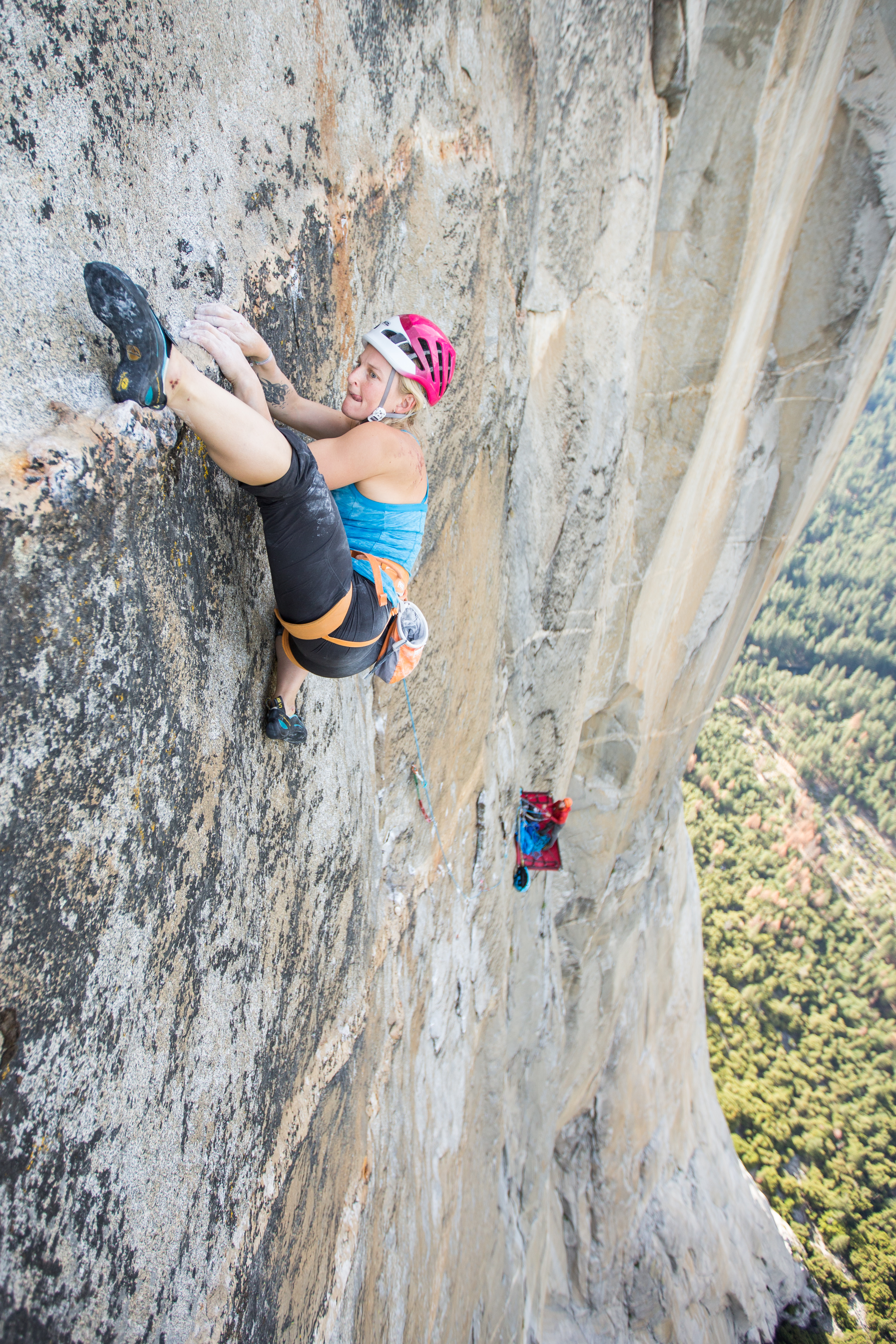
Emily Harrington on a climb in Yosemite National Park. Photo/Provided

During the presentation, Harrington talked about these relationships and how they have influenced her life, starting with her close friend Michelle Parker.

A professional big mountain skier from Squaw Valley, Parker joined Harrington and a group of other Tahoe skiers on an Ecuador ski-mountaineering expedition to Cotopaxi, the famed, snow-covered and active volcano. According to Harrington, the three-day journey up Cotopaxi was fraught with danger from high wind to mud-soaked roads and horrendous weather – “the worst in decades.”

But for Harrington, even though the group was deterred by conditions and was unable to ski the slopes of the volcano, because of Parker’s positive outlook, the trip was a success.

“Certain people make you feel like everything is a good time, even when it’s not,” Harrington said. “We are lucky to call her a Tahoe local.”

Harrington also talked about her relationship with her mentor and professional mountaineering-skier Hilary Nelson, who was just proclaimed National Geographic’s 2018 adventurer of the year.

In 2014, Nelson took Harrington on a 900-mile overland journey though Myanmar to summit Hkakabo Razi, one of the most remote mountains in the world. The duo took almost every mode of transportation available in the developing country to reach the mountain. They boarded a bone-shaking train known as the “death train” because it hadn’t been updated since 1948, they clung to the back of motorbikes manned by Myanmar locals down boggy, mud-soaked roads, and when the roads finally petered out, they walked. Harrington and Nelson hiked 125 miles through the Burmese jungle to get to Hkakabo Razi.

“I did not grasp what I’d signed up for; it was an expedition,” Harrington said. “Hilary is a purist at heart, and this was her adventure.”

When they finally reached Hkakabo Razi, the climbing conditions were horrible. The loose, crumbly rock threatened to come away in the climbers’ hands as they scrambled for the summit. It was dangerous. Harrington was scared and completely out of her comfort zone.

“If something happened, there was no rescue; it wasn’t like modern expeditions,” Harrington said. “We had underestimated the trip and the mountain. It was too technical and too dangerous, and we had pushed ourselves to the limits.”

Harrington and Nelson never made it to the summit. After a lot of discussion, they camped out on a ledge for a few days with the summit in sight and 1,000-foot drops on either side. Then turned back, hiking the 125 miles back to civilization.

“It sucked. But in the end, I realized that the trip was about patience,” Harrington said. “I hope that 15 years from now I will continue to have the drive and passion that Hilary does.”

Originally from Boulder, Colo., Harrington is a Tahoe-transplant who moved here six years ago to join her partner Adrian Ballinger, a professional mountain guide and founder of Alpenglow Expeditions, who Harrington met on Mount Everest in 2012.

“Thankfully, I’ve discovered that it does snow here and that there is amazing granite for climbing,” Harrington told the audience.

Blue Angel Café donated the space for the evening and it was awash in sultry, low lighting with a bar serving wine and craft beer to guests. The event was conceptualized by Lake Tahoe photographer Corey Rich.

“I met Emily when she was 15-years-old and immediately she seemed super smart, talented, and was an incredible athlete,” Rich told the audience. “In 16 years, nothing has changed.”

The 31-year-old Harrington is a sprightly, fierce woman with blonde braids coiled around her head. Although Harrington has claimed five national titles in rock climbing, summited Mount Everest, and free-climbed El Capitan in Yosemite, the talk wasn’t as much about her athletic career as it was about the people who have shaped it.

Harrington began rock climbing competitively when she was 11-years-old and has been pursuing the sport ever since, gaining world recognition for her technical climbing feats. Although she started as a gym-climber, over the years she has transitioned into outdoor climbing, ice climbing, and mountaineering.

“It’s because of these people that I keep believing in myself and have the courage to keep going,” Harrington said. “So I want to encourage others to get out and be uncomfortable and afraid, and find those things that forces them to grow.”

Harrington continues her adventures next week with a rock climbing expedition to Spain and plans to spend her summer climbing in Yosemite.


Report: Half of the West’s rivers altered by development, diversions

By Matt Weiser, Water Deeply

Many Americans may not realize it, but rivers throughout the West are increasingly under siege. The threats are not as apparent as they once were in the era of big dam building, which makes them that much more troubling. Climate change, land development and catastrophic forest fires are the big concerns today. These are relatively slow-moving threats, but no less transformative.

Water development is still a player. Colorado, Utah and California are all entertaining big new dam proposals. All three states are also pondering major pipelines to divert river flows, even as those flows diminish due to persistent drought and a warming climate.

A new report by the Center for American Progress helps put all this in perspective. The report, produced in partnership with Conservation Science Partners, found that 49 percent of all river miles in Western states have been modified from their original condition, either by changes in flow or adjacent land development. High-elevation headwaters have not been spared, with 35 percent disturbed by some form of development. The report includes an interactive map that illuminates conditions on thousands of western rivers.

Read the whole story


Beauty of Tahoe unfolds after short ‘shoe

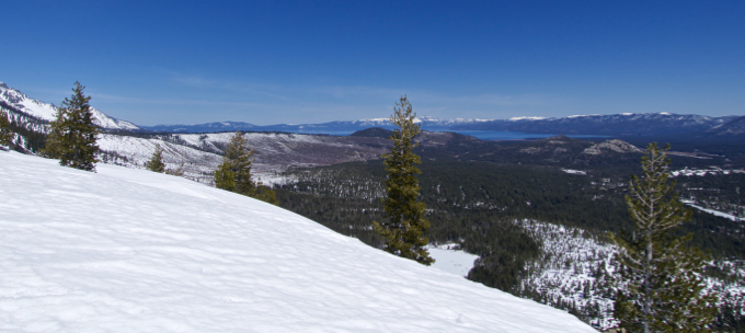
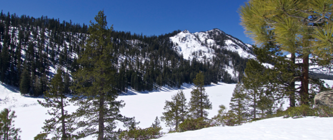
Views are the reason to hike or snowshoe to the ridge above Echo Lake. Photo/Kathryn Reed

By Kathryn Reed

A short jaunt up to the ridge above Echo Lake was a much needed reminder of just how gorgeous this area is. Sometimes it’s easy to take the beauty of Lake Tahoe for granted when one is immersed in daily life.

It’s been such a strange snow season that last Sunday was the first time I snowshoed all winter, um spring.

Stripped down to short sleeves – two of the five on the outing were in shorts – it was a glorious day. Not a cloud was in the sky. A cool breeze greeted us as we hiked farther on the ridge.

It’s amazing how in less than 1½ miles we had a spectacular view of what seemed like the entire basin. Mostly, though, it was the South Shore that spilled forth. At that elevation it was a good reminder of how we really do live in a forest and not a concrete jungle.

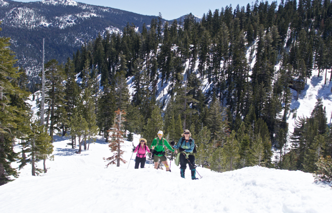
Leilani, Donna and Sue make their way up the trail. Photo/Kathryn Reed

On this particular day the road to Echo Lake was wide, matted down and easy to walk without snowshoes. Two in our group had been there just a couple weeks before when it was a different world because of the fresh snow; with snow a couple feet deep and much more of a workout.

We passed by the frozen lake, crossed the dam and headed up to get to the point where we’d get that view. Others, though, had stopped to play on Lower Echo Lake – cross country skiing and skate skiing.

Once across the dam we all had our snowshoes on.

We opted to head toward Flagpole Peak (elevation 8,363 feet) a bit. From the point we turned around we could look down on some of the devices used for avalanche control above Highway 50.

It’s the 360-degree views that make this such a great jaunt. And it’s relatively easy, and at just less than 3½ miles round trip, it should be done every year.

Besides seeing Lake Tahoe in the distance, there are iconic peaks like Freel and Becker scratching the sky.

A frozen Echo Lake with Becker Peak above it and skate skiers on it. Photo/Kathryn Reed

—–

Getting there from South Lake Tahoe:

Go west on Highway 50 to the top of Echo Summit. A short way down, turn right on Johnson Pass Road. Follow the road to the Sno-Park area. (Pass required and must be purchased before arrival.) Cross road and begin trek on road to Echo Lake.


Earth Day workday in Alpine County

The Alpine Watershed Group will be hosting an Earth Day Work Day on April 21 at Grover Hot Springs State Park. 

This event allows for the completion of restoration work to an alpine meadow. Volunteers are needed to help with invasive weed removal, fence rebuilding and extension, and state park maintenance. All are welcome to attend. No experience is necessary.

Gather at Grover Hot Springs at 8:30am for registration and introductions. Volunteers are asked to bring water in reusable water bottles (water refill stations will be provided), sun protection, and appropriate clothing. The workday will wrap up at 12:30pm. Snacks will be provided. Starbucks and Subway will be providing coffee and pastries in the morning and sandwiches for lunch.

The Alpine Watershed Group is a nonprofit organization whose mission is to protect and enhance the natural system functions of Alpine County watersheds. For more information on this event, go online.


Outdoor education Tahoe-style for 5th-graders

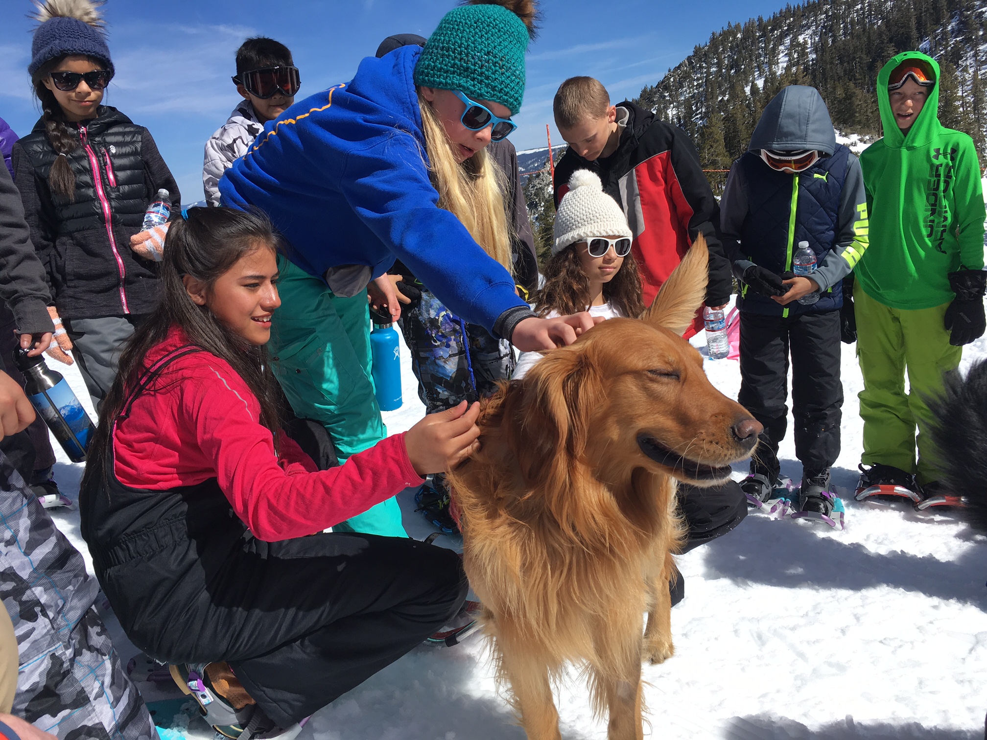
Neyeli Jimenez, left, and other students pet avalanche dog Peak. Photo/Terra Breeden

By Terra Breeden

Playing in the snow isn’t all fun and games. It can be deadly without the correct preparation or tools.

At the avalanche awareness and snow safety station hosted by David Reichel from the Sierra Avalanche Center, students learned how to rescue an avalanche victim by using a beacon and probe. They also learned how to check avalanche conditions by looking at the layers of snow in the snow pack. Avalanche conditions on this day were moderate.

On this particular day students from Bijou Community School were being taught a wealth of information about the outdoors.

“We realized that not every kid gets a chance to get outdoors, so this gives them that experience,” Adam Jensen, environmental education specialist at the Tahoe Regional Planning Agency, told Lake Tahoe News. “The goal is to get every student outdoors to learn about their natural environment.”

Alaina Corona and her classmates trek on snowshoes from station-to-station. Photo/Terra Breeden

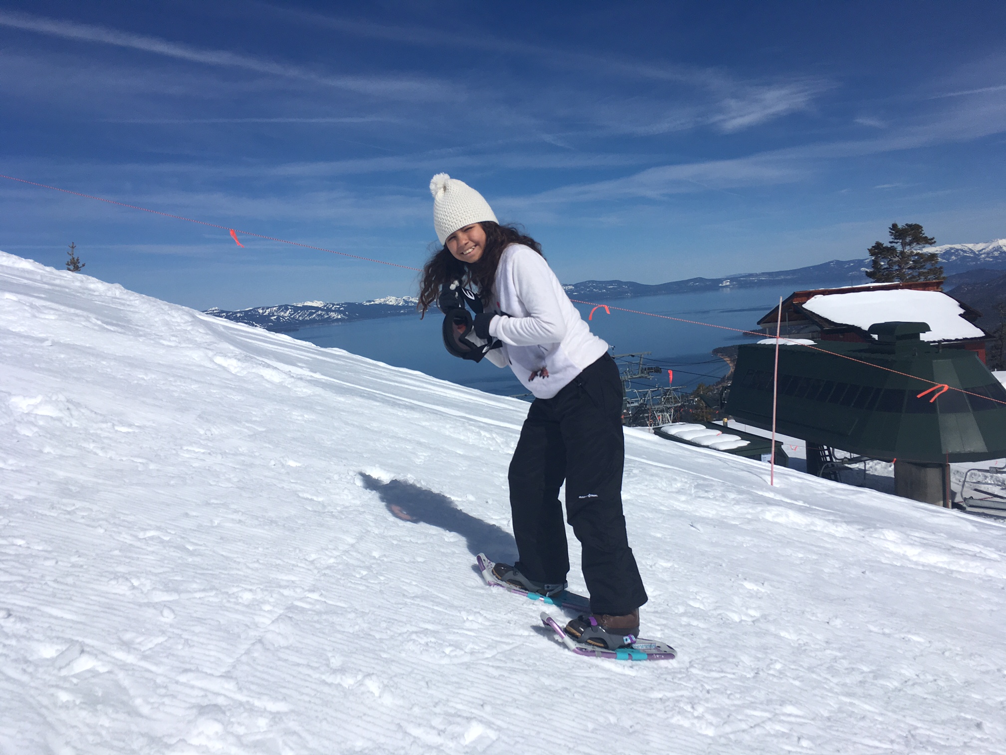
Fifth-graders from Bijou joined the third annual Winter Adventure EpicPromise Program at Heavenly Mountain Resort last week. Designed to educate local kids about Lake Tahoe winters, more 300 children from across the Lake Tahoe Unified School District have joined ski patrollers and teachers for the program this year.

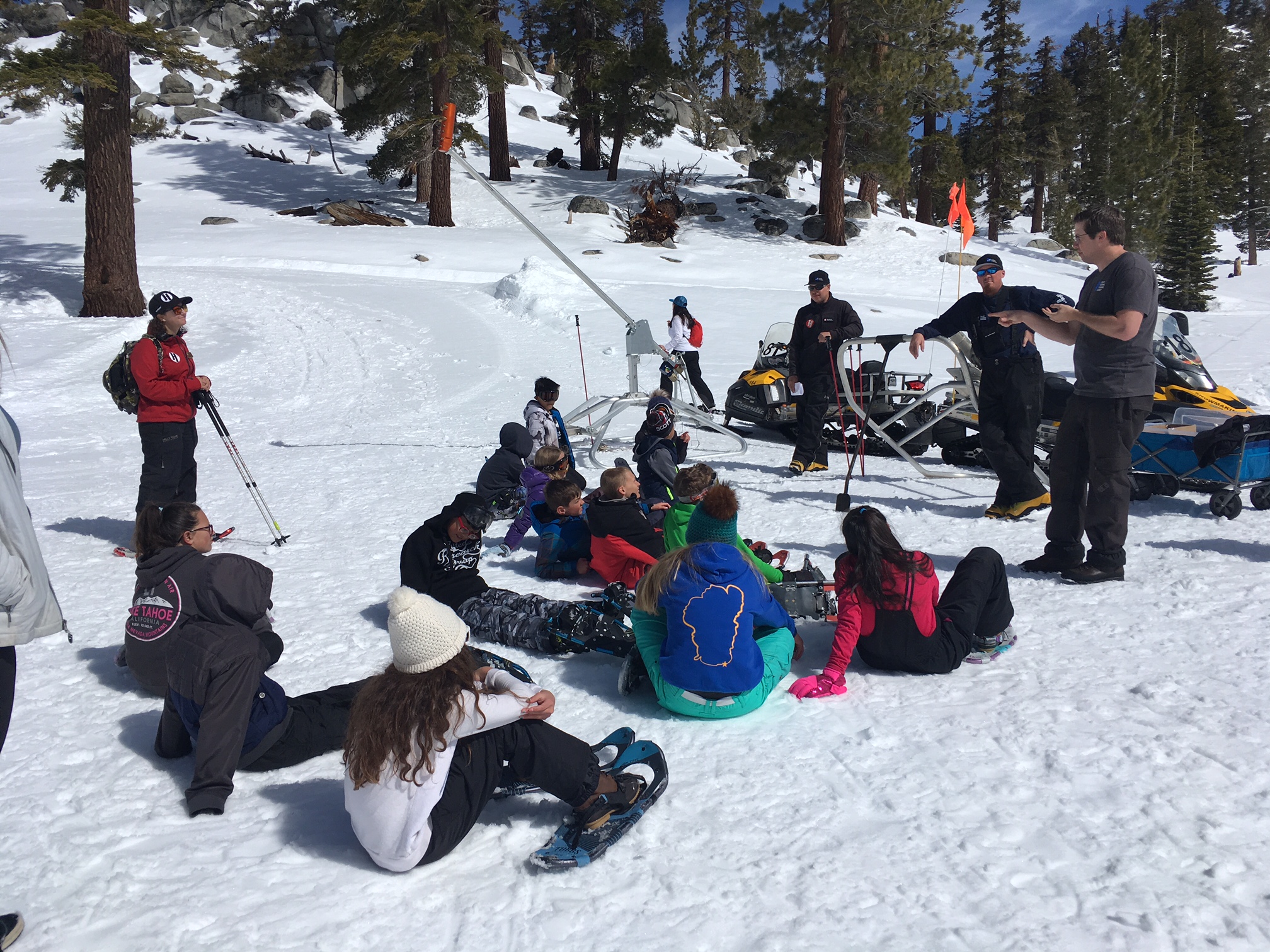
The program brings a different group of fifth-graders from the district to the mountain. During the event, the children snowshoe to education stations at the top of the tram at Heavenly where they learn about Lake Tahoe’s winter wildlife, avalanche awareness, snowpack conditions, environmental protection, and snowmaking technology.

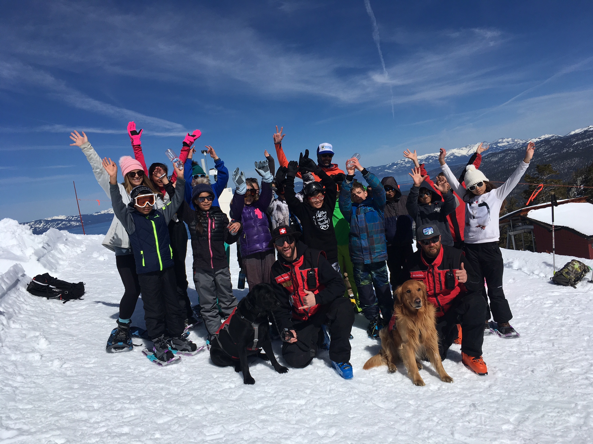
At the avalanche awareness station, Heavenly rescue dogs Peak, a golden retriever, and Vader, a black Lab mix, were introduced to the students. Ski patrollers explained how the dogs are trained to locate people who have been buried in a snow slide.

Heavenly snowmaking gurus explain how they help Mother Nature. Photo/Terra Breeden

“My favorite part of this learning station were the dogs,” 10-year-old Neyeli Jimenez said as she petted Peak who wagged his tail.

Students were divided into three groups and snowshoed to three different learning stations set up by Heavenly staff.

“Snowshoeing is tiring, but fun,” 11-year-old Alaina Corona told LTN.

Each learning station had its own educational goal. At the winter wildlife station volunteers from the Tahoe Institute for Natural Science (TINS) taught students about the animals that live in the basin during the winter season. There are three types of winter wildlife in Lake Tahoe the volunteers explained; animals that hibernate, those that migrate away from the cold, and animals that tolerate the snowy season.

“I enjoy having an outdoor experience with the kids and teaching them about the wildlife that’s in the area where they live,” TINS intern Gary McGaughey told Lake Tahoe News. “It helps the students relate what they’re learning in school to the Tahoe region.”

Students took part in a scavenger hunt where they discovered evidence of winter-tolerant wildlife. At this station, the children learned how to spot animal tracks, identify droppings left by wildlife, and find pine cone seeds discarded by hungry animals.

“We like to show them how animals adapt to survive the winter,” TINS education manager Michelle Witte said.

At the final station, students were taught about the snowmaking science and environmental restoration Heavenly employs on its slopes. Ski runs can be erosion hot spots, flowing with muddy water in the spring. Heavenly rehabilitates the soil by sowing a native seed mixture of wildflowers and grasses to prevent erosion.

“This is what Heavenly does to protect our environment and Lake Tahoe,” Heavenly sustainability manager Frank Papandrea told the students.

Heavenly has 100 miles of pipeline pumping water to its snow-guns in the winter. The children were shown how snowmaking technology works and learned about the weather conditions needed to produce snow.

“Heavenly didn’t get much snow over the winter so we had to make it,” snowmaking supervisor Billy Clark said. “We are snowmakers, scientists and weathermen. Without us, you would have been skiing down dirt this year.”

After visiting the learning stations, students gathered in the snow for a picnic lunch.

All in all, the Winter Adventure Program was a big hit with the Bijou students. The children had the opportunity to enjoy the outdoors on a day that was sunny and clear, snowshoe to the top of a mountain with views of the lake and received a winter education whilst doing it. 

Bijou fifth-graders spend a day at Heavenly learning about the outdoors. Photo/Terra Breeden

“I like being at Heavenly today because I get to be with my friends and be outside,” Alaina said. “I learned how to snowshoe, how to make snow, and about avalanches and animals. It’s fun.”

The Tahoe Institute for Natural Science, Sierra Avalanche Center, and the U.S. Forest Service partnered with TRPA to provide the educational activities during the Winter Adventure Program Funding for the program was secured by TRPA through the Vail Resorts EpicPromise Foundation.

“A lot of kids in Lake Tahoe don’t get to experience snowshoeing or other outdoor activities. We saw that need and decided to do something about it,” Jensen said.

The EpicPromise Foundation is designed to enhance education and sustainability in Vail Resort communities. For the Winter Adventure Program this year, Heavenly comped 400 tram tickets for students and donated $675 to provide bus transportation from the schools to the resort.

“EpicPromise provides funding to a large number of nonprofits on the South Shore,” Papandrea told Lake Tahoe News. “Our goal is to provide support in our resort communities and give back.”


Memorial ski-party at Heavenly for Sakioka

Ronson Sakioka

The Ronson Sakioka Memorial “Face Rat” Party will be April 6 at Heavenly Mountain Resor.

Ronson was one of the original Face Rats. He died last year.

Friends will be begin skiing The Face at 2pm, then everyone will meet at the top at 4pm for a final run with Ronson at 4:20pm.

The party will be from 5-7:30pm at the Cal Bar.

Bring memories and any photos to share.


Smoke expected from large prescribed fire project

The Eldorado National Forest will begin implementing the Power Fire Fuels Maintenance project today.

Approximately 1,350 acres will be burned this week. These units are south of Highway 88 between Bear River Reservoir and the Mokelumne River in the 2004 Power Fire burn scar. 

Each prescribed fire operation follows a prescribed fire burn plan, which considers temperature, humidity, wind, moisture of the vegetation, and conditions for the dispersal of smoke. This information is used to decide when and where to burn. This project is targeting primarily the bear clover in the burn scar which is a light fuel that dries out sooner and burns quickly.
 
Smoke from prescribed fire operations is normal and may continue for several days after an ignition depending on the project size and environmental conditions. S


Controlled burns this week throughout Tahoe

Members of the Tahoe Fire and Fuels Team, which includes local, state and federal agencies, will resume prescribed fire operations this week in multiple locations around the Lake Tahoe Basin. 

Weather and conditions permitting, Tahoe Douglas Fire Protection District, California State Parks, California Tahoe Conservancy and the U.S. Forest Service will conduct prescribed fire operations in Sugar Pine Point and Burton Creek state parks on the West Shore, near Carnelian Bay and Kings Beach on the North Shore, near Logan Shoals on the East Shore and on Kingsbury Grade near Edgewood Creek and urban lots off Ski Run Boulevard on the South Shore. 

Smoke may be present. 

Whenever weather and conditions allow, prescribed fire operations are conducted by the TFFT to reduce overgrown vegetation, which decreases the severity of future wildland fires and protects communities.