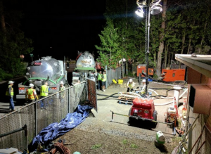
By Joann Eisenbrandt
Another wet season has ended, but concerns about toxic storm water runoff from properties near a popular walking and biking trail just west of Placerville on the county’s West Slope remain. Testing done last winter confirms that the same high pH levels that first prompted concerns about public safety in the area in early 2016 remain.
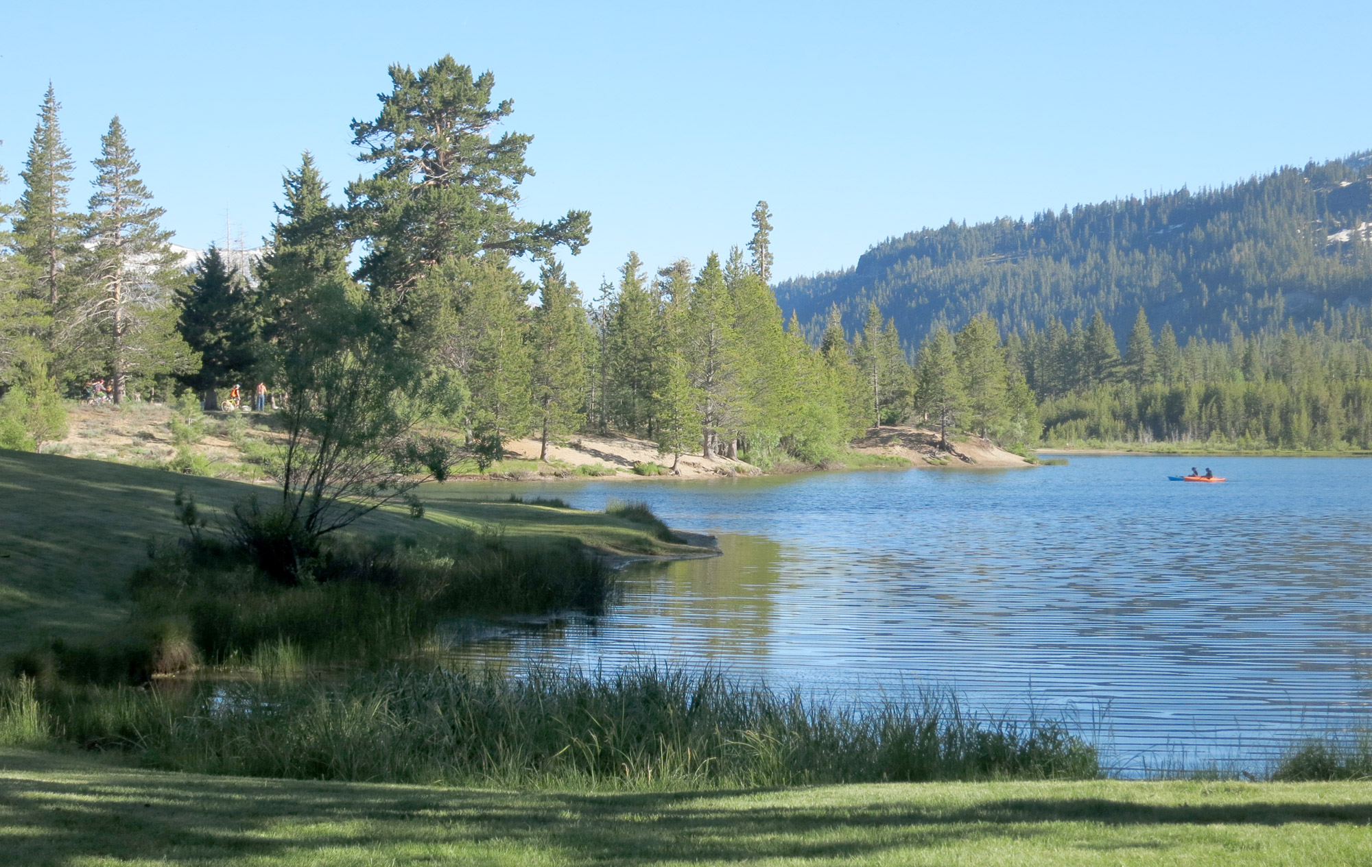
The El Dorado Trail winds through lush vegetation and is crossed by tributaries that lead to Weber Creek and eventually to the American River. The trail is below and to the west of the former Diamond Lime Plant. The plant processed limestone from area quarries for industrial and agricultural uses from the1920s until the late 1970s. It was located between what is now Missouri Flat Road and Highway 49. It has been gone for decades, but its legacy lives on.
The piles of crushed lime rocks, lime kilns and limestone settling ponds that dotted the site were never totally cleaned up when the plant ceased operation. The site was simply covered over and repurposed for other industrial and commercial operations. Parcels now owned by Michael Lindeman, Laurence Abel and the material recovery facility (MRF) owned by Waste Connections are all part of the Diamond Lime Plant’s original footprint.
It is clear the high pH runoff still occurring along the El Dorado Trail is coming from the former lime plant site.
Citizens speak out
Local resident George Turnboo saw milky storm water runoff bubbling up along the El Dorado Trail in January 2016, and concerns over what remained of the long-abandoned Diamond Lime Plant came under a public spotlight. Turnboo tested the runoff, and along with local land use advocacy group Save Our County, publicly called for El Dorado County to deal immediately with the potential hazards to those using the trail, and to the wildlife and aquatic species in the area.
In a report to county then Environmental Management Director Greg Stanton, he noted that his hands had burned while doing the testing and that he’d gotten a pH reading of 13.5.
The pH scale ranges from 0 to 14. It indicates how acidic or alkaline a solution is. A reading of 7 is neutral. More than 7 is alkaline and less than 7 is acidic. Subsequent tests by the California Department of Fish and Wildlife and El Dorado County Environmental Management staff also showed pH readings of 12 and above.

Google Earth/Joann Eisenbrandt
Another rainy season
Following the high pH testing in winter 2015-16, the county put up warning signs along the El Dorado Trail. They also put up temporary mesh fencing to keep people from going down the sides of the trail into the seasonal tributaries. A hundred and twenty feet of permanent fencing was later installed. A series of three press releases were put on the county website advising residents to “… avoid contact with storm water in the vicinity of the El Dorado Trail.” That signage and fencing remain in place today.
Asked how the situation along the El Dorado Trail has changed following the exceptionally wet 2016-17 rain season, Stanton, now interim director of the Environmental Management Department, told Lake Tahoe News, “El Dorado County has taken proactive measures to ensure the (El Dorado) trail is safe. There really is no change to the status. Storm water staff has monitored the discharge points. The results have been as anticipated. We will continue to monitor it in the next wet weather season.”
Monthly samples collected by county staff ranged from pH levels of 8.17 to 13.52.
The Central Valley Regional Water Quality Control Board conducted testing along the trail beginning in October 2016 with similar results.
Walter Floyd, engineering geologist for the Water Board, confirmed, “The hot spots that existed last year are present this year also.” The Water Board manages water quality issues in California for the federal Environmental Protection Agency.
Not a new problem
Local, regional, and state agencies have been aware of the issues on the former lime plant site for years. A number of citizen complaints have been received; citations and orders for remediation have been issued and site investigations and testing undertaken.
Until recently, concerns focused on the property owned by Michael Lindeman. An environmental site assessment (ESA) done as far back as 2008 in preparation for eventual commercial construction on the property found that the surface and groundwater on the property might be “compromised” by lime-based pollutants.
The 2013-14 El Dorado County Grand Jury reviewed Lindeman’s actions in response to multiple orders to clean up the lime waste on his property. It concluded, “Toxic limestone waste continues to flow into adjacent waterways. Nobody is doing anything to stop it. Not the owner, not the county and not the state.”
The Grand Jury recommended that the Diamond Dorado Retail Center that Lindeman and his partners planned on constructing on the site not be allowed to go forward without significant additional environmental review. The county had approved the large commercial center in 2012.
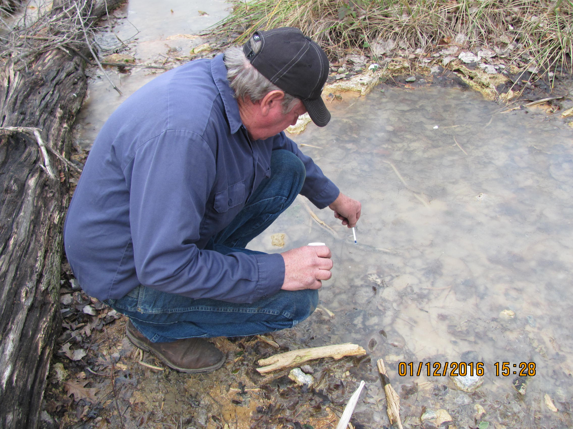
El Dorado County’s Solid Waste Advisory board member George Turnboo in 2016 tests the toxicity of storm water runoff in Placerville; not much has changed since then. Photo/Provided
The Board of Supervisors is updated
On June 8, 2017, the county Community Development Services Environmental Management Department sent a memo to the Board of Supervisors updating the five on the environmental concerns associated with the former Diamond Lime Plant. It pointed to the Lindeman property as the source of the high pH runoff on the El Dorado Trail.
“Elevated pH lime deposits have been confirmed to be present on the south side of the trail on the Lindeman property…. It is hypothesized that the lime deposits on the south side of the trail are coming into contact with groundwater and flowing under the trail.”
The memo noted that the Water Board, “… is the lead agency regarding the investigation of elevated pH soil and impact to surface and groundwater in the affected area.”
Floyd agrees with the county’s assessment of the source of the high pH runoff along the trail. “At this time there is no indication that the water emanating from the Waste Connections site is impacting water near the El Dorado Trail.”
While the Water Board is at the top of the water quality food chain, a number of other public agencies, including a variety of county departments and divisions also are involved. Coordinating these efforts has proved to be difficult.
The investigation widens
The Lindeman property is not the only remnant of the old Diamond Lime Plant now coming under close scrutiny. Community activists have been calling for some time for a deeper investigation of the Waste Connections site and the MRF. The federal Clean Water Act requires businesses like the MRF that discharge pollutants off-site to have a National Pollutant Discharge Elimination System (NPDES) permit and a Storm Water Pollution Prevention Plan (SWPPP) showing how they are controlling pollutants in storm water runoff on their property. The Water Board is in charge of monitoring their compliance.
Critics have alleged that the MRF was basically built on top of the polluted remnants of the Diamond Lime Plant with no real remediation, and that there have been deficiencies with its storm water discharge system and issues with overflow from the three retention ponds that catch storm water runoff. The Lindeman property that directly adjoins it has been the subject of multiple investigations related to its lime processing history; the MRF has not.
In March 2016, the Water Board conducted an inspection at the MRF that found discrepancies with their SWPPP and a notice of violation (NOV) was prepared. Floyd indicated to Lake Tahoe News at that time that the Water Board did not plan to look more closely into the possibility of high pH runoff coming from the MRF and impacting the El Dorado Trail. In June 2016, Floyd visited the Lindeman property and took soil samples of the area where the Lindeman property and the MRF adjoin. The soil in a trench excavated on an exposed hillside adjoining the MRF was found to have elevated soil pH.
Subsequently, Waste Connections hired Youngdahl Consulting to conduct soil testing to determine pH levels on the site. The western portion of the site was found to have elevated pH. The Water Board approved the work plan for additional investigation of soil and groundwater on the property. It included installation of 12 monitoring wells with water samples to be collected for laboratory analysis. They also did a subsurface exploratory program that evaluated the extent of residual lime material on the site and the pH levels of soil and shallow groundwater. Their final report was received by the Water Board in May 2017.
This additional testing confirmed the existence of elevated pH values greater than 12 in the soil and in the water in the trough in the western portion of the site.
As Floyd explained, “The (groundwater) has an elevated pH in the western portion of the Waste Connections site, and appears to locally elevate the pH in the seasonal creek west of the Waste Connections site when groundwater levels get sufficiently high.”
The western seasonal drainage referred to is the seasonal creek to the west of the Waste Connections and Lindeman properties. It flows northwest and is a tributary to Weber Creek. Floyd clarified that “groundwater” and “storm water runoff” are two different things. Storm water runoff is the water flowing above the ground over paved surfaces during storm events. “There are no data,” he explained, “to support that the water flowing over the surface of the Waste Connections Site has an elevated pH.”
The next step will be to evaluate the cost and effectiveness of remedial options at the MRF and then select one. A report must be submitted to the Water Board by Sept. 29, right before the start of the next wet season.

Diamond Springs Parkway project site’s two phases. Source/2011 draft EIR
Timetable for a new MRF
As part of its Solid Waste Services Agreement with the county, Waste Connections is obligated to construct a new, modern MRF on the existing site. County Environmental Management is the contract administrator for the Waste Connections contract. Waste Connections signed a five-year contract in October 2014, with an automatic 10-year renewal dependent on completion of the new MRF by October 2019.
Stanton told LTN, “Clearly, with the environmental concerns that have been identified, that timetable has been pushed back.” Waste Connections can ask for two one-year extensions of this deadline.
Susan VanDelinder, divisional vice president for the Northern California Division of Waste Connections and district manager for El Dorado Disposal told Lake Tahoe News, “We concur with the (Youngdahl) report conclusions.”
She also noted that the water sampling over the last rainy season showed that the Waste Connections site “meets current bench marks. So we don’t believe that storm water runoff from the site created or poses a hazard.” VanDelinder said that the ongoing investigation required by the Water Board will most likely delay construction of the new MRF by a year. “We anticipate requesting an extension.”
Asked if the county had anticipated the level of soil and water testing and remediation now needed on the MRF site, Stanton said, “The Water Board has been aware of the (Diamond Lime) plant and its impact to the surrounding properties for many years. It is not uncommon for properties to not be remediated until development or construction proceeds. It is anticipated that work will be required but we don’t always know ahead of time. That is the typical process for land development.”
Under the terms of the California Environmental Quality Act, Waste Connections will have to prepare an environmental document outlining any potential environmental consequences from the construction of the new MRF and identifying what measures will be taken to mitigate them. This would not be the first environmental document prepared for this site.
County roads project comes into play
A third parcel that was part of the Diamond Lime Plant is also getting a closer look from the Water Board. The Laurence Abel property is within the footprint of both phases of the county’s proposed Diamond Springs Parkway Project (DSP). This Department of Transportation roads project has two phases, Phase 1A and Phase 1B, and has been simmering on the back burner since its approval by the board in 2011.
Phase 1A includes the widening and adding of improvements to Highway 49 above the affected properties and all the way to its juncture with Pleasant Valley Road in Diamond Springs. Phase 1B is the creation of a four-lane connector road between Missouri Flat and Highway 49. This road, Diamond Springs Parkway, would run alongside the Lindeman and Abel properties. It requires irrevocable offers of dedication (IOD) for easements from both property owners. Both IODs have been submitted and signed but no change of title has yet occurred.

A sample location on the south side of El Dorado Trail. Photo/Provided
Investigation leads to delays
In November 2016, the Water Board advised Abel that, “An aerial photograph from 1962 shows lime waste on your property, and your property is uphill of the area where the high pH water is observed in the creek by Throwita Way. It therefore appears that your property may be contributing to the elevated pH in the creek.” Throwita Way runs between the Lindeman and Abel properties and leads to the entrance to the MRF.
This April, the Water Board required preparation of a Site Investigation Work Plan to evaluate the extent of high pH lime waste on the property and propose plans to remediate it. This report is due July 31.
In a letter to the Water Board on behalf of the Laurence & Jacqueline Abel Trust, their representative Rich Ferriera explained, “The Abel’s understood that the described parcel in the order had no conditions that would cause the high PH (sic) that the Water Board suspects. Their determination is based on a geo-technical firm’s verbal discussion with Laurence Abel that took place on the described parcel in the order. Mr. Abel was told that his parcel was not part of the Lime Plant processing area and his parcel soil conditions are of native material and that he had nothing to worry about. The letter from the Water Board has come as a real surprise ….”
Prior to purchasing properties or easements in the DSP project footprint, the county conducted an environmental site assessment (ESA). Its purpose is to identify any existing environmental issues on the properties. The Phase 1 ESA for the first phase of the Diamond Springs Parkway project was prepared by Youngdahl Consulting in January 2009. It noted that the Lindeman property was “formerly part of the Diamond Lime Mineral Plant” and that there is “a potential for hazardous materials releases or disposal areas.” For the Abel parcel, there was no mention of the former lime plant, but only commercial orchards. Property owners were asked to submit answers to a questionnaire and to note if there were any RECs (recognized environmental conditions) on their parcels. The ESA includes a chart outlining property owners’ responses. Abel’s response was that there were no RECs. Lindeman’s response indicated the presence of the Diamond Lime Plant, but also said there were no RECs.
In October 2016, Dustin Harrington, senior civil engineer with the Transportation Division of the county’s Community Development Agency, and DSP project manager, had told LTN that, “No recognized environmental conditions or hazardous materials have been found within the footprint for the DSP’s Phase 1A. It’s all clean dirt.”
Phase 1A of the Diamond Springs Parkway project was originally slated to begin in early spring 2017. It has now been delayed until spring 2018. When asked how the Water Board’s current investigation of the Abel property might impact the timetable of the DSP, Floyd said, “The nature and extent of lime waste on Abel’s property needs to be characterized before any assessment on the impacts to the Diamond Springs Parkway project can be provided.”
County spokeswoman Carla Hass said, “The reason the Phase 1A construction won’t begin until spring 2018 is because the utility design for the underground conversions requires coordination with four different utilities (PG&E, AT&T, Comcast and EID) and took longer than anticipated. Additionally, Caltrans has to review and approve the contract documents before we put them out to bid. Finally, the winter storm damage added to the delay.” Hass added that the county had “adjusted our schedule” before the Water Board’s order to Abel.
Lindeman property still under scrutiny
In addition to the testing Michael Lindeman’s own consultant has done on the property, the county Department of Transportation began soil and groundwater testing as part of the Phase II ESA assessment of parkway Phase 1B—the connector road between Missouri Flat and Highway 49. The Lindeman property is in the footprint of Phase 1B. Lindeman and several partners, including Laurence Abel, were originally going to build the 250,000 square foot Diamond Dorado Retail Center on this property once the connector road from Missouri Flat to Highway 49 was completed. The EIR for the project was approved by the board in September 2012 and rescinded in May 2016 because of what the county termed failure by the developers to move the project forward.
Beginning in late 2016, soil samples were taken and two monitoring wells were drilled on the Lindeman parcel. “Preliminary results of the investigation,” the board was told in the June 2017 staff memo, “indicate lime deposits at various thicknesses throughout the area investigated. Groundwater sampling results from the two monitoring wells had elevated pH levels.”
The final results of this report will be available in late June or early July.
Floyd indicated the Water Board had met with representatives from the county Transportation and Environmental Management departments in late May 2017 to discuss this upcoming report and the status of the property transfer from Lindeman to the county for the easement. “Prior to accepting ownership, the county needs to determine the liabilities associated with the property.”
The parties agreed that evaluating remedial options on how to clean up the property was a better use of resources at this point than doing further site investigations. Hass noted, “Without knowing the exact type and extent of remediation, at this point it is difficult to determine its impacts to project schedule and completion of right of way acquisition.”
The big picture
The area around the former Diamond Lime Plant has changed considerably in the last four decades. It is now surrounded by recreational, single- and multi-family residential, commercial and industrial uses. Area residents have expressed concerns in the past that properties in the area on well water might be contaminated by groundwater emanating from the lime plant site.
Floyd noted that “sensitive receptors” were discussed at the Water Board’s recent meeting with county staff. This refers to areas “downgradient” of the lime plant to the northwest of the MRF, basically following the path of Weber Creek. One of these is the Depot Lake area. The county indicated that there had been no well installation permits issued on the downgradient properties.
“To the best of the county’s knowledge at this time and relying on GotNet, parcel research and the EID service area for the information,” Hass told Lake Tahoe News, “the county is not currently aware of water wells used for drinking water supply in the area immediately downgradient from the former Diamond Lime Plant site.”
Same question, same answer
It is now June 2017, almost a year and a half since George Turnboo encountered milky storm water runoff along the El Dorado Trail and reported it to the county. It has been close to 40 years since the Diamond Lime Plant ceased its lime processing operations. It has been no secret for all of those 40 years that hazardous lime-based materials remained on the site.
The next rainy season is just a few months away. There have been years of soil testing and storm water runoff and groundwater analysis conducted by private contractors and public agencies on the impacted properties. Remedial action plans have been requested, but no actual remediation has begun. As Dustin Harrington told Lake Tahoe News in late 2016, “It’s a puzzling issue out there.”
When all the puzzle pieces will finally be assembled remains uncertain.
—–
Note: The Water Board is attempting to locate any property owners with wells in the Depot Lake area. Contact engineering geologist Walter Floyd at walter.floyd@waterboards.ca.gov.