Stateline bike path opens up another world
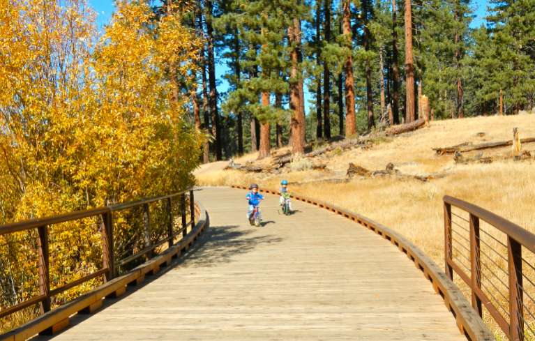
Users of all ages enjoy the trail at Rabe Meadow. Photos/Kathryn Reed

Users of all ages enjoy the trail at Rabe Meadow. Photos/Kathryn Reed

By Kathryn Reed

STATELINE – It’s being called a game changer. And it just might challenge the Camp Richardson trail as the go-to path for pedestrians and cyclists on the South Shore.

The 2.2-mile section of the Stateline-to-Stateline bike path that goes from Rabe Meadow to Round Hill Pines beach officially opened this week.

One day this path will link the actual state line on the South Shore to the state line on the North Shore.

Not one tree had to be removed on the Rabe Meadow section. The route meanders through a large tract of U.S. Forest Service land. For the most part it follows trails that already existed. The difference now is there is pavement.

But there are still trails that are dirt, so it has not ruined what has always been a popular access point to Nevada Beach. It has opened up the area to other types of users and now goes farther.

Curves in the trail make it more interesting than if it were a linear path.

By the end of the month signs are expected to be in. Some are directional signs, others will be interpretive. A larger sign will be at Rabe Meadow showing the trail and the distances to different points of interest.

Without signs, as was the case last weekend, one can get slightly off course. Once at Elks Point Road there is a sign toward Nevada Beach – the correct route. Going right leads to the commercial area. (Don’t stop in at the Wyndham resort, they don’t know anything about the trail – even though it’s been talked about for years, written about a ton and the first phase completed a year ago.)

The point to cross the road is slightly down toward Nevada Beach. Once across the street it’s a clear shot to Round Hill Pines.

For those who are adverse to hills, just keep looking at the scenery. This new section of trail swerves around Round Hill. The climb isn’t so noticeable until it’s time to descend to Round Hill beach.

Along the way are benches that offer views and a chance to rest if need be.

Added late was the trail to that beach. It was going to drop people onto the road. This addition, which is to the right and above where vehicles drive, is a pleasant, safe way to get to the sand.

(Any day the U.S. Forest Service will release who will be running the concession at Round Hill Pines. Local USFS officials are citing the National Defense Authorization Act of 1997 as to why they can’t ever release the names of the people/businesses that bid on the proposal except for the winner.)

A short spur leads to Highway 50 just west of the Bourne Meadow.

This bike path is a collaborative project spearheaded by the Tahoe Transportation District.

A cost savings on the project of $800,000 will allow for Laura Drive behind Lakeside Inn casino to be worked on next summer. Still to be determined is if it will be a separated bikeway or a bike lane.

“Concurrently, we are working with Edgewood on the right-of-way to do final design of the section of (Highway) 50 in front Edgewood and Lake Parkway,” Alfred Knotts, planner with TTD, told Lake Tahoe News. Building it is a few years out.

(One day the Greenway Bike Path in California will be built and connect with what will be the true starting point of the Stateline-to-Stateline trail.)

Construction on the Incline to Sand Harbor section of the Stateline-to-Stateline trail, which is just more than 3 miles, is expected to start in 2015. It’s in the environmental phase. Lakeside and mountainside routes are being studied. It goes mostly through Nevada State Parks and Nevada Department of Transportation rights-of-way.

“There is no fatal flaw with either one. It depends on how the document shakes out and the public comments we get,” Knotts said.

A feasibility study was done that came up with three possible routes for the path from Round Hill to Sand Harbor. No money is in the coffers right now to continue with designing that main link. But planners are looking at options.

Douglas County will be responsible for the maintenance and operation of the trail on the South Shore.

—-

Getting there:

From South Lake Tahoe, go east on Highway 50. Turn left on Kahle Drive in Stateline. Park immediately to the right. Bike trail starts at far end of the lot. At the first Y, stay to the right. At the T, follow the sign toward Nevada Beach. Cross Elks Point Road to continue to Round Hill Pines. Once at Round Hill Pines, cross the road and follow the path toward the beach. At the next intersection, left goes to the beach; right goes to Highway 50 where the trail ends.

ngg_shortcode_0_placeholder (Click on photos to enlarge.)


Questioning economic benefit of harvesting beetle-infested trees

By Science Daily

A recently published study by U.S. Forest Service researchers evaluates potential revenues from harvesting standing timber killed by mountain pine beetle in the Western United States.

The study shows that while positive net revenues could be produced in West Coast and Northern Rockies states with active timber markets, the central Rocky Mountain states of Colorado, Utah, and Wyoming — which have the largest volume of standing dead timber — would not generate positive net revenues by salvaging beetle-killed timber.

A mountain pine beetle epidemic in the Western United States has left mountainsides covered with dead pines, especially lodgepole pine, with most of the timber and land affected on national forests.

Policymakers and forest managers are considering increasing timber salvage rates on these lands as a way to address potential wildfire threat, hazards from falling trees, and visual impact, but first need to assess the broader economic ramifications of putting more timber on the market in areas where mills have closed and markets have waned over the two last decades.

Research Forester Jeff Prestemon and fellow scientists with the Forest Service Southern Research Station Forest Economics and Policy unit and with the Eastern Forest Environmental Threat Assessment Center were asked to evaluate the circumstances under which salvaging pine beetle-killed timber would be cost-effective. The researchers used an economic assessment model to estimate potential salvage volumes, costs and revenues from programs that would encourage salvage of standing dead timber, summarizing findings by state and owner groups.

Read the whole story


Tahoe resorts make upgrades for ski season

By Paul McHugh, Sacramento Bee

One might imagine that it’s all about snow and nothing else. But optimism is just as valuable a resource these days for skiers, snowboarders and resort operators in and around the region.

Last winter, both were in short supply. A few early storm dumps, backed up by snow-making, enabled an adequate holiday season. But New Year’s Day led straight into the dry months that left ski conditions marginal by March, forcing an early season closure on many slopes.

Many Tahoe area ski resorts want to open before Thanksgiving. Photo/LTN file

Many Lake Tahoe area ski resorts want to open before Thanksgiving. Photo/LTN file

However, this fall meteorologists predict a mild El Niño – in other words, an “average” winter, and an improvement from the previous season. That notion is seconded by folklorists who cite signals as varied as early acorn drops, the coats on caterpillars and the gloss on black bear fur. The resorts are back to cultivating optimism and hoping for a robust run.

“Last season was challenging,” said Bob Roberts, CEO and president of the California Ski Industry Association. “I’d estimate we had a fall-off of about 12 percent (from the previous year’s attendance), for a total of less than 7 million visits to our resorts. Yet economic yields were still good, since early season-pass sales now establish a solid base. And new efficiencies in services, as well as expansion into summer operations, increasingly help most resorts to stay profitable.”

In preparing for the coming months, California resorts have generally been burnishing their appeal by expanding programs and making facility improvements, rather than by championing big-infrastructure additions that won headlines in seasons past. However, there are notable exceptions, including Sugar Bowl and feisty up-and-comer Sierra-at-Tahoe.

Read the whole story


Tahoe’s mucky shoreline getting attention

By Kathryn Reed

KINGS BEACH – The problem with being able to come up with solutions for how to make the water along the shoreline of Lake Tahoe as pristine as the deep water is that there has been no monitoring done in the shallow areas. This means researchers have no data to study to come up with a cause and then an action plan.

This was the message delivered to the Tahoe Regional Planning Agency board Oct. 23 in Kings Beach. Alan Heyvaert with the Desert Research Institute in Reno presented the report that was created by more than a dozen scientists from DRI, UNR and UC Davis.

“If we don’t have monitoring programs, we can’t say anything in a quantitative sense,” Heyvaert said.

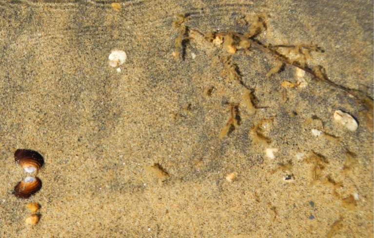
A clam shell, left, and weeds are two aquatic invasive species found Oct. 23 at Regan Beach in South Lake Tahoe. Photo/Kathryn Reed

A clam shell, left, and small stringy plants are found Oct. 23 in the water at Regan Beach in South Lake Tahoe. Photo/Kathryn Reed

And without monitoring, there is no baseline from which to establish where scientists will eventually want to get back to in terms of clarity and other measurables.

This is in contrast to the overall clarity of the lake that for decades was first measured with a white dinner plate and now a Secchi disc to see how far down it can be seen with the naked eye. But that all takes place far from shore.

The document – more than 300 pages – is a framework for how to go forward with addressing what is called the near shore. It’s a scientific document, not a policy manual. The TRPA board was there to listen and not take action.

The price tag for the “Yugo model” of the monitoring system could be $400,000 per year.

But some of what is going on with other monitoring programs could be tweaked to satisfy near shore questions. That is going to be looked into. But scientists warn there is no time to waste.

“We are seeing more invasive aquatic plants. We are losing a lot of native macroinvertebrate species that are only found in Lake Tahoe,” Heyvaert said.

The group first looked at the 62 standards related to the near shore that TRPA, Lahontan Regional Water Quality Control Board and Nevada Department of Environmental Protection use. They whittled those to 38 categories deemed relevant or important. From there the study group came up with 10 metrics associated with four indicators. Those are:

• Turbidity is associated with clarity

• Light transmissivity – clarity

• Chlorophyll – clarity and trophic status

• Phytoplankton – trophic status

• Periphyton – trophic status and community structure

• Macrophytes – trophic status and community structure

• Macroinvertebrates – community structure

• Fish and crayfish – community structure

• Toxins – human health

• Pathogens – human health.

Heyvaert explained it is not a good use of time and money to measure the nutrients at the near shore, that it is better to quantify the amount of algae that is eating the nutrients. This way researchers can determine if algae is increasing or decreasing, where this is taking place and at what times of year. Then the causes can be determined and solutions found.

One of the other difficulties with ridding the shoreline of gunk is that the 72 miles are not all the same. Different problems are occurring different places.

The scientists define near shore as from the water’s edge to a minimum of 350 feet from shore and about 69 feet down. The depth is the mid-summer thermocline, or where the warm and cold waters meet.

While there are no definite reasons to why the water along the shore is mucky in places, likely contributors, according to scientists, are aquatic invasive species, pollutants entering the lake from the watershed or groundwater, stormwater, runoff from the developed and undeveloped portions of the surrounding watershed, greater vulnerability to increased temperature from climate change, recreation, existing structures, and fluctuation in lake levels.


Making a case for why libraries are critical

By Neil Gaiman, Guardian

It’s important for people to tell you what side they are on and why, and whether they might be biased. A declaration of members’ interests, of a sort. So, I am going to be talking to you about reading. I’m going to tell you that libraries are important. I’m going to suggest that reading fiction, that reading for pleasure, is one of the most important things one can do. I’m going to make an impassioned plea for people to understand what libraries and librarians are, and to preserve both of these things.

And I am biased, obviously and enormously: I’m an author, often an author of fiction. I write for children and for adults. For about 30 years I have been earning my living though my words, mostly by making things up and writing them down. It is obviously in my interest for people to read, for them to read fiction, for libraries and librarians to exist and help foster a love of reading and places in which reading can occur.

So I’m biased as a writer. But I am much, much more biased as a reader. And I am even more biased as a British citizen.

And I’m here giving this talk tonight, under the auspices of the Reading Agency: a charity whose mission is to give everyone an equal chance in life by helping people become confident and enthusiastic readers. Which supports literacy programs, and libraries and individuals and nakedly and wantonly encourages the act of reading. Because, they tell us, everything changes when we read.

And it’s that change, and that act of reading that I’m here to talk about tonight. I want to talk about what reading does. What it’s good for.

I was once in New York, and I listened to a talk about the building of private prisons – a huge growth industry in America. The prison industry needs to plan its future growth – how many cells are they going to need? How many prisoners are there going to be, 15 years from now? And they found they could predict it very easily, using a pretty simple algorithm, based on asking what percentage of 10- and 11-year-olds couldn’t read. And certainly couldn’t read for pleasure.

It’s not one to one: you can’t say that a literate society has no criminality. But there are very real correlations.

And I think some of those correlations, the simplest, come from something very simple. Literate people read fiction.

Read the whole story


Study: High-quality preschool worth the investment

By Randye Hoder, New York Times

A decade or so ago, when it was time to send my children to preschool, it never occurred to me to do anything else. For an upper-middle-class family like mine, enrolling my kids in a half-day nursery school program with all of its benefits (socialization and school readiness, among them) was a no-brainer.

Now, amid a highly contentious national debate about whether preschool should be made available to all children, a new study provides a mountain of evidence that my parental instincts were right on the money. Literally. High-quality preschool programs are “the most cost-effective educational interventions and are likely to be profitable investments for society as a whole,” concludes the study, financed by the Foundation for Child Development and produced in collaboration with the Society for Research in Child Development.

The report, written by an interdisciplinary group of 10 early-childhood experts, is actually a “research brief” — an overview of “the most recent rigorous research” on a hot-button issue. Among its key findings:

•Large-scale, high-quality public preschool programs can have substantial impacts on children’s early learning.

•Quality preschool education can benefit middle-class children as well as disadvantaged children, though children from low-income families benefit more.

•Quality preschool education is a profitable investment, with $3 to $7 saved for every $1 spent.

The analysis will undoubtedly be greeted as good news by the Obama administration, given the president’s call to make federally funded, high-quality preschool “available to every single child in America.” Not that the critics can’t find fault. The research brief points to evaluations of early-childhood education programs in Tulsa, Okla., and Boston, which found large gains in math and reading among participants. But scholars at the Brookings Institution and elsewhere have attacked the Tulsa and Boston studies for their supposedly unreliable methodology.

Read the whole story


South Shore struggling to be more than it is

By Kathryn Reed

Connecting the dots of the South Shore is getting closer, but what the end picture will look like remains to be seen.

Tuesday night was the third economic forum in the last year focusing on gathering people to discuss visions for the area and starting the dialog to be able implement ideas. (The other meetings were Oct. 23, 2012, and March 5.)

On Oct. 22, 12 speakers gave brief overviews of what their entities are doing.

They were:

The South Shore is trying to figure out what will be the solution for a sustainable economic future. Photo/Kathryn Reed

South Shore is trying to figure out what will be the solution for a sustainable economic future. Photo/Kathryn Reed

• Jason Drew – Lake Tahoe South Shore Chamber of Commerce – talking about the chamber’s vision for 2020 and being active politically.

• Tom Greene – Tahoe Prosperity Center – the need for a substantial digital delivery system.

• Kim Kerr – El Dorado County – Meyers plan and recreation on the South Shore.

• Mimi Moss – Douglas County – South Shore area plan, recreation.

• Lew Feldman – attorney – next phase of Chateau project should be done in July.

• James Grant – Vail Resorts – zipline at Heavenly should open in December, rope courses next summer.

• Nancy Kerry – South Lake Tahoe – recreation plan under way, Harrison Avenue next summer, tourist core plan to TRPA in November.

• Carl Hasty – Tahoe Transportation District – loop road progressing, Stateline bike trail ready to ride, bus shelters going in, ferry service to begin environmental study phase.

• Kindred Murillo – Lake Tahoe Community College – planning for next 40 years, becoming an education and cultural center, four-year education, desire for new facilities.

• Mike Cook – Caltrans – projects on South Shore continue though 2019.

• Ivone Larson – South Tahoe High School – unparalleled opportunities through new programs in state-of-the-art facilities.

• Cindy Martinez – Bijou Community School – two-way immersion program.

A common thread weaving through their presentations is one builds upon the other. It’s about education, having a knowledgeable workforce, providing recreation activities for locals and tourists, and having the transportation-infrastructure to move people from place to place.

The more than 100 people at Lake Tahoe Resort Hotel were asked to use one word to describe what they heard from the speakers. They said – vision, recreation, implementation, progress, community, positivity and education.

Then it came time for four predetermined ideas to be discussed. And while recreation was a common theme at the start of the meeting, it had nothing to do with the four ideas.

The ideas were an outdoor music venue, business incubator-accelerator-innovation center, interpretive discovery center, and arts identity.

The four speakers each gave three examples of other locations that have brought the same ideas to fruition and then they talked a bit about what it took for those venues to prosper.

When it came time to find out what the audience thought should be done going forward there was not overwhelming consensus. However, more hands went up for believing a music venue would have the greatest impact on the area, while creating an arts identity would be easiest to do.


Bears looking for food; 2 die in Tahoe

A bear in South Lake Tahoe on Oct. 22 munches away on apples. Photo/Kathryn Reed

A bear in South Lake Tahoe on Oct. 22 munches away on apples. Photo/Kathryn Reed

Two bears have died recently in Lake Tahoe, others have been caught and released, and many are roaming neighborhoods.

A female cub was hit and killed by a car near Zephyr Cove and a 2-year-old female was found in a stream. Nevada Department of Wildlife officials said residents in the area of the stream had reported a “lethargic, sickly looking bear” before it was found.

NDOW caught two bears in traps in Reno. One was in the area around West Plumb Lane and Ferris Lane, and the other in the Juniper Ridge area of Reno. Both were released back into the wild.

“These bears are hungry and west Reno offers a lot of temptation,” NDOW black bear biologist Carl Lackey said in a press release. “Besides the always-present human garbage, there are still fruit trees which attract these very hungry bears.”

One of the females was last caught in 2007 by NDOW. That year was another poor year for wildland nuts and berries, similar to the conditions in the Sierra Nevada this year.

NDOW still has two traps set in west Reno.

Early Tuesday morning, a 350-pound male black bear was caught in west Carson City. That bear, according to Lackey, had never been handled before and was expected to be released Oct. 23.

Lackey estimates his department has run into 10 bears in 10 days.

In addition to the ongoing issue with people leaving trash out for bears, they are also attracted to fruit on the ground and in trees. Fruit on the ground is a bear magnet.

Officials expect bear activity to continue for another month before they begin hibernating. That usually happens between Thanksgiving and Christmas as food sources become harder to find.

— Lake Tahoe News staff report


Calif. falls behind on mapping quake fault lines

By Rong-Gong Lin II, Rosanna Xia and Doug Smith, Los Angeles Times

After the 1971 Sylmar earthquake, California began to map faults across the state.

Over the next two decades, officials published 534 maps of active earthquake faults. New construction was prohibited on top of these fissures because previous quakes showed that buildings could be torn apart during violent shaking.

But the mapping campaign has slowed to a crawl – with many dangerous faults still undocumented.

Since 1991, only 23 have been drawn. Because of budget cuts, none were completed between 2004 and 2011.

State officials said there are still about 300 maps to draw and even more to revise – including some in heavily populated areas of Southern California. That represents about 2,000 miles of faults statewide.

The slow pace affects public safety. The ban on building atop faults is enforced only for those mapped by the state; the regulations don’t cover faults not on California’s official map.

Officials are also concerned about several other zones they believe need further seismic research, including San Diego Harbor, Yorba Linda, the San Gabriel and Pomona valleys, Indio, Napa County and South Lake Tahoe.

Read the whole story


Meyers mural captures Celio family’s heritage

Celio mural at Meek's in Meyers. Photo/Kathryn Reed

Celio mural at Meek’s in Meyers. Photo/Kathryn Reed

By Kathryn Reed

Capturing the South Shore’s history via murals has been an ongoing endeavor since the 1990s. The last creation was recently installed on the Meek’s building in Meyers.

Called the Celio Family Cattle Drive, it brings to life the annual cattle drive between Lake Valley and the West Slope. In the center is one of the Celio men on horseback. His wife is to the left driving the wagon with their three children. To keep it authentic, chickens and most of their belongings are also in the wagon.

Above the vintage scene are portraits of Charles Guiseppi Celio Jr., Henrietta Celio, George Celio, Carlo Guiseppi Celio, Benjamin Caesar Celio and Frank E. Celio.

The Celio family used to own what is now Meyers, along with thousands of acres in the area. Today 103 acres in the Lake Tahoe Basin are controlled by the Celios.

“This is my final tribute to the pioneering Celio family,” Shirley Taylor told Lake Tahoe News. Taylor used to live at the family ranch. Now her cousin and his wife call the South Upper Truckee area home.

A plaque explaining the significance of the mural and what is going on in the picture will be installed later.

The Celio mural is the last of nine that were part of the Heritage Murals of Lake Tahoe project. This was a joint endeavor by the Lake Tahoe Historical Society and the now defunct South Lake Tahoe Chamber of Commerce.

John Cerney of Salinas created the mural. Besides being an accomplished muralist, Cerney was chosen because his work can be relocated if need be. The mural is not painted directed on to the building.

The other murals include: the one at the South Lake Tahoe museum, Nepheles courtyard off Ski Run Boulevard, El Dorado Beach at Lakeview Commons, Tahoe Daily Tribune building, Tallac professional building, South Tahoe Refuse transfer station, and U. S. Forest Service Taylor Creek Stream Profile Chamber. The one at Chateau Suites no longer exists.

The goal was to capture a bit of the various aspects of the area. With the Celio mural complete, Tahoe’s pioneers are now represented.