Genetic research lays foundation for conservation

By Cally Carswell, High Country News

Back when he was in his 30s, Tom Whitham would have been leery of the meddlesome approach to conservation that he is laying the foundation for today. Whitham came out West in 1973 to pursue a doctorate in biology at the University of Utah. He had just finished a tour as an Army photographer at a hospital in Hawaii filled with soldiers injured in Vietnam, a difficult experience that had one positive result: He encountered buzzing, singing and tangled rainforests, and became enchanted with wild places, which were rare in his native Iowa. He decided to move to the American West because, he says, “we hadn’t plowed it under yet.”

He imagined it as an untamed frontier. Though not naive about the human tendency to damage the environment, he thought the West was still too big and sparsely populated to be threatened in any existential sense. One good way to protect or heal the environment, he believed, was to leave it alone. Given time and space, nature could often fix itself.

Today, Whitham is a meticulous and accomplished ecologist based at Northern Arizona University in Flagstaff. He wears round glasses, a gray goatee and, when outdoors, an oiled leather cowboy hat. His love of nature hasn’t wavered. At last count, his home garden boasted 120 species of native conifers, poplars, shrubs and grasses. In the field, he always carries a camera, and even at sites he’s studied for decades, he still finds things worth photographing. But he thinks the frontier is dead. He is no longer optimistic about nature healing itself. The challenges — a climate in disorder, a looming sixth extinction, and people, always more people, always seduced by short-term gain — have grown too big, too fast.

Whitham believes the answers lie in an unexpected place: The DNA of species so common we usually take them for granted. As Whitham and his colleagues have researched the Southwest’s cottonwoods and piñon pines, they’ve introduced groundbreaking new ideas about how these trees’ genetic traits influence the community of surrounding organisms, and even shape entire ecosystems. If their discoveries hold true in kelp beds, coral reefs, tropical forests and desert shrublands — and so far, they have — they may transform our understanding of how everything in the web of life is connected.

Read the whole story


Beach-goers sip their way around booze ban

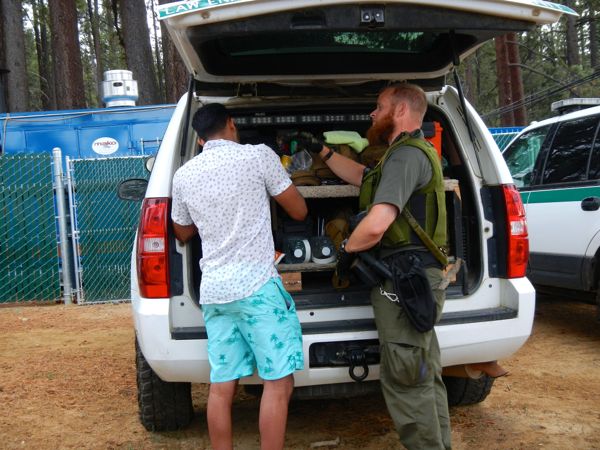
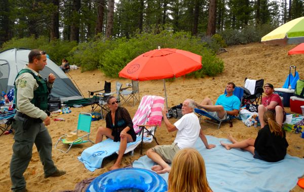
Frank Machler, USFS law enforcement officer. tells a group the beer is not allowed at the beach. Photos/Kathryn Reed

Frank Machler, USFS law enforcement officer. tells a group their beer is not allowed at the beach. Photos/Kathryn Reed

By Kathryn Reed

ZEPHYR COVE – It was hard to know an alcohol ban was in place at Zephyr Cove beach on July 4.

“Why can’t I drink today and yesterday I could?” Neil Fenton asked. The Irishman, one of about a group of 25 on the South Shore beach, practically begged U.S. Forest Service employees to be able to keep his beer.

No such luck.

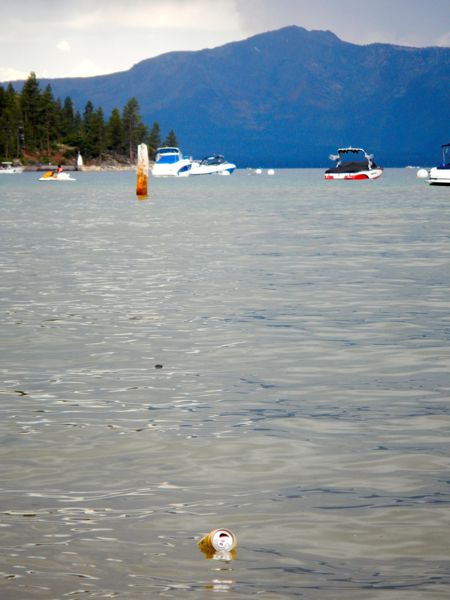
A beer can floats in Lake Tahoe.

A beer can on the Fourth of July floats in Lake Tahoe.

The Forest Service, which owns this beach along with many others in the basin, for several years has been saying no to alcohol on July 4 to help prevent things from getting out of hand.

With about 10,000 people just at this beach – as well as the neighboring Dreyfus Estate, the Forest Service is on a quest to maintain control. One way is curbing alcohol consumption.

People were lining up at 6:30am Saturday to get onto Zephyr Cove beach. With the thunderstorm rolling through midmorning, it scattered some people and kept the temperatures cooler than usual. This may have played a role in keeping the alcohol-induced troubles to a minimum.

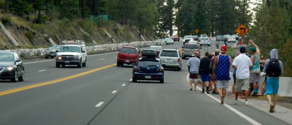
Vehicles and pedestrians fill the lanes of Highway 50.

Vehicles and pedestrians fill the lanes of Highway 50.

While signs were posted – and were up the day before the Fourth – and the media had gotten the word out about the booze ban, some people said they weren’t aware of the rules and others deliberately tried to get around them.

Jonathan Cook-Fisher, a forest protection officer with the USFS, had warned a multigenerational group at 11:30am about the alcohol ban. Frank Machler, a law enforcement officer with the USFS, saw the same people more than three hours later with beer cans next to them that anyone could see. He waited to see the cooler being hauled away. The older man in the group – at least in his 60s – glared at Cook-Fisher and his partner for the day, Gerard Dean, when he saw them later.

USFS law enforcement officers patrol the beer garden at Zephyr Cove.

USFS law enforcement officers patrol the beer garden at Zephyr Cove.

Cook-Fisher and Dean run into the Irishmen who’ve stopped in the forest to drink some more. Cans are scattered about. They are told to move on, but to first take their trash. They mumble and mosey on.

Beer cans on the beach prove the ban is being ignored. Some are empties on the beach, some float in the water. An abundance of trash litters the sand. No obvious trash cans are in sight.

Others try not to be so blatant with their alcohol consumption. On the party side a guy is drinking a cola colored beverage from a bottle that says it is water. An officer confiscates it, pours it out. It wasn’t just soda.

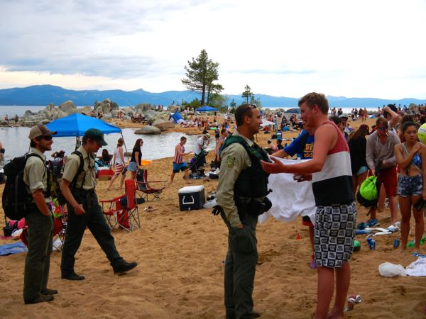
Frank Machler, center, talks with Neil Fenton, right, about getting rid of his booze, as USFS employees Gerard Dean and Jonathan Cook-Fisher standby.

Frank Machler, center, talks with Neil Fenton, right, about getting rid of his booze, as USFS employees Gerard Dean and Jonathan Cook-Fisher standby.

Instead of traditional water bottles, people are getting more deceptive with their contraband. Shampoo and sunscreen bottles are being used to transport alcohol. The problem is the container isn’t always washed out well so the imbiber ends up vomiting.

Machler said he likes to get people to pour the alcohol out or take it back to the vehicle. Citations are not immediate. If things get out of hand, the resort can tell people to leave or sheriff’s deputies can take people to jail.

Machler also has no tolerance for marijuana use. It’s illegal on federal property no matter what the state laws say – even medical marijuana. A guy admits to using, but said it was hours before and not on federal land.

A man receives a citation for disorderly conduct and interfering with a law enforcement officer.

A man receives a citation for disorderly conduct and interfering with a law enforcement officer.

Cook-Fisher said that’s one of the things those patrolling the beaches have to do – make quick decisions in the moment. They weigh the seriousness of the infraction against possibly taking resources from where they might better be served. Is education more beneficial than a citation? Ruining someone’s fun at Tahoe is not their goal; instead it’s about making them and the others at the beach safe.

Another way to help maintain calm has been to increase the number of people who are working the Fourth holiday. On a normal summer weekend the Forest Service has 10 to 15 people in the field. (This doesn’t count fire personnel.) This weekend more than 40 additional USFS employees are in the basin working.

Cook-Fisher said the biggest change in the last five years is the collaboration between agencies.

“There’s a common understanding that resources are limited and we need to share,” Cook-Fisher told Lake Tahoe News.

At Zephyr Cove, in addition to Forest Service employees, Douglas County sheriff’s deputies were out, the resort hired Marines to work security, and Tahoe Douglas fire regulates how many people can be in the beer garden. Tahoe Douglas paramedics administer the serious medical aid. Before they can arrive the USFS Klamath firefighters who are in the region for added fire suppression relief render basic aid. One woman was about to get an ambulance ride in her bikini. She cut her elbow and thigh climbing a fence. Stitches were in her future.

Piles of garbage could be seen at Zephyr Cove beach on July 4.

Piles of garbage at Zephyr Cove beach on July 4.

Cook-Fisher ends up giving medical attention to a group of women, one of whom is clearly intoxicated. Her fingernail is nearly torn off and she is whimpering in pain.

“Our purpose today is not about writing citations. It’ public safety and protecting natural resources,” Cook-Fisher said.

At this South Shore beach a temporary fence is erected on the Fourth with the goal of keeping families on one side, the more raucous revelers on the other.

The only alcohol allowed is in the beer garden that Zephyr Cove Resort runs. It’s hopping in there, with music playing and people dancing. Several law enforcement officers monitor who comes and goes.

About 4pm the beer garden closes. The beach closes about an hour later for a short time. Many people were headed for a place where they could watch the fireworks, like Nevada Beach.

For authorities, it was just another day at the beach — Lake Tahoe style.


Product aims to prevent drowning

By Bob Shallit, Sacramento Bee

A Gridley company is off to a great start in its plans to raise capital for an emergency flotation device targeted at surfers, boaters and other water sports participants.

Kingii Corp. initially planned to raise $65,000 to start production. But money raised from investors, retailers and consumers via a crowdfunding campaign launched Monday on Indiegogo has pushed funding over $427,000 as of Friday afternoon.

The company’s lightweight product – called Kingii and named after an Australian lizard that raises a frill over its neck when alarmed – is worn around the wrist and quickly expands when a user triggers an attached carbon dioxide cartridge. It’s aimed at people who regard life vests as too bulky.

“If you’re swimming and you get tired or get a cramp when you’re out too far, it’s nice to have something to get you through” to safety, said Crystal Bullard, the company’s sales and marketing director.

Read the whole story


Reflections on the atomic blast test in Nevada

By Joni Tevis, High Country News

Nevada Test Site, 1953
Put yourself in his shoes: cold, Army-issue, treads packed with sand. Rise before dawn, climb into the truck and bump down the road to Doom Town. As the convoy tops the last ridge, narrow your eyes at the rising sun’s brilliant seam. Showtime. Up the ladder you go, sun already warm on your neck, roof shingles softening underfoot, nail heads gleaming silver.

The day wears on in pounding and shouts as you move down the line, lapping layers tight enough to turn any water, although this roof will never see rain. Down below, masons raise the chimney a row at a time, scraping excess mortar free. The painters spray the siding, not bothering to tape the windows; time is of the essence. Saltbrush shivers on the ridge and smashed jackrabbits stain the road as you ride back to Mercury Camp, work done, clothes heavy with sweat and tar, paint and dirt, tacky with sap from lumber that was a tree six months ago.

Operation Doorstetp-Shot Annie, 1953
Full dark over a silent house. See how easy it is to make a family, twins sprawled on the floor, Baby in his high chair, Mother bending near, a spoonful of pears in her shapely hand. J.C. Penney provided the mannequins and wardrobe: rompers for the twins, footed sleeper for Baby, and Mother’s sensible skirt, button-front blouse, clip earrings. (Daddy’s at work, offstage.)

The bomb will detonate in a minute’s time.

Read the whole story


Wildflowers in full bloom in Sierra

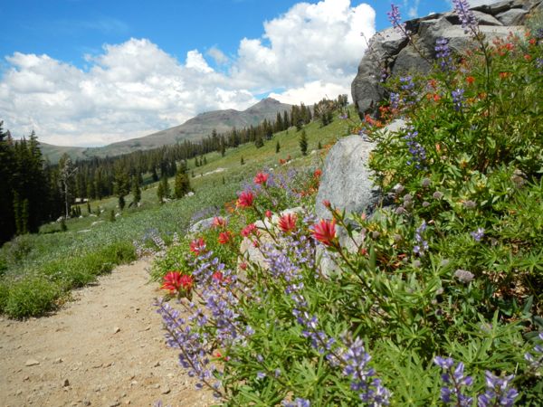
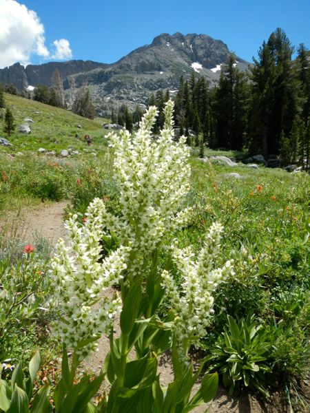
Wildflowers are peaking in the High Sierra. Photos/Kathryn Reed

Wildflowers are peaking in the High Sierra. Photos/Kathryn Reed

By Kathryn Reed

CARSON PASS – Wildflowers as far as the eye could see. Some are more than 5-feet-tall, others look like ground cover. The kaleidoscope of color is mesmerizing.

Even in the parking lot at the Woods Lake trailhead the water is rushing and the flowers are blooming. While the lot was full, as was the Carson Pass area, the number of people on the trail was not overwhelming. Getting a late start meant we passed more people on their way out.

Wildflower hike, Winnemucca and Round Top lakes with Sue and AJ

Wildflower hike, Winnemucca and Round Top lakes with Sue and AJ

We started the loop by going toward Winnemucca Lake. This is the route where the bulk of the flowers are.

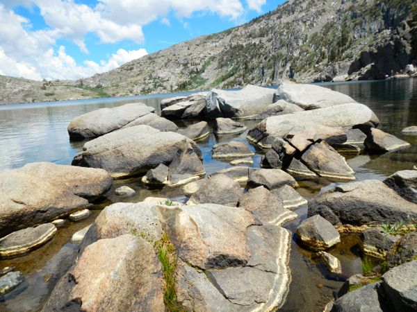
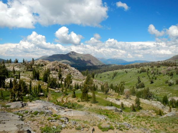
The open terrain was glorious. It was as though the hillside had been painted green and then dollops were splattered about to provide a rainbow of color. Granite boulders provided a steel grey contrast.

It didn’t take long before columbine, then Wildflower hike, Winnemucca and Round Top lakes with Sue and AJIndian paint brush and a variety of daisies, joined lupine. Soon it was a cornucopia of wildflowers. It was like a painter’s palette.

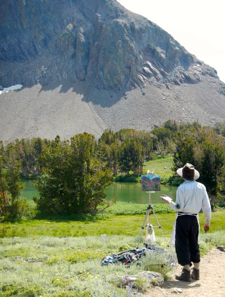
This was appropriate considering David Yapp of San Francisco was with his palette and easel at Round Top Lake capturing the Sierra’s summer beauty.

It was one of those magical days where clouds danced in the sky, providing shade when needed, but enough sun to necessitate a good dose of sunscreen. At Winnemucca it was as though the sky had been splashed with grey paint.

Here people were fishing, sitting on the shore having lunch and swimming. We hopped out to the boulders to have a bite to eat.Wildflower hike, Winnemucca and Round Top lakes with Sue and AJ

Round Top peak in the background.

Round Top peak in the background.

The smell of rain was still in the air Friday afternoon as we took our time on this six-mile round trip trek in the Carson Pass area. The amount of water and dampness brought out the skeeters as well as other biting bugs – at least along the first part of the trail.

Round Top peak towers above Winnemucca Lake at 10,381 feet. Our top elevation of the day was 9,400 feet, having gained about 1,200 feet.

The steepest section seemed to be the one mile trek between Winnemucca Lake and Round Top Lake. The decent from Round Top seemed steeper than the ascent on the other side. Few wildflowers were on this side. The conifers, especially at the base, were denser.Wildflower hike, Winnemucca and Round Top lakes with Sue and AJ From the trail down we could see Woods Lake, but never came close enough for AJ to take a swim. There is plenty of water on this hike, though, for the dog to stay hydrated and cooled off.

Pollen on the rocks at Winnemucca Lake.

Pollen on the rocks at Winnemucca Lake.

Wildflowers weren’t the only reason people were out on July 3. The dichotomy of interests of the trail users was interesting. Several had fishing poles, with a few saying they caught some brook trout. Two others had their skis on their backs. They had taken a few turns on Round Top. This was hard to believe based on how little snow is still there.

David Yapp paints Round Top Lake.

David Yapp paints Round Top Lake.

Originally our destination was Fourth of July Lake, which is another 1½ miles past Round Top Lake. My cold had me at times wondering if I was going to be spending the night in the wilderness, so we stuck to the loop. Not one step were we disappointed. It is near peak wildflower season in the High Sierra.

—–

Wildflower hike, Winnemucca and Round Top lakes with Sue and AJ (Red Lake Peak)

Red Lake Peak

        Getting there:

From South Lake Tahoe, go west on Highway 50. Turn left onto Highway 89 in Meyers.

At Picketts Junction, go right on Highway 88.

Go beyond the Carson Pass parking area. Woods Lake turn off is on the left. Trailhead parking is clearly marked on the right. It costs $5 to park.


DC commissioners say no to Liberty solar plant

People were on the floor and in the hall for the July 2 Douglas County Commission meeting. Photos/Anne Knowles

People were on the floor and in the hall for the July 2 Douglas County Commission meeting. Photos/Anne Knowles

By Anne Knowles

MINDEN — The Douglas County Commission has denied another application for a solar facility in Carson Valley.

Citing too many unknowns about the project, and a few surprises, the commissioners on July 2 unanimously rejected the application by Greenstone Renewables to build a 260-acre, 20 megawatt solar plant on Muller Lane.

“We’re finding out things today I wasn’t aware of and I don’t like that,” commission Chairman Doug Johnson said. “It’s OK, that’s the nature of the beast.”

After more than four hours of presentations, public comment and discussion, the commissioners agreed the project did not meet the county’s mandate to maintain a scenic and rural valley.

“I can’t get past the location,” said Commissioner Nancy McDermid. “The Planning Commission is the gatekeeper of the master plan and I believe the ones that voted for this project relied on private property rights and ignored the master plan.”

A special use permit required for the project was approved by the Douglas County Planning Commission by a 4-3 vote at its May 12 meeting.

Commissioners had volumes of paperwork to read before making their decision.

Commissioners had volumes of paperwork to read before making their decision.

That decision was appealed by Steve and Mary Walker, whose home is the only residence to abut the project property.

Their appeal contested six of the 16 conditions the planning commission imposed on the permit and four of its eight findings.

Those disputes centered on mitigation of glare from panels, noise in high winds, dust control, irrigation loss and wildlife impact, particularly to the bird population.

“We ask that you deny the application. It was an erroneous decision in conflict with the county master plan and recommendations of the Valley Vision plan,” said Steve Walker during his presentation to the board.

Walker also said an additional 40 acres would be required for a potential battery storage unit, bringing the total project acreage to 300 acres, which was news to the commissioners.

“I have a question I did not have before,” said Commissioner Steve Thaler after presentations from the Walkers and from Keith Rutledge with Greenstone Renewables. “This battery storage facility. I was not aware of this additional 40 acres. That’s taken me by surprise.”

Rutledge said Greenstone did not include the battery storage unit in its application because it was uncertain if it would be needed, and that the developer would return to acquire permission for that in the future.

But Walker pointed to the minutes of the Planning Commission meeting, in which staff said the battery storage facility would be considered an accessory use and would need no further permits.

Daniel Leck, a local appraiser engaged by the Walkers, said the solar plant would not only impact the Walkers’ property value but have a ripple effect in the community. He estimated property values in Douglas County, which stand at $6 billion, could drop between 5 and 10 percent, or by $300 million to $600 million.

The Walkers helped to generate a lot of public interest in the Greenstone project, collecting 700 signatures on a petition opposing the project.

The commissioners said they had received hundreds of emails and phone calls from county residents.

At least 200 people attended the county commissioners meeting, jamming the room and outside halls. Twenty-eight people rose to offer public comment, the majority of who opposed the project.

One complaint for many was the fact the power generated by the solar plant would be going to California customers serviced by Liberty Utilities, which had entered into an initial contract with Greenstone for the power generated.

Travis Johnson, Liberty Utilities’ director of Utility Planning and Business Development, spoke during public comment, to say those customers are all around Lake Tahoe. However, Liberty has no Nevada customers.

“Liberty Utilities is disappointed by the decision of Douglas County Commission. We believe that Greenstone’s proposed solar project would be an environmentally responsible means of bringing renewable resources to the region, as well as providing reliability improvements to the Carson Valley. Liberty remains committed to the pursuit of cost-effective renewable development for its 49,000 electric customers in the Lake Tahoe region,” Liberty Utilities’ VP of Operations Rich Salgo told Lake Tahoe News.

The owner of the Muller Lane property, which was set to be leased by Greenstone, also spoke.

“We feel strongly that we all have property rights,” said Jon Park. “We love to ranch. We love to irrigate our property. At the end of the day if this was a perfect world, we’d just ranch.”

Barbara Byington, whose ranch is adjacent to the Park property, also spoke in support of the plan.

“I border it, but I’m in favor of it,” said Byington. “I’ve kept my ranch green for all you people who want it green. But how can I keep it green in this drought? I think we ranchers need something. Maybe it’s not a solar farm, but every time we come to you, you say no, you can’t have that.”

In the end, the board, acting as the board of adjustments, voted unanimously to approve the Walker’s appeal and deny the solar project.

In July 2014, the county commission approved an ordinance adding solar to the county’s agricultural zoning.

In March, the commissioners denied a request by E.On Climate and Renewables for a 320-acre solar plant on Bently Ranch because it was too close to nearby residences. In June, they passed a 180-day moratorium on solar projects, but excluded the Greenstone plan because the application was already in process.

Greenstone could file a petition for judicial review. It would need to be filed within 25 days.



Californians starting to reduce water use

By Fenit Nirappil, AP

California’s drought-stricken cities set a record for water conservation, reducing usage 29 percent in May, according to data released by a state agency Wednesday.

Regulators hope the savings will last through summer as California communities are under order to cut water use by 25 percent compared to 2013 levels. Gov. Jerry Brown announced his mandatory conservation order in April.

Felicia Marcus, chairwoman of the State Water Resources Control Board enforcing Brown’s order, said the results show it’s possible to meet steep conservation targets.

“It’s gratifying that far more communities are stepping up, and we want to see this much more through the summer,” Marcus said. “It ends up putting off the need for much harsher rationing, which has greater impacts on people and the economy.”

California is in a four-year drought that has devastated some rural communities, prompted some farmers to leave fields unplanted or tap expensive water supplies and dented fish populations. Many cities have avoided the brunt of the dry spell because of backup supplies and preparation, but the governor wanted conservation efforts ramped up with no clear end to the drought in sight.

May’s water savings were the best showing since the state started tracking conservation last summer. The report followed several months of tepid conservation, 13.5 percent in April and 4 percent in March.

Conservation may have been skewed by rain in parts of the state in May, which reduces the need to water lawns.

The data is self-reported by more than 400 California water departments and includes residential and business consumption. All regions of the state showed improvement.

Sacramento and its surrounding communities were the state’s top performer, cutting water use by nearly 40 percent.

The southern coast, where more than half of the state’s population lives in cities including Los Angeles and San Diego, conserved 25 percent in May after months of lackluster savings. Temperatures in the region were about 5 degrees cooler compared to May 2013 with an additional half inch of rain, according to National Oceanic and Atmospheric Administration data.

Regulators have been encouraging Californians to let their lawns go dry this summer as the easiest way to save large amounts of water and maintain local supplies if the drought continues.

The water board has assigned each community a mandatory conservation target between 4 and 36 percent, depending on how much water residents used last summer, that will be tracked between June and February. Cities that don’t meet these targets face fines or state-imposed restrictions on water use.

Some have complained these targets are unfair because it doesn’t take into account water savings made before the drought or how secure local supplies are. The city of Riverside is suing the water board over conservation, saying it has ample groundwater supplies.


‘On Golden Pond’ captures family strife, love

Pam Taylor and Dave Anderson star in "On Golden Pond" at the Boathouse Theatre. Photos/Kathryn Reed

Pam Taylor and Dave Anderson star in “On Golden Pond” at the Boathouse Theatre. Photos/Kathryn Reed

By Kim Wyatt

CAMP RICHARDSON – The Boathouse Theatre is one sweet place to see live theater. It’s charming and intimate, like the production of “On Golden Pond” that debuted July 2 at the Tallac Historic Site. Playing to an appreciative and almost full house, this iconic play drove home all that is wonderful (and awful) about family.

The 2015 Valhalla Art, Music & Theatre Festival kicked off its 35th season with the play penned by Ernest Thompson in 1979 that won a Tony and then three Oscars for the film adaptation featuring Henry Fonda and Katherine Hepburn.

Ethel and Norman Thayer have spent 43 summers together at a home on Golden Pond. In a testament to her youthful appearance or good genes, Pam Taylor’s ebullient Ethel hardly looks 69 years old as she swats back bugs that threaten their idyll. Norman, skillfully played by Dave Anderson, is a good decade older than his wife, and he acts like it. Even so, his curmudgeonly outlook made for the best and longest laughs of the night.

Pam Taylor and Stephanie Grigsby are adept at capturing mother-daughter angst.

Pam Taylor and Stephanie Grigsby are adept at capturing mother-daughter angst.

When their daughter Chelsea visits with her fiancé Billy Ray and his son Billy Ray Jr., the father-daughter relationship rankles — Chelsea is hanging on to some major childhood baggage, and is still seeking approval from her distant father.

The men in the play shine in the first act, likely because they have the best lines. The women get their chance in the second act, revealing their characters’ interior lives. The familiar tenor of the fight between Ethel and her daughter made me squirm. And when Chelsea, played by Stephanie Grigsby, opens up to her withholding father, I winced at his continued rejection. They are each wanting to connect, but their inability to be vulnerable makes it impossible. A vulnerability, that when it comes full circle at the end, gives us hope for the family, and maybe all families.

The appearance of Billy Jr. added a bright note to this production. Thomas Rayo did a crackerjack job as a 13-year-old boy who adds spice — and purpose — to an old man’s life, which leads to the healing of his fractured family. Ryan Adams and Jody Paslov rounded out the cast nicely as Chelsea’s current and former suitors.

Co-produced by the Dakota Organization, a theatrical organization based in Minden, the tender drama was directed by Ethan Niven, who is also on staff as the festival assistant.

—–

Notes:

·      “On Golden Pond” will run: July 3 and 5, July 9-12 and July 16-18.

·      Find ticket information online.

Kim Wyatt is the owner of the independent press Bona Fide Books and the co-founder of Tahoe WordWave, to debut Oct. 9 at the Tallac Historic Site.


Climate changes can throw off wildlife patterns

Publisher’s note: This article was first published in Tahoe In Depth and is reprinted with permission.

By Ruby Lyon

A shifting climate affects the timing of important events in the plant and animal world. These important life cycle events — known as phenology — happen when the wildflowers bloom, when plants make fruit or new leaves, or when birds migrate or build nests. The timing of these life cycle events is intricately connected to many environmental factors, including elevation and weather.

For example, a long winter with heavy precipitation will result in many phenological events happening later in the season, while a mild, dry winter, such as those in recent years, is linked to the early arrival of spring.

Some phenological processes may be responsive to weather events and therefore can react quickly as climate shifts. For example, local sparrows, robins, and bluebirds may only descend to lower elevations during the harshest winter weather, then return after a couple of mild weeks.

Migrating animals

This is not the case for many other organisms. Western tanagers wintering in Central America have no idea if Tahoe is having a mild winter and an early spring. They try to get here early to secure the best territory and capitalize on the brief summer flush of resources, but if they arrive too early, they may be faced with limited food and freezing weather. Migration patterns develop over many generations, and it can take a while for these patterns to shift to match changing conditions at Lake Tahoe.

With small feet and heavy bodies, Tahoe’s mule deer are not built to cope with deep snow. To make matters worse, their principal food source gets buried. Therefore, Tahoe’s deer typically move to lower elevations for the winter, with many making the shortest trip possible by heading east. Many of Truckee’s Loyalton herd will descend the Truckee River canyon to Verdi; others head north. The Carson Range deer have an easy migration to lower elevations, while deer in Christmas Valley and the Angora Burn area migrate up over Luther Pass to Hope Valley, and then down the Carson River.

It is not unheard of for deer to be caught by early snowfall and get trapped in the Tahoe basin, and such animals usually are seen in the vicinity of Emerald Bay, where they spend the winter at lake level. Quite a few deer have been seen at Tahoe mid-winter in recent years, and earlier this year a few young bucks were seen swimming off Pope Beach in February. The timing and routes of deer migrations are worked out over many generations, and are passed down culturally by older members of the herd. After four years of drought, it is safe to assume that many of the deer now overwintering at Tahoe have never experienced a “real” Tahoe winter, and have never learned to migrate away from an average Tahoe snowpack. Mule deer only live around 10 years on average, so additional mild winters may bring about a significant drop-off in the numbers of deer that know how to migrate.

Early insects

Plants seem to be more responsive than animals to warming temperatures, leafing out or flowering as soon as possible. However, danger lies in that flowers may open up before their pollinators are available.

Another challenge is that flowers are vulnerable to spring storms and frost damage. This latter issue is equally problematic for the insects that try to emerge earlier in an attempt to sync up with the plants. Many insects may not have a choice, and butterflies are a classic example. Plants develop chemical compounds to make themselves unpalatable to insects. Butterflies then evolve defenses and a tolerance to these compounds, and as a result they begin to specialize in only eating certain plants as caterpillars. Therefore, most butterflies have a fairly narrow range of options for larval host plants. If the plants are growing earlier in the season, the caterpillars must be active earlier in the season as well, and often that means the adults must fly earlier in the season to find the right plants on which to lay their eggs.

Research has shown many different adaptations to shifting climate as it relates to butterflies and their host plants. Most commonly, we see the butterflies flying earlier in the season, but emerging earlier is still a risky move in the mountains, and spring storms are always likely. Many butterfly species are shifting habitats or ranges. Some are showing disrupted migration patterns, while other species are showing more novel shifts like staying locked in their typical timing, but shifting host plants instead. However, many species have shown a complete lack of adaptive response, falling out of sync with their host plants, and these species and populations may be disappearing.

Future monitoring

The understanding of life cycle events and their consequential effects on birds, insects, and mammals will be an important factor to monitor in the future. Anecdotal evidence is already demonstrating a shift in the behavior of Tahoe’s organisms due to unseasonably warm winters and drought conditions. A more permanent shift in our weather patterns could have effects on everything from successful gardens and ski seasons to larger-scale impacts related to food security. In response, the Tahoe Institute for Natural Science has created the Sierra Seasons Project, a citizen science program monitoring Tahoe’s phenology. It is our hope that long-term observations from local school kids, hikers, and residents will result in data that can be used to determine how climate change is affecting the phenology of Tahoe.

Ruby Lyon is an outreach manager and AmeriCorps member with the Tahoe Institute for Natural Science.


Weather a critical factor in Washington Fire

The Washington Fire for several days threatened the town of Markleeville. Photo/Carolyn E. Wright/Copyright

The Washington Fire for several days threatened the town of Markleeville. Photo Copyright 2015 Carolyn E. Wright

Updated 10:55pm: The Washington Fire’s perimeter is 90 percent contained, at 17,790 acres; full containment expected by July 31.

By Susan Wood

Fire officials evaluated the response timeline of the 2-week-old Markleeville-area blaze that spread rapidly in a wind-driven 24-hour period and found good news and bad news in their assessment.

The good news: The fire agencies and respective personnel followed protocol to the best of their ability under normal circumstances.

Key Activity Timeline –  Washington Fire near Markleeville June 9-11, 2015 – Wide‐spread heavy rain with lightning activity took place in the area where the fire began. With the right fuel and moisture conditions, this lightning can often ignite deep dead vegetative material on the forest floor that can smolder undetected for a couple of weeks before changing weather conditions such as low relative humidity, wind, and high temperatures fan embers to life, causing visible smoke.   June 19 about 6:15pm – Smoke was first reported in the Silver Peak area on the Humboldt‐Toiyabe National Forest (HTNF) Carson Ranger District. June 19, 6:30pm – Both HTNF fire staff and Alpine County fire and law enforcement personnel began looking for the fire’s exact location by traveling different routes. June 19, about 7:15pm – HTNF fire staff located the general area of the fire, estimated to be about an acre in size, in a remote location. An engine was staged nearby while best access points were identified.   June 19, about 7:45pm – When it became apparent the fire was in an area with no road access, a helicopter was ordered to arrive in the morning. By the time a helicopter could have reached the fire when initially ordered, darkness would have made its use inappropriate. June 19, about 8:40pm – A fire patrolman on foot arrived within 50 yards of the fire to better establish its location and size. The fire was in steep terrain with dense old‐growth timber. June 19, about 9pm – The four‐person engine crew arrived at the nearest road location and began hiking into the fire area for initial attack of the fire with hand tools. Soon after, additional crews were ordered for the morning shift as they would not have been able to safely enter the fire area under darkness.   June 19, about 11:15pm – The engine crew reported the fire’s latitude and longitude and the fire size at approximately 1.5 acres with active fire in the perimeter, including group‐torching of trees in deep duff. The crew planned to conduct hand‐tool suppression work through the night.   June 20, about 7am – Overnight the crew had been able to build line around one‐third of the 1.5‐acre fire. Snags within the perimeter were throwing out embers and would need to be felled. June 20, 8am-3pm – Additional ground crews and air support conducted suppression activities, including building line, felling burning snags, and dropping water and retardant from the air. Hot, windy conditions caused the fire to grow quickly as its intensity increased, bringing long‐range spotting and group tree‐torching. June 20, about 4pm – Because long‐range spotting was becoming more frequent, the decision was made to order Air Attack, including a heavy air tanker.   June 20, about 4:45pm – Fire intensity increased further, and winds became more erratic, causing the need to disengage all resources from the fire to reassess the situation from a safe location. More fire resources were also ordered to prepare for future operations. June 20, 5pm – The fire size had grown to about 35 acres, and Air Attack recommended ordering another heavy air tanker. June 20, 5:45pm – The Type III Sierra Front team was ordered in time to be mobilized the following morning. June 20, about 6:30pm – Extreme fire behavior continued, and the fire was spotting over a mile in front of itself. Fire leaders determined a Type II team was needed. The request was made immediately. Before midnight, the Type III Sierra Front team was briefed in preparation for taking over management of the fire in the morning. June 21, 6am – The Type III Sierra Front team took over management of the fire until the transition to the Great Basin Incident Management Team (Type II team) at 6am on June 22.

                                                 Photo Copyright 2015 Carolyn E. Wright                                                  

Key Activity Timeline – Washington Fire near Markleeville
June 9-11, 2015 – Wide‐spread heavy rain with lightning activity took place in the area where the fire began. With the right fuel and moisture conditions, this lightning can often ignite deep dead vegetative material on the forest floor that can smolder undetected for a couple of weeks before changing weather conditions such as low relative humidity, wind, and high temperatures fan embers to life, causing visible smoke.  
June 19 about 6:15pm – Smoke was first reported in the Silver Peak area on the Humboldt‐Toiyabe National Forest (HTNF) Carson Ranger District.
June 19, 6:30pm – Both HTNF fire staff and Alpine County fire and law enforcement personnel began looking for the fire’s exact location by traveling different routes.
June 19, about 7:15pm – HTNF fire staff located the general area of the fire, estimated to be about an acre in size, in a remote location. An engine was staged nearby while best access points were identified.  
June 19, about 7:45pm – When it became apparent the fire was in an area with no road access, a helicopter was ordered to arrive in the morning. By the time a helicopter could have reached the fire when initially ordered, darkness would have made its use inappropriate.
June 19, about 8:40pm – A fire patrolman on foot arrived within 50 yards of the fire to better establish its location and size. The fire was in steep terrain with dense old‐growth timber.
June 19, about 9pm – The four‐person engine crew arrived at the nearest road location and began hiking into the fire area for initial attack of the fire with hand tools. Soon after, additional crews were ordered for the morning shift as they would not have been able to safely enter the fire area under darkness.  
June 19, about 11:15pm – The engine crew reported the fire’s latitude and longitude and the fire size at approximately 1.5 acres with active fire in the perimeter, including group‐torching of trees in deep duff. The crew planned to conduct hand‐tool suppression work through the night.  
June 20, about 7am – Overnight the crew had been able to build line around one‐third of the 1.5‐acre fire. Snags within the perimeter were throwing out embers and would need to be felled.
June 20, 8am-3pm – Additional ground crews and air support conducted suppression activities, including building line, felling burning snags, and dropping water and retardant from the air. Hot, windy conditions caused the fire to grow quickly as its intensity increased, bringing long‐range spotting and group tree‐torching.
June 20, about 4pm – Because long‐range spotting was becoming more frequent, the decision was made to order Air Attack, including a heavy air tanker.  
June 20, about 4:45pm – Fire intensity increased further, and winds became more erratic, causing the need to disengage all resources from the fire to reassess the situation from a safe location. More fire resources were also ordered to prepare for future operations.
June 20, 5pm – The fire size had grown to about 35 acres, and Air Attack recommended ordering another heavy air tanker.
June 20, 5:45pm – The Type III Sierra Front team was ordered in time to be mobilized the following morning.
June 20, about 6:30pm – Extreme fire behavior continued, and the fire was spotting over a mile in front of itself. Fire leaders determined a Type II team was needed. The request was made immediately. Before midnight, the Type III Sierra Front team was briefed in preparation for taking over management of the fire in the morning.
June 21, 6am – The Type III Sierra Front team took over management of the fire until the transition to the Great Basin Incident Management Team (Type II team) at 6am on June 22.
                                                            Source: U.S. Forest Service

The bad news: The new normal is anything but normal in drought conditions and climate change. Hot, cold or otherwise, climatologists have long warned of more severe weather conditions in multiple seasons with climate change. One of those factors is wind.

“They did a good job, but it wasn’t textbook,” Russ Bird, U.S. Forest Service fire management officer in charge of nine ranger districts in Nevada and a slice of California from Bridgeport to north of Reno, told Lake Tahoe News.

“The way they responded and how the people responded – they followed procedure. No one could have predicted (the wind) would have come up like that. I don’t think they knew the severity of the weather. It was not worth the risk. It was hard to get people up there,” Bird said of June 20, the second-day inferno when 40 mph consistent wind carried the fire and tree snags crashed, leaving embers flying every which way in steep, overgrown terrain.

“It was 40mph constant wind. It was like a cold front passing,” Bird said.

Lightning sparked the June 19 blaze, which has consumed almost 18,000 acres and is 77 percent contained. Fire officials believe the lightning hit Alpine County 10 days prior to the first reports of smoke at 6:15pm June 19 in the Silver Peak area off Highway 4 in the Humboldt-Toiyabe National Forest of the Carson Ranger District. This was reported in the time line from the U.S. Forest Service Minden dispatch team to the duty officer of the Markleeville station. Upon hiking in to within 50 yards of the fire at 8:40pm that night, a fire patrol scout assessed most of the crews should stand down that night and wait to go in upon first light.

At another time, the fire’s intensity prompted all the resources to disengage to reassess the situation from a safe location. The wind was erratic and more resources were ordered, the latter an answer to a shortcoming Tactical Team Division Chief Kevin Kutterer complained about when Lake Tahoe News asked about progress while on the scene off Wolf Creek Road.

Kutterer wasn’t the only one being critical.

Local businessman and property owner Tom Abdoo questioned what took so long for firefighters to attack the blaze.

“There was a 24-hour period when nothing happened,” Abdoo told Lake Tahoe News. “It was hard to get to. I understand that. But there were several ways they could have attacked it. Then, it went crazy.”

In some respects, Bird would agree with Abdoo that the fire went crazy on the second day. And, both men would like to see more tools at firefighters’ disposal to use for what many think the Sierra Nevada is embarking on – one of the worst fire seasons ever.

Under conditions of “high” fire danger, protocol calls for federal fire officials to send a chief officer, air tanker, three engines and a helicopter. But there’s no real protocol on when. The timing is based on a case-by-case basis.

“It takes time to get in there to figure things out,” Bird said of the rugged terrain.

The firefighting veteran would like more money for cameras so firefighters have more eyes in the woods. The two cameras that the UNR has installed on Snow Valley Peak and another at McClellan south of Carson City were turned the wrong way at the time of the fire, Bird said.