SLT evacuations possible; mudslides on 50, 80


Updated 9:30pm:

The 2,700 Liberty Utilities customers in the Heavenly to Al Tahoe areas who were without power have lights again. A blown breaker at the South Tahoe substation caused the outage.

In Douglas County, Waterloo is closed from Highway 395 to Tires Plus due to flooding. People going to the Community Center  should use 756-Centerville and turn east on Waterloo. Kingslane Court in Gardnerville is now under a voluntary evacuation to the Douglas County Community Center.

Highway 395 from Lee Vining to the Nevada state line and Highway 182 from Bridgeport to Nevada are closed due to flooding and rockslide.

Updated: 7:30pm:

Douglas County schools at the lake will be closed on Monday.

“Only essential employees are to report to work if it is safe. Essential include me, directors, principals, VPs, head secretaries, head custodians and maintenance staff,” DCSD Superintendent Teri White told Lake Tahoe News. 

Lake Tahoe Community College, which was to start a new quarter on Jan. 9, will be closed.

Mudslides and road closures are hampering Liberty Utilities’ efforts to restore power. The estimated restoration time for customers from Meeks Bay to Tahoe City has been extended to midnight. Customers south of Homewood should plan on being out of power beyond midnight due to falling trees and mudslides; there is no estimated restoration time for this area. Customers with damage to service wire feeding their home should plan on being out for 24-48 hours.

Evacuations are in order for the 49 mobile homes of older section of the Aspen Mobile Home Park on 1380 Centerville Lane in the Carson Valley. Douglas County will provide transportation for those who may need it. Dresslerville Lane from Highway 88 to the Ranchos is closed.

An evacuation center is now open at 1300 Waterloo Lane, Gardnerville.

North Tahoe Event Center in Kings Beach is an evacuation center.

Mount Rose Highway is closed in both directions because of a mudslide.
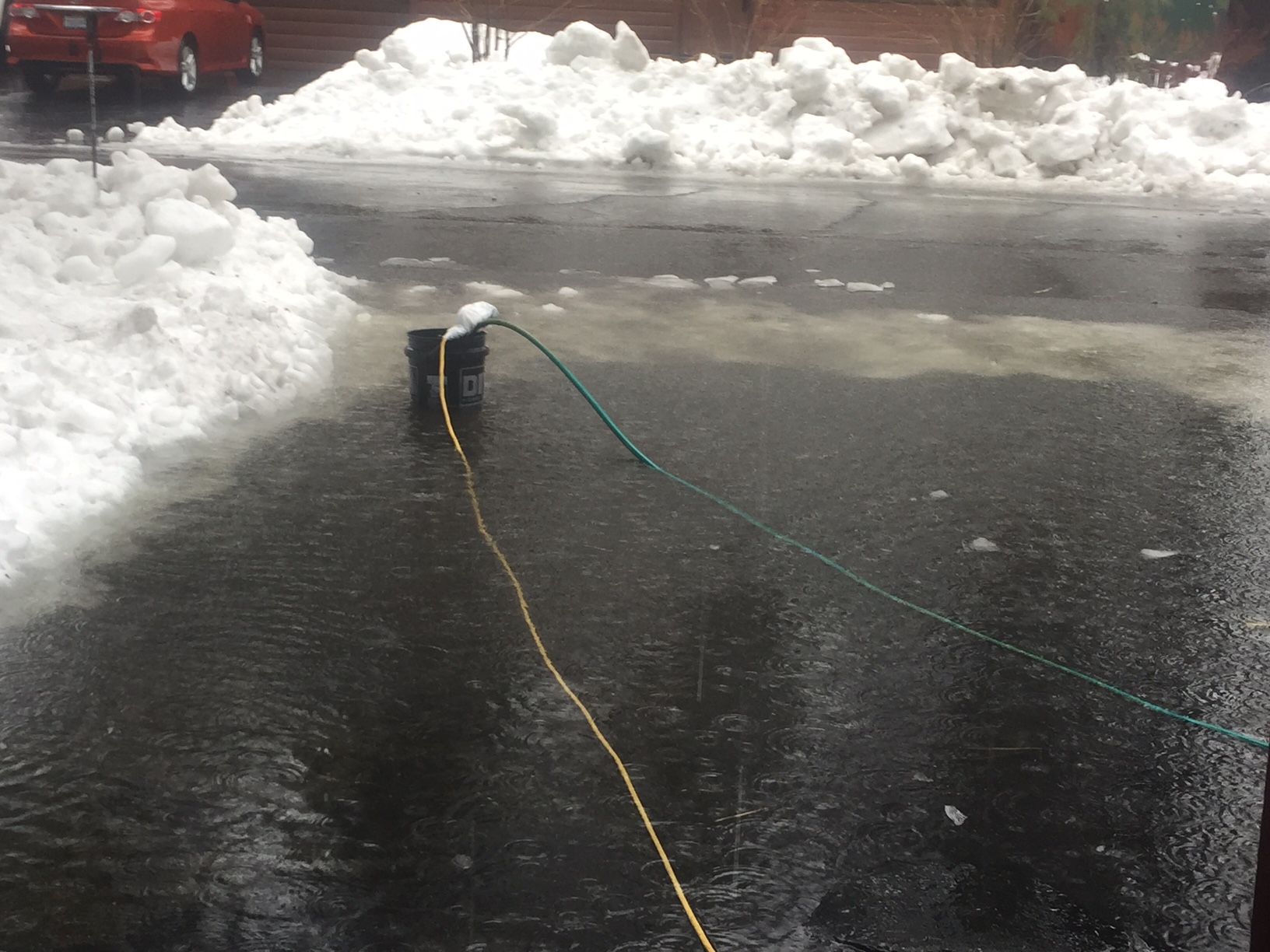
A sump pump works to remove water Jan. 8 from a flooded driveway in South Lake Tahoe. Photo/Susan Wood

A sump pump works to remove water Jan. 8 from a flooded driveway in South Lake Tahoe. Photo/Susan Wood

Updated 6:30pm:

South Lake Tahoe officials are evaluating whether the state streets and potentially the Tahoe Keys area will have to be evacuated because the Upper Truckee River keeps rising.

City Manager Nancy Kerry told Lake Tahoe News the flow is starting to slow down a bit. “We hope that means it is freezing at higher elevations.”

The river is within 6 inches of flood stage. It is already causing minor flooding in the city limits and in Meyers.

“We are deploying resources into those areas now to evaluate conditions and evacuation at this point is precautionary; not required,” Kerry said in a statement.

An evacuation center has been set up at South Tahoe High School.

Lake Tahoe Unified School District has canceled classes for Monday. UNR has also canceled classes.

The fire damaged Tahoe Queen has been pulled out of the water at Zephyr Cove and is now on the beach.

Interstate 80 near Truckee is closed because of a mudslide. Pyramid Highway southbound is closed because of flooding between Eagle Canyon and Dolores. A mudslide is blocking Highway 50 west of Kyburz.

The Truckee River in the Reno area is at 15.86 feet. Should it reach the forecast 21.2 feet, it would surpass its crest of 20.04 feet on Dec. 31, 2005.
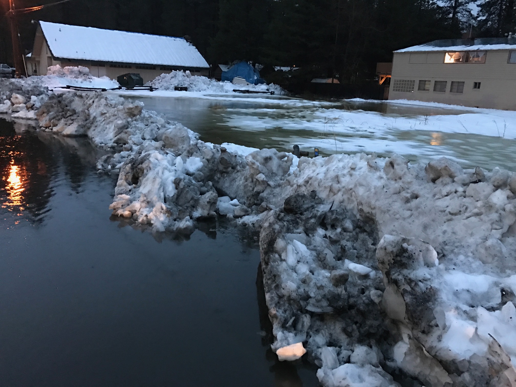
The California Tahoe Conservancy lots by the Knights Inn in South Lake Tahoe are flooded. Photo/Hal Cole

The California Tahoe Conservancy lots by the Knights Inn in South Lake Tahoe are flooded. Photo/Hal Cole

Updated 4:30pm:

South Lake Tahoe officials have opened the airport up as the command post for the office of emergency services because of widespread flooding in town.

Most of the problem areas are in the state streets and Tahoe Keys area. Colorado Street is flooded, with water crossing Tahoe Keys Boulevard, going through houses and covering parts of Jeffery Street. The city reports severe flooding near the Knights Inn on Highway 50.

“The drainage system is at capacity and is pushing the flow into the streets,” City Manager Nancy Kerry told Lake Tahoe News. “That melting snow is bringing in additional water.”

Lake Tahoe Unified School District is still assessing whether schools will be open Monday.

“We are watching the (Upper) Truckee River near the bridge. If it floods, that will split the district,” Superintendent Jim Tarwater told Lake Tahoe News.

Water has been coming into the multipurpose room at South Tahoe Middle School. A pump has been placed there to get rid of the water. Water also came into the district office, but is now being diverted. There has also been flooding in the parking lots at Al Tahoe and Tahoe Valley elementary schools. A few leaks in buildings have also been reported.

The hesitation in calling off school is that the storms behind this one could mean even more days off.
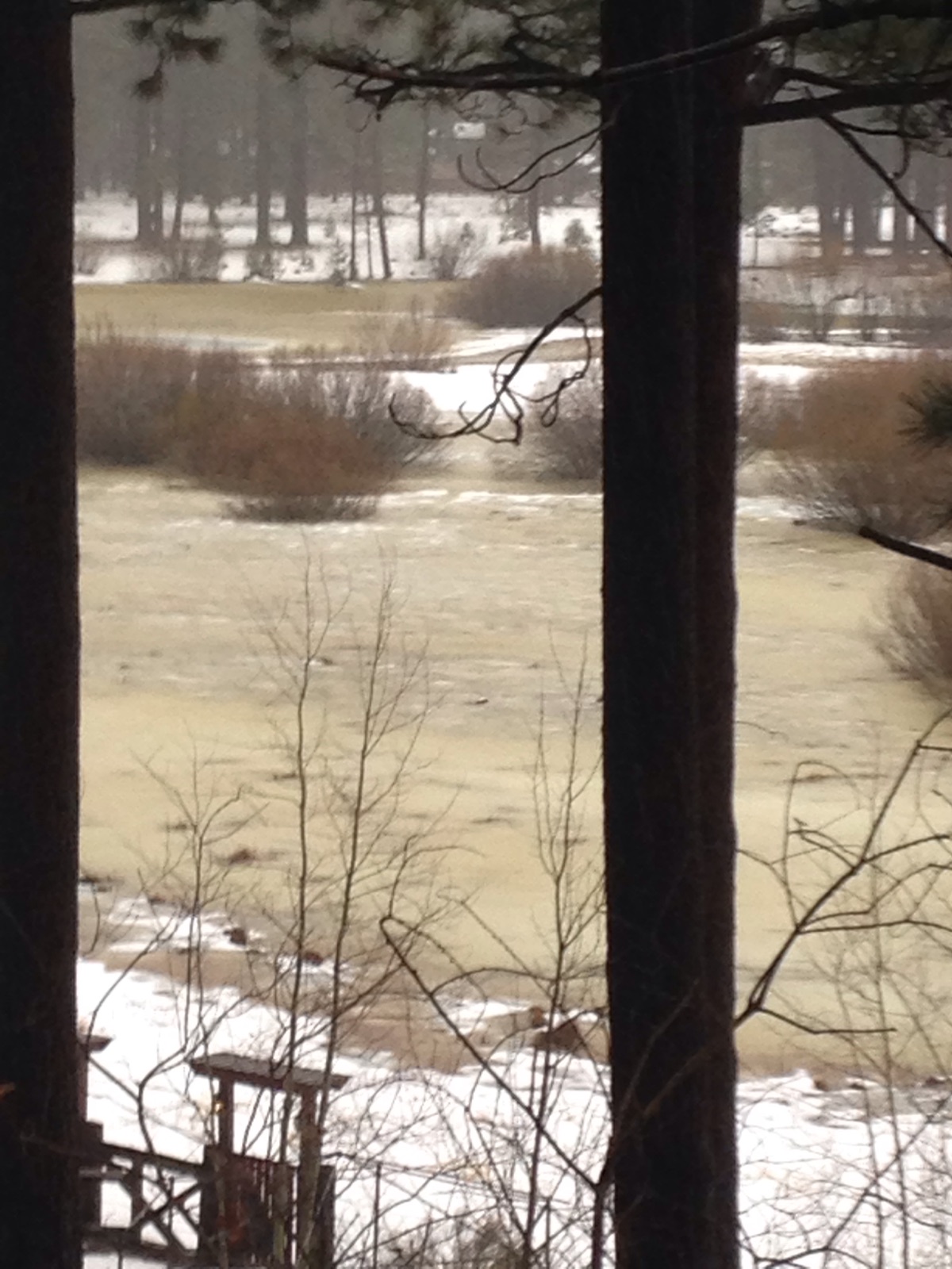
 

Trout Creek behind the houses on El Dorado Street in South Lake Tahoe looks more like a river on Jan. 8 and it keeps expanding. Photo/Lisa Huard

Trout Creek behind the houses on El Dorado Street in South Lake Tahoe looks more like a river on Jan. 8 and it keeps expanding, including into back yards. Photo/Lisa Huard

Reports are that the Sawmill Road-Lake Tahoe Boulevard area has 2 feet of standing water. Sawmill is closed now.

At least 3 feet of water is being let out of Lake Tallac in the Tahoe Keys.

The Pope marsh area is already a lake.

The flood watch for the basin is in effect through 4am Jan. 12.

There is minor localized flooding, but no major flooding in Truckee. Public works continues to work to clear snow filled drainage ditches.  The Truckee River in Truckee has hit flood stage, according to officials there.. Old Highway 40 (Donner Pass Road) from South Shore Drive to Sugar Bowl is closed. There is a large amount of water across the roadway and concerns for undermining of the roadway. 

The Truckee River has hit flood stage in Sparks.

Road closures in Douglas County in the Carson Valley include: Nye Drive, Centerville between Highway 88 and Foothill, and the dirt road alongside Power Dam. 

People are being advised to stay away from Muller, Mottsville, Genoa Lane, Power Dam area, Foothill between Jacks Valley and Genoa, and East Valley near Powerline Road.

Snow is falling between the 8,000 and 10,000 foot levels.

Numerous wet deep slab avalanches occurred either Saturday night or Sunday morning in the Carson Pass area, according to the Sierra Avalanche Center. The avalanche warning has been extended to Jan. 12 at 4am.

Alpine Meadows and Squaw Valley will remain closed on Monday.
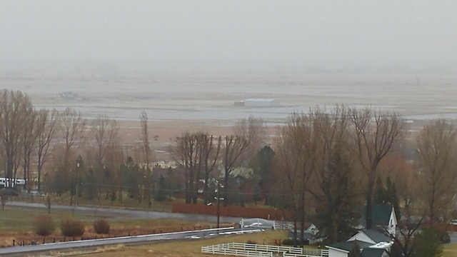
Water is accumulating in the Carson Valley, with several roads closed on Jan. 8 because of flooding. Photo/Suzy Allionoe

Water is accumulating in the Carson Valley, with several roads closed on Jan. 8 because of flooding. Photo/Suzy Allione

Updated 1pm:

Lake Tahoe Boulevard between Sawmill Road and Tahoe Mountain Road in the unincorporated area of El Dorado County is closed because of flooding. Sawmill is also closed.

“It was starting to flood before this storm,” El Dorado County sheriff’s Lt. Matt Underhill told Lake Tahoe News.

The meadow at Sawmill is prone to flooding.

The Nevada Highway Patrol told Lake Tahoe News there is a boulder on Highway 50 near Lakeview that the Nevada Department of Transportation will be removing.

The right lane westbound lane of Interstate 80 near Floriston is closed due to mudflows and falling rock.

It has been raining heavily all day in the basin. Residents near the Tahoe Keys in South Lake Tahoe are reporting more than a half a foot of water under houses. There is flooding in the state streets.

The wind has been strong at times, with a 159 mph gust registered at Squaw Valley at 8,700 feet at 9am.

Liberty Utilities has outages in Tahoe City, Truckee, West Shore and the Interstate 80 corridor because of multiple power lines that have tripped. From Meeks Bay Avenue to the greater Tahoe City region is without power as a result of fallen trees that have downed three strands of wire. Highway 89 is reduced to one lane so crews can safely make repairs. Estimated restoration is at 9pm Sunday. 

“Additional problems are expected as wind/rain continue to increase. We have re-opened our emergency operations center and called all crews in who will patrol the lines looking for problems,” spokeswoman Kathy Carter said in a statement.

Upper Truckee River in South Lake was at 8.4 inches as of 12:30pm, crest is at 10 feet.

There has been some flooding in Soda Springs around Old Highway 40 in the Truckee area.

All Washoe County schools will be closed Monday, including those in Incline Village. Lake Tahoe Community College will make decision about classes at 6am Jan. 9.

—–

A sump pump works to remove water Jan. 8 from a flooded driveway in South Lake Tahoe. Photo/Susan Wood

A sump pump works to remove water Jan. 8 from a flooded driveway in South Lake Tahoe. Photo/Susan Wood


Updated 9:40am:

The Sierra Avalanche Center is telling people not to go into the backcountry now.

“Natural and human triggered avalanches are certain today due to the significant amount of rain and snow expected below 9,300 feet and heavy, wet snow loading above 9,000 feet. Large, deep, destructive wet slab, deep slab and wind slab avalanches will occur (Sunday) as well as loose wet avalanches. Avalanches could run farther than expected and involve almost the entire snowpack,” the agency’s website says.

An avalanche warning is in effect for the backcountry through at least 7am Monday.

Northstar, Kirkwood, Mt. Rose, Sierra-at-Tahoe, Heavenly, Squaw Valley and Alpine Meadows are closed Sunday. Before heading to any resort, check their website for conditions.
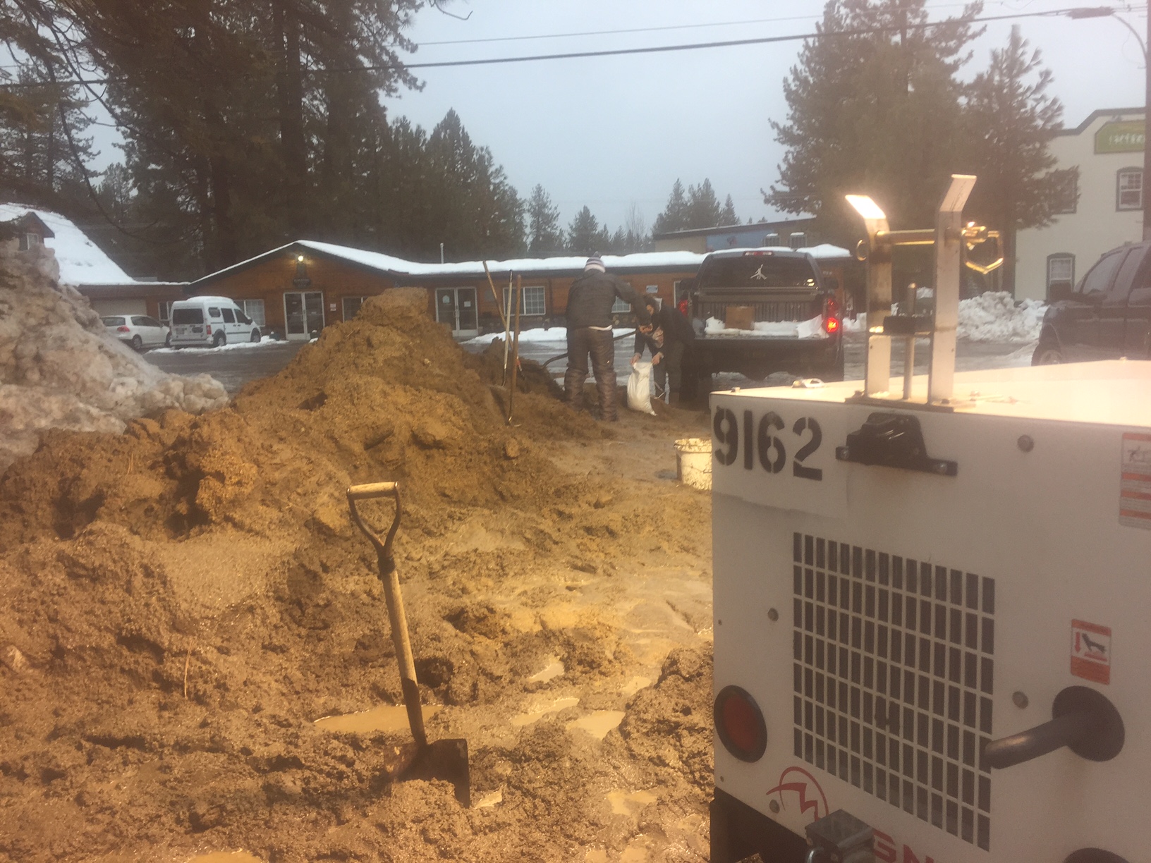
Sand is still available in South Lake Tahoe. Photo/Susan Wood

Sand is still available in South Lake Tahoe. Photo/Susan Wood

The National Weather Service in Reno’s flood watch for the Lake Tahoe Basin remains in effect through Monday afternoon.

The Upper Truckee River is starting to crest in locations on the South Shore. The river is taking in about 6 inches an hour, authorities told Lake Tahoe News.

“A combination of intense rain on saturated soils and melting snow will lead to excessive runoff. Flooding along the Truckee River, Carson River including the east and west forks, creeks, streams, urban areas, and farmland is likely,” the Weather Service said. “Travel could be very difficult with some roads covered by water and impacted by rock and mud slides.”

The National Weather Service in Sacramento has issued a flood warning for small streams in El Dorado, Placer and Alpine counties through 6am Tuesday.

Liberty Utilities is working to get power to 100 customers in Placer County.

For road updates, click on the state icons on the home page of Lake Tahoe News.

— Lake Tahoe News staff report
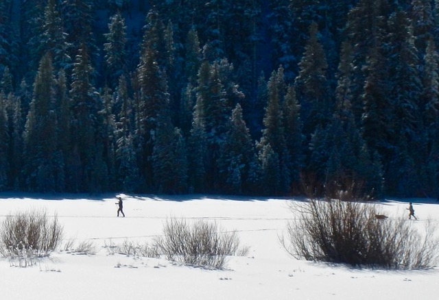


Cross country ski becomes learning experience

Grass Lake is a haven for cross country skiers. Photo/Kathryn Reed

Grass Lake is a haven for cross country skiers. Photo/Kathryn Reed

By Kathryn Reed

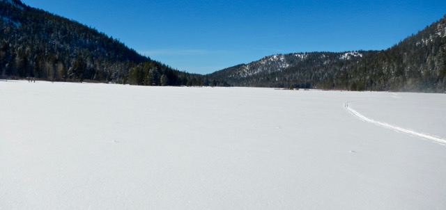
Keep me away from hills and groomed trails. Flat, scenic and free equals perfect cross country ski conditions.

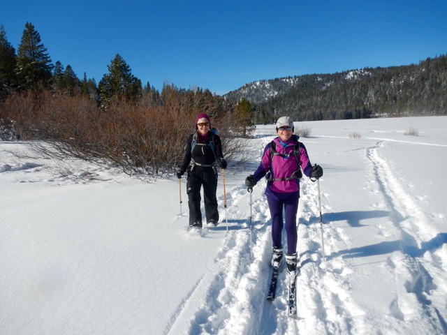
Grass Lake was serene in late December, as it is much of the winter. The snow could not have been better. The powder was like sugar, so easy to glide through. Others has been there before us so we didn’t have to break trail if we didn’t want to.

Waterhouse Peak (9,497 feet) is the highest, nearest landmark. And while that may sound like it is towering, remember that Luther Pass – where Grass Lake is – is at 7,740 feet.

Renee and Rosemary snowshoe and cross country ski through Grass Lake on Dec. 26. Photo/Kathryn Reed

Renee and Rosemary snowshoe and cross country ski through Grass Lake on Dec. 26. Photo/Kathryn Reed

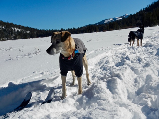
When there isn’t much snow at lake level, this is an ideal place for cross country skiing or snowshoeing. Plenty of dogs were out getting exercise on this particular day, too.

When snow isn’t on the ground this is a marshy area. It’s not a true lake.

Even though Highway 89 is so close, it’s only noticeable if you want it to be. That may sound odd, but I’m a firm believer people have the capability to tune out at least some distractions. The din of traffic is one of them.

Ironically, the three of us welcomed that traffic when were done. You see, we committed one of the bigger mistakes while playing in the woods. No one paid any attention to our starting point. That meant when we got back to the road we didn’t know which way to go.

The expansive area is ideal for those who don't want to climb. Photo/Kathryn Reed

The expansive area is ideal for those who don’t want to climb. Photo/Kathryn Reed

Rosemary was right – we needed to keep heading toward Meyers. Renee and I were on the road while she kept skiing, almost parallel to us. We got around a bend and as far as the eye could see there were no parked vehicles, just another bend. We thought we should turn around and head toward Hope Valley.

Then the three of us were on the road. It was time to hitchhike. After Rosemary got in the vehicle with the couple, their son and granddaughter (of course we didn’t know this makeup or that they were super helpful at the time), I asked Renee if she got the license plate number or knew the make of the vehicle. Neither of us had those answers.

We knew Rosemary had been correct after they stopped to tell us they were going to try the other way. Then she came up in her vehicle.

I share this story because combined the three of us have lived on the South Shore for decades. We are experienced at outdoor play in all seasons. We are normally smart women. But for some reason we weren’t that Monday. It was a good reminder that communication is necessary, it’s essential to look in all directions when starting off, and to have a focal point to know what to look for when returning. We were never going to be in danger based on where we were that day, but that might not always be the case.

We were lucky. This was an experience we could laugh about as we shook our heads.

AJ and Jackson have tons of open space to run in. Photo/Kathryn Reed

AJ and Jackson have tons of open space to run in. Photo/Kathryn Reed

—–

Getting there:

From South Lake Tahoe go west on Highway 50. In Meyers, go left onto Highway 89. At the crest of Luther Pass is Grass Lake to the right. There are several pullouts for parking.


Bill Craven — 1928-2016

By Kathryn Reed

A quiet man who never wanted much attention, but whose family has left a rich history at Fallen Leaf Lake has died.

Bill Craven died Dec. 28, 2016. He was 88.

Bill Craven's impact on Fallen Leaf Lake will be long-lasting. Photo/LTN file

Bill Craven’s impact on Fallen Leaf Lake will be long-lasting. Photo/LTN file

His grandfather, William W. Price, started Camp Agassiz for boys in 1895, which led to the resort at Fallen Leaf Lake. It started as a tent camp. Price and his wife, Bertha, had Fallen Leaf Lodge up and running in 1909. They also operated the Housekeeping Camp.

To start with there was no indoor refrigeration; the ice house was located near what is now Stanford Sierra Camp. Supplies were bought at the Celio’s in Meyers because there was no commercial development at the Y in South Lake Tahoe then.

Born in 1928, Mr. Craven, spent his childhood summers at the lodge. In those days it was possible to take the train from San Francisco to the Tahoe Tavern and the S.S. Tahoe steamer to Camp Richardson. Most of the time, though, the trip was made by car.

In the mid-1940s, Mr. Craven met his future wife, Barbara Granger, at Fallen Leaf. Their families had neighboring cabins. She was 18 and he was 16. The couple managed the lodge from 1972 to 1985. They were among a handful of people who lived at Fallen Leaf Lake year round. Mrs. Craven continues to live there.

Mr. Craven’s mother, Harriet Price Craven, and her sister Francis Price Street ran the lodge before he took it over.

The 20-acre lodge site was sold to the Stanford Alumni Association in 1951, which was appropriate since his grandfather graduated from Stanford. That is where Stanford Sierra Camp now exists. The families operated the adjacent 78-acre parcel as a camp and cabin rentals until the 1980s.

In the forward for Janet Beales Kaidantzis’ book “Fallen Leaf: A Lake and its People 1850-1950” Mr. Craven wrote, “Fallen Leaf Lake’s happiest years occurred during the one-hundred-year period of this book. For most of that time, the Lake was unknown and sparsely populated. It took great effort to get here; those who made the trip were hardy types who appreciated nature and simple living.”

Mr. Craven attended UNR, where he graduated in 1951 with a degree in mining engineering. He worked as a mining engineer in Ione until he took over the lodge.

Mr. Craven served as the president of the Lake Tahoe Historical Society. His mother had been a founding member of the organization.

In October 2010 he gave a talk at the South Lake Tahoe Library that was videotaped. Per his instructions, the Historical Society could not release copies of it until after his death. Mostly he talks about others and not his contributions to the South Shore.

He got his driver’s license when he was 13. During World War II he drove a truck for Sierra Tahoe Market which was dealing in the black market for meat.

At the talk he admitted that when gaming came to the Stateline as a 15-year-old he was playing penny slots.

Mr. Craven was saddened to see regulations put in place that essentially curtailed the building of old-style Tahoe cabins, but instead favored McMansions.

He is survived by his wife, Barbara; a son and daughter; and several grandchildren.

Per his request there were no services. Donations may be made to the UNR Foundation, Mackay School of Mining, PO Box 162, Reno, NV  89557.


Not everyone wants national monuments in Nev.

By Benjamin Spillman, Reno Gazette-Journal

With some rural Nevadans still seething over President Obama’s designation of two national monuments two Republican lawmakers want to restrict the ability of future presidents to create more in the Silver State.

On Wednesday Sen. Dean Heller, R-Nev., and Rep. Mark Amodei, R-Nev., announced legislation that would make Nevada off-limits to new monuments that don’t have approval from Congress.

The announcement comes in the wake of decisions by Obama to follow the advice of former Sen. Harry Reid, D-Nev., to designate the Basin and Range and Gold Butte monuments in southern Nevada.

Read the whole story


Noise monitoring at LT Airport keeps evolving

By Joann Eisenbrandt

“Noise, by definition, is ‘unwanted sound.’”

This is how the Tahoe Regional Planning Agency’s 2015 Threshold Evaluation report characterizes it. The report goes on to note that vehicular traffic and “aircraft activity at the South Lake Tahoe airport have been identified as the predominant noise sources in the basin.”

El Dorado County opened the Lake Tahoe Airport in August 1959. It was annexed by South Lake Tahoe in 1983. From the beginning of city ownership, there have been vigorous debates over the environmental impacts of the airport versus its economic benefits. The “unwanted sound” of noisy aircraft operations in the skies above the lake’s clear blue waters has often been at center stage.


With Lake Tahoe Airport not being used as much, noise issues have diminished. Photo/Kathryn Reed

With Lake Tahoe Airport not being used as much, noise issues have diminished. Photo/Kathryn Reed

Airport Master Plan update under way

The city began an update to its Airport Master Plan in 2013. This plan outlines the preferred configuration of the physical facility and the number of flight operations and mix of aircraft using the airport over the next 20 years. When the 1992 Master Plan was put in place, the noise generated by scheduled commercial flights over residential neighborhoods was a key concern, as well as that created by business jets bringing celebrities and tourists to the lake in the summer for special events.

The environmental document required by CEQA (California Environmental Quality Act) that must accompany the master plan is being prepared, with the 30-day circulation and comment period for the draft document expected to take place in February. It will identify potential environmental impacts of the master plan, including noise, and outline ways in which they can be mitigated.

TRPA’s noise standards

In its Regional Plan, the Tahoe Regional Planning Agency sets maximum allowable noise levels in decibels for aircraft operations. The 1980 federal Compact that created the bi-state agency gives it this power. The TRPA noise standard for daytime aircraft arrivals and departures (8am to 8pm) is 80 dBA and the nighttime standard (8pm to 8am) is 77 dBA. Aircraft noise is measured in A-weighted decibels (dBA), a measurement that eliminates very high and very low frequency sounds in the same way they are perceived by the human ear.

These noise standards are also a part of Lake Tahoe Airport Master Plan. The airport monitors noise at six sites in the vicinity of the airport and logs all exceedances of these single-event noise standards. It is to provide TRPA with quarterly and yearly reports. Cumulative noise impacts (CNEL) over a 24-hour period from aircraft in the South Lake Tahoe Airport Transportation Corridor are also measured. The TRPA threshold standard for these noise events is 60 dBA.

Commercial air service and noise

When the city took over the airport in 1983, it agreed to finish the county’s incomplete Airport Master Plan. The airport facility had been deteriorating and annual enplanements had gone down from a high of 294,188 in 1978 to a low of 37,553 in 1982. AirCal was the existing commercial carrier, and the city chose to immediately increase the number of its flights into Tahoe. TRPA believed this was a violation of its noise and other environmental standards and filed a cease and desist order. The city sued TRPA saying it did not have jurisdiction over the airport; the California Attorney General’s Office sued the city and AirCal. More lawsuits followed.

After years of legal wrangling, the 1992 Airport Master Plan Settlement Agreement ended all pending litigation and set strict guidelines for commercial operations at the airport for the next 20 years. It included requirements for the airport to adhere to the TRPA noise standards, have noise monitoring equipment in place, keep records and submit reports of noise exceedances to TRPA.

Commercial service to the airport ended in 2000, but until recently, the city continued to affirm its important economic value to the community and retained hope for its eventual return. In a 2012 Lake Tahoe News article, then interim City Manager Nancy Kerry insisted, “We have this facility. What is its best and highest use? A general aviation airport is just a waste of space … The goal is to bring commercial service back here.” Those like the League to Save Lake Tahoe who saw the return of commercial service and the noise that would come with it as an inappropriate assault on the basin’s fragile environment, continued to vocally protest against it.

Changes in the aircraft industry, the cost of maintaining the airport’s FAA Part 139 certificate for commercial service, and the prohibitively expensive changes to the physical layout of the airport that would be required to again accommodate scheduled air service changed the city’s mind. The preferred alternative chosen by the City Council as part of the current master plan update does not include commercial service. The city relinquished its FAA Part 139 certificate.

But even without commercial service, noise from aircraft operations still affects the South Shore community. In addition to general aviation aircraft, business jets and chartered transport category planes still use the airport, as do helicopters for medical and scenic purposes. Because the airport has received federal funding, military aircraft have the right to access the facility.

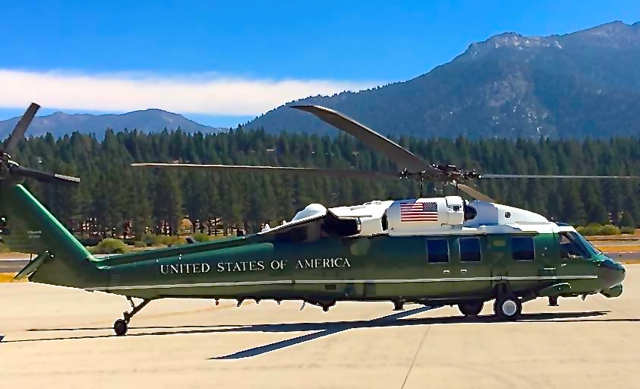
President Obama used Marine One to land at Lake Tahoe Airport in August. Photo/South Lake Tahoe

President Obama used Marine One to land at Lake Tahoe Airport in August. Photo/South Lake Tahoe

Measuring the impacts of noise

The technical measurement of acoustical sound levels is important in determining a noise event’s impacts. But equally important, and much harder to measure, is the subjective component of noise — how it is perceived by those who hear it.

The Federal Aviation Administration (FAA) in its Aviation Noise Effects circular concludes, “It is not possible to state simply that a given noise level from a given noise source will elicit a particular community reaction … an individual’s attitudes, beliefs and values may greatly influence the degree to which a person considers a given sound annoying.”  

This is especially true at Lake Tahoe. The fact that the background, or ambient noise levels, at the lake are much lower than those in more industrial or urbanized areas makes noise events like aircraft arrivals and departures stand out. Because of the lake’s spectacular beauty and national status, there is a heightened focus on preventing degradation of its valued natural character.

How Lake Tahoe Airport monitors noise

Noise monitoring at the airport has been ongoing for decades, but recently, concerns were raised about the functionality of the aircraft noise monitoring equipment and how well noise complaints from the public and violations of the TRPA aircraft noise standards were being addressed.

For the noise monitoring of aircraft operations to be effective, the noise monitoring system must be able to not only accurately record the decibel levels of noise events at the monitored locations, but there must also be a way to differentiate between noise from aircraft and loud noises generated by other nearby sources such as roadway traffic or chain saws.

Over the years, the airport has used a variety of methods to tie TRPA noise level exceedances recorded at its monitoring sites to specific aircraft events. Until 2004, the airport had a manned FAA Air Traffic Control Tower, which recorded all aircraft to aircraft and aircraft to tower radio transmissions in the airport’s traffic pattern. All aircraft in the traffic pattern were required to be in contact with other aircraft in the pattern and the tower.

An administrative assistant at the city coordinated the timing of noise exceedance events at the monitoring stations with the FAA tower recordings. If a pilot were on the radio at the time of such an event, it was assumed the violation came from aircraft noise. If there were no aircraft transmissions around the time of an exceedance, it was considered a non-aircraft noise event. When the tower closed in 2004, the aircraft radio recording system owned by the FAA was decommissioned. Due to city budget cuts and reorganization, the administrative assistant position was later eliminated.

Mark Gibbs, the city’s new airport manager, told LTN that in 2005, the airport “tried another approach to differentiate noise monitoring exceedance events between aircraft and non-aircraft ….”  However, it proved to be, “less accurate, more time consuming and quite costly to provide.” The airport purchased radar data from the Approach Control facility in Oakland. This radar data monitors all aircraft with transponders that are turned on in TVL terminal airspace. But not all aircraft have transponders and not all pilots who have transponders operate their planes with them turned on, so the only noise exceedances that could be positively identified were those from planes equipped with transponders that were turned on. The data was costly to purchase and also needed third-party software to translate the FAA data into a format for noise analysis. The city discontinued this approach in 2010.

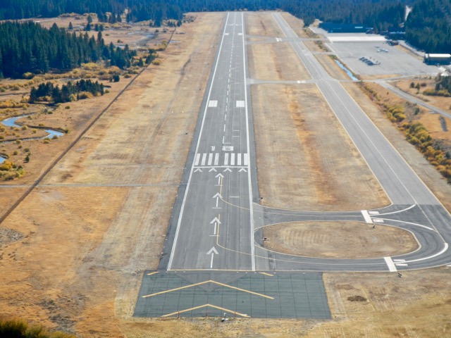
Lake Tahoe Airport gets more use as a city hall than it does for planes. Photo/LTN file

Lake Tahoe Airport gets more use as a city hall than it does for planes. Photo/LTN file

TRPA’s analysis of compliance

Every five years, TRPA puts out a Threshold Evaluation Report which analyzes how well the standards and goals of its Regional Plan are being met. In its Draft Report for 2015, the agency originally noted that during the years between 2011 and 2015, analyzing the noise data from Lake Tahoe Airport was difficult and trends were hard to determine because the noise monitoring equipment was “malfunctioning” and unable to tell the difference between aircraft and other noise events.

Gibbs explained, “The French built 01DB Airport Noise Monitors were never designed to differentiate between aircraft sounds and other sources so that was never a “malfunction” of the equipment. The TVL noise monitors were operational the entire reporting period 2010-15. The noise monitoring equipment is designed to only log the time, date and dba level of each discrete exceedance of TRPA standards. There is no readily available electronic noise monitoring technology that can differentiate between aircraft and other sources.”

TRPA’s final 2015 Threshold Evaluation Report has removed any references to equipment malfunction, but does note that between 2011 and 2015, only total exceedances of the noise standards were reported by the city without discriminating between aircraft and non-aircraft noise events. This made it impossible to determine if the number of noise violations at the airport had trended upward or downward from previous reporting periods. TRPA did estimate, based on historical data, that an average of 17 percent of noise level exceedances are caused by aircraft. For the years during the latest monitoring period where the city reported a full year of data, total exceedances ranged from 1,038 to 1,698.

In 2015, the city found a cost-effective aircraft radio transmission recording system to replace the system in place when there was a control tower at the airport. VersaDial records aircraft radio traffic on the common traffic advisory frequency for TVL. 

“If a noise complaint is logged,” Gibbs explained, “the city will review the recording to ascertain the aircraft in violation based on time/date of occurrence and compare that against the active noise monitoring system readings. If a noise exceedance is found, the airport can reference the owner of the aircraft by the call sign used on the radio transmissions. The airport now has the capability to replay aircraft radio transmissions to ascertain if a noise exceedance event logged by the noise monitoring equipment coincided with aircraft operations at the same time in terminal airspace.”

Gibbs added that, “The TRPA and the airport will continue a dialogue to ensure that the public has the best available data on airport noise impacts in the future … The airport and TRPA are both committed to limiting the negative impacts of noise in the community to the greatest extent practicable.”

Re-evaluating TRPA’s noise standards

Beyond the issue of how well the airport’s noise monitoring system can identify aircraft noise violations, is the question of the current validity of the standards themselves. Tom Lotshaw, TRPA’s public information officer, told Lake Tahoe News, “These airport noise standards are pushing 30 years old and were developed and adopted as part of the Settlement Agreement in 1992. From our perspective, these are legacy standards from back in the day when there were commercial service operations and a higher level of (airport) activity.” 

TRPA’s 2011 Threshold Evaluation Report was peer reviewed, as was the 2015 report, by an outside panel of experts in different fields. The 2011 report’s review indicated that TRPA’s noise program is too complex with too many land categories and noise thresholds to be able to evaluate attainment. It could not effectively evaluate single noise events at the Lake Tahoe Airport for compliance and they were given a status of “unknown.” Lotshaw noted that under its Strategic Initiative, TRPA is now working with the Tahoe Science Advisory Council, a science advisory group, and several dozen other partners, to bring science to the table when trying to determine which TRPA policies continue to work. TRPA will be looking at their noise threshold standards and re-evaluating them to make sure they are scientifically sound.

This re-evaluation will not happen overnight. In the interim, the city will continue to monitor aircraft noise and submit reports to TRPA. In 2015, there were 19 noise complaints logged at the airport.

“Any noise complaint is investigated by the airport manager,” Gibbs confirmed, “and, if warranted, an attempt to contact the pilot is made.”

Residents can report noise concerns from aircraft by using the city’s website or by calling the airport manager’s office.

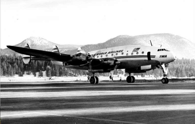
TWA was one of several airlines that used to fly into Lake Tahoe Airport. Photo/Del Laine

TWA was one of several airlines that used to fly into Lake Tahoe Airport. Photo/Del Laine

Aircraft noise as an issue in the future

With commercial service not envisioned in the Airport Master Plan update now being finalized, how much of an issue for the South Shore community will airport noise continue to be?

South Lake Tahoe City Manager Nancy Kerry said, “People don’t see it as a big issue. I don’t even think it was a big issue in the Master Plan (public) hearings. The issue was whether or not there would be commercial service.” 

The city chose to do a mitigated negative declaration, a less exhaustive CEQA environmental document, instead of the more in-depth environmental impact report. Hilary Roverud, the city’s deputy director of Development Services, explained the rationale behind that choice.

“We feel there are no impacts that can’t be mitigated. We are not anticipating any expansion of the airport property or significant changes in its configuration. (ESA, the consultants) are evaluating the master plan based on the current baseline conditions and looking at any changes the master plan is proposing that will affect noise … nothing in the draft master plan will create noise issues. The city has already reduced the footprint of the airport, narrowed the runway, and performed SEZ (stream environment zone) restoration,” she said.

According to Gibbs, the city is also looking at NextGen, an FAA national initiative program that would replace ground-based navigation aids with GPS-enabled instrument procedures. This allows aircraft to follow a tighter flight path to the airport. In Tahoe’s case, it would make it easier for pilots to follow the recommended “meadow” approach which takes them over open space rather than residential neighborhoods. The city has put in a request for these procedures, hoping that Tahoe’s sensitive environment will make it good candidate, but it must compete with many other airports. It isn’t a grant program and doesn’t cost the city money because it only involves FAA-owned airspace. The selection process is expected to take a number of years.

The League to Save Lake Tahoe, which has remained vocal regarding the environmental impacts of the Lake Tahoe Airport, was asked about its view of aircraft noise as an ongoing issue. Darcie Goodman Collins, League executive director, told LTN in an email, “We are happy that the city has ended its efforts to renew the commercial status for the airport. As the city moves forward, they are required to take actions to comply with Tahoe’s threshold for noise. This will be challenging for an operational airport, but we remain confident that the city, working in cooperation with TRPA, will make progress on its efforts to reduce noise and be a good neighbor for the surrounding community.”

Once the mitigated negative declaration is completed it will be available for review by public agencies and individuals for 30 days. The city plans on having one public hearing during this review period to receive input from residents on potential environmental impacts identified in the Airport Master Plan, including aircraft noise, and the adequacy of the mitigation measures the Plan proposes to reduce them to less than significant. This will be the public’s chance to indicate how significant an issue airport noise is.


Research: Outdoor recreation disrupts wildlife

By Benjamin Spillman, Reno Gazette-Journal

Hikers and skiers might want to think twice before criticizing motorcyclists and snowmobilers for disrupting the environment.

Research recently compiled by Colorado State University found virtually every type of outdoor recreation has potential to harm wildlife, with non-motorized activity showing more documented negative effects motorized sports.

The findings were part of a scientific review published last month that looked at the effects of recreation in protected areas on wildlife.

Read the whole story


Bill Johnson — 1931-2016

Three-term El Dorado County supervisor Bill Johnson has died.

William Van Dyke Johnson was part of the pioneer family that helped create South Lake Tahoe before it was even a city.

Bill Johnson

Bill Johnson

Mr. Johnson died Dec. 19, 2016. He was 85.

He was born at the J Lazy J Ranch on Mottsville Lane in Gardnerville on March 21, 1931. He graduated from Gardnerville High School class of 1949. 

Mr. Johnson served two years in the Korean War in the Army. Upon being discharged he went to San Francisco where he went to hotel and restaurant management school.

It was on Aug. 29, 1953, that he married Felice Muldoon in South Lake Tahoe. He was in the property management business for nearly 20 years.

In 1969, the voters elected him to represent Tahoe on the El Dorado County Board of Supervisors, where he served for 12 years. He was instrumental in convincing the county to sell Lake Tahoe Airport to the city – and at a favorable price for South Lake Tahoe. The bill — $1.

Mr. Johnson along with his sister Marjorie Springmeyer and brother Knox Johnson gave land to the city for what is now the city-county government complex on Johnson Boulevard in South Lake Tahoe.

As an elected official, Mr. Johnson was on various boards, including the Tahoe Basin Transportation Authority for nine years, Tahoe Transportation District, and Highway 50 study corridor group.

More recently Mr. Johnson and his wife had property in Camino where they ran Bills Apples and Felices Dolls.

He was preceded in death by his wife, Felice, and sister Marjorie Johnson Springmeyer.

Mr. Johnson is survived his sons, Ross, Kent and Curtis; brother Knox; daughters-in-law; four grandchildren; and several nieces and nephews.

There were no services. Donations may be made in Mr. Johnson’s name to any veterans group.

— Lake Tahoe News staff report


Opinion: Don’t wait — prepare for storms

By Tracy Franklin

The National Oceanic and Atmospheric Administration (NOAA) is forecasting a major atmospheric river to hit the region this weekend starting on Jan. 8 and continuing through Jan. 9 with widespread flooding expected.

NOAA is also forecasting another atmospheric river arriving in the region on Jan. 10t-11. NOAA is
stating that this event could be similar or greater than the floods of 1997 and 2005 which greatly impacted
South Lake Tahoe.

An atmospheric river is a conveyor belt of vapor that extends thousands of miles from out at sea, carrying as much water as 15 Mississippi Rivers. Each storm can dump inches of rain or feet of snow. NOAA is predicting 6-8 inches of rain falling in the Tahoe basin between Sunday and Monday; if these predictions hold, residents and visitors of South Lake Tahoe need to be prepared.

City public works and public safety crews are working around the clock between Friday and Monday to
prepare for the storm. Friday and Saturday crews will be out clearing snow and storm drains. Residents need to prepare for the storm.

Today we encourage residents to get prepared by doing the following:

  • Stay home. If you really don’t have to go out, don’t. Even if you can drive well in the snow, not
    everyone else can. Don’t tempt fate: If you don’t have somewhere you have to be,
    #StayHomeStaySafe.
  • Get sand bags. Sand bags are available at the city yard at 1160 Rufus Allen Blvd. and also at fire
    station No. 3 at 2101 Lake Tahoe Blvd.
  • Clear storm drains. There are 1,874 storm drains in the city. City crews will be out clearing to clear
    high priority drains in expected flood areas. Residents can also help by clearing any storm drains in
    front of their home. Use a shovel or pick to break ice and snow away from storm drains so that water
    can enter the drains.
  • Prepare for utility outage. Gather flashlights and replace batteries. During the storm, Liberty Utility
    crews will work 24/7 to restore power where needed. To report a power outage, call 844.245.6868.
  • Keep roofs cleared. Snow with high water content is heavy. When it’s followed up by torrential rain,
    existing snow on your roof will become heavier. Spend Friday and Saturday clearing as much snow off your residential structures before the next storm arrives.
  • Expect berms. Heavy snow is more difficult to plow and often results in berms in driveways and at
    street intersections.
  • Stock up on supplies. People using oxygen tanks need to have battery back-up power on hand.
    Residents should store up on food, water, batteries, pet food. #StayHomeStaySafe
  • Don’t drive through water that is too deep. If flooding occurs, don’t drive through it.
  • Stay informed. 
  • Get the word out. Advise neighbors, friends and family of expected flooding and to plan and prepare.
  • Emergency operations. In anticipation of flooding and severe weather, the city has already contacted
    American Red Cross and prepared its emergency operations teams to be on call and ready to open
    evacuation centers as needed. Stay up to date with emergency and weather information with the city’s social media accounts, Twitter feed, Facebook, and NewsFlash reports.

During the 1997 and 2005 floods the following neighborhoods experienced flooding and we anticipate flooding to occur again during these storms:

  • Lower Tahoe Keys
  • State streets
  • Mobile home parks at Third Street and Jean Avenue and Woodbine
  • Winnemucca and Highway 50
  • Pioneer Trail and Blackbart at the meadow

Recreation center staff are currently working with the Red Cross to have emergency shelter established for residents displaced during the storm. The recreation swim complex is located at 1180 Rufus Allen Blvd.

Tracy Franklin is the public information officer for South Lake Tahoe.


Nevada students learn legislative ropes

By Sandra Chereb, Las Vegas Review-Journal

CARSON CITY — Former state Sen. Valerie Wiener was aghast when she read a 2003 report that painted a bleak picture of young people and their basic understanding of government.

“We learned that more than 80 percent of 15- to 25-year-olds could identify the most recent ‘American Idol’ (winner), while fewer than half knew the party of their state’s governor,” Wiener, D-Las Vegas, told an Assembly committee in 2007.

 Wiener was testifying on Senate Bill 247, a measure that created what is now the Nevada Youth Legislature, an award-winning program that not only educates Nevada high school students about civics but gives them an active role in setting policy and passing laws pertinent to their generation.

Ten years later, dozens of former and current participants credit the program with sparking their interest in public service. Present and past youth legislators will meet on Saturday for a reunion of sorts, with one event scheduled in Las Vegas and the other in Carson City.

Read the whole story


Innovation helps keep harmful stormwater from Tahoe

By Zack Bradford, Tahoe In Depth

Winter snow is a welcome sight at Lake Tahoe, particularly since four of the last five winters were exceptionally dry. But as much as we all enjoy skiing or riding and as much as our towns depend on winter tourists to keep our economy going, there is a hidden cost to a return to winter: stormwater, and the pollution that it transports into Lake Tahoe.

Lake Tahoe is designated an outstanding national resource water by the U.S. Environmental Protection Agency, affording it protections that most lakes its size don’t have. EPA, however, also lists Tahoe as “impaired” by fine sediment pollution and an excess of the nutrients nitrogen and phosphorus. Both are carried into Lake Tahoe when rain and snow washes off Tahoe’s roads and parking lots. Unlike grains of sand, which sink, fine sediment particles — each smaller than the width of a human hair — remain suspended in the lake, reducing its clarity. Plants need nutrients to grow, but excessive nutrients fuel the growth of algae.

Under federal law, Tahoe’s special status requires agencies in the basin to reduce the inputs of these contaminants and restore Lake Tahoe to its historic clarity. When Charles Goldman began dropping the Secchi disk in the lake in the 1950s, clarity reached over 100 feet in depth. It worsened over the decades, but for the past four years, the Tahoe Environmental Research Center’s clarity measurements at the center of Tahoe have been better than any other year in the previous decade. It’s no coincidence that these same four years were a record drought.

n recent years, many Tahoe agencies have begun to change what road sand they use to treat snowy roads in the winter. Illustration/League to Save Lake Tahoe

Many Tahoe agencies have begun to change the treatment they use to treat snowy roads. Illustration/League to Save Lake Tahoe

So, what can we expect when Tahoe again experiences above-average winters, with accompanying stormwater transporting these pollutants to the lake? Many agencies at Tahoe have been preparing for that scenario.

From engineered stormwater “infiltration basins” on the South Shore, to curb and gutter projects on the West Shore, agencies have been acting to reduce the amount of fine sediment coming off our urban streets, roads, and developments. But the biggest impact, perhaps, has been made by agencies modifying their road sanding practices.

Scientists have found that road traction abrasives, or road sands, are responsible for the vast majority of fine sediment ending up in Lake Tahoe. Road managers apply abrasives in the winter for public safety to provide traction for vehicles traveling on snowy roads. These traction materials are crushed by our car tires and ground into clarity-degrading fine sediment.

Staff from state and local public works departments balance public safety and the environment by monitoring and analyzing storms, applying road salts at precise times, and spreading road sands in precise locations before temperatures drop. They also sweep up road sands after storms. The improvements they’ve made over the past decade have been challenging.

One major change has been to switch, over the past five years, from a material known as “volcanic cinders” to “Washoe sand.” The cinders are a brittle volcanic rock that cars easily crush into an ash-like dust, while the sturdy grains of Washoe sands can withstand more abuse. Washed into a body of water, more of the finely crushed cinders remain suspended, while the larger and heavier grains of Washoe sand sink harmlessly to the bottom.

Research conducted by El Dorado County and Caltrans showed that switching to Washoe sand could reduce ultra-fine particles, those most responsible for clarity loss, by as much as 90 percent.

Agencies have also taken steps to improve efficiency in applying these road abrasives.

“Our drivers now focus on spot sanding at key intersections, steep areas, and critical public safety areas,” said Jason Burke with the city of South Lake Tahoe. Caltrans now relies more heavily on weather forecasts, and has installed vehicle sensors to measure road temperature. Both Caltrans and El Dorado County have also begun treating roads with a brine solution, which lowers the freezing point of the road, as a potent ice-prevention step before storms arrive.

“The brine technology allows the county to prevent ice buildup, use less salt, and be strategic in placement of road sand,” said Russ Wigart, stormwater coordinator for El Dorado County.

South Lake Tahoe also engages in what Burke calls a “combined effort of refined sand application and enhanced street sweeping after storm events to recover traction materials as soon as feasible.” The city recently purchased new spreaders to enable the use of brine on city streets for the first time this winter.

“Brine use reduces the bounce and scatter typical when dropping dry sand onto the roadway,” said Burke, allowing the city to reduce the amount of sand it needs to apply by 30 percent.

Nevada public works officials are also using the best available technology, from road temperature sensors to high efficiency street sweepers, to combat the fine sediment runoff problem.

The results of some of these changes have been encouraging. Caltrans’ Sean Cross reports that “water quality monitoring and testing have shown reductions to fine sediment particles,” while Wigart said “the concentrations of fine sediments in urban runoff appear much cleaner.” The real impact though, may not be known for several years, as it takes time for sediment to reach the center of the lake where TERC takes its clarity readings.

So, what can community members like you do to protect Lake Tahoe?

Slow down when driving in winter conditions and bring your vehicle to the car wash more frequently to reduce the spread of roads sands trapped under your car. Residents and business owners can also use less salt, and encourage private snow removal companies to switch to Washoe sand instead of cinders.

Reducing the number of cars on the road can reduce the fine sediment pollution that threatens Lake Tahoe’s clarity. Community members can help by carpooling, and riding the bus and ski shuttles. Little steps add up, and together our actions can help protect Lake Tahoe.

Zack Bradford is the natural resources manager for the League to Save Lake Tahoe. He manages Pipe Keepers, a community-based volunteer monitoring program that examines stormwater entering Lake Tahoe and its tributaries, and Eyes on the Lake, a volunteer program to help prevent the spread of aquatic invasive plants in Tahoe’s waters. This article first appeared in Tahoe In Depth.