It snowed 5.7 trillion gallons of water in Calif.

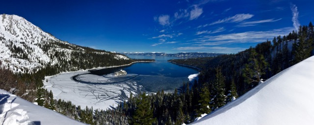
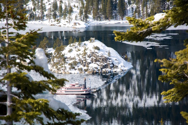
The M.S. Dixie makes it way around a partially frozen Emerald Bay. Photo/John Gomez

The M.S. Dixie makes it way around a partially frozen Emerald Bay. Photo/John Gomez

By Jason Samenow, Washington Post

How do you seriously dent a drought? You blast it with the equivalent of trillions of gallons of water. That’s exactly what happened in California in January.

Twenty feet of snow buried parts of Northern California in just two weeks, with up to 30 feet in some ski areas. For the month, the Sierra Nevada witnessed 120 percent of its annual snowfall.

The January snow output by itself eliminated 37 percent of a five-year (2012-16) snow water deficit, according to University of Colorado-Boulder Center for Water, Earth Science, and Technology.

Read the whole story


Chinese achieved enormous feats on Donner railroad

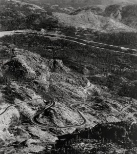
The railroad made Donner Summit much easier to cross; now it's an interstate. Photo/Caltrans

The railroad made Donner Summit much easier to cross; now vehicles traverse it across the interstate. Photo/Caltrans

By Abby Stevens, Moonshine Ink 

When Charles Crocker, an executive for the Central Pacific Railroad, suggested in 1864 the company hire Chinese immigrants to help build the railroad, he was met with laughter.

The defense against hiring Chinese was that the men were small in stature and building railroads required brute strength. At the time, Central Pacific was charged with building the railroad from the West Coast to Utah, and Union Pacific was building its portion from the East Coast to Utah much quicker — so Crocker was feeling pressure.

Many Chinese men had immigrated to the U.S. to try and get a piece of the gold rush, but as jobs in mines dwindled, Central Pacific decided to capitalize and hired 50 men on a trial basis. The experiment went well — by 1865, there were 3,000 Chinese working on the railroad.

Read the whole story


Manzanar — Testament to racism in the U.S.

Not everyone made it out of Manzanar alive. Photo Copyright 2017 Carolyn E. Wright

Not everyone made it out of Manzanar alive. Photo Copyright 2017 Carolyn E. Wright

By Kathryn Reed

INDEPENDENCE – Without touching the barbed wire, it inflicts a wound on my soul.

The raw imagery of Manzanar coupled with my imagination is almost too much to take in. What’s left of this internment camp is a stark reminder of one of the darkest times in U.S. history.

The government sent more than 100,000 Japanese-Americans to what were called war relocation centers. Others would call it jail. The only crime committed was their ancestry.

After Pearl Harbor was bombed, President Franklin Roosevelt in 1942 issued an executive order that removed anyone of Japanese descent – even if they were born in the United States – to the camps. It was forced incarceration. Most lost their homes, businesses and worldly belongings all because they looked different than the white power structure.

Guard towers were located throughout the property to ensure no one escaped. Photo Copyright 2017 Carolyn E. Wright

Guard towers were located throughout the property to ensure no one escaped. Photo Copyright 2017 Carolyn E. Wright

They were finally allowed to leave the camps in November 1945, three months after World War II ended.

Manzanar is a juxtaposition with its desolate beauty. The Eastern Sierra peaks – including Mount Whitney – tower over the Owens Valley. They are majestic no matter the season. For the people shipped there they were just another physical barrier. Most of those at Manzanar had come from coastal towns in California.

They had to endure barren conditions. Temperatures in the summer along this outpost on Highway 395 can hit triple digits. It was nothing like what they were used to.

When Manzanar was open there were rows of barracks. Photo Copyright 2017 Carolyn E. Wright

The 504 barracks housed 11,070 people. Privacy didn’t exist – showers were communal and toilets had no barriers. Dust blew through the knot holes in the floorboards. Mattresses were filled with hay.

Looking at the barracks today from the outside it would be easy to say these were nothing more than barns – except people were housed in them.

It was like a little self-contained city in some ways. A driving tour points to where a garden once blossomed, to the various buildings that have long since been demolished. It was row, upon row of substandard housing.

Barracks were crowded and lacked privacy. Photo Copyright 2017 Carolyn E. Wright

Barracks were crowded and lacked privacy. Photo Copyright 2017 Carolyn E. Wright

The first time I went to Manzanar I watched the video in the visitors center. To this day I remember walking out feeling ashamed to be white, ashamed to live in a country that could lock people away because of their race.

When I went back last year there had been improvements to the displays that allowed me to get a better idea of what living conditions were like. Cots fill the barracks. Cloths lines are full of hand washed items. They lived out of suit cases or trunks. There were no closets.

Remnants of the limited recreation at the site. Photo Copyright 2017 Carolyn E. Wright

Remnants of the limited recreation at the site. Photo Copyright 2017 Carolyn E. Wright

A dirt basketball court shows there was time for play amid the travesty.

Scattered about are testimonials regarding the “loyalty questionnaire” they had to fill out. One question asked if the men would serve in the military and if the women would aid the war effort in some other manner. They were being asked to fight for a country that had taken away their freedoms. That irony was not lost on them.

Manzanar was one of 10 war relocation centers. Photo Copyright 2017 Carolyn E. Wright

Manzanar was one of 10 war relocation centers. Photo Copyright 2017 Carolyn E. Wright

More than 130 internees died at Manzanar. One of the inmates who had been a stonemason built a memorial at the cemetery. The literal translation of the inscription means “soul consoling tower,” though some say a better phrase in English would be “memorial to the dead.”

Since 1992 Manzanar has been a National Historic Site operated under the National Park Service. It’s one of those places every U.S. citizen should go to – especially white ones. We can’t forget our history, lest we repeat the evils of the past.


Calif. looks to build $7B legal pot economy

By Michael R. Blood and Don Thompson, AP

SACRAMENTO — The future of California’s legal marijuana industry is being shaped in a warren of cubicles tucked inside a retired basketball arena, where a garden of paper cannabis leaves sprouts on file cabinets and a burlap sack advertising “USA Home Grown” dangles from a wall.

Here, in the outskirts of Sacramento, a handful of government workers face a daunting task: By next year, craft regulations and rules that will govern the state’s emerging legal pot market, from where and how plants can be grown to setting guidelines to track the buds from fields to stores.

Getting it wrong could mean the robust cannabis black market stays that way — outside the law — undercutting the attempt to create the nation’s largest legal marijuana economy. The new industry has a projected value of $7 billion, and state and local governments could eventually collect $1 billion a year in taxes.

California is “building the airplane while it’s being flown,” lamented state Sen. Mike McGuire, a Democrat whose sprawling Northern California district includes some of the world’s most prized pot fields.

He questions if the state can meet January deadlines to create a coherent system that accounts for the loosely regulated medical marijuana industry, now two decades old and developing its own rules, while transforming the enormous illegal market into a legal, licensed one.

“It’s going to take us 10 years to dig out of the mess we are in,” predicted McGuire, referring to the unruly market, legal and not.

It’s likely that tens of thousands of people and businesses will need licensing. The job of overseeing the industry touches on issues from protecting water quality for fish in streams near pot grows, to safely collecting hundreds of millions of dollars in taxes from businesses that often operate in cash.

Inside the former arena, Lori Ajax, the state’s top pot regulator, acknowledged the challenges but said the state can, indeed must, be ready on Jan. 1 when California is required to issue licenses.

“We’re small but mighty,” she said of her staff of 11 full-time workers spearheading the project.

The new law calls for nearly 20 different types of licenses, including permits for farmers; delivery services that will take pot to a buyer’s front door; testing labs; distributors; and dispensary operators at the retail level.

Part of the job heading toward the start of next year falls to other agencies, including the Food and Agriculture Department, which will issue licenses for cultivators.

In November, California joined a growing number of states in legalizing recreational marijuana use for adults. In general, the state will treat cannabis like alcohol, allowing people 21 and older to legally possess up to an ounce of pot and grow six marijuana plants at home.

The law kicks in Jan. 1, 2018, but many communities already turn an indifferent eye toward pot smoking and local cultivators.

Earlier this month, Gov. Jerry Brown proposed spending more than $50 million to establish programs to collect taxes and issue licenses while hiring dozens of workers to regulate the industry, a figure some say is too low. His office stresses that one regulatory framework is needed, not separate ones for recreational and medical cannabis, even though there are laws for each that could duplicate costs and confuse businesses.

One of the new law’s requirements calls for the state to develop a computerized system to track cannabis, sometimes called “seed-to-sale” monitoring. It’s envisioned that scanners will be used to keep tabs on pot as it moves from the leafy raw product to street-level sales.

McGuire, however, projects it could take much of this year for the state to evaluate and hire a company to do the work, making it questionable if a functioning system could be in place when legal sales launch in January.

Attorney Aaron Herzberg, a partner at CalCann Holdings, which leases property to cannabis operations, called the governor’s funding only a starting point. He doesn’t believe there’s enough time to get a regulatory system in place by January.

“You are always going to have a black market,” he said. To make the new economy work, “you have to reduce the black market to tolerable levels.”

With the rules in development, there are concerns that cottage-industry growers could be driven out by corporate-type businesses, much the way large-scale agribusiness doomed family farms in the Midwest.

State Treasurer John Chiang, who is running for governor, has asked President Donald Trump for guidance on how the state’s marijuana industry can participate in the nation’s banking system, while pot remains illegal under U.S. law.

Legislators were to hold a hearing Monday on whether the state can meet the January deadline.

Ajax, whose agency is an arm of the California Department of Consumer Affairs, is well-versed in controlled substances. Six badges she carried while rising through the ranks as an agent with the state Department of Alcoholic Beverage Control are on display in her sunny, corner office.

Along with her extensive experience, she brings a sense of humor to the job. Her office decor includes a psychedelic-style painting of a 1960s hippie wearing a peace symbol necklace with a marijuana plant, joints and a bong.

It’s inscribed by the artist to the “new czarina of weed.”

“We’re confident that we can get this accomplished,” Ajax said.


When an avalanche comes knocking

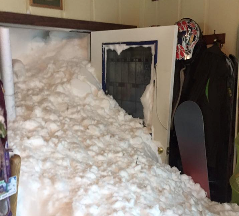
A wall of snow at the Siig's house in Alpine Meadows on Jan. 10. Photo/Steven Siig

A wall of snow at the Siig’s house in Alpine Meadows on Jan. 10. Photo/Steven Siig

By Melissa Siig, Moonshine Ink

On the morning of Jan. 10, little did I know that by the end of the day I would have one of the most famous doorways in the country. But that’s what happened when an avalanche slammed into the front of our house, and the picture we took of our mudroom filled with snow went viral.

Welcome to life in an avalanche zone.

Living in Alpine Meadows’ Avalanche Zone is like living anywhere else in Tahoe, except when there is major snowfall. Then the mountainside across from our house, which separates Squaw Valley from Alpine Meadows, begins to look different. It begins to look ominous. I stare at it and pray: please be kind. Please be stable. Please don’t slide into our home.

Read the whole story


Tahoe stormwater systems survive Jan. deluge

By Kathryn Reed

Stormwater systems were put to the test this month, and seemed to handle the onslaught of water without any serious problems.

“It is somewhat of a success story. In Tahoe all the sewer agencies reported a high flow, but they kept it in their systems. With the stormwater we haven’t heard of any problems,” Lauri Kemper with the Lahontan Regional Water Quality Control Board told Lake Tahoe News.

Lahontan regulates and monitors the amount of sediment reaching Lake Tahoe from the various jurisdictions in the basin on the California side, including Caltrans. The Tahoe Resource Conservation District oversees the stormwater.

On Jan. 7 when more than 5 inches of rain fell in some parts of the basin Tahoe RCD measured the highest flows ever recorded at all eight monitoring locations since monitoring began in 2013. 

“During this storm event our Tahoe Valley site, located off Tahoe Keys Boulevard, measured 1.5 million-cubic-feet of flow, nearly 90 percent of the flow that was observed throughout the whole 2016 water year,” Sarah Bauwens with TRCD said in a statement.

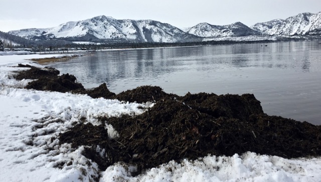
Rich soil covers the edge of the beach at Cove East. Photo/Kathryn Reed

Rich soil covers the edge of the beach at Cove East. Photo/Kathryn Reed

In one storm this month 18 million gallons of runoff was recorded at the TRCD sites. Even more reached the lake through the other pipes.

The Bijou pump area was temporarily clogged, but South Tahoe Public Utility District and the city of South Lake Tahoe worked together to get it functioning properly.

“There were no major incidents of any kind,” City Manager Nancy Kerry told Lake Tahoe News during the thick of the storms. “Many of the investments we’ve made over the last 10 years such as the Bijou erosion control project and others performed exceptionally well.”

One of the good things about strong runoff in the heart of winter when it’s so cold is that fine sediment tends to drop to the lake’s floor relatively quickly. This is what happened in the 1997 storms. Had there been this much runoff in the summer, it might be a different outcome for the effect to lake clarity. This is because when the air and water temperature is warmer that sediment stays closer to the surface, making the water murky and creating a situation where algae can grow.

UC Davis working through the Tahoe Environmental Research Center at Sierra Nevada College regularly tests the lake’s clarity in the winter and summer. The results will reveal in part how the storms this season have affected the lake.

TRCD through its monitoring system analyzes for fine sediment particles, nitrogen, and phosphorus to estimate nutrient and sediment loading from urban stormwater runoff.

Lahontan is still waiting to receive samples taken at various marinas during the storm events. 

“When I look around California we are lucky in Tahoe that we made such a big deal about disapproving development in flood lands and wetlands. We have a lot less infrastructure damage because we have not put infrastructure there,” Kemper said.

Restoration of meadows and stream environment zones is paying off. For rivers and creeks to overflow their banks into meadows is a good thing. That means the ecosystem is working. Much of the sediment in the water is filtered out naturally.

But it’s also normal for Mother Nature to wash away the top layer of soil and carry it downstream. That is why a layer of dirt has been distributed along the beach area of Cove East on the South Shore. It is what was naturally carried out via the Upper Truckee River.


Nonprofit gives free ski trip to disabled vets

By Brad Branan, Sacramento Bee

Accidentally shot by a fellow U.S. Army soldier, Larry Celano suffered a spinal cord injury that left him unable to walk. After earning a Purple Heart for his service in the 1989 Panama invasion, Celano worked as an accountant for five years before continued medical problems led to an early retirement.

Despite the setbacks, Celano said he tries not to let his disability get in the way, including going on ski trips in the Sierra the last two years.

“Last year the goal was not to get hurt,” the Chandler, Ariz., resident said as he got ready for a run at Alpine Meadows ski resort. “This year the goal is to go a little bit faster.”

 Celano was one of 17 veterans who received an all-expenses-paid trip last week from Achieve Tahoe, a nonprofit organization based at Alpine Meadows and a national pioneer in helping the disabled ski and participate in other “high-challenge” sports.

Read the whole story


Biggest NorCal traffic jam? Try Tahoe

By Tony Bizjak, Sacramento Bee

Where’s the biggest traffic jam in Northern California this weekend? Try Tahoe. 

With sunny skies, clear roads and plenty of snow, tens of thousands of skiers, snowboarders, families and other recreationists are hitting mountain highways this weekend, creating hourlong traffic jams in some areas around Lake Tahoe.

“It’s ‘blue bird weather’ up there this weekend,” Caltrans spokeswoman Deanna Shoopman said. Any sunny weekend after a few weeks of heavy snowfall, “everybody has the same idea,” she said.

The result this weekend, much like the recent Martin Luther King Jr. holiday weekend, is traffic backups at numerous crossroads and main corridors, notably in Truckee, where Highway 89 heads to Squaw Valley and Alpine Meadows, and on the often congested roads in the South Lake Tahoe and Stateline area.

Read the whole story


Icy Emerald Bay a treat to Hwy. 89 foot traffic

emerald bay-lead

Emerald Bay is frozen at the west end. Photo/Kathryn Reed

By Kathryn Reed

EMERALD BAY STATE PARK – Splintered ice on the bay’s edge gives way to a deep sapphire hue. Inviting, mesmerizing, magical. Emerald Bay.

With Highway 89 closed, now is the time to explore this area on foot. For decades it was the norm for the South and West shores to be cut off all winter. Now, with modern technology, the highway is rarely closed more than a few days in the winter.

But this has not been an ordinary winter.

“The amount of snow and the timing of the storms are what have made this season challenging so far to keep it open. We have snow piled up as high as 30 feet on the highway in some locations,” Steve Nelson, spokesman for Caltrans, told Lake Tahoe News. “There are about a dozen slide areas in that 4-mile section of the highway, and it’s not just snow that falls down – it’s large boulders, tree limbs, entire trees in some cases.”

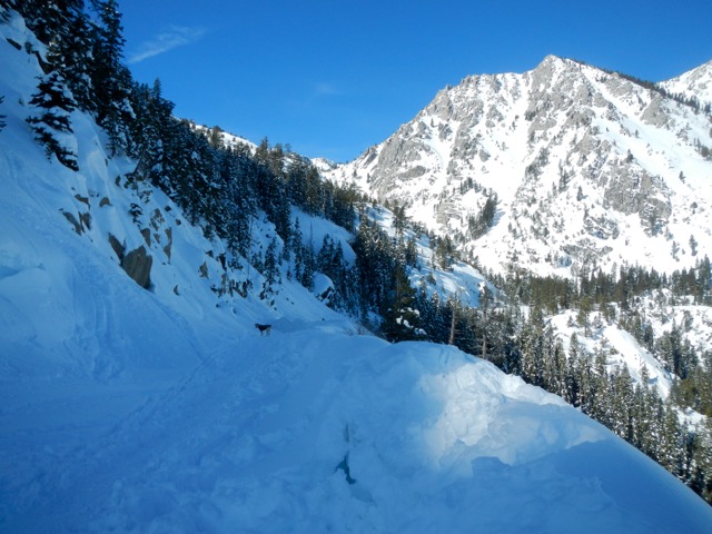
A large amount of snow still covers Highway 89, making off-limits to vehicles. Photo/Kathryn Reed

A large amount of snow still on Jan. 28 covers Highway 89, making it off-limits to vehicles. Photo/Kathryn Reed

Compounding the problem is that three blowers are in the shop for repairs and crews have not even reached the main slide.

The good news is that the scar from last fall’s Emerald Fire is remaining in place. Kit Bailey, Lake Tahoe Basin Management Unit’s chief fire officer, told Lake Tahoe News, “The Emerald Fire area is holding up great.” He has been making periodic visits to that section of Highway 89. “It’s a testament to the excellent post-fire mitigation that took place on a slope with a high-use transportation route.”

When the original highway was built in 1930-31 it was to link Highway 70 on the north to Highway 50 on the south.

“With the construction methods available at that time, the road closely followed the lay of the land, following ridge lines and older wagon trails along the edge of the lake. This resulted in a number of very dramatic vistas from the route, particularly in the area around Emerald Bay,” according to the Federal Highway Administration.

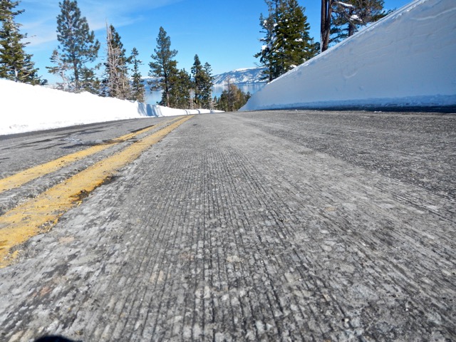
According to Caltrans, profile grinding on the highway makes the road level. Photo/Kathryn Reed

According to Caltrans, profile grinding on the highway makes the road level. Photo/Kathryn Reed

Sixty years later this stretch of highway was overhauled a bit. Slope stabilization was a main part of the $9.2 million, 18-month project that started in April 1992. The entire road was closed for six weeks, with alternating traffic the rest of the time.

On Saturday people in all types of footwear were walking along the road. On the south side it is pavement – though slick in some locations –  from the gate to just past Inspiration Point. After that a fairly worn path is accessible without the need for snowshoes. Those coming from the D.L. Bliss area to the north had snowshoes on.

Others took off into the trees to make fresh tracks on their skis and snowboards.

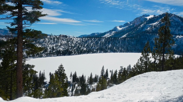
Cascade Lake looks like an ice rink in need of a Zamboni machine. Photo/Kathryn Reed

Cascade Lake looks like an ice rink in need of a Zamboni machine. Photo/Kathryn Reed

We stopped as the trail narrowed and the path went up a bit. One slip and that would have easily been a fatal fall. After all, this is prime avalanche area.

We had seen what we came for – Emerald Bay in all her glory. And the views were not going to get any better.

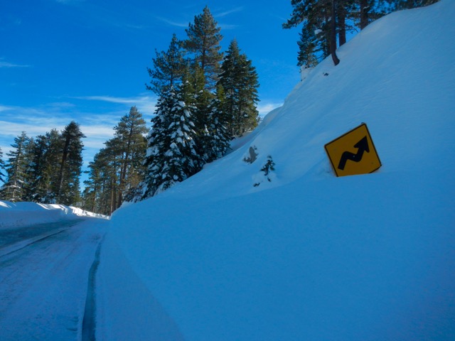
Most of the road signs near Emerald Bay are at least partially buried. Photo/Kathryn Reed

Most of the road signs near Emerald Bay are at least partially buried. Photo/Kathryn Reed

Most of the area between the western shore and Fannette Island is a layer of ice. It’s obvious a boat has plowed through it. Chunks of ice float near the mouth of the bay. A sailboat barely enters before deciding to turn around.

The last time the entire bay froze was January 1993 when the mercury hit minus 28 degrees in South Lake Tahoe. Prior to that the bay was solid ice in February 1989; the temperature in South Lake Tahoe was minus 29.

With not a whisper of wind, the bay is like glass. The few clouds seem to dance across the water, looking more like steam rising than a reflection.


Sandoval, Legislature ready to put partisanship aside

By Sean Whaley, Las Vegas Review-Journal

CARSON CITY — As Gov. Brian Sandoval begins the job of selling his $8.1 billion legacy budget to the Nevada Legislature, he finds himself in familiar territory.

The Republican will have to work with Democratic majorities to achieve his objectives when the 2017 session kicks off on Feb. 6, a situation he faced in both his first and second sessions as governor.

Sandoval has proved to be a governor who knows how to compromise and find a path forward for his goals of expanding economic development opportunities and improving public education. Working with supportive Republicans and Democrats who often seek the same objectives, Sandoval has won approval of most of his initiatives over the past six years.

Read the whole story