

Then and now: Tahoe airports change locations


In the 1940s, the Sky Harbor Casino and Airport was where today we know as Rabe Meadow at Stateline, with the popular Lam Watah Trail.
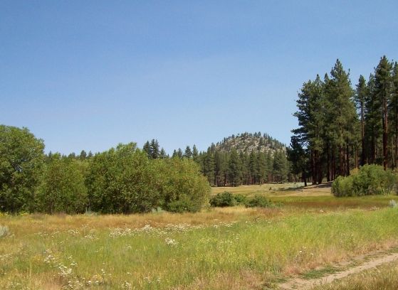
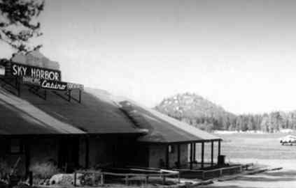 Photo No. 1 (1946) shows the Sky Harbor Casino (“Cocktails, Dancing”). That site is roughly at the foot of today’s Kahle Drive near the entrance to Tahoe Shores Mobile Home Community, photo No. 2 (2013).
The easily identifiable Round Hill is clearly evident in both photos (officially, it is “Round Mound” according to U.S. Geological Survey maps).
Photo No. 3 depicts the 1946 landing area looking toward Mt. Tallac. One observer is quoted as saying, “The airport was so poorly engineered you either took off safely or you splashed in the lake.”
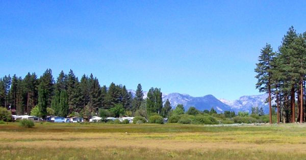
 Today that area is mostly occupied by Tahoe Shores, photo No. 4 (2013).
After Sky Harbor closed, Lake Tahoe had no airport until 1958.
It is interesting to note that El Dorado County attempted to buy what became Tahoe Keys to pave-over for an airport, but lost-out in the bidding process.
Photo credits: 1946 from David Borges, 2013 from Bill Kingman.
— Bill Kingman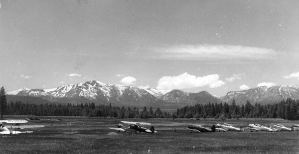

I continue to delight in these articles by Bill. In addition, Dr. Borges did an exceptional presentation on the airports of South Lake Tahoe for the Lake Tahoe Historical Society. It was incredible. Thank you both for keeping our history alive.
The presentation by Dr. Borges at the Historical Society was, yes, excellent!
Expanded information was presented by him at the recent SIR (Sons-In-Retirement)luncheon gathering.
I well remember that airport from the first time I visited Tahoe, think it was January 1952.