Tahoe putting emphasis on regional transit
By Kathryn Reed
Lake Tahoe is making strides to have a coordinated regional transit system. A significant step is this week there will be a job posting by Tahoe Transportation District for a transit system program manager.
“We need to answer: ‘What does an integrated transit system in the entire Tahoe area look like?’,” Carl Hasty, TTD executive director, told Lake Tahoe News.
As TTD goes forward with developing the environmental documents for ferry service on the lake between the North and South shores, it must explain how the basin could have coordinated service. This is because if ferry passengers are left at the terminus without public transit, the boat will be a failure.
As it is now, the bus companies operating at the lake are not integrated.
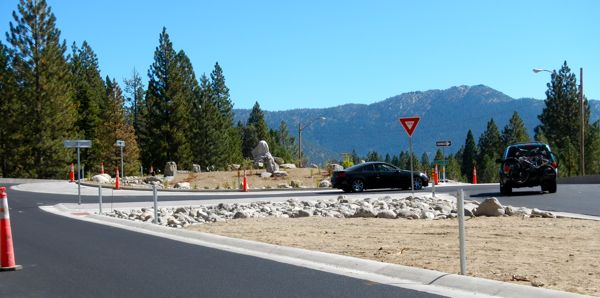
Improvements are already happening on Highway 28, like the roundabout at the base of Mount Rose Highway. Photo/LTN
The person who is hired will be tasked with coming up with a plan that links current systems and anticipates for future growth.
One thing planners are looking at is how the 6.5 million people who are in the Bay Area/Sacramento market could come to Tahoe. How will they get here? And how will they get around when they are here? And with the forecast calling for that number to grow by 4 million more in the next few decades, it could be gridlock in the basin if everyone is in a private vehicle.
That is why local transit officials are also looking at transit along Highway 50 to Sacramento, Interstate 80 to Sac and Highway 395 in Carson City-Reno and then the routes to Tahoe.
“The system needs to be attractive to riders who don’t typically ride,” Hasty said.
What that looks like still needs to be worked out.
While TTD is and will continue to do its own studies, it will also tap into other resources. One of those is the travel survey the Tahoe Regional Planning Agency did Aug. 15-24.The survey conducted by NuStats Research Solutions was intended primarily to gather data on travel patterns involving commercial and recreation areas.
TTD is not letting the lack of a coordinated transit manager slow down its progress in making the region more transit friendly.
Instead of going on a project-by-project basis, the new thinking is to look at the entire transit corridor. This was and is still being done along Highway 28 from Spooner to Incline Village. Fourteen stakeholders are involved.
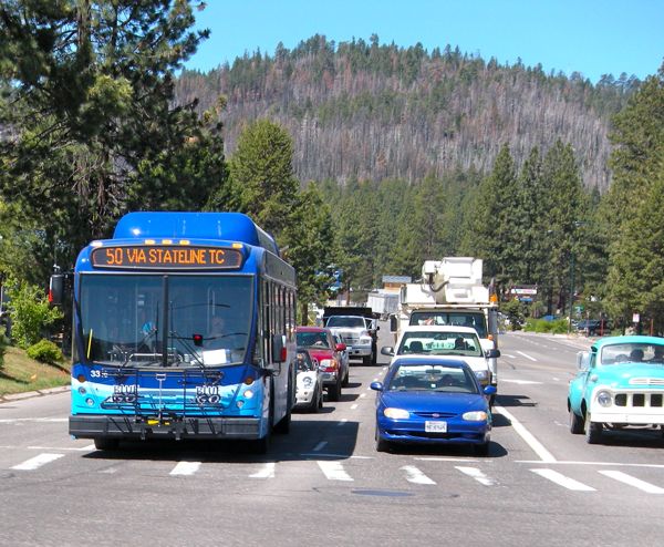
BlueGo helps eliminate the need for a vehicle on the South Shore. Photo/LTN file
The roundabout at Highway 28 and the Mount Rose Highway is one component, as is the East Shore Express bus that operates in the summer.
Now those stakeholders – which include public land owners, NDOT, IVGID and others – are working on a state highway erosion control project that will include highway parking lots. A park and ride at Spooner is being considered, as well as a different location for the aquatic invasive species decontamination operation. It’s possible fire hydrants will be installed along Highway 28.
Incline Village General Improvement District needs to move its sewage export line that sits in the highway. That line would be moved into the forest where 11 miles of bike trail are proposed. If the trail goes where the line is, then IVGID would be responsible for the maintenance of it.
The economies of scale approach to planning means total implementation costs less, maintenance could be less and more gets done. Ideally, it’s mostly for the public benefit.
Hasty said a coordinated synergy exists today that hasn’t been there in the past that is allowing for this cooperative approach to take place.
The corridor approach will be used whenever possible and practical, he said. The Y section of South Lake Tahoe from about Trout Creek to Emerald Bay has been plotted as a corridor, as has Trout Creek to Zephyr Cove.