Restoration brings out charm of Ward Creek Park
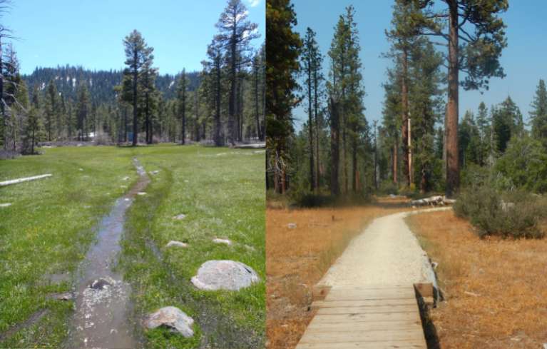
The trail through the meadow, left, before restoration; and after work was completed. Photos/State Parks and LTN
By Kathryn Reed
TAHOE CITY – A thick overgrown forest with logging roads that became gullies during the wet season that would then carry sediment into Ward Creek and Lake Tahoe.
That was what these 179 acres near Tahoe City were like in the early 1980s when the McClatchy family deeded the property to California State Parks.
Today, Ward Creek Park is probably the least used state park in the Lake Tahoe Basin. Restoration began in 2009, with the network of trails completed in 2012. Still to come this fall are interpretive signs.
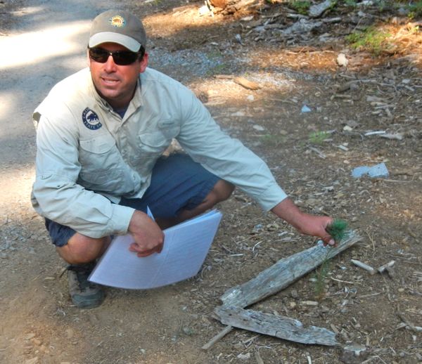
Nathan Shasha points out a newly planted sugar pine. Photo/Kathryn Reed
Part of the restrictions with the land is no pavement can be put in and a campground cannot be developed.
It was the Angora Fire of 2007 on the South Shore that freed up money for this project. Reducing hazardous fuels has been the mantra in the basin since then. And that is what enabled State Parks to turn this plot of land into something officials want to promote and no longer worry about being a fire hazard.
“We tried to keep the larger trees,” Cyndie Walck with State Parks explained. “There was massive thinning to decrease the fire hazard.”
This area was commercially logged in the 1930s and 1960s, so many of the large trees were already long gone.
The 12- to 15-foot-wide roads went straight up. This is just the opposite of how trails are designed, so they have been rehabbed. This will prevent erosion. And in a few years the shrubs will grow in and the rocks and logs used to make the roads impassible will not be noticeable. Much of the infill needed came from the neighboring California Tahoe Conservancy project at Blackwood Canyon. The roads in places were 2 feet below grade.
Two stands of more dense trees were left.
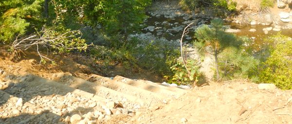
Stairs now allow access to Ward Creek. Photo/Kathryn Reed
“The best thing for habitat is variability in age and density instead of treating the park all the same,” Walck said.
The Sugar Pine Foundation has planted thousands of trees in Ward Creek Park. And the grove of ferns adds to the diversity.
A network of about 3 miles of trails meanders through this once secret gem. While some of the user-created trails are gone, the things people like most are still there. This includes access from the bike trail along Highway 89 to the park, two locations to get to Ward Creek, and trails that connect to the U.S. Forest Service trails that lead to Stanford Rock, and a connection to the Tahoe Rim Trail. The upper part of the watershed is where the Sherwood chairlift at Alpine Meadows is.
“It’s a complete watershed with recreation,” Walck told Lake Tahoe News.
California Conservation Corps members did much of the work.
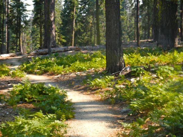
Ferns create a diverse landscape. Photo/Kathryn Reed
“We maintained all the major access points to the park,” Nathan Shasha with State Parks said while walking along some of the trails. He oversaw the construction.
While there is a larger loop, it’s not just one trail. Several offshoots are part of the network.
One spot leading to Ward Creek now has stairs to help with ease of access and to prevent erosion. Before people scrambled up and down a steep embankment.
The first part of the trail from the Rideout Community Center is designed to comply with American with Disabilities Act requirements.
Different types of material were used to get people across the meadow. Part is boardwalk. This elevated path allows water to freely flow under it in the spring or other wet times.
The boardwalk then becomes a turnpike that has logs on the sides and a coarse trail.
The goal was to be able to experience the meadow without impacting it.
Sod plugs have been put in to help restore the meadow.
Walck and Shasha have pictures of what the meadow looked like before the work. At times it was impassable because of the amount of water. People would ride bikes and make grooves. Water would pond.
Restoration work was designed so the water will flow more evenly, this in turn should restore the water table. And with an elevated trail it keeps people from harming the ecosystem.
—-
Notes:
• Getting there: From South Lake Tahoe, take Highway 89 north. Turn left on Timberland Lane. Turn right at the Rideout Community Center. Park. Trail starts in the right rear of the center. There is also access a bit farther up off Timberland; with a gate on the right.
• Parking is free.
• Mountain bikes OK.
• Dogs on leash OK.