NOAA: La Niña an uncertain forecast for Tahoe
By Susan Wood
The National Oceanic and Atmospheric Administration on Thursday released the U.S. Winter Outlook, which calls for La Niña. For Lake Tahoe it’s a wild card with equal chances for above- and below-normal precipitation and temperatures.
The outlook encompasses December through February.
La Niña, a weather phenomenon originating off the western shores of South America, is more than halfway developed and could influence the West Coast in its predictable ways – if there is such a thing.
Typically, La Niña brings on a warmer and drier Southern California, while giving the northern end cooler temps and more precipitation. El Niño, which formed two years ago, results in the opposite. Lake Tahoe is on the cusp for both, which strengthen in varying degrees.

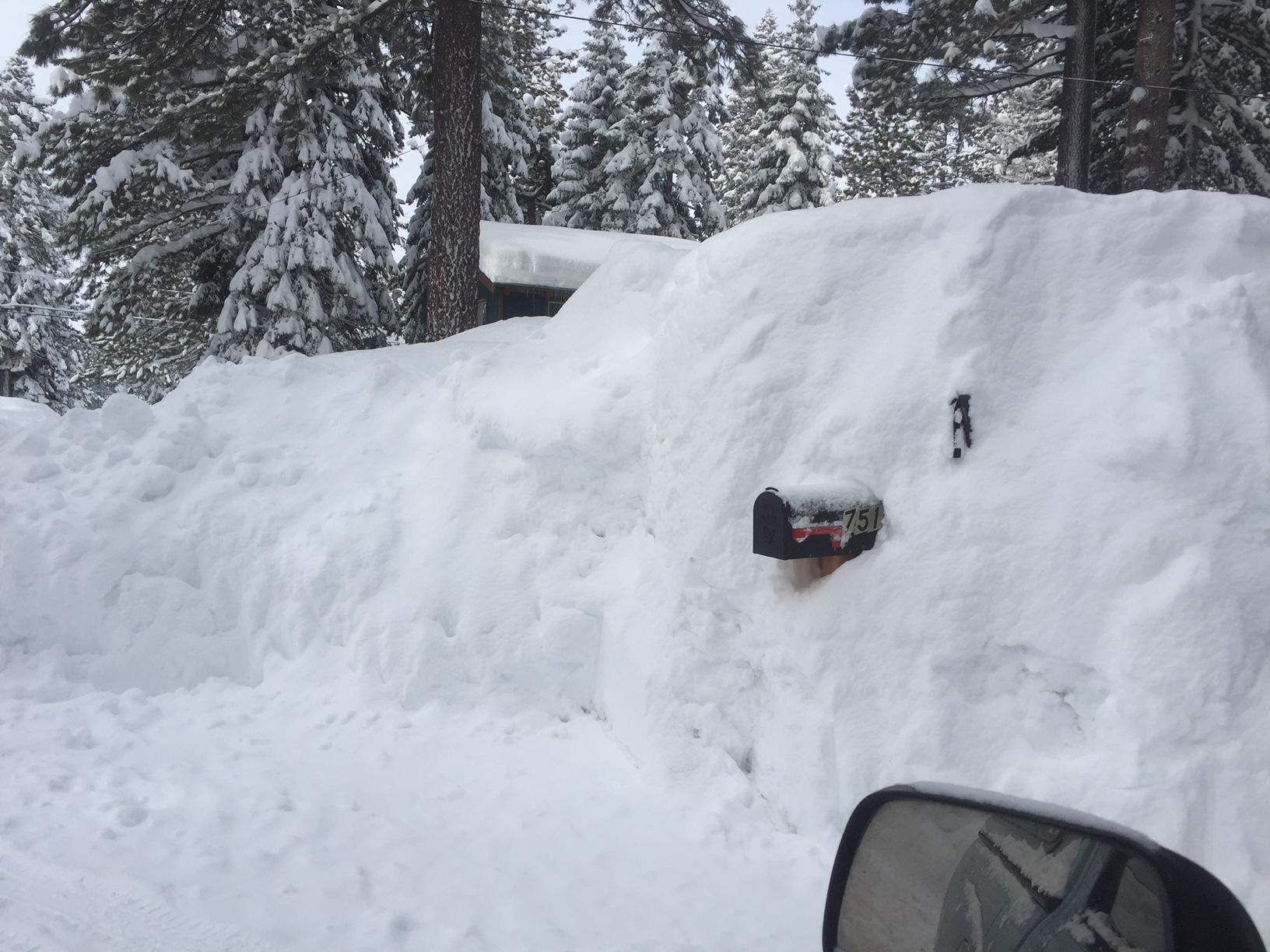
Buried mailboxes were the mild inconveniences of last winter. Photo/Susan Wood
“The reality is, the storm tracks don’t come out the same each time, and we don’t know in advance,” NOAA’s Climate Prediction Center Deputy Director Mike Halpert told Lake Tahoe News on a media conference call Oct. 19. “It’s a tricky one. I would plan for it all.”
Certainly, last winter’s deluge has shown a need for the Tahoe-Truckee-Reno area to be prepared.
Halpert said he doesn’t expect “such an extreme event, especially with La Niña (conditions)” because “that wouldn’t favor it.” But Northern California could see “any one of three outcomes” meaning above, below or equal chances.
NOAA will provide an update on Nov. 15.
The climatologist called last year “a rare event” that had “less than a 5 percent chance” of forming.
That rarity coming off four years of drought provided a huge crop of fuel for exploding wildfires this summer and fall that marked some of the hottest days recorded.
The winter of 2016-17 prompted many closures in government offices as well as private sector companies. Lakes formed in South Lake Tahoe where none had been seen before. Roads crumbled and shut down. Blizzards blinded commuters on the mountain passes. Sandbagging was all the rage. And while skiers rejoiced, commuters experienced nightmarish driving conditions.
“We were shaking our heads a little bit,” Halpert said in discussing the extremes.
Within its models, NOAA’s Climate Prediction Center studies factors that influence the precipitation and temperatures across the United States. But gusty winds that turn wildland fires into raging infernos and snowstorms into blizzards are “something to look at,” Halpert told LTN. NOAA is in the process of developing a “hazards product” that can more closely evaluate and account for risk of the

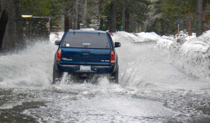
Flooding in the Tahoe Keys and state street areas of South Lake Tahoe was normal last winter. Photo/LTN file
nation’s communities.
The “2018 Farmers Almanac” calls for “above normal snowfall” in the California mountains and characterized the zone where Lake Tahoe falls as “cold and wet.”
Last winter’s severe storms produced quite a quandary, as water managers celebrated an end of the long-term drought in California. But there is such a thing as too much, too fast.
Reno had its wettest water year on record. Tahoe’s seasonal snowfall last winter measured 248.5 inches between November to April, dwarfing the average of 184.9, according to the National Weather Service. And some ski resorts topped 400 inches. But that wasn’t the whole story. It was particularly wet.
“The difference is the precipitation. This was the biggest winter we’ve had since 2010-2011. Then we had the drought,” Weather Service meteorologist Scott McGuire said from his Reno office. “Atmospheric rivers” became a part of our vernacular.
From Reno to Carson City to Gardnerville to Lake Tahoe, much of that water flowed everywhere and flooded areas not accustomed to seeing water. In the North State, the Oroville Dam was breached.
And so begins our water season, according to the California Department of Water Resources. DWR ranks the 2017 water year as second only to 1983 as the state’s wettest. That was an El Niño year that flooded large swaths of Southern California and caused bluffs to collapse.
Last year, 52 counties declared states of emergency due to January’s sequence of storms. There are 58 counties in California.

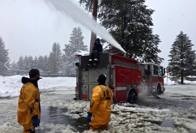
South Lake Tahoe fire crews in February get rid of ice and water on city streets. Photo/SLTFD
The phenomenal wet winter has resulted in residual effects. Mice have taken up residence in homes at abnormal rates because their ground holes were filled in.
The impact of last winter could linger into this year. Standing water dots the landscape of South Lake Tahoe.
Where does that water go? The thought of this may keep engineers and storm water gurus up at night.
“If we end up having an above average winter or even an average winter this year, it could be challenging,” South Lake Tahoe storm water program coordinator Jason Burke told Lake Tahoe News.
It’s a perfect storm of reasons.
The lake level is up, the groundwater is high and an already moist soil can’t absorb as much.
Crews are out now using the hydro vac truck to clean the pipes in anticipation. Like last winter, the city will avail sandbags at its yards and stations.
“People should be prepared for a hard winter,” Burke said.
In particular, Burke said homeowners in low-lying areas such as Tahoe Island, Tahoe Keys, Glenwood, Al Tahoe, the state streets, and Bijou Meadow should be on the lookout. The city just completed Phase 3 of its $3.4 million storm water project at Sierra Tract.
The problems lie in drainage systems, which have public works staffers hopping. The city was laid out with minimal thought to storm water placement and channeling. Now retrofitting that backward infrastructure is an expensive endeavor. For example, Sierra Tract’s entire project cost about $15 million just for that neighborhood.


